
630 N Cerritos Ave Unit 217
Azusa, CA 91702
-
Bedrooms
1
-
Bathrooms
1
-
Square Feet
--
Highlight
- Pets Allowed

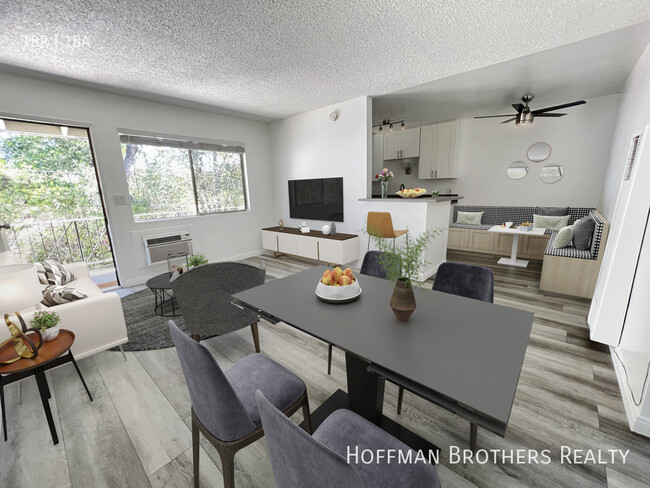
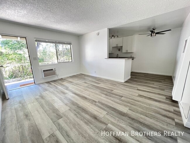
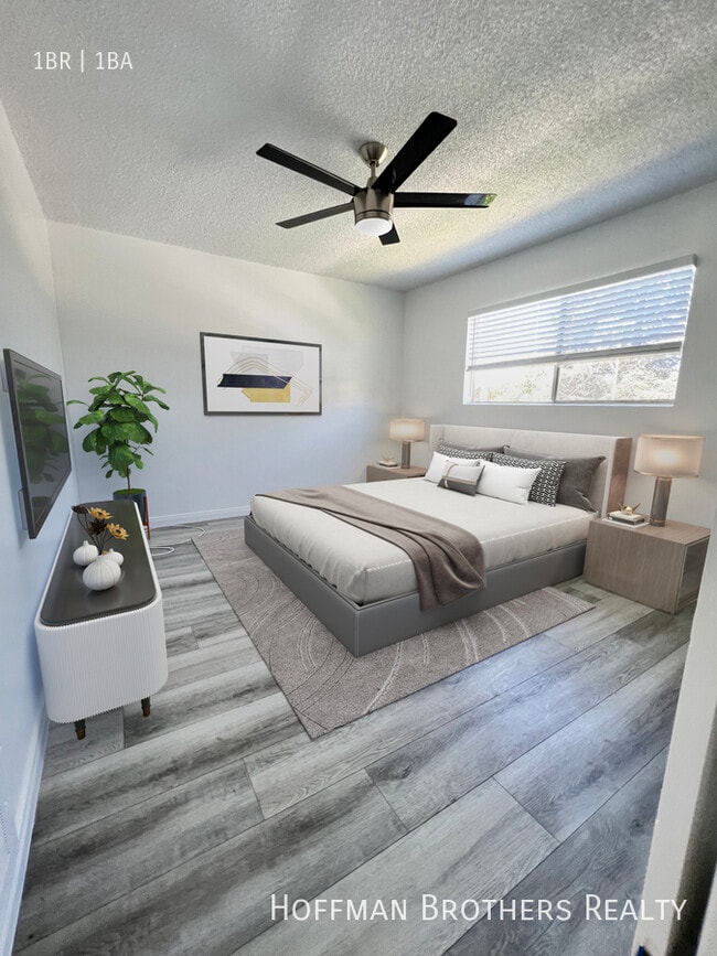
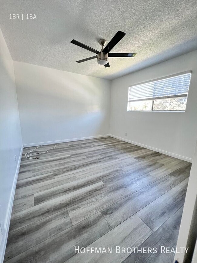
About This Home
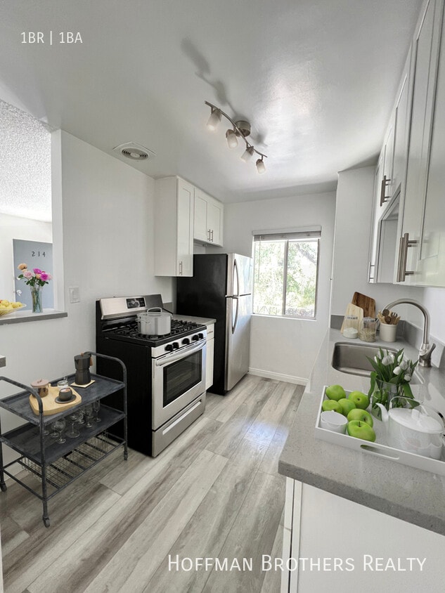
*Modern Luxury Apartments w/ Oasis Pool – Limited Time! Welcome to Citrus Pacific Villas, where comfort meets convenience in the heart of Azusa. Imagine living just steps away from your favorite restaurants, coffee shops, banks, and stores—with Azusa Pacific University and Citrus College right around the corner. Whether you’re a student, commuter, or simply looking for a vibrant yet peaceful place to call home, Citrus Pacific Villas puts everything within reach. Enjoy easy access to public transportation and the 210 freeway, making your commute to Pasadena or beyond a breeze. Apartment Features: Modern laminate flooring Refrigerator included Stylishly remodeled bathroom High-end finishes throughout Air conditioning for year-round comfort Spacious closets for easy storage Community Perks: Secure gated community Beautiful landscaped courtyard with sparkling pool Laundry facilities on-site Pet-friendly Convenient online rent payment options Parking available Please note: Photos may not be of exact apartment home available*Square footage when listed or from inquiry, is approximate*Pricing is subject to change without notice*Pricing can vary between similar apartments for many reasons*Features may vary between similar apartments*Renter to verify all information, including availability*Rental Policy may change without notice*Price breaks are extended to all Applicants, no matter what may have been previously advertised*We adhere to all Fair Housing guidelines and all housing laws
630 N Cerritos Ave is an apartment community located in Los Angeles County and the 91702 ZIP Code.
Fees and Policies
The fees listed below are community-provided and may exclude utilities or add-ons. All payments are made directly to the property and are non-refundable unless otherwise specified.
-
Dogs
-
Allowed
-
-
Cats
-
Allowed
-
Property Fee Disclaimer: Based on community-supplied data and independent market research. Subject to change without notice. May exclude fees for mandatory or optional services and usage-based utilities.
Features
- Washer/Dryer
Contact
- Website View Property Website
-
Source

Azusa sits at the base of the San Gabriel Mountains in Los Angeles County, where the foothills meet the eastern edge of the San Gabriel Valley along historic Route 66. Known locally as the Canyon City, it occupies about 10 square miles and carries a distinctly grounded, working-city feel that sets it apart from more polished suburbs to the west. Azusa Pacific University anchors much of the city's identity, drawing students and staff who give the area steady energy throughout the academic year. The city's neighborhoods range from quieter residential streets near the canyon entrance to denser corridors along Foothill Boulevard and Azusa Avenue, where retail and services concentrate. Housing options include older single-family homes, garden-style apartment communities, and smaller multi-unit buildings typical of San Gabriel Valley suburbs.
Learn more about living in Azusa- Washer/Dryer
| Colleges & Universities | Distance | ||
|---|---|---|---|
| Colleges & Universities | Distance | ||
| Walk: | 18 min | 0.9 mi | |
| Walk: | 19 min | 1.0 mi | |
| Drive: | 16 min | 8.9 mi | |
| Drive: | 17 min | 10.1 mi |
Transportation options available in Azusa include Azusa Downtown Station, located 0.8 mile from 630 N Cerritos Ave Unit 217. 630 N Cerritos Ave Unit 217 is near Ontario International, located 22.6 miles or 30 minutes away, and Long Beach (Daugherty Field), located 33.4 miles or 44 minutes away.
| Transit / Subway | Distance | ||
|---|---|---|---|
| Transit / Subway | Distance | ||
| Walk: | 14 min | 0.8 mi | |
| Walk: | 20 min | 1.0 mi | |
| Drive: | 7 min | 3.6 mi | |
| Drive: | 10 min | 6.0 mi | |
| Drive: | 11 min | 7.5 mi |
| Commuter Rail | Distance | ||
|---|---|---|---|
| Commuter Rail | Distance | ||
|
|
Drive: | 6 min | 3.4 mi |
|
|
Drive: | 12 min | 6.8 mi |
|
|
Drive: | 17 min | 11.1 mi |
|
|
Drive: | 17 min | 11.5 mi |
|
|
Drive: | 20 min | 15.6 mi |
| Airports | Distance | ||
|---|---|---|---|
| Airports | Distance | ||
|
Ontario International
|
Drive: | 30 min | 22.6 mi |
|
Long Beach (Daugherty Field)
|
Drive: | 44 min | 33.4 mi |
Scores provided by
Traffic
ActiveAirport
CalmBusinesses
ActiveScores provided by
HowLoud What is a Sound Score Rating? A Sound Score Rating aggregates noise caused by vehicle traffic, airplane traffic and local sources. How It WorksTime and distance from 630 N Cerritos Ave Unit 217.
| Shopping Centers | Distance | ||
|---|---|---|---|
| Shopping Centers | Distance | ||
| Walk: | 2 min | 0.0 mi | |
| Walk: | 3 min | 0.2 mi | |
| Walk: | 9 min | 0.5 mi |
| Parks and Recreation | Distance | ||
|---|---|---|---|
| Parks and Recreation | Distance | ||
|
Covina Park
|
Drive: | 7 min | 3.3 mi |
|
Santa Fe Dam Recreation Area
|
Drive: | 18 min | 5.9 mi |
|
Santa Fe Dam Nature Center
|
Drive: | 18 min | 5.9 mi |
|
Galster Wilderness Park Nature Center
|
Drive: | 14 min | 7.2 mi |
|
San Dimas Canyon Nature Center
|
Drive: | 12 min | 7.8 mi |
| Hospitals | Distance | ||
|---|---|---|---|
| Hospitals | Distance | ||
| Drive: | 3 min | 2.1 mi | |
| Drive: | 3 min | 2.2 mi | |
| Drive: | 7 min | 3.6 mi |
| Military Bases | Distance | ||
|---|---|---|---|
| Military Bases | Distance | ||
| Drive: | 45 min | 35.4 mi |
You May Also Like
What Are Walk Score®, Transit Score®, and Bike Score® Ratings?
Walk Score® measures the walkability of any address. Transit Score® measures access to public transit. Bike Score® measures the bikeability of any address.
What is a Sound Score Rating?
A Sound Score Rating aggregates noise caused by vehicle traffic, airplane traffic and local sources.
630 N Cerritos Ave
Azusa, CA 91702