$1,250
/ Month
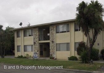
630 Maple St
West Sacramento, CA 95691
Favorites
630 Maple St

Favorites
Check Back Soon for Upcoming Availability
| Beds | Baths | Average SF |
|---|---|---|
| 2 Bedrooms 2 Bedrooms 2 Br | 1 Bath 1 Bath 1 Ba | 853 SF |
Fees and Policies
The fees listed below are community-provided and may exclude utilities or add-ons. All payments are made directly to the property and are non-refundable unless otherwise specified.
About This Property
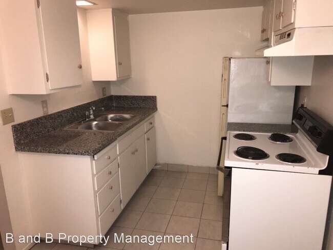
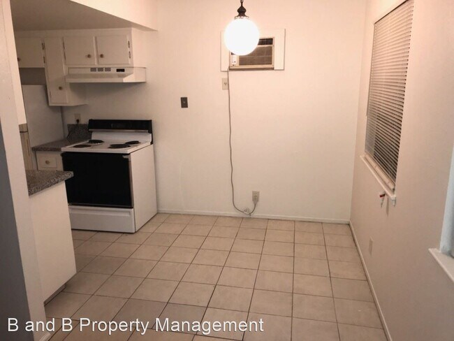
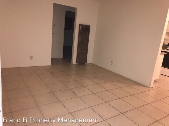
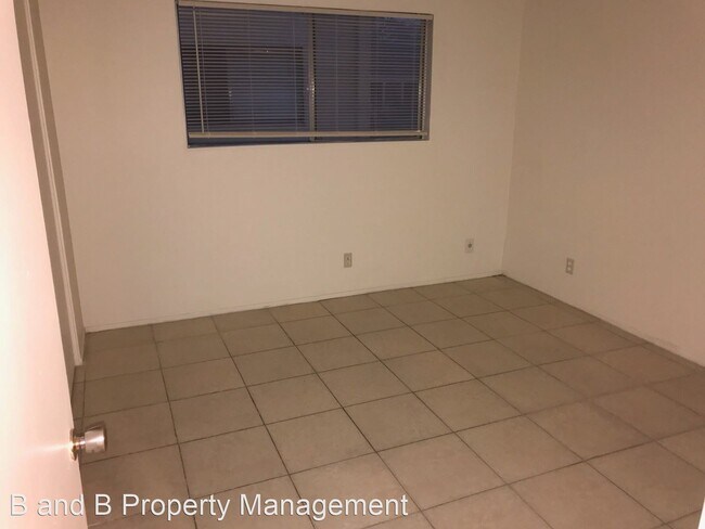
(916) 660-0509 x3 - 2 Bedroom / 1 Bathroom Apartment - West Sacramento - Downstairs apartment. Spacious bedrooms and closets with extra storage. Window a/c unit and wall furnace. Water/sewer/garbage utilities included. Onsite resident manager DETAILS - Deposit equal to rent - One year lease - No pets (not negotiable) PLEASE & THANK YOU - Contact Raul @ 916-284-7185 (call/text) for viewing appointments - Submit questions/inquiries to accounting@bnbre.com or 916-660-0509 ext 3 - Please drive by property/through neighborhood to determine if location/area are suitable/convenient for your (prior to scheduling appointment) - Check website for other available properties: www.bnbre.com APPLICATION REQUIREMENTS - Income of 3x monthly rent - No evictions - Good credit - Positive rental history - $30 application fee per adult No Pets Allowed (RLNE4160770) Other Amenities: Other (parking onsite). Appliances: Washer & Dryer On-Site. Pet policies: No Dogs Allowed, No Cats Allowed.
630 Maple St is an apartment community located in Yolo County and the 95691 ZIP Code.
Unique Features
- No Dogs Allowed, No Cats Allowed, Amenities - parking onsite
Features
- Laundry Facilities
630 Maple St,
West Sacramento,
CA
95691
West Sacramento enjoys the unique privilege of being a fairly quiet residential community right next door to a thriving metropolis. Separated from the state capital only by the Sacramento River, West Sac (as the locals call it) shares virtually all of Sacramento’s resources, cultural and otherwise. The I Street Bridge and Tower Bridge both feed straight into Sacramento’s historic district and downtown entertainment district. On West Sacramento’s side of the river, one of the biggest attractions is the shopping, but scenic areas like River Walk Park and venues like Raley Field give folks plenty to do in their own neighborhood.
Learn more about living in West Sacramento
Amenities
- Laundry Facilities
- No Dogs Allowed, No Cats Allowed, Amenities - parking onsite
Education
| Colleges & Universities | Distance | ||
|---|---|---|---|
| Colleges & Universities | Distance | ||
| Drive: | 10 min | 5.2 mi | |
| Drive: | 14 min | 8.5 mi | |
| Drive: | 20 min | 13.0 mi | |
| Drive: | 22 min | 15.1 mi |
630 Maple St is within 10 minutes or 5.2 miles from Sacramento City College. It is also near Sacramento State and Cosumnes River College.
Transportation options available in West Sacramento include 8Th & Capitol, located 2.7 miles from 630 Maple St. 630 Maple St is near Sacramento International, located 13.0 miles or 21 minutes away.
| Transit / Subway | Distance | ||
|---|---|---|---|
| Transit / Subway | Distance | ||
|
|
Drive: | 6 min | 2.7 mi |
|
|
Drive: | 6 min | 2.7 mi |
|
|
Drive: | 7 min | 2.8 mi |
|
|
Drive: | 7 min | 2.8 mi |
|
|
Drive: | 7 min | 2.9 mi |
| Commuter Rail | Distance | ||
|---|---|---|---|
| Commuter Rail | Distance | ||
| Drive: | 7 min | 2.8 mi | |
| Drive: | 16 min | 12.0 mi | |
|
|
Drive: | 32 min | 23.7 mi |
|
|
Drive: | 33 min | 25.8 mi |
|
|
Drive: | 46 min | 35.4 mi |
| Airports | Distance | ||
|---|---|---|---|
| Airports | Distance | ||
|
Sacramento International
|
Drive: | 21 min | 13.0 mi |
Walkability Near 630 Maple St West Sacramento, CA 95691
Getting Around
 What do Walkability, Transit, Drivability, and Bikeability mean?
Walkability measures the walking distance to day-to-day needs.
Transit measures access to public transportation.
Drivability measures congestion, parking availability, and access to major roads.
Bikeability measures the suitability for cycling.
How It Works
What do Walkability, Transit, Drivability, and Bikeability mean?
Walkability measures the walking distance to day-to-day needs.
Transit measures access to public transportation.
Drivability measures congestion, parking availability, and access to major roads.
Bikeability measures the suitability for cycling.
How It Works
Fairly Walkable
Walkability
50
/ 100
Limited Public Transit
Transit
30
/ 100
Exceptionally Drivable
Drivability
90
/ 100
Moderately Bikeable
Bikeability
60
/ 100
Scores provided by
Active
Soundscore™
75
/ 100
Traffic
ActiveAirport
CalmBusinesses
ActiveScores provided by
HowLoud What is a Sound Score Rating? A Sound Score Rating aggregates noise caused by vehicle traffic, airplane traffic and local sources. How It WorksTime and distance from 630 Maple St.
| Shopping Centers | Distance | ||
|---|---|---|---|
| Shopping Centers | Distance | ||
| Walk: | 13 min | 0.7 mi | |
| Walk: | 15 min | 0.8 mi | |
| Walk: | 16 min | 0.9 mi |
630 Maple St has 3 shopping centers within 0.9 mile, which is about a 16-minute walk. The miles and minutes will be for the farthest away property.
| Parks and Recreation | Distance | ||
|---|---|---|---|
| Parks and Recreation | Distance | ||
|
Old Sacramento Historic District
|
Drive: | 6 min | 2.3 mi |
|
California State Railroad Museum
|
Drive: | 6 min | 2.5 mi |
|
California Native Plant Demonstration Garden
|
Drive: | 7 min | 3.0 mi |
|
California State Capitol Museum
|
Drive: | 7 min | 3.0 mi |
|
Natomas Oaks Park
|
Drive: | 10 min | 5.9 mi |
630 Maple St has 5 parks within 5.9 miles, including Old Sacramento Historic District, California State Railroad Museum, and California Native Plant Demonstration Garden.
| Hospitals | Distance | ||
|---|---|---|---|
| Hospitals | Distance | ||
| Drive: | 8 min | 5.3 mi | |
| Drive: | 9 min | 5.4 mi | |
| Drive: | 10 min | 6.3 mi |
630 Maple St has 3 hospitals within 6.3 miles, the nearest is Sutter Medical Center, Sacramento which is 5.3 miles away and a 8 minute drive.
| Military Bases | Distance | ||
|---|---|---|---|
| Military Bases | Distance | ||
| Drive: | 27 min | 14.2 mi | |
| Drive: | 50 min | 37.9 mi | |
| Drive: | 71 min | 49.7 mi |
630 Maple St has 3 military bases within 49.7 miles, the nearest is McClellan Air Force Base which is 14.2 miles away and a 27 minute drive.
You May Also Like
Similar Rentals Nearby


What Are Walk Score®, Transit Score®, and Bike Score® Ratings?
Walk Score® measures the walkability of any address. Transit Score® measures access to public transit. Bike Score® measures the bikeability of any address.
What is a Sound Score Rating?
A Sound Score Rating aggregates noise caused by vehicle traffic, airplane traffic and local sources.

630 Maple St
West Sacramento, CA 95691