$950
/ Month
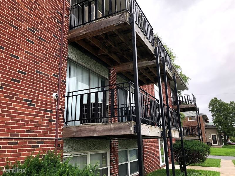
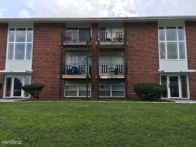
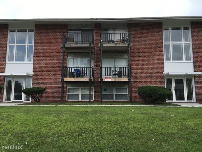
6226 Laurelton Ave
Baltimore, MD 21214
Favorites
6226 Laurelton Ave

Favorites
Check Back Soon for Upcoming Availability
| Beds | Baths | Average SF |
|---|---|---|
| 2 Bedrooms 2 Bedrooms 2 Br | 1 Bath 1 Bath 1 Ba | — |
Fees and Policies
The fees listed below are community-provided and may exclude utilities or add-ons. All payments are made directly to the property and are non-refundable unless otherwise specified.
- Dogs Allowed
-
Fees not specified
- Cats Allowed
-
Fees not specified
About This Property
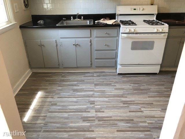
(443) 279-2200 - Laurelton Ridge Apartments & Townhomes - Property Id: 416099 Spacious 1 and 2 bedroom apartments and townhomes with plenty of closet space and storage. Quiet neighborhood located in a tree-lined wooded area close to Northern Parkway right on the 55 and 19 buss lines. Many shopping areas, great schools and places of worship. For more information on availability, please contact the Leasing Office at 410.321.9661. Apply at TurboTenant: http://rental.turbotenant.com/p/6226-laurelton-ave-baltimore-md/416099 Property Id 416099 (RLNE6216450) Lease lengths: 12 Months. Pet policies: Small Dogs Allowed, Cats Allowed.
6226 Laurelton Ave is a townhome located in Baltimore City County and the 21214 ZIP Code. This area is served by the Baltimore City Public Schools attendance zone.
6226 Laurelton Ave,
Baltimore,
MD
21214
Harford-Echodale-Perring Parkway is a suburban community situated just five miles north Downtown Baltimore. The western border of the neighborhood runs along Mount Pleasant Woods Park, providing residents with a scenic escape close to home. The majority of Harford-Echodale-Perring Parkway is residential with an array of affordable apartments for rent. For shopping and dining, residents have the choice of going into Downtown Baltimore or traveling a short distance north into Towson to places like Towson Town Center and Towson Place. Additional features surrounding this neighborhood include sprawling golf courses and community parks.
Learn more about living in Harford-Echodale-Perring ParkwayBelow are rent ranges for similar nearby apartments
Education
| Colleges & Universities | Distance | ||
|---|---|---|---|
| Colleges & Universities | Distance | ||
| Drive: | 7 min | 2.5 mi | |
| Drive: | 10 min | 3.2 mi | |
| Drive: | 13 min | 4.7 mi | |
| Drive: | 13 min | 4.9 mi |
6226 Laurelton Ave is within 7 minutes or 2.5 miles from Morgan State University. It is also near Loyola University Maryland and Notre Dame of Md. Univ..
Schools


Public Elementary & Middle School
Grades PK-8
815 Students
Attendance Zone
Public Middle School
Grades 6-8
157 Students
Attendance Zone
Public Middle School
Grades 6-8
339 Students
Attendance Zone
Public High School
Grades 9-12
1,067 Students
Attendance Zone
Private Elementary, Middle & High School
Grades PK-12
32 Students
Nearby
Private Elementary, Middle & High School
Grades K-12
64 Students
Nearby
Private Elementary School
Grades PK-5
100 Students
Nearby
Private Elementary School
Grades PK-5
29 Students
Nearby
School data provided by
 The GreatSchools Rating helps parents compare schools within a state based on a variety of school quality indicators and provides a helpful picture of how effectively each school serves all of its students. Ratings are on a scale of 1 (below average) to 10 (above average) and can include test scores, college readiness, academic progress, advanced courses, equity, discipline and attendance data. We also advise parents to visit schools, consider other information on school performance and programs, and consider family needs as part of the school selection process.
View GreatSchools Rating Methodology
Data provided by GreatSchools.org © 2026. All rights reserved.
View GreatSchools Rating Methodology
Data provided by GreatSchools.org © 2026. All rights reserved.
Transportation options available in Baltimore include North Avenue, located 5.8 miles from 6226 Laurelton Ave. 6226 Laurelton Ave is near Baltimore/Washington International Thurgood Marshall, located 16.9 miles or 36 minutes away.
| Transit / Subway | Distance | ||
|---|---|---|---|
| Transit / Subway | Distance | ||
|
|
Drive: | 15 min | 5.8 mi |
|
|
Drive: | 14 min | 5.8 mi |
| Drive: | 16 min | 6.2 mi | |
|
|
Drive: | 16 min | 6.3 mi |
|
|
Drive: | 16 min | 6.9 mi |
| Commuter Rail | Distance | ||
|---|---|---|---|
| Commuter Rail | Distance | ||
|
|
Drive: | 15 min | 5.7 mi |
| Drive: | 20 min | 7.3 mi | |
| Drive: | 22 min | 8.2 mi | |
| Drive: | 21 min | 11.1 mi | |
| Drive: | 34 min | 13.1 mi |
| Airports | Distance | ||
|---|---|---|---|
| Airports | Distance | ||
|
Baltimore/Washington International Thurgood Marshall
|
Drive: | 36 min | 16.9 mi |
Walkability Near 6226 Laurelton Ave Baltimore, MD 21214
Getting Around
 What do Walkability, Transit, Drivability, and Bikeability mean?
Walkability measures the walking distance to day-to-day needs.
Transit measures access to public transportation.
Drivability measures congestion, parking availability, and access to major roads.
Bikeability measures the suitability for cycling.
How It Works
What do Walkability, Transit, Drivability, and Bikeability mean?
Walkability measures the walking distance to day-to-day needs.
Transit measures access to public transportation.
Drivability measures congestion, parking availability, and access to major roads.
Bikeability measures the suitability for cycling.
How It Works
Moderately Walkable
Walkability
60
/ 100
Limited Public Transit
Transit
30
/ 100
Moderately Drivable
Drivability
60
/ 100
Fairly Bikeable
Bikeability
50
/ 100
Scores provided by
-
Soundscore™
-
/ 100
Traffic
-Airport
-Businesses
-Scores provided by
HowLoud What is a Sound Score Rating? A Sound Score Rating aggregates noise caused by vehicle traffic, airplane traffic and local sources. How It WorksTime and distance from 6226 Laurelton Ave.
| Shopping Centers | Distance | ||
|---|---|---|---|
| Shopping Centers | Distance | ||
| Walk: | 9 min | 0.5 mi | |
| Walk: | 20 min | 1.1 mi | |
| Drive: | 5 min | 1.7 mi |
6226 Laurelton Ave has 3 shopping centers within 1.7 miles, which is about a 5-minute drive. The miles and minutes will be for the farthest away property.
| Parks and Recreation | Distance | ||
|---|---|---|---|
| Parks and Recreation | Distance | ||
|
Maryland Natural History Society
|
Drive: | 6 min | 2.5 mi |
|
Herring Run Park
|
Drive: | 9 min | 3.1 mi |
|
Clifton Park
|
Drive: | 11 min | 4.1 mi |
|
Watson-King Planetarium
|
Drive: | 12 min | 4.6 mi |
|
Cromwell Valley Park
|
Drive: | 11 min | 4.7 mi |
6226 Laurelton Ave has 5 parks within 4.7 miles, including Maryland Natural History Society, Herring Run Park, and Clifton Park.
| Hospitals | Distance | ||
|---|---|---|---|
| Hospitals | Distance | ||
| Drive: | 6 min | 2.4 mi | |
| Drive: | 11 min | 4.4 mi | |
| Drive: | 11 min | 4.5 mi |
6226 Laurelton Ave has 3 hospitals within 4.5 miles, the nearest is MedStar Good Samaritan Hospital which is 2.4 miles away and a 6 minute drive.
| Military Bases | Distance | ||
|---|---|---|---|
| Military Bases | Distance | ||
| Drive: | 47 min | 26.6 mi | |
| Drive: | 69 min | 42.2 mi | |
| Drive: | 78 min | 48.0 mi |
6226 Laurelton Ave has 3 military bases within 48.0 miles, the nearest is Fort George Meade which is 26.6 miles away and a 47 minute drive.
You May Also Like
Similar Rentals Nearby


What Are Walk Score®, Transit Score®, and Bike Score® Ratings?
Walk Score® measures the walkability of any address. Transit Score® measures access to public transit. Bike Score® measures the bikeability of any address.
What is a Sound Score Rating?
A Sound Score Rating aggregates noise caused by vehicle traffic, airplane traffic and local sources.

6226 Laurelton Ave
Baltimore, MD 21214