
$2,750
/ Month
6203 Joaquin Murieta Ave Unit D
Newark, CA 94560
2 Weeks Ago
|
Edit
Favorites
6203 Joaquin Murieta Ave

Favorites
Check Back Soon for Upcoming Availability
| Beds | Baths | Average SF |
|---|---|---|
| 2 Bedrooms 2 Bedrooms 2 Br | 2 Baths 2 Baths 2 Ba | 1,357 SF |
Fees and Policies
The fees below are based on community-supplied data and may exclude additional fees and utilities.
- Parking
-
Garage--
Details
Utilities Included
-
Water
-
Trash Removal
-
Sewer
About This Property
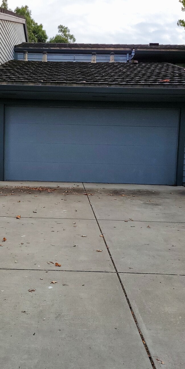
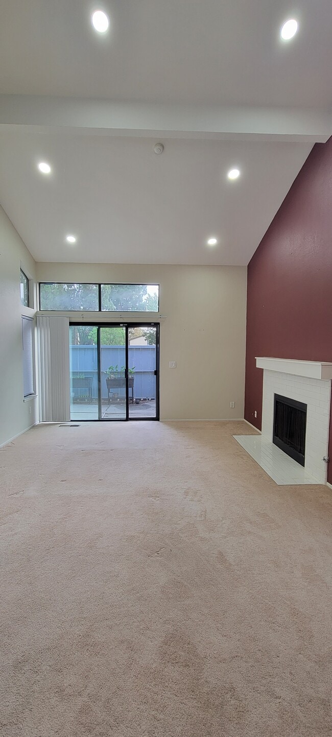
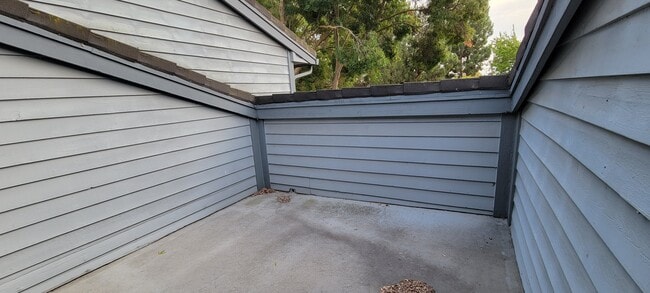
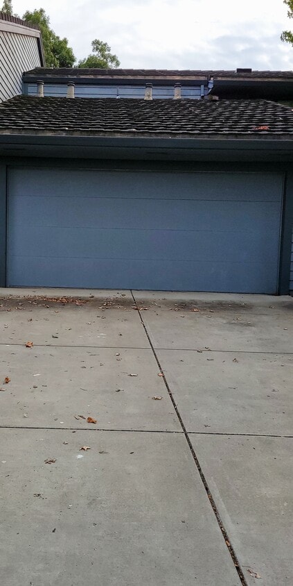
High ceiling, recess lighting driveway, 2 car garage, patio, balcony, easy access to 880, 680 highways, close to restaurants, Costco, includes community pools, tennis courts, gym, in unit washer dryer and many more amenities
6203 Joaquin Murieta Ave is a townhome located in Alameda County and the 94560 ZIP Code.
Townhome Features
Washer/Dryer
Dishwasher
Fireplace
Smoke Free
- Washer/Dryer
- Smoke Free
- Fireplace
- Dishwasher
- Fitness Center
- Pool
- Balcony
- Patio
Location
Get Directions
Newark, California is a quiet community fringed by thousands of acres of pristine wetlands on the eastern edge of the San Francisco Bay. Located 25 miles south of Oakland, Newark forms part of the Tri-City area, along with Union City and Fremont. The neighborhood is family-oriented with rows of small homes and many parks interspersed throughout. Many people who work in nearby San Jose or across the bay in Palo Alto choose to live in Newark for the more affordable cost of living and more laid-back pace of life.
Five parks are housed within Newark’s boundaries, adding the aquatic scenery and outdoor attractions of the area. Amenity-laden apartment communities sit just minutes from the conveniences along the Nimitz Freeway and Fremont.
Learn more about living in Newark
Amenities
- Washer/Dryer
- Smoke Free
- Fireplace
- Dishwasher
- Balcony
- Patio
- Fitness Center
- Pool
Expenses
Utilities Included
Water, Trash Removal, Sewer
Included
Education
| Colleges & Universities | Distance | ||
|---|---|---|---|
| Colleges & Universities | Distance | ||
| Walk: | 11 min | 0.6 mi | |
| Drive: | 12 min | 6.3 mi | |
| Drive: | 17 min | 11.7 mi | |
| Drive: | 28 min | 19.9 mi |
6203 Joaquin Murieta Ave is within 11 minutes or 0.6 mile from Ohlone College, Newark. It is also near Ohlone College, Fremont Campus and Palmer College of Chiropractic West Campus.
Transportation options available in Newark include Fremont Station, located 3.8 miles from 6203 Joaquin Murieta Ave. 6203 Joaquin Murieta Ave is near Norman Y Mineta San Jose International, located 15.8 miles or 21 minutes away, and Metro Oakland International, located 21.6 miles or 28 minutes away.
| Transit / Subway | Distance | ||
|---|---|---|---|
| Transit / Subway | Distance | ||
|
|
Drive: | 8 min | 3.8 mi |
|
|
Drive: | 9 min | 4.0 mi |
|
|
Drive: | 9 min | 4.6 mi |
|
|
Drive: | 13 min | 7.2 mi |
| Drive: | 20 min | 15.1 mi |
| Commuter Rail | Distance | ||
|---|---|---|---|
| Commuter Rail | Distance | ||
| Drive: | 8 min | 4.6 mi | |
| Drive: | 8 min | 4.8 mi | |
| Drive: | 18 min | 13.3 mi | |
| Drive: | 25 min | 18.5 mi | |
| Drive: | 25 min | 18.5 mi |
| Airports | Distance | ||
|---|---|---|---|
| Airports | Distance | ||
|
Norman Y Mineta San Jose International
|
Drive: | 21 min | 15.8 mi |
|
Metro Oakland International
|
Drive: | 28 min | 21.6 mi |
Time and distance from 6203 Joaquin Murieta Ave.
| Shopping Centers | Distance | ||
|---|---|---|---|
| Shopping Centers | Distance | ||
| Walk: | 11 min | 0.6 mi | |
| Walk: | 11 min | 0.6 mi | |
| Walk: | 11 min | 0.6 mi |
6203 Joaquin Murieta Ave has 3 shopping centers within 0.6 mile, which is about a 11-minute walk. The miles and minutes will be for the farthest away property.
| Parks and Recreation | Distance | ||
|---|---|---|---|
| Parks and Recreation | Distance | ||
|
Central Park (Lake Elizabeth)
|
Drive: | 8 min | 3.9 mi |
|
Quarry Lakes Regional Recreation Area
|
Drive: | 9 min | 5.5 mi |
|
Alameda Creek Regional Trail
|
Drive: | 10 min | 5.7 mi |
|
Niles Community Park
|
Drive: | 14 min | 6.8 mi |
|
Ardenwood Historic Farm
|
Drive: | 12 min | 7.6 mi |
6203 Joaquin Murieta Ave has 5 parks within 7.6 miles, including Central Park (Lake Elizabeth), Ardenwood Historic Farm, and Quarry Lakes Regional Recreation Area.
| Hospitals | Distance | ||
|---|---|---|---|
| Hospitals | Distance | ||
| Drive: | 6 min | 3.2 mi | |
| Drive: | 8 min | 3.7 mi | |
| Drive: | 15 min | 10.7 mi |
6203 Joaquin Murieta Ave has 3 hospitals within 10.7 miles, the nearest is Kaiser Foundation Hospital - Fremont which is 3.2 miles away and a 6 minute drive.
| Military Bases | Distance | ||
|---|---|---|---|
| Military Bases | Distance | ||
| Drive: | 26 min | 18.5 mi |
6203 Joaquin Murieta Ave is 18.5 miles and a 26 minute drive from Ames Research Center.
You May Also Like
Similar Rentals Nearby


")


What Are Walk Score®, Transit Score®, and Bike Score® Ratings?
Walk Score® measures the walkability of any address. Transit Score® measures access to public transit. Bike Score® measures the bikeability of any address.
What is a Sound Score Rating?
A Sound Score Rating aggregates noise caused by vehicle traffic, airplane traffic and local sources
6203 Joaquin Murieta Ave
Newark, CA 94560