$2,500
/ Month
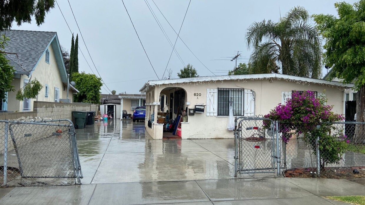
620 E Saxon Ave Unit APT B
San Gabriel, CA 91776
Today
Favorites
626-877-1581
-
Bedrooms
2
-
Bathrooms
1
-
Square Feet
900 sq ft
-
Available
Available Now
620 E Saxon Ave Unit APT B

Favorites
Garvey is a predominantly residential neighborhood located in the heart of San Gabriel Valley. Complemented by cacti and palm trees, a variety of moderately-priced to upscale Mediterranean-style houses, and apartments dot the neighborhood. Garvey has several schools, parks, stores, authentic restaurants, and international grocery stores. Residents enjoy access to several roadways including Interstate 710, Interstate 10, and Highway 60. Downtown Los Angeles, which is just 10 miles away, and other major destinations are convenient to Garvey. If you’re looking for a family-oriented neighborhood or a quiet place convenient for commuting, Garvey is a great choice.
Learn more about living in Garvey
Education
| Colleges & Universities | Distance | ||
|---|---|---|---|
| Colleges & Universities | Distance | ||
| Drive: | 9 min | 5.2 mi | |
| Drive: | 11 min | 5.8 mi | |
| Drive: | 16 min | 6.4 mi | |
| Drive: | 14 min | 7.4 mi |
620 E Saxon Ave Unit APT B is within 9 minutes or 5.2 miles from Cal State Los Angeles. It is also near East Los Angeles College and Caltech.
Transportation options available in San Gabriel include Atlantic, located 6.1 miles from 620 E Saxon Ave Unit APT B. 620 E Saxon Ave Unit APT B is near Bob Hope, located 23.8 miles or 31 minutes away, and Long Beach (Daugherty Field), located 24.2 miles or 34 minutes away.
| Transit / Subway | Distance | ||
|---|---|---|---|
| Transit / Subway | Distance | ||
|
|
Drive: | 11 min | 6.1 mi |
|
|
Drive: | 13 min | 6.8 mi |
|
|
Drive: | 15 min | 7.5 mi |
| Drive: | 10 min | 7.5 mi | |
|
|
Drive: | 11 min | 8.0 mi |
| Commuter Rail | Distance | ||
|---|---|---|---|
| Commuter Rail | Distance | ||
|
|
Drive: | 8 min | 4.6 mi |
|
|
Drive: | 14 min | 6.8 mi |
|
|
Drive: | 14 min | 9.6 mi |
|
|
Drive: | 17 min | 11.8 mi |
| Drive: | 16 min | 13.1 mi |
| Airports | Distance | ||
|---|---|---|---|
| Airports | Distance | ||
|
Bob Hope
|
Drive: | 31 min | 23.8 mi |
|
Long Beach (Daugherty Field)
|
Drive: | 34 min | 24.2 mi |
Time and distance from 620 E Saxon Ave Unit APT B.
| Shopping Centers | Distance | ||
|---|---|---|---|
| Shopping Centers | Distance | ||
| Walk: | 13 min | 0.7 mi | |
| Walk: | 15 min | 0.8 mi | |
| Walk: | 15 min | 0.8 mi |
620 E Saxon Ave Unit APT B has 3 shopping centers within 0.8 mile, which is about a 15-minute walk. The miles and minutes will be for the farthest away property.
| Parks and Recreation | Distance | ||
|---|---|---|---|
| Parks and Recreation | Distance | ||
|
Whittier Narrows Recreation Area
|
Drive: | 10 min | 4.0 mi |
|
Huntington Botanical Gardens
|
Drive: | 15 min | 5.3 mi |
|
Whittier Narrows Nature Center
|
Drive: | 12 min | 6.3 mi |
|
Los Angeles County Arboretum
|
Drive: | 15 min | 7.0 mi |
|
Pio Pico State Historic Park
|
Drive: | 16 min | 7.3 mi |
620 E Saxon Ave Unit APT B has 5 parks within 7.3 miles, including Whittier Narrows Recreation Area, Huntington Botanical Gardens, and Whittier Narrows Nature Center.
| Hospitals | Distance | ||
|---|---|---|---|
| Hospitals | Distance | ||
| Drive: | 5 min | 2.3 mi | |
| Drive: | 4 min | 2.6 mi | |
| Drive: | 7 min | 2.8 mi |
620 E Saxon Ave Unit APT B has 3 hospitals within 2.8 miles, the nearest is BHC Alhambra Hospital which is 2.3 miles away and a 5 minute drive.
| Military Bases | Distance | ||
|---|---|---|---|
| Military Bases | Distance | ||
| Drive: | 35 min | 26.8 mi | |
| Drive: | 39 min | 27.8 mi |
620 E Saxon Ave Unit APT B is 26.8 miles from Los Angeles Air Force Base, and is convenient to other military bases, including Los Alamitos Army Airfield.
You May Also Like
Similar Rentals Nearby


 - Violet on Virgil")


 - AVA Burbank")


What Are Walk Score®, Transit Score®, and Bike Score® Ratings?
Walk Score® measures the walkability of any address. Transit Score® measures access to public transit. Bike Score® measures the bikeability of any address.
What is a Sound Score Rating?
A Sound Score Rating aggregates noise caused by vehicle traffic, airplane traffic and local sources
620 E Saxon Ave
San Gabriel, CA 91776