
Anton Menlo
3639 Haven Ave,
Menlo Park, CA 94025
$3,200 - $6,973
Studio - 3 Beds
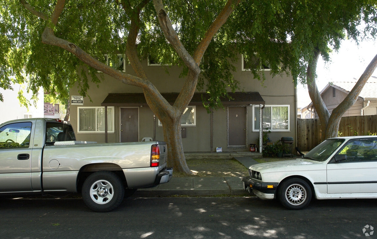

618-634 Buckeye St offers a combination of comfort and quality. The location of this community is at 618-634 Buckeye St. in Redwood City. The team of leasing professionals is ready to help you find the perfect floorplan. Make sure you to see the current floorplan options. Contact us or drop by the leasing office to find out current pricing and find your new home at 618-634 Buckeye St.
618-634 Buckeye St is an apartment community located in San Mateo County and the 94063 ZIP Code. This area is served by the Redwood City Elementary School District attendance zone.
High Speed Internet Access
Smoke Free
Heating
Kitchen
Though difficult to pronounce, there’s nothing complicated about living in Staumbaugh Heller. With an incredible location in the Bay area city of Redwood City, this neighborhood boasts extremely sunny weather, large technology companies, affluent residential areas, public transportation, and highly walkable streets.
In the heart of the Silicon Valley, Staumbaugh Heller is also known for its proximity to the active deep water port in the southern San Francisco Bay. This lively neighborhood is just minutes from popular parks and nature preserves right on the coast. Though bayside views are something to brag about, the proximity to Redwood City’s downtown theater and the San Mateo County History Museum aren’t too shabby either!
Local restaurants and bars, popular chains, community parks, and grocery stores reside around town, making this neighborhood a premier destination to put down roots and find the perfect apartment.
Learn more about living in Staumbaugh HellerCompare neighborhood and city base rent averages by bedroom.
| Staumbaugh Heller | Redwood City, CA | |
|---|---|---|
| Studio | $1,977 | $2,444 |
| 1 Bedroom | $2,263 | $3,021 |
| 2 Bedrooms | $2,990 | $3,970 |
| 3 Bedrooms | $3,232 | $5,145 |
| Colleges & Universities | Distance | ||
|---|---|---|---|
| Colleges & Universities | Distance | ||
| Drive: | 8 min | 3.0 mi | |
| Drive: | 11 min | 4.2 mi | |
| Drive: | 17 min | 6.6 mi | |
| Drive: | 16 min | 11.1 mi |


Transportation options available in Redwood City include Mountain View Station, located 12.4 miles from 618-634 Buckeye St. 618-634 Buckeye St is near San Francisco International, located 15.5 miles or 22 minutes away, and Metro Oakland International, located 31.2 miles or 40 minutes away.
| Transit / Subway | Distance | ||
|---|---|---|---|
| Transit / Subway | Distance | ||
| Drive: | 16 min | 12.4 mi |
| Commuter Rail | Distance | ||
|---|---|---|---|
| Commuter Rail | Distance | ||
| Walk: | 16 min | 0.9 mi | |
| Drive: | 8 min | 3.2 mi | |
| Drive: | 8 min | 3.5 mi | |
| Drive: | 11 min | 4.7 mi | |
| Drive: | 9 min | 5.8 mi |
| Airports | Distance | ||
|---|---|---|---|
| Airports | Distance | ||
|
San Francisco International
|
Drive: | 22 min | 15.5 mi |
|
Metro Oakland International
|
Drive: | 40 min | 31.2 mi |
Scores provided by
Traffic
-Airport
-Businesses
-Scores provided by
HowLoud What is a Sound Score Rating? A Sound Score Rating aggregates noise caused by vehicle traffic, airplane traffic and local sources. How It WorksTime and distance from 618-634 Buckeye St.
| Shopping Centers | Distance | ||
|---|---|---|---|
| Shopping Centers | Distance | ||
| Walk: | 6 min | 0.3 mi | |
| Walk: | 12 min | 0.6 mi | |
| Walk: | 12 min | 0.6 mi |
| Parks and Recreation | Distance | ||
|---|---|---|---|
| Parks and Recreation | Distance | ||
|
Red Morton Park
|
Drive: | 5 min | 1.9 mi |
|
Holbrook-Palmer Park
|
Drive: | 7 min | 2.6 mi |
|
Stulsaft Park
|
Drive: | 7 min | 2.8 mi |
|
Bayfront Park
|
Drive: | 8 min | 3.4 mi |
|
Fremont Park
|
Drive: | 9 min | 3.8 mi |
| Hospitals | Distance | ||
|---|---|---|---|
| Hospitals | Distance | ||
| Walk: | 14 min | 0.7 mi | |
| Drive: | 6 min | 2.3 mi | |
| Drive: | 13 min | 5.2 mi |
| Military Bases | Distance | ||
|---|---|---|---|
| Military Bases | Distance | ||
| Drive: | 19 min | 12.4 mi |
Fitness Center Pool In Unit Washer & Dryer High-Speed Internet Stainless Steel Appliances Package Service
Pets Allowed Dishwasher Walk-In Closets Balcony Maintenance on site CableReady Elevator
What Are Walk Score®, Transit Score®, and Bike Score® Ratings?
Walk Score® measures the walkability of any address. Transit Score® measures access to public transit. Bike Score® measures the bikeability of any address.
What is a Sound Score Rating?
A Sound Score Rating aggregates noise caused by vehicle traffic, airplane traffic and local sources.

618-634 Buckeye St
Redwood City, CA 94063


