
$2,800
/ Month
6140 Monterey Rd Unit #329
Los Angeles, CA 90042
2 Weeks Ago
Favorites
6140 Monterey Rd Unit #329

Favorites
Check Back Soon for Upcoming Availability
| Beds | Baths | Average SF |
|---|---|---|
| 2 Bedrooms 2 Bedrooms 2 Br | 2 Baths 2 Baths 2 Ba | 1,200 SF |
Fees and Policies
Details
Utilities Included
-
Water
-
Trash Removal
Lease Options
-
12 Months
About This Property
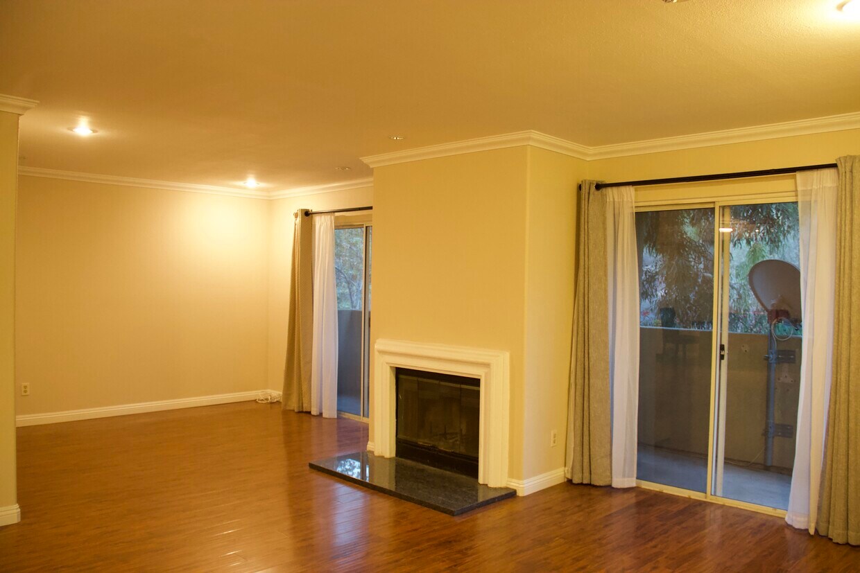
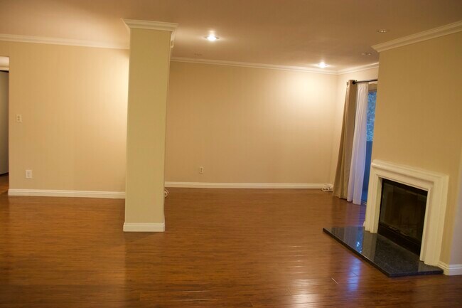
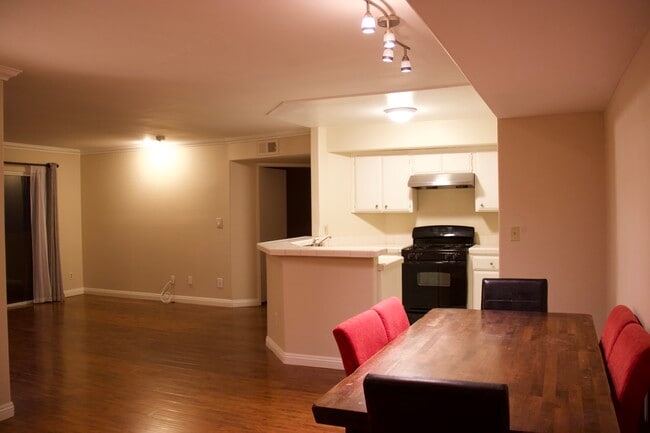
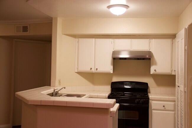
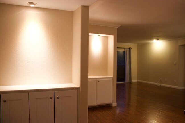
2 bedroom + 2 full bath + 2 walk in closet + 2 fireplace Condo - Pool, Jaccuzi, Gym 2-car Parking Included. Central AC, heating. Right on the boarder of South Pasadena and LA, right off 110 freeway, minutes to Downtown LA. Facing to the hillside, beautiful view and quiet. Washer and dryer are already in Unit, included.
6140 Monterey Rd is a condo located in Los Angeles County and the 90042 ZIP Code. This area is served by the Los Angeles Unified attendance zone.
Condo Features
Washer/Dryer
Air Conditioning
Dishwasher
Hardwood Floors
- Washer/Dryer
- Air Conditioning
- Heating
- Smoke Free
- Fireplace
- Wheelchair Accessible (Rooms)
- Dishwasher
- Hardwood Floors
- Walk-In Closets
- Wheelchair Accessible
- Elevator
- Fitness Center
- Pool
- Gated
- Balcony

6140 Monterey
92 Units
4 Stories
Built in 1989
153,889 Sq Ft
6140 Monterey Road is a four-story condominium building completed in 1989, located in the serene Montecito Heights neighborhood. With 92 units, this building offers a peaceful retreat while being conveniently close to the vibrant areas of Highland Park and Pasadena. The building's design focuses on providing a comfortable living experience, blending seamlessly with the lush, woodsy surroundings that Montecito Heights is known for.
Learn more about 6140 Monterey
Location
Get Directions
A quiet suburb outside of Los Angeles, Monterey Hills is known for its rolling hills, winding residential streets, and elevated city views. Check out Elephant Hill, a popular place to bike or hike that offers beautiful views of the neighborhood. Herman Park is nestled along Highway 110 in the north end of the neighborhood, offering tennis courts, playgrounds, and a dog park. And for more outdoor recreation, visit the biking paths and hiking trails at Ernest E. Debs Regional Park, bordering Monterey Hills.
Monterey Hills is a more secluded part of Northeast Los Angeles with larger lots, single-family homes, and tree-lined streets. However, if you cross over Highway 110, you’ll find theatres, restaurants, services, and more. Monterey Hills is located just seven miles northeast of Downtown Los Angeles and eight miles east of major attractions such as Griffith Park, the Los Angeles Zoo, the Greek Theatre, and Glendale Galleria.
Learn more about living in Monterey HillsBelow are rent ranges for similar nearby apartments
Amenities
- Washer/Dryer
- Air Conditioning
- Heating
- Smoke Free
- Fireplace
- Wheelchair Accessible (Rooms)
- Dishwasher
- Hardwood Floors
- Walk-In Closets
- Wheelchair Accessible
- Elevator
- Gated
- Balcony
- Fitness Center
- Pool
Expenses
Utilities Included
Water, Trash Removal
Included
Education
| Colleges & Universities | Distance | ||
|---|---|---|---|
| Colleges & Universities | Distance | ||
| Drive: | 8 min | 3.1 mi | |
| Drive: | 6 min | 3.5 mi | |
| Drive: | 9 min | 4.2 mi | |
| Drive: | 12 min | 5.2 mi |
6140 Monterey Rd Unit #329 is within 8 minutes or 3.1 miles from Occidental College. It is also near Art Center College of Design and USC, Health Sciences Campus.
Schools


Public Elementary School
Grades K-6
756 Students
Nearby
Public Elementary School
Grades K-5
181 Students
Attendance Zone
Public Middle & High School
Grades 6-12
1,389 Students
Attendance Zone
Public Middle School
Grades 6-8
904 Students
Attendance Zone
Private Elementary School
Grades PK-5
131 Students
Nearby
Private Elementary, Middle & High School
Grades K-12
93 Students
Nearby
Private Elementary & Middle School
Grades K-8
Nearby
Private Elementary School
Grades K-6
Nearby
School data provided by
 The GreatSchools Rating helps parents compare schools within a state based on a variety of school quality indicators and provides a helpful picture of how effectively each school serves all of its students. Ratings are on a scale of 1 (below average) to 10 (above average) and can include test scores, college readiness, academic progress, advanced courses, equity, discipline and attendance data. We also advise parents to visit schools, consider other information on school performance and programs, and consider family needs as part of the school selection process.
View GreatSchools Rating Methodology
Data provided by GreatSchools.org © 2025. All rights reserved.
View GreatSchools Rating Methodology
Data provided by GreatSchools.org © 2025. All rights reserved.
Transportation options available in Los Angeles include Highland Park Station, located 0.9 mile from 6140 Monterey Rd Unit #329. 6140 Monterey Rd Unit #329 is near Bob Hope, located 17.6 miles or 25 minutes away, and Los Angeles International, located 20.6 miles or 33 minutes away.
| Transit / Subway | Distance | ||
|---|---|---|---|
| Transit / Subway | Distance | ||
|
|
Walk: | 17 min | 0.9 mi |
|
|
Drive: | 4 min | 1.7 mi |
|
|
Drive: | 5 min | 2.3 mi |
|
|
Drive: | 5 min | 2.6 mi |
|
|
Drive: | 6 min | 3.8 mi |
| Commuter Rail | Distance | ||
|---|---|---|---|
| Commuter Rail | Distance | ||
|
|
Drive: | 10 min | 5.5 mi |
|
|
Drive: | 12 min | 5.6 mi |
|
|
Drive: | 11 min | 6.8 mi |
| Drive: | 14 min | 9.6 mi | |
|
|
Drive: | 22 min | 13.9 mi |
| Airports | Distance | ||
|---|---|---|---|
| Airports | Distance | ||
|
Bob Hope
|
Drive: | 25 min | 17.6 mi |
|
Los Angeles International
|
Drive: | 33 min | 20.6 mi |
Time and distance from 6140 Monterey Rd Unit #329.
| Shopping Centers | Distance | ||
|---|---|---|---|
| Shopping Centers | Distance | ||
| Walk: | 14 min | 0.7 mi | |
| Drive: | 3 min | 1.2 mi | |
| Drive: | 3 min | 1.3 mi |
6140 Monterey Rd Unit #329 has 3 shopping centers within 1.3 miles, which is about a 3-minute walk. The miles and minutes will be for the farthest away property.
| Parks and Recreation | Distance | ||
|---|---|---|---|
| Parks and Recreation | Distance | ||
|
Audubon Center at Debs Park
|
Drive: | 4 min | 1.6 mi |
|
Kidspace Children's Museum
|
Drive: | 10 min | 5.1 mi |
|
Elysian Park
|
Drive: | 12 min | 5.3 mi |
|
Elyria Canyon Park
|
Drive: | 10 min | 5.6 mi |
|
Marsh Park
|
Drive: | 11 min | 5.9 mi |
6140 Monterey Rd Unit #329 has 5 parks within 5.9 miles, including Audubon Center at Debs Park, Elyria Canyon Park, and Kidspace Children's Museum.
| Hospitals | Distance | ||
|---|---|---|---|
| Hospitals | Distance | ||
| Drive: | 8 min | 3.6 mi | |
| Drive: | 8 min | 3.9 mi | |
| Drive: | 6 min | 3.9 mi |
6140 Monterey Rd Unit #329 has 3 hospitals within 3.9 miles, the nearest is Alhambra Hospital Medical Center which is 3.6 miles away and a 8 minute drive.
| Military Bases | Distance | ||
|---|---|---|---|
| Military Bases | Distance | ||
| Drive: | 30 min | 22.2 mi | |
| Drive: | 43 min | 29.6 mi |
6140 Monterey Rd Unit #329 is 22.2 miles from Los Angeles Air Force Base, and is convenient to other military bases, including Los Alamitos Army Airfield.
You May Also Like
Similar Rentals Nearby


What Are Walk Score®, Transit Score®, and Bike Score® Ratings?
Walk Score® measures the walkability of any address. Transit Score® measures access to public transit. Bike Score® measures the bikeability of any address.
What is a Sound Score Rating?
A Sound Score Rating aggregates noise caused by vehicle traffic, airplane traffic and local sources

6140 Monterey Rd
Los Angeles, CA 90042