Presidential Towers
555 W Madison St,
Chicago, IL 60661
$1,738 - $5,510
Studio - 2 Beds
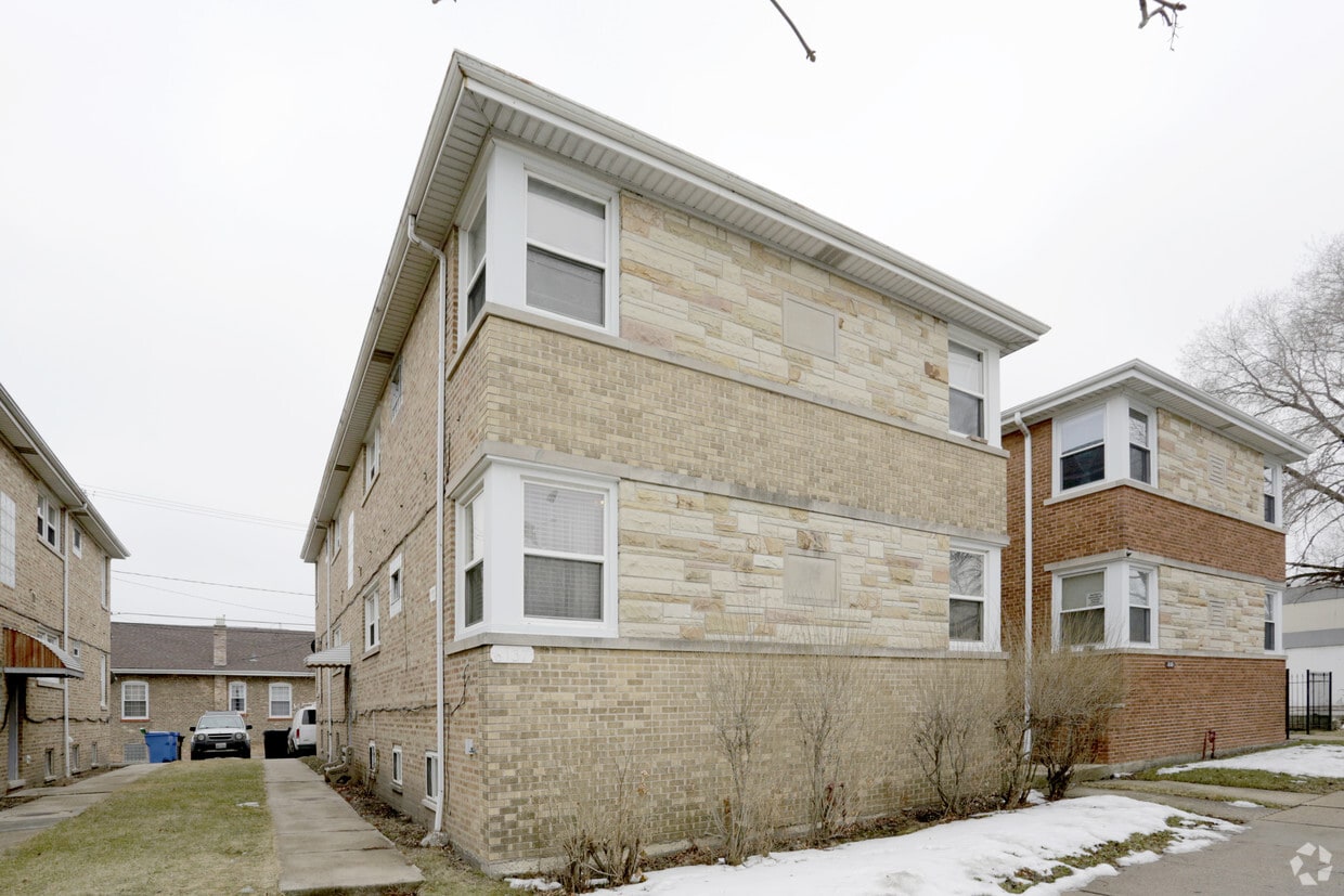
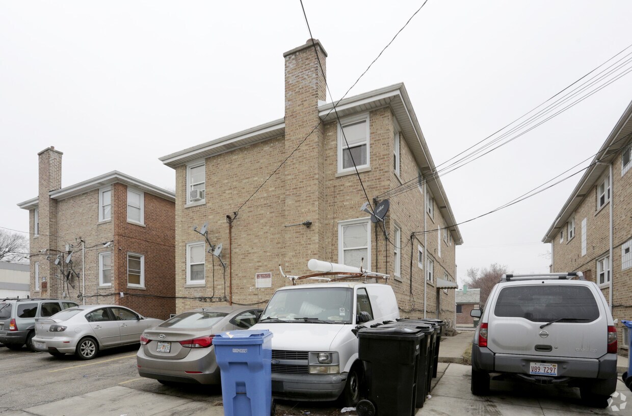
6137 W Fullerton Ave offers a blend of style, comfort and livability. Located in the 60639 area of Chicago on W. Fullerton Ave, local residents have connection to a mixture of great entertainment options found in the surrounding area. The leasing staff is ready to take you for a tour. Come by to view the available floorplans. Contact us or drop by the leasing office to talk about leasing your new apartment and make your move to 6137 W Fullerton Ave.
6137 W Fullerton Ave is an apartment community located in Cook County and the 60639 ZIP Code. This area is served by the Chicago Public Schools attendance zone.
Belmont Central is a residential community about 10 miles northwest of Chicago featuring good schools, a variety of restaurants, stores, and a community park known as Riis Park. Belmont Central holds many styles of rentals ranging from moderate to more luxury prices. While Diversey Avenue, Belmont Avenue, and Fullerton Avenue provide an abundance of delicious food and shopping choices, more retail and restaurant options are situated just outside of the town’s western border at Brickyard Mall and its surrounding shopping centers. Continue traveling for about five miles west to reach the picturesque parks, trails, and golf courses along the Des Plaines River, or head 10 miles east to enjoy outdoor adventure at Lake Michigan.
Learn more about living in Belmont CentralCompare neighborhood and city base rent averages by bedroom.
| Belmont Central | Chicago, IL | |
|---|---|---|
| Studio | $1,153 | $1,641 |
| 1 Bedroom | $1,219 | $2,037 |
| 2 Bedrooms | $1,902 | $2,561 |
| 3 Bedrooms | $3,493 | $3,070 |
| Colleges & Universities | Distance | ||
|---|---|---|---|
| Colleges & Universities | Distance | ||
| Drive: | 9 min | 3.0 mi | |
| Drive: | 8 min | 3.2 mi | |
| Drive: | 10 min | 3.7 mi | |
| Drive: | 9 min | 3.7 mi |
The GreatSchools Rating helps parents compare schools within a state based on a variety of school quality indicators and provides a helpful picture of how effectively each school serves all of its students. Ratings are on a scale of 1 (below average) to 10 (above average) and can include test scores, college readiness, academic progress, advanced courses, equity, discipline and attendance data. We also advise parents to visit schools, consider other information on school performance and programs, and consider family needs as part of the school selection process.
Transportation options available in Chicago include Ridgeland Station, located 3.2 miles from 6137 W Fullerton Ave. 6137 W Fullerton Ave is near Chicago O'Hare International, located 10.1 miles or 19 minutes away, and Chicago Midway International, located 11.2 miles or 20 minutes away.
| Transit / Subway | Distance | ||
|---|---|---|---|
| Transit / Subway | Distance | ||
|
|
Drive: | 8 min | 3.2 mi |
|
|
Drive: | 6 min | 3.3 mi |
|
|
Drive: | 9 min | 3.4 mi |
|
|
Drive: | 8 min | 3.8 mi |
|
|
Drive: | 10 min | 3.9 mi |
| Commuter Rail | Distance | ||
|---|---|---|---|
| Commuter Rail | Distance | ||
|
|
Walk: | 15 min | 0.8 mi |
|
|
Walk: | 20 min | 1.1 mi |
|
|
Drive: | 3 min | 1.2 mi |
|
|
Drive: | 3 min | 1.3 mi |
|
|
Drive: | 4 min | 1.9 mi |
| Airports | Distance | ||
|---|---|---|---|
| Airports | Distance | ||
|
Chicago O'Hare International
|
Drive: | 19 min | 10.1 mi |
|
Chicago Midway International
|
Drive: | 20 min | 11.2 mi |
Time and distance from 6137 W Fullerton Ave.
| Shopping Centers | Distance | ||
|---|---|---|---|
| Shopping Centers | Distance | ||
| Walk: | 9 min | 0.5 mi | |
| Walk: | 12 min | 0.7 mi | |
| Drive: | 4 min | 1.4 mi |
| Parks and Recreation | Distance | ||
|---|---|---|---|
| Parks and Recreation | Distance | ||
|
Riis Park
|
Walk: | 5 min | 0.3 mi |
|
Wonder Works Children's Museum
|
Drive: | 3 min | 1.5 mi |
|
LaFollette Park
|
Drive: | 4 min | 2.4 mi |
|
Portage Park
|
Drive: | 7 min | 3.2 mi |
|
Kilbourn Park
|
Drive: | 8 min | 3.5 mi |
| Hospitals | Distance | ||
|---|---|---|---|
| Hospitals | Distance | ||
| Drive: | 3 min | 1.3 mi | |
| Drive: | 4 min | 2.3 mi | |
| Drive: | 7 min | 2.7 mi |
| Military Bases | Distance | ||
|---|---|---|---|
| Military Bases | Distance | ||
| Drive: | 20 min | 10.1 mi | |
| Drive: | 31 min | 14.9 mi | |
| Drive: | 29 min | 19.5 mi |
What Are Walk Score®, Transit Score®, and Bike Score® Ratings?
Walk Score® measures the walkability of any address. Transit Score® measures access to public transit. Bike Score® measures the bikeability of any address.
What is a Sound Score Rating?
A Sound Score Rating aggregates noise caused by vehicle traffic, airplane traffic and local sources.