
$2,500 / Month
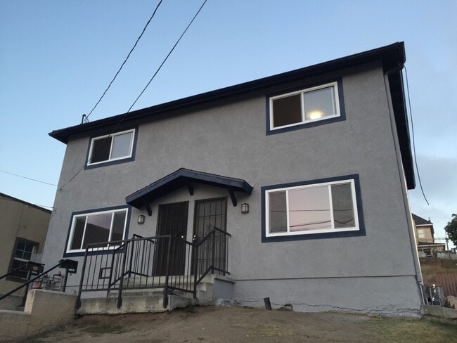
612 San Benito Street
Los Angeles, CA 90033
2 Weeks Ago
Favorites
612 San Benito Street

Favorites
Check Back Soon for Upcoming Availability
| Beds | Baths | Average SF |
|---|---|---|
| 2 Bedrooms 2 Bedrooms 2 Br | 1.5 Baths 1.5 Baths 1.5 Ba | 1,000 SF |
Fees and Policies
The fees below are based on community-supplied data and may exclude additional fees and utilities.
- Dogs Allowed
-
Fees not specified
- Cats Allowed
-
Fees not specified
- Parking
-
Surface Lot--
Details
Utilities Included
-
Water
-
Trash Removal
Property Information
-
Built in 1991
About This Property
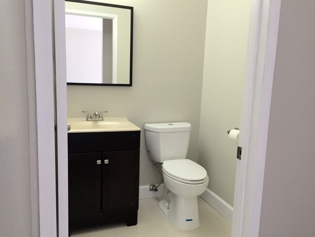
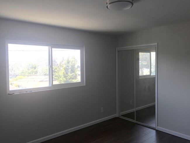
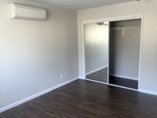
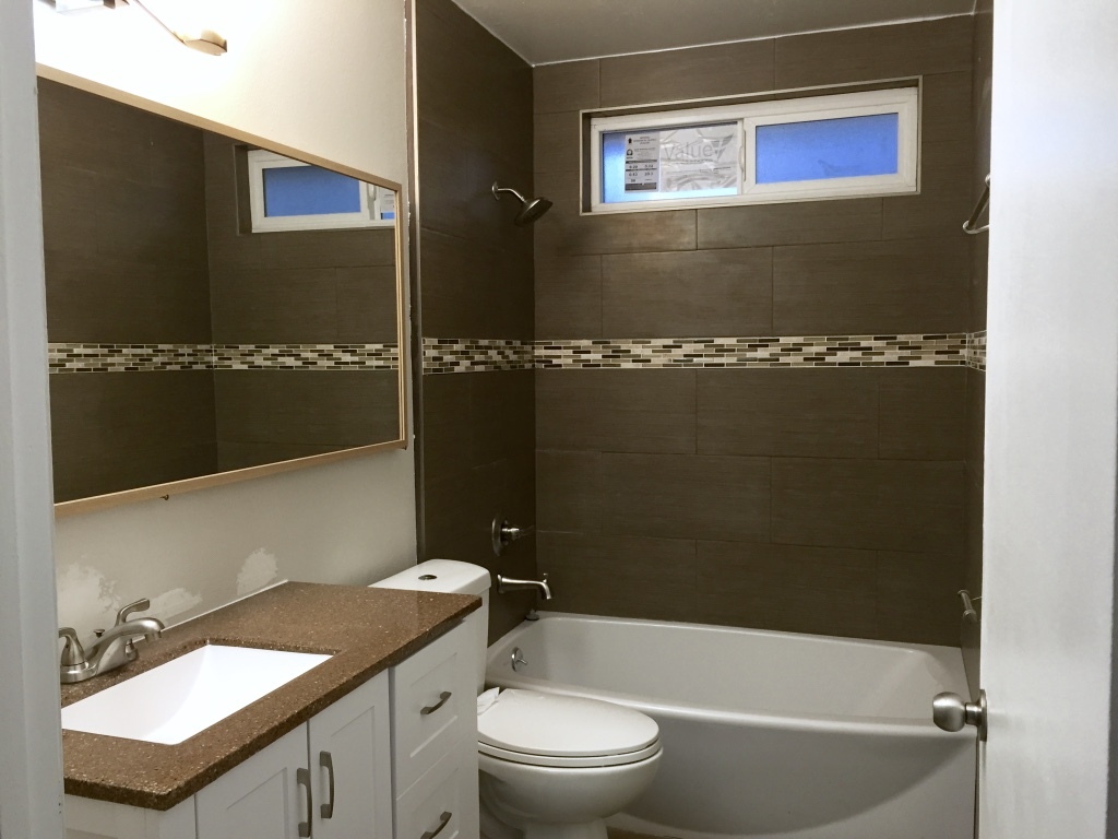
Large modern unit with stainless steel appliances, including washer, dryer, microwave, stove, dishwasher, and refrigerator. Water and trash removal are included in the rent. The unit has laminate wood flooring throughout, recess lighting in the living room, tankless water heater, as well as ductless heating and cooling in both living area and bedrooms. Unit also includes private parking for two medium-sized cars in the rear. Please Text or Email to arrange viewing.
612 San Benito Street is a townhome located in Los Angeles County and the 90033 ZIP Code.
Townhome Features
Washer/Dryer
Air Conditioning
Dishwasher
Washer/Dryer Hookup
- High Speed Internet Access
- Washer/Dryer
- Washer/Dryer Hookup
- Air Conditioning
- Heating
- Cable Ready
- Storage Space
- Tub/Shower
- Handrails
- Framed Mirrors
- Dishwasher
- Stainless Steel Appliances
- Microwave
- Refrigerator
- Hardwood Floors
- Storage Space
- Patio
Location
Get Directions
Southeast Los Angeles is directly south of the Fashion District and east of the University of Southern California (USC). This large neighborhood is minutes from downtown Los Angeles, Hollywood, and Beverly Hills, with easy access to the 110 Freeway. This great location places you near sunny beaches, nature trails, and a bevy of leading employers. Students can access both USC and California State University Long Beach from their Southeast LA apartment.
This densely populated, diverse neighborhood features everything from food trucks and corner markets to wide sidewalks and residential areas filled with bungalows, ranch, and Spanish Colonial architecture. Southeast LA features palm trees and mountain views, tampered with gritty undertones to give it a cool, funky vibe.
As for outdoor fun, take your pick between Catalina Island, Venus Beach, or the Santa Monica Pier. Nearby, you’ll find more sunny beaches like White Point, Cabrillo, and Long Beach.
Learn more about living in Southeast Los AngelesBelow are rent ranges for similar nearby apartments
Amenities
- High Speed Internet Access
- Washer/Dryer
- Washer/Dryer Hookup
- Air Conditioning
- Heating
- Cable Ready
- Storage Space
- Tub/Shower
- Handrails
- Framed Mirrors
- Dishwasher
- Stainless Steel Appliances
- Microwave
- Refrigerator
- Hardwood Floors
- Storage Space
- Patio
Expenses
Utilities Included
Water, Trash Removal
Included
Education
| Colleges & Universities | Distance | ||
|---|---|---|---|
| Colleges & Universities | Distance | ||
| Drive: | 4 min | 1.4 mi | |
| Drive: | 6 min | 3.4 mi | |
| Drive: | 7 min | 3.9 mi | |
| Drive: | 7 min | 3.9 mi |
612 San Benito Street is within 4 minutes or 1.4 miles from USC, Health Sciences Campus. It is also near Cal State Los Angeles and Golden Gate Univ, Los Angeles.
Transportation options available in Los Angeles include Mariachi Plaza / Boyle Heights Station, located 0.7 mile from 612 San Benito Street. 612 San Benito Street is near Bob Hope, located 16.6 miles or 22 minutes away, and Los Angeles International, located 18.3 miles or 29 minutes away.
| Transit / Subway | Distance | ||
|---|---|---|---|
| Transit / Subway | Distance | ||
| Walk: | 12 min | 0.7 mi | |
| Walk: | 14 min | 0.8 mi | |
| Drive: | 3 min | 1.2 mi | |
| Drive: | 5 min | 1.8 mi | |
| Drive: | 4 min | 1.9 mi |
| Commuter Rail | Distance | ||
|---|---|---|---|
| Commuter Rail | Distance | ||
| Drive: | 3 min | 1.5 mi | |
|
|
Drive: | 4 min | 2.0 mi |
| Drive: | 8 min | 5.9 mi | |
| Drive: | 10 min | 6.6 mi | |
| Drive: | 13 min | 8.4 mi |
| Airports | Distance | ||
|---|---|---|---|
| Airports | Distance | ||
|
Bob Hope
|
Drive: | 22 min | 16.6 mi |
|
Los Angeles International
|
Drive: | 29 min | 18.3 mi |
Time and distance from 612 San Benito Street.
| Shopping Centers | Distance | ||
|---|---|---|---|
| Shopping Centers | Distance | ||
| Walk: | 5 min | 0.3 mi | |
| Drive: | 3 min | 1.5 mi | |
| Drive: | 3 min | 1.8 mi |
612 San Benito Street has 3 shopping centers within 1.8 miles, which is about a 3-minute walk. The miles and minutes will be for the farthest away property.
| Parks and Recreation | Distance | ||
|---|---|---|---|
| Parks and Recreation | Distance | ||
|
Hollenbeck Lake
|
Drive: | 3 min | 1.2 mi |
|
Vista Hermosa Natural Park
|
Drive: | 7 min | 3.5 mi |
|
Echo Park Lake
|
Drive: | 6 min | 3.6 mi |
|
Elysian Park
|
Drive: | 10 min | 4.1 mi |
|
Chavez Ravine Arboretum
|
Drive: | 7 min | 4.9 mi |
612 San Benito Street has 5 parks within 4.9 miles, including Hollenbeck Lake, Vista Hermosa Natural Park, and Echo Park Lake.
| Hospitals | Distance | ||
|---|---|---|---|
| Hospitals | Distance | ||
| Walk: | 15 min | 0.8 mi | |
| Drive: | 4 min | 1.6 mi | |
| Drive: | 7 min | 3.4 mi |
612 San Benito Street has 3 hospitals within 3.4 miles, the nearest is LAC + USC Medical Center which is 0.8 mile away and a 15 minute walk.
| Military Bases | Distance | ||
|---|---|---|---|
| Military Bases | Distance | ||
| Drive: | 27 min | 19.6 mi |
612 San Benito Street is 19.6 miles and a 27 minute drive from Los Angeles Air Force Base.
You May Also Like
Similar Rentals Nearby
-
-
-
-
-
-
1 / 50

-
-
-
-


What Are Walk Score®, Transit Score®, and Bike Score® Ratings?
Walk Score® measures the walkability of any address. Transit Score® measures access to public transit. Bike Score® measures the bikeability of any address.
What is a Sound Score Rating?
A Sound Score Rating aggregates noise caused by vehicle traffic, airplane traffic and local sources
612 San Benito Street
Los Angeles, CA 90033