
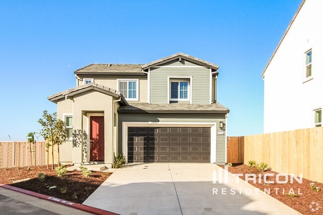
$2,395 / Month
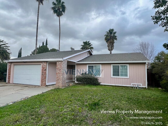
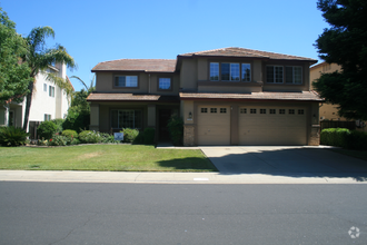
6113 Burntwood Way
Citrus Heights, CA 95621
2 Weeks Ago
Favorites
6113 Burntwood Way

Favorites
Check Back Soon for Upcoming Availability
| Beds | Baths | Average SF |
|---|---|---|
| 3 Bedrooms 3 Bedrooms 3 Br | 2 Baths 2 Baths 2 Ba | 1,151 SF |
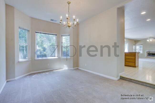
About This Property
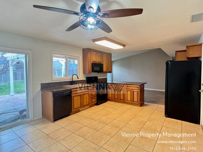
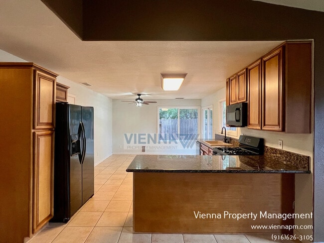
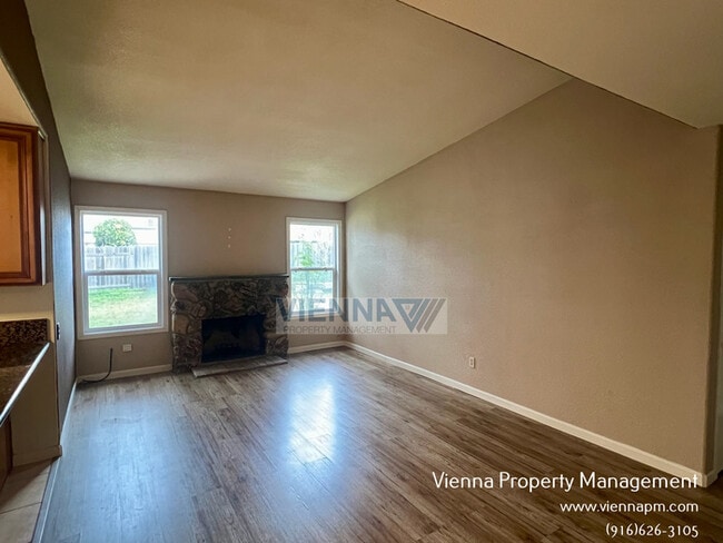
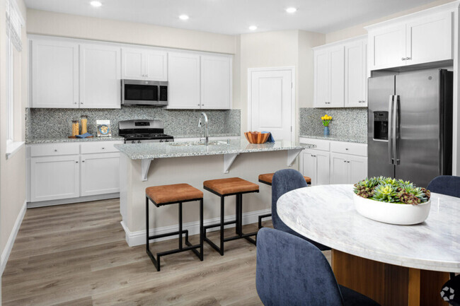
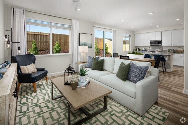
Bedrooms: 3 Bathrooms: 2 SF: 1,151 Rent: $2,395/month Utilities: Tenants are responsible for power/gas/trash/water/sewer Security Deposit: $2,395 Available Date: 3/24/2024 Landscaping: Tenants responsibility Appliances: Tenant provides appliances This immaculate 3 Bedroom 2 Bath home is located in a great neighborhood. The home begins with a living/dining combo room once you walk in and then extends into the family/kitchen combo room. The kitchen has some nice granite counters andwood laminate floors! Down the hall you will make your way to the laundry room, the second bath, two bedrooms, and then finally end up at the Master Suite! All showings are scheduled in a open house format $27.95/month Resident Benefits Package delivers savings and convenient, professional services that make taking care of your home second nature. Please review the flyer for more information! Basic Screening Guidelines: All adults 18 & over must have at least a 640 credit score Verifiable income of at least 3 times the rent amount required 36 months positive verifiable housing history required $45 application fee per adult Vienna Property Management BRE #01882979 Contact us to schedule a showing. Contact us to schedule a showing.
6113 Burntwood Way is a house located in Sacramento County and the 95621 ZIP Code. This area is served by the San Juan Unified attendance zone.
Location
Get Directions
Defined by sun-drenched neighborhoods, tree-lined streets, and lacy palm trees against bright blue sky, Citrus Heights is a beautiful suburban city just 14 miles northeast of Downtown Sacramento. Citrus Heights residents enjoy easy access to I-80, for quick trips to Sacramento or northeast to Roseville, home of the Westfield Galleria at Roseville. Folsom Lake, a popular resort area, is minutes east of Citrus Heights.
Apartments in Citrus Heights provide a quieter option to city living while still being well within reach of everything this busy area has to offer -- including California State University, Sacramento, the Sacramento Zoo, and Sacramento International Airport. But as a busy city with plenty of businesses, shops, restaurants, and entertainment of its own, you'll find plenty to do closer to home. Go shopping at the Sunrise Mall, visit Rusch Park, home of the Historic Rusch Home and Gardens, and spend the afternoon golfing at Foothill Golf Center.
Learn more about living in Citrus Heights
Education
| Colleges & Universities | Distance | ||
|---|---|---|---|
| Colleges & Universities | Distance | ||
| Drive: | 13 min | 6.0 mi | |
| Drive: | 14 min | 9.2 mi | |
| Drive: | 28 min | 14.2 mi | |
| Drive: | 23 min | 14.3 mi |
6113 Burntwood Way is within 13 minutes or 6.0 miles from American River College. It is also near Sierra College, Rocklin Campus and Folsom Lake College, Folsom.
Schools


Public Elementary School
Grades K-3
372 Students
Nearby
Public Elementary & Middle School
Grades K-8
492 Students
Attendance Zone
Public High School
Grades 9-12
888 Students
Attendance Zone
Private Elementary, Middle & High School
Grades PK-12
275 Students
Nearby
Private Elementary, Middle & High School
Grades K-12
Nearby
School data provided by
 The GreatSchools Rating helps parents compare schools within a state based on a variety of school quality indicators and provides a helpful picture of how effectively each school serves all of its students. Ratings are on a scale of 1 (below average) to 10 (above average) and can include test scores, college readiness, academic progress, advanced courses, equity, discipline and attendance data. We also advise parents to visit schools, consider other information on school performance and programs, and consider family needs as part of the school selection process.
View GreatSchools Rating Methodology
View GreatSchools Rating Methodology
Transportation options available in Citrus Heights include Roseville Road Station (Wb), located 7.9 miles from 6113 Burntwood Way. 6113 Burntwood Way is near Sacramento International, located 21.8 miles or 30 minutes away.
| Transit / Subway | Distance | ||
|---|---|---|---|
| Transit / Subway | Distance | ||
| Drive: | 11 min | 7.9 mi | |
| Drive: | 11 min | 7.9 mi | |
| Drive: | 12 min | 8.5 mi | |
| Drive: | 12 min | 8.6 mi | |
| Drive: | 19 min | 10.6 mi |
| Commuter Rail | Distance | ||
|---|---|---|---|
| Commuter Rail | Distance | ||
|
|
Drive: | 10 min | 5.0 mi |
|
|
Drive: | 13 min | 8.4 mi |
| Drive: | 20 min | 15.2 mi | |
| Drive: | 26 min | 20.6 mi | |
|
|
Drive: | 26 min | 20.6 mi |
| Airports | Distance | ||
|---|---|---|---|
| Airports | Distance | ||
|
Sacramento International
|
Drive: | 30 min | 21.8 mi |
Time and distance from 6113 Burntwood Way.
| Shopping Centers | Distance | ||
|---|---|---|---|
| Shopping Centers | Distance | ||
| Walk: | 10 min | 0.5 mi | |
| Walk: | 11 min | 0.6 mi | |
| Walk: | 12 min | 0.6 mi |
6113 Burntwood Way has 3 shopping centers within 0.6 mile, which is about a 12-minute walk. The miles and minutes will be for the farthest away property.
| Parks and Recreation | Distance | ||
|---|---|---|---|
| Parks and Recreation | Distance | ||
|
Aerospace Museum of California
|
Drive: | 12 min | 5.5 mi |
|
Gibson Ranch County Park
|
Drive: | 14 min | 6.3 mi |
|
Mahany Park
|
Drive: | 13 min | 6.9 mi |
|
Mahan Park
|
Drive: | 14 min | 7.7 mi |
|
Luken Park
|
Drive: | 14 min | 7.8 mi |
6113 Burntwood Way has 5 parks within 7.8 miles, including Aerospace Museum of California, Mahany Park, and Gibson Ranch County Park.
| Hospitals | Distance | ||
|---|---|---|---|
| Hospitals | Distance | ||
| Drive: | 8 min | 4.2 mi | |
| Drive: | 10 min | 6.5 mi | |
| Drive: | 10 min | 7.5 mi |
6113 Burntwood Way has 3 hospitals within 7.5 miles, the nearest is Mercy San Juan Medical Center which is 4.2 miles away and a 8 minute drive.
| Military Bases | Distance | ||
|---|---|---|---|
| Military Bases | Distance | ||
| Drive: | 19 min | 7.5 mi |
6113 Burntwood Way is 7.5 miles and a 19 minute drive from McClellan Air Force Base.
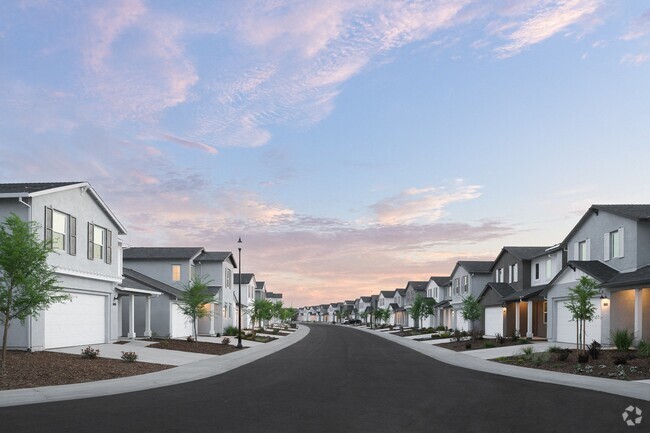
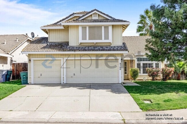
You May Also Like
Similar Rentals Nearby

What Are Walk Score®, Transit Score®, and Bike Score® Ratings?
Walk Score® measures the walkability of any address. Transit Score® measures access to public transit. Bike Score® measures the bikeability of any address.
What is a Sound Score Rating?
A Sound Score Rating aggregates noise caused by vehicle traffic, airplane traffic and local sources
6113 Burntwood Way
Citrus Heights, CA 95621