
Venue Residences
3688 Overland Ave,
Los Angeles, CA 90034
$2,625 - $5,650
Studio - 2 Beds

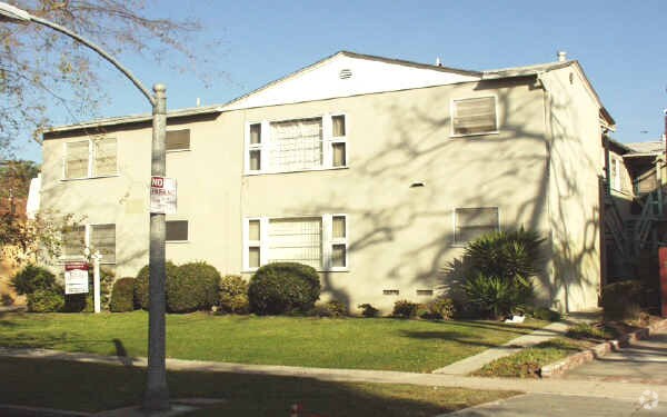
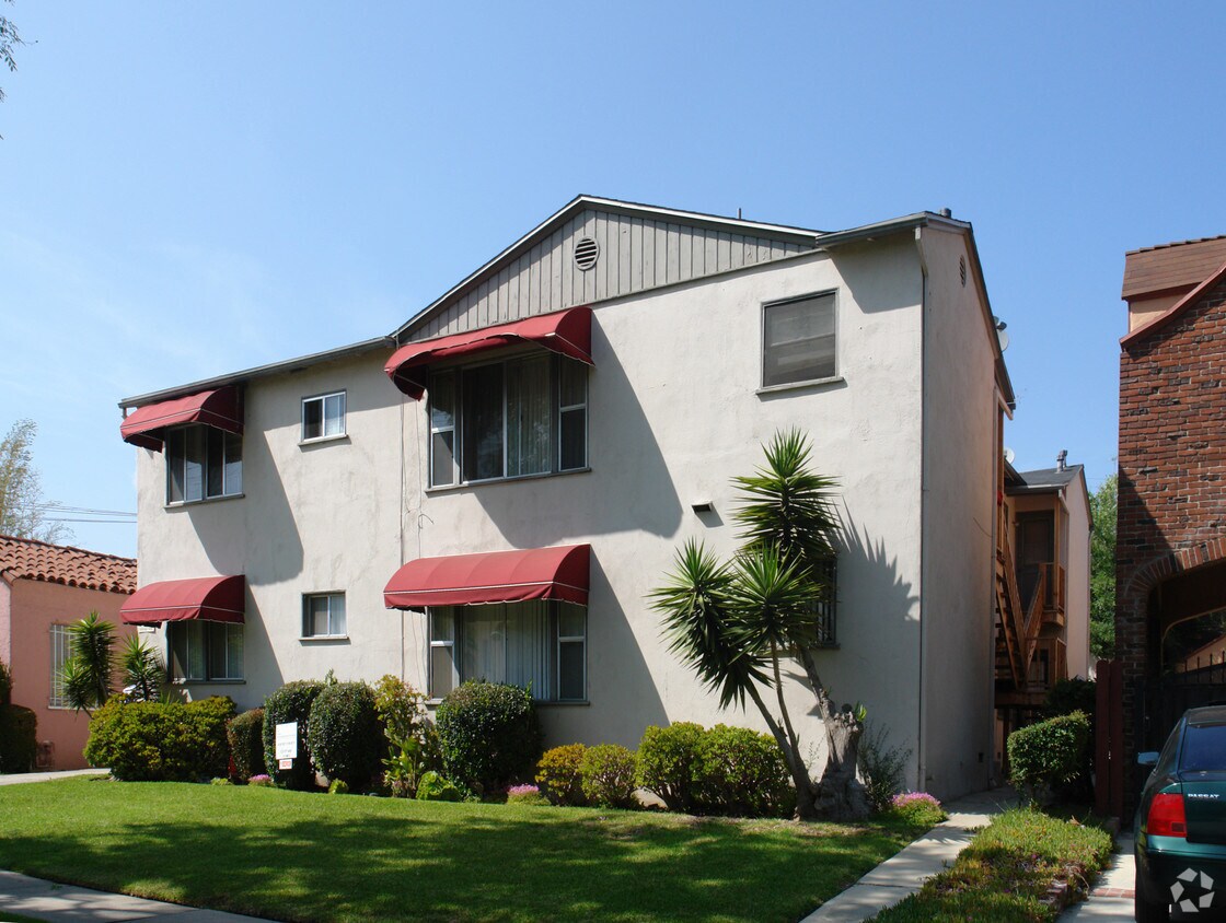
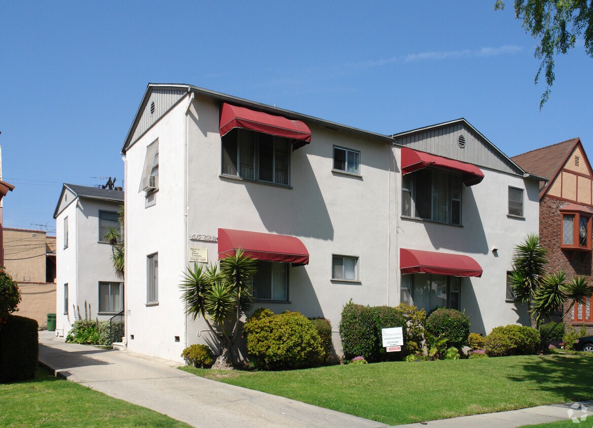
At 6079 Saturn St in Los Angeles, find a great place to live. The location of this community is in the 90035 area of Los Angeles. Here at this community, the community staff is ready to help match you with the perfect place to live. Be sure to check out the apartment floorplan options. Stop by to talk about your next apartment.
6079 Saturn St is an apartment community located in Los Angeles County and the 90035 ZIP Code. This area is served by the Los Angeles Unified Rocp School District attendance zone.
Los Angeles sprawls across nearly 500 square miles between the Pacific Ocean and the San Gabriel Mountains, making it one of the few places where you can surf in the morning and hike through chaparral-covered hills by afternoon. Sunshine, open-air farmers markets, and a food scene that pulls from dozens of culinary traditions are a staple of living in the city.
Neighborhoods each have a distinct personality surrounding a particular focus, whether it be culture or nature. Westwood keeps residents close to entertainment at UCLA and the Hammer Museum's rotating art exhibitions. Koreatown is a cultural and food destination, known for authentic restaurants and shops paired with a bustling street energy and nightlife.
The city overflows with iconic landmarks, from natural to man-made. Griffith Park, one of the largest urban parks in the country, offers hiking trails, sweeping skyline views, and the iconic Griffith Observatory.
Learn more about living in Los AngelesCompare neighborhood and city base rent averages by bedroom.
| Mid-City | Los Angeles, CA | |
|---|---|---|
| Studio | $1,427 | $1,711 |
| 1 Bedroom | $1,698 | $2,183 |
| 2 Bedrooms | $2,479 | $3,016 |
| 3 Bedrooms | $3,242 | $4,340 |
| Colleges & Universities | Distance | ||
|---|---|---|---|
| Colleges & Universities | Distance | ||
| Drive: | 11 min | 4.5 mi | |
| Drive: | 11 min | 5.5 mi | |
| Drive: | 12 min | 5.9 mi | |
| Drive: | 13 min | 7.6 mi |


Transportation options available in Los Angeles include La Cienega/Jefferson, located 2.1 miles from 6079 Saturn St. 6079 Saturn St is near Los Angeles International, located 9.2 miles or 18 minutes away, and Bob Hope, located 13.8 miles or 26 minutes away.
| Transit / Subway | Distance | ||
|---|---|---|---|
| Transit / Subway | Distance | ||
|
|
Drive: | 5 min | 2.1 mi |
|
|
Drive: | 5 min | 2.1 mi |
|
|
Drive: | 5 min | 2.9 mi |
|
|
Drive: | 7 min | 3.3 mi |
|
|
Drive: | 8 min | 3.8 mi |
| Commuter Rail | Distance | ||
|---|---|---|---|
| Commuter Rail | Distance | ||
|
|
Drive: | 17 min | 10.3 mi |
|
|
Drive: | 19 min | 10.4 mi |
|
|
Drive: | 20 min | 11.5 mi |
|
|
Drive: | 23 min | 11.8 mi |
|
|
Drive: | 25 min | 12.7 mi |
| Airports | Distance | ||
|---|---|---|---|
| Airports | Distance | ||
|
Los Angeles International
|
Drive: | 18 min | 9.2 mi |
|
Bob Hope
|
Drive: | 26 min | 13.8 mi |
Scores provided by
Traffic
-Airport
-Businesses
-Scores provided by
HowLoud What is a Sound Score Rating? A Sound Score Rating aggregates noise caused by vehicle traffic, airplane traffic and local sources. How It WorksTime and distance from 6079 Saturn St.
| Shopping Centers | Distance | ||
|---|---|---|---|
| Shopping Centers | Distance | ||
| Walk: | 4 min | 0.3 mi | |
| Walk: | 13 min | 0.7 mi | |
| Walk: | 15 min | 0.8 mi |
| Parks and Recreation | Distance | ||
|---|---|---|---|
| Parks and Recreation | Distance | ||
|
Zimmer Children's Museum
|
Drive: | 3 min | 1.4 mi |
|
La Brea Tar Pits
|
Drive: | 4 min | 1.7 mi |
|
Kenneth Hahn State Recreation Area
|
Drive: | 11 min | 4.2 mi |
|
Virginia Robinson Gardens
|
Drive: | 10 min | 4.2 mi |
|
Mathias Botanical Garden
|
Drive: | 12 min | 5.4 mi |
| Hospitals | Distance | ||
|---|---|---|---|
| Hospitals | Distance | ||
| Walk: | 20 min | 1.1 mi | |
| Drive: | 2 min | 1.1 mi | |
| Drive: | 2 min | 1.2 mi |
| Military Bases | Distance | ||
|---|---|---|---|
| Military Bases | Distance | ||
| Drive: | 18 min | 10.8 mi | |
| Drive: | 40 min | 27.5 mi | |
| Drive: | 43 min | 29.8 mi |
Pets Allowed In Unit Washer & Dryer Maintenance on site Heat Controlled Access Elevator
What Are Walk Score®, Transit Score®, and Bike Score® Ratings?
Walk Score® measures the walkability of any address. Transit Score® measures access to public transit. Bike Score® measures the bikeability of any address.
What is a Sound Score Rating?
A Sound Score Rating aggregates noise caused by vehicle traffic, airplane traffic and local sources.
6079 Saturn St
Los Angeles, CA 90035


