
$2,600
/ Month
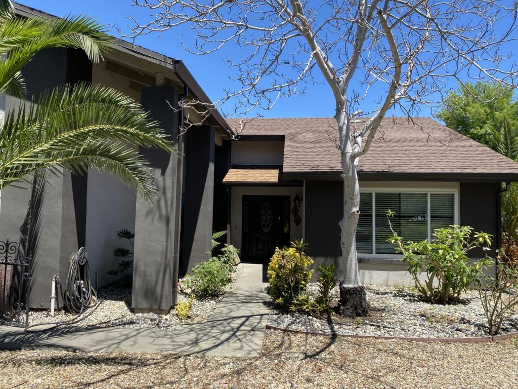
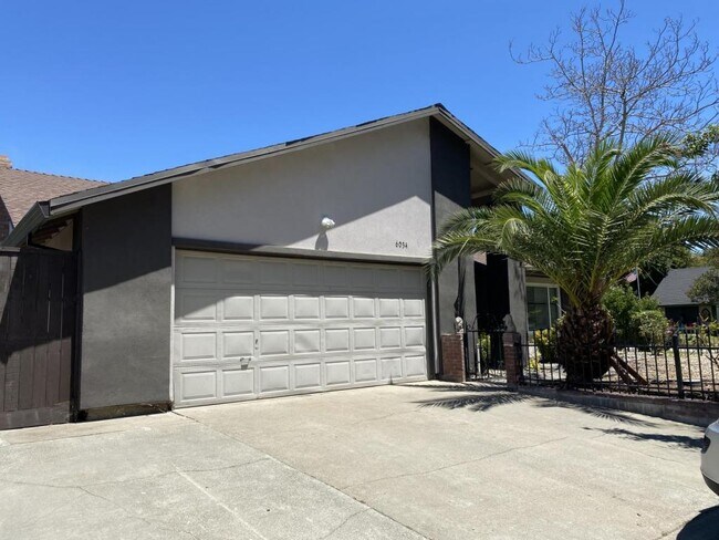
6034 Centurion Cir
Citrus Heights, CA 95621
2 Weeks Ago
Favorites
6034 Centurion Cir

Favorites
Check Back Soon for Upcoming Availability
| Beds | Baths | Average SF |
|---|---|---|
| 4 Bedrooms 4 Bedrooms 4 Br | 2 Baths 2 Baths 2 Ba | 1,726 SF |
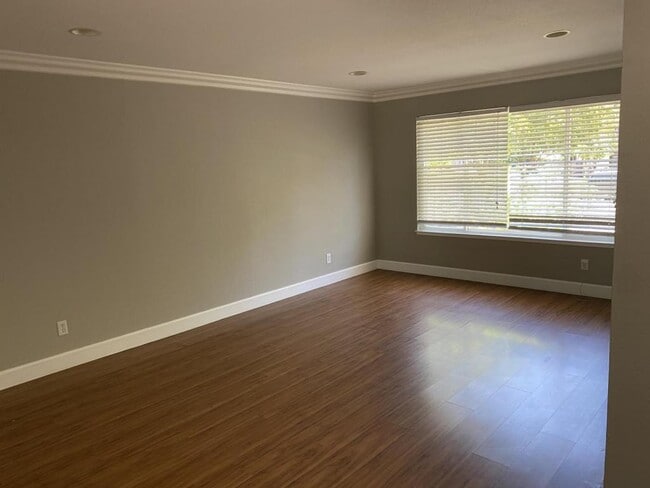
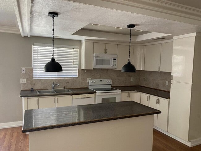
About This Property
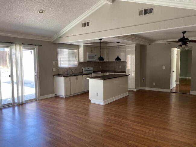
Beautiful 4/2 located in Citrus Heights available for rent in beginning of July. Please call for complete detail. Application available online. To qualify you must have two time of rent income. No eviction history. (Verifiable rental history needed). Pets ok with additional deposit. Landlord will maintain back and front yard. RV and boat access and storage space.
6034 Centurion Cir is a house located in Sacramento County and the 95621 ZIP Code. This area is served by the San Juan Unified attendance zone.
Location
Get Directions
Defined by sun-drenched neighborhoods, tree-lined streets, and lacy palm trees against bright blue sky, Citrus Heights is a beautiful suburban city just 14 miles northeast of Downtown Sacramento. Citrus Heights residents enjoy easy access to I-80, for quick trips to Sacramento or northeast to Roseville, home of the Westfield Galleria at Roseville. Folsom Lake, a popular resort area, is minutes east of Citrus Heights.
Apartments in Citrus Heights provide a quieter option to city living while still being well within reach of everything this busy area has to offer -- including California State University, Sacramento, the Sacramento Zoo, and Sacramento International Airport. But as a busy city with plenty of businesses, shops, restaurants, and entertainment of its own, you'll find plenty to do closer to home. Go shopping at the Sunrise Mall, visit Rusch Park, home of the Historic Rusch Home and Gardens, and spend the afternoon golfing at Foothill Golf Center.
Learn more about living in Citrus Heights
Education
| Colleges & Universities | Distance | ||
|---|---|---|---|
| Colleges & Universities | Distance | ||
| Drive: | 10 min | 3.8 mi | |
| Drive: | 17 min | 10.9 mi | |
| Drive: | 24 min | 11.3 mi | |
| Drive: | 22 min | 13.4 mi |
6034 Centurion Cir is within 10 minutes or 3.8 miles from American River College. It is also near Sierra College, Rocklin Campus and Folsom Lake College, Folsom.
Schools


Public Elementary School
Grades K-3
372 Students
Nearby
Public Elementary School
Grades K-5
331 Students
Attendance Zone
Public Middle School
Grades 6-8
605 Students
Attendance Zone
Public High School
Grades 9-12
559 Students
Attendance Zone
Private Elementary & Middle School
Grades 1-8
Nearby
Private Elementary, Middle & High School
Grades 3-12
Nearby
Private Elementary School
Grades PK-1
Nearby
School data provided by
 The GreatSchools Rating helps parents compare schools within a state based on a variety of school quality indicators and provides a helpful picture of how effectively each school serves all of its students. Ratings are on a scale of 1 (below average) to 10 (above average) and can include test scores, college readiness, academic progress, advanced courses, equity, discipline and attendance data. We also advise parents to visit schools, consider other information on school performance and programs, and consider family needs as part of the school selection process.
View GreatSchools Rating Methodology
Data provided by GreatSchools.org © 2025. All rights reserved.
View GreatSchools Rating Methodology
Data provided by GreatSchools.org © 2025. All rights reserved.
Transportation options available in Citrus Heights include Watt/I-80, located 5.8 miles from 6034 Centurion Cir. 6034 Centurion Cir is near Sacramento International, located 20.9 miles or 29 minutes away.
| Transit / Subway | Distance | ||
|---|---|---|---|
| Transit / Subway | Distance | ||
|
|
Drive: | 9 min | 5.8 mi |
|
|
Drive: | 10 min | 7.1 mi |
|
|
Drive: | 13 min | 7.3 mi |
| Drive: | 11 min | 7.6 mi | |
|
|
Drive: | 15 min | 8.3 mi |
| Commuter Rail | Distance | ||
|---|---|---|---|
| Commuter Rail | Distance | ||
|
|
Drive: | 15 min | 6.6 mi |
|
|
Drive: | 16 min | 10.1 mi |
| Drive: | 19 min | 14.3 mi | |
| Drive: | 29 min | 22.3 mi | |
|
|
Drive: | 29 min | 22.3 mi |
| Airports | Distance | ||
|---|---|---|---|
| Airports | Distance | ||
|
Sacramento International
|
Drive: | 29 min | 20.9 mi |
Time and distance from 6034 Centurion Cir.
| Shopping Centers | Distance | ||
|---|---|---|---|
| Shopping Centers | Distance | ||
| Walk: | 15 min | 0.8 mi | |
| Walk: | 16 min | 0.8 mi | |
| Walk: | 16 min | 0.9 mi |
6034 Centurion Cir has 3 shopping centers within 0.9 mile, which is about a 16-minute walk. The miles and minutes will be for the farthest away property.
| Parks and Recreation | Distance | ||
|---|---|---|---|
| Parks and Recreation | Distance | ||
|
Jensen Botanical Gardens
|
Drive: | 8 min | 4.5 mi |
|
Lower Sunrise Recreational Area
|
Drive: | 13 min | 6.5 mi |
|
Ancil Hoffman Park
|
Drive: | 14 min | 6.8 mi |
|
Effie Yeaw Nature Center
|
Drive: | 15 min | 6.8 mi |
|
Rossmoor Bar County Park
|
Drive: | 15 min | 7.7 mi |
6034 Centurion Cir has 5 parks within 7.7 miles, including Jensen Botanical Gardens, Effie Yeaw Nature Center, and Ancil Hoffman Park.
| Hospitals | Distance | ||
|---|---|---|---|
| Hospitals | Distance | ||
| Walk: | 20 min | 1.0 mi | |
| Drive: | 9 min | 4.4 mi | |
| Drive: | 13 min | 8.2 mi |
6034 Centurion Cir has 3 hospitals within 8.2 miles, the nearest is Mercy San Juan Medical Center which is 1.0 miles away and a 20 minute walk.
| Military Bases | Distance | ||
|---|---|---|---|
| Military Bases | Distance | ||
| Drive: | 19 min | 7.8 mi |
6034 Centurion Cir is 7.8 miles and a 19 minute drive from McClellan Air Force Base.
You May Also Like
Similar Rentals Nearby


What Are Walk Score®, Transit Score®, and Bike Score® Ratings?
Walk Score® measures the walkability of any address. Transit Score® measures access to public transit. Bike Score® measures the bikeability of any address.
What is a Sound Score Rating?
A Sound Score Rating aggregates noise caused by vehicle traffic, airplane traffic and local sources

6034 Centurion Cir
Citrus Heights, CA 95621