
$3,000
Total Monthly Price
12 Month Lease
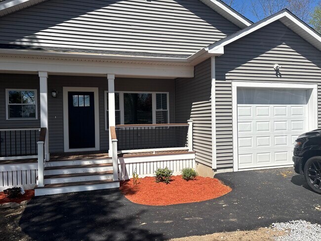
60 Osgood Ave
Dracut, MA 01826
Favorites
-
Bedrooms
2
-
Bathrooms
1
-
Square Feet
900 sq ft
-
Available
Available May 15
Highlights
- Hardwood Floors
- Smoke Free
60 Osgood Ave

Favorites
About This Home
12 Month Lease
,
Available May 15
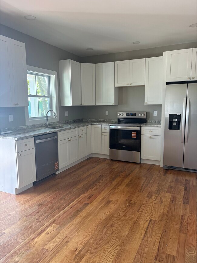
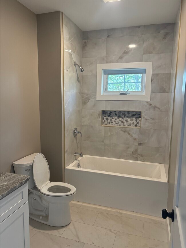
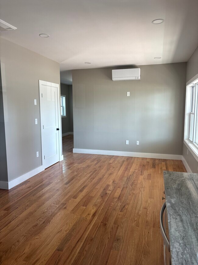
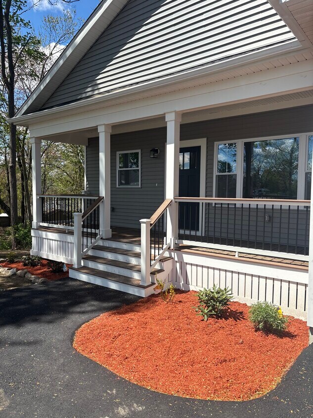
Welcome to 60 Osgood Avenue, Dracut -- Unit B a brand new construction 900 sqft. home thoughtfully designed for comfortable, modern living in your home single family property. Step inside to an inviting, bright, open-concept layout that connects the kitchen and living area. The home features hardwood flooring throughout, modern kitchen and bathroom, recessed lighting, stylish kitchen with stainless steel appliances, and ample counter space. Large windows bring in natural light giving the space a warm and airy feel. Enjoy the convenience of a well-designed floor plan with two bedrooms and full bathroom, private outdoor space, one car garage and beautiful farmer's porch ideal for relaxing or enjoying fresh air. Brand new paved driveway with ample parking. Perfect for those seeking a fresh, brand-new, modern space in a manageable size. Property will be ready for occupancy middle of May. All applicants must have good credit, references and proof of income. No smoking and no pets.
60 Osgood Ave is a house located in Middlesex County and the 01826 ZIP Code.
* Price shown is total price based on community-supplied monthly required fees. Excludes user-selected optional fees and variable or usage-based fees and required charges due at or prior to move-in or at move-out. Price, availability, fees, and any applicable rent special are subject to change without notice.
* Square footage definitions vary. Displayed square footage is approximate.
House Features
Hardwood Floors
Stainless Steel Appliances
Smoke Free
Kitchen
- Smoke Free
- Stainless Steel Appliances
- Kitchen
- Hardwood Floors
- Porch
Contact
- Contact
Location
Get Directions
Bordering downtown Lowell, the Centralville neighborhood lies about 30 miles north of downtown Boston. The area is primarily residential, with the downtown business district within walking distance across the Merrimack River. Loft-style apartments line the streets near the river, allowing for views of Riverfront Park. The nearby highways of I-93 and I-495 connect the area to Boston, Worcester, and the state of New Hampshire.
Get fresh air by riding your bike along the paths of Merrimack River Bike Path in Centralville, then cross the bridge to Brew'd Awakening Coffeehaus for a cup of coffee and a grilled cheese sandwich. Remember hometown hero Jack Kerouac each year at the Lowell Celebrates Kerouac! festival, where you can join your neighbors on a tour of the city, listen to students read their poetry, or discuss the author's most famous works.
Learn more about living in Centralville
Education
| Colleges & Universities | Distance | ||
|---|---|---|---|
| Colleges & Universities | Distance | ||
| Drive: | 3 min | 1.7 mi | |
| Drive: | 5 min | 1.8 mi | |
| Drive: | 22 min | 10.7 mi | |
| Drive: | 24 min | 13.4 mi |
60 Osgood Ave is within 3 minutes or 1.7 miles from UMass Lowell. It is also near Middlesex C.C., Lowell Campus and Rivier College.
Getting Around
 What do Walkability, Transit, Drivability, and Bikeability mean?
Walkability measures the walking distance to day-to-day needs.
Transit measures access to public transportation.
Drivability measures congestion, parking availability, and access to major roads.
Bikeability measures the suitability for cycling.
How It Works
What do Walkability, Transit, Drivability, and Bikeability mean?
Walkability measures the walking distance to day-to-day needs.
Transit measures access to public transportation.
Drivability measures congestion, parking availability, and access to major roads.
Bikeability measures the suitability for cycling.
How It Works
Moderately Walkable
Walkability
60
/ 100
Limited Public Transit
Transit
30
/ 100
Very Drivable
Drivability
80
/ 100
Fairly Bikeable
Bikeability
50
/ 100
Scores provided by
-
Soundscore™
-
/ 100
Traffic
-Airport
-Businesses
-Scores provided by
HowLoud What is a Sound Score Rating? A Sound Score Rating aggregates noise caused by vehicle traffic, airplane traffic and local sources. How It Works
Amenities
- Smoke Free
- Stainless Steel Appliances
- Kitchen
- Hardwood Floors
- Porch
60 Osgood Ave Photos
What Are Walk Score®, Transit Score®, and Bike Score® Ratings?
Walk Score® measures the walkability of any address. Transit Score® measures access to public transit. Bike Score® measures the bikeability of any address.
What is a Sound Score Rating?
A Sound Score Rating aggregates noise caused by vehicle traffic, airplane traffic and local sources.
60 Osgood Ave
Dracut, MA 01826