$1,850
/ Month
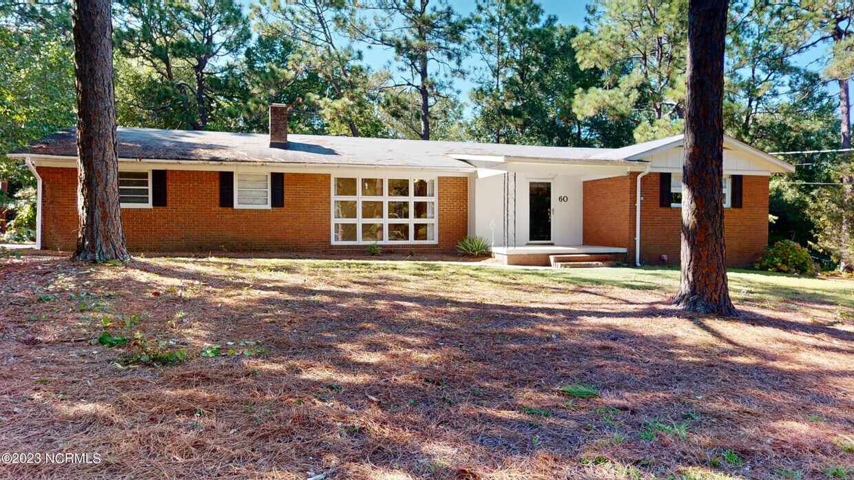
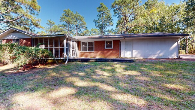
60 Midland Rd
Southern Pines, NC 28387
Favorites
60 Midland Rd

Favorites
Check Back Soon for Upcoming Availability
| Beds | Baths | Average SF |
|---|---|---|
| 3 Bedrooms 3 Bedrooms 3 Br | 2 Baths 2 Baths 2 Ba | 1,500 SF |
About This Property
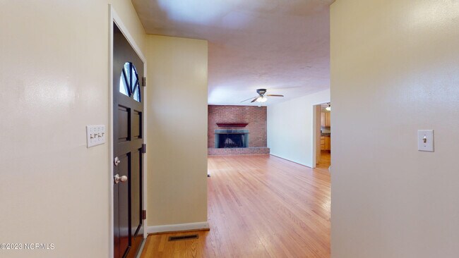
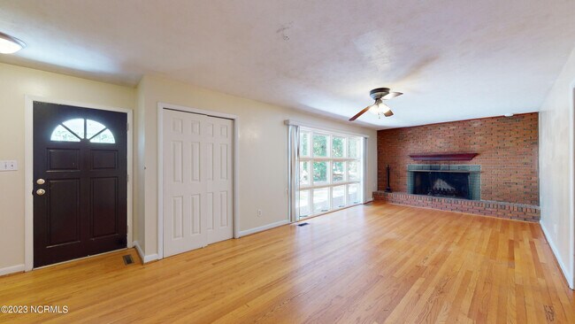
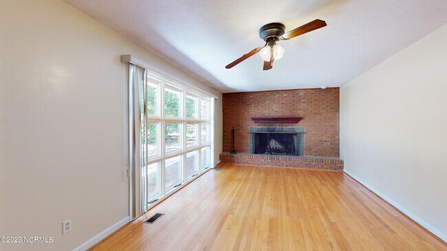
Wonderful all brick home on .61 acre and just a block from the sidewalks of Downtown So Pines! Previous updates include new kitchen, hardwood floors, and bathrooms. Huge living room with brick fireplace. Lots of storage. Large lot sits high above road. pet friendly too! (with $250pet fee)
60 Midland Rd is a house located in Moore County and the 28387 ZIP Code. This area is served by the Moore County School District attendance zone.
60 Midland Rd,
Southern Pines,
NC
28387
Education
| Colleges & Universities | Distance | ||
|---|---|---|---|
| Colleges & Universities | Distance | ||
| Drive: | 9 min | 4.5 mi | |
| Drive: | 41 min | 27.5 mi | |
| Drive: | 56 min | 37.5 mi | |
| Drive: | 57 min | 37.8 mi |
60 Midland Rd is within 9 minutes or 4.5 miles from Sandhills Community College. It is also near Central Carolina Comm. Coll. and Fayetteville Tech. Comm. Coll..
Schools


Public Elementary School
Grades PK-5
277 Students
Nearby
Public Elementary School
Grades PK-5
612 Students
Attendance Zone
Public Middle School
Grades 6-8
592 Students
Attendance Zone
Public High School
Grades 9-12
2,221 Students
Attendance Zone
Private Elementary, Middle & High School
Grades PK-12
139 Students
Nearby
School data provided by
 The GreatSchools Rating helps parents compare schools within a state based on a variety of school quality indicators and provides a helpful picture of how effectively each school serves all of its students. Ratings are on a scale of 1 (below average) to 10 (above average) and can include test scores, college readiness, academic progress, advanced courses, equity, discipline and attendance data. We also advise parents to visit schools, consider other information on school performance and programs, and consider family needs as part of the school selection process.
View GreatSchools Rating Methodology
Data provided by GreatSchools.org © 2026. All rights reserved.
View GreatSchools Rating Methodology
Data provided by GreatSchools.org © 2026. All rights reserved.
Walkability Near 60 Midland Rd Southern Pines, NC 28387
Getting Around
 What do Walkability, Transit, Drivability, and Bikeability mean?
Walkability measures the walking distance to day-to-day needs.
Transit measures access to public transportation.
Drivability measures congestion, parking availability, and access to major roads.
Bikeability measures the suitability for cycling.
How It Works
What do Walkability, Transit, Drivability, and Bikeability mean?
Walkability measures the walking distance to day-to-day needs.
Transit measures access to public transportation.
Drivability measures congestion, parking availability, and access to major roads.
Bikeability measures the suitability for cycling.
How It Works
Fairly Walkable
Walkability
40
/ 100
Exceptionally Drivable
Drivability
90
/ 100
Fairly Bikeable
Bikeability
40
/ 100
Scores provided by
-
Soundscore™
-
/ 100
Traffic
-Airport
-Businesses
-Scores provided by
HowLoud What is a Sound Score Rating? A Sound Score Rating aggregates noise caused by vehicle traffic, airplane traffic and local sources. How It WorksYou May Also Like
Similar Rentals Nearby
-
-

-

-

-

-

-

-

-

-
 4 Beds, 2 Baths, 1,460 sq ft$2,000Total Monthly PriceTotal Monthly Price NewPrices include all required monthly fees.1420 Central Dr

What Are Walk Score®, Transit Score®, and Bike Score® Ratings?
Walk Score® measures the walkability of any address. Transit Score® measures access to public transit. Bike Score® measures the bikeability of any address.
What is a Sound Score Rating?
A Sound Score Rating aggregates noise caused by vehicle traffic, airplane traffic and local sources.

60 Midland Rd
Southern Pines, NC 28387