
MI Place at First Radio
450 W Westfield Ave,
Roselle Park, NJ 07204
$2,225 - $3,555
1-2 Beds
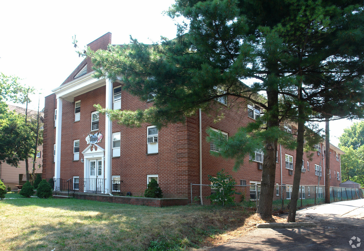
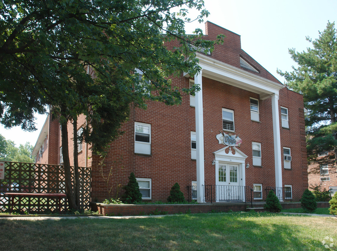

At 60 E Westfield Ave in Roselle Park, NJ, find your new home. The E. Westfield Ave address in the 07204 area of Roselle Park is a popular place for you to live. The professional leasing staff is ready to show you our community. Come for a visit to view the available floorplans. Come be a part of 60 E Westfield Ave. Contact or drop by to check the availability and schedule a tour today.
60 E Westfield Ave is an apartment community located in Union County and the 07204 ZIP Code. This area is served by the Roselle Park Board Of Education School District attendance zone.
Roselle Park sits in the heart of Union County, just under 20 miles from Midtown Manhattan, making it one of New Jersey's well-connected small boroughs. Incorporated in 1901 and spanning only two square miles, this tight-knit community carries a quiet, residential character that stands apart from the bustle of nearby Elizabeth and Newark. NJ Transit rail service links residents to New York City with ease, and the proximity to major employers like Merck's campus just to the north adds to the borough's practical appeal for those who want suburban calm without sacrificing access to opportunity.
Daily life here revolves around walkable streets, neighborhood diners, and a genuine small-town atmosphere rarely found this close to a major metro. The housing stock reflects the borough's early 20th-century roots, with charming single-family homes, two-family houses, and converted multi-unit buildings lining tree-lined blocks.
Learn more about living in Roselle Park| Colleges & Universities | Distance | ||
|---|---|---|---|
| Colleges & Universities | Distance | ||
| Drive: | 6 min | 2.6 mi | |
| Drive: | 7 min | 2.7 mi | |
| Drive: | 12 min | 4.1 mi | |
| Drive: | 18 min | 8.8 mi |


Transportation options available in Roselle Park include Norfolk Street, located 8.4 miles from 60 E Westfield Ave. 60 E Westfield Ave is near Newark Liberty International, located 9.3 miles or 17 minutes away, and LaGuardia, located 27.1 miles or 51 minutes away.
| Transit / Subway | Distance | ||
|---|---|---|---|
| Transit / Subway | Distance | ||
|
|
Drive: | 17 min | 8.4 mi |
|
|
Drive: | 15 min | 8.8 mi |
|
|
Drive: | 16 min | 9.3 mi |
|
|
Drive: | 17 min | 9.8 mi |
| Drive: | 19 min | 10.0 mi |
| Commuter Rail | Distance | ||
|---|---|---|---|
| Commuter Rail | Distance | ||
|
|
Walk: | 13 min | 0.7 mi |
|
|
Drive: | 5 min | 2.5 mi |
|
|
Drive: | 7 min | 2.7 mi |
|
|
Drive: | 7 min | 2.9 mi |
|
|
Drive: | 6 min | 3.1 mi |
| Airports | Distance | ||
|---|---|---|---|
| Airports | Distance | ||
|
Newark Liberty International
|
Drive: | 17 min | 9.3 mi |
|
LaGuardia
|
Drive: | 51 min | 27.1 mi |
Scores provided by
Traffic
-Airport
-Businesses
-Scores provided by
HowLoud What is a Sound Score Rating? A Sound Score Rating aggregates noise caused by vehicle traffic, airplane traffic and local sources. How It WorksTime and distance from 60 E Westfield Ave.
| Shopping Centers | Distance | ||
|---|---|---|---|
| Shopping Centers | Distance | ||
| Walk: | 14 min | 0.7 mi | |
| Walk: | 18 min | 1.0 mi | |
| Walk: | 19 min | 1.0 mi |
| Parks and Recreation | Distance | ||
|---|---|---|---|
| Parks and Recreation | Distance | ||
|
William Miller Sperry Observatory
|
Drive: | 10 min | 3.9 mi |
|
Hawk Rise Sanctuary
|
Drive: | 13 min | 5.3 mi |
|
Cora Hartshorn Arboretum
|
Drive: | 20 min | 7.1 mi |
|
Staten Island Industrial Park
|
Drive: | 14 min | 7.4 mi |
|
Liberty State Park
|
Drive: | 16 min | 8.7 mi |
| Hospitals | Distance | ||
|---|---|---|---|
| Hospitals | Distance | ||
| Drive: | 7 min | 3.0 mi | |
| Drive: | 11 min | 4.5 mi | |
| Drive: | 11 min | 5.5 mi |
| Military Bases | Distance | ||
|---|---|---|---|
| Military Bases | Distance | ||
| Drive: | 17 min | 7.3 mi | |
| Drive: | 15 min | 7.7 mi | |
| Drive: | 22 min | 13.1 mi |
What Are Walk Score®, Transit Score®, and Bike Score® Ratings?
Walk Score® measures the walkability of any address. Transit Score® measures access to public transit. Bike Score® measures the bikeability of any address.
What is a Sound Score Rating?
A Sound Score Rating aggregates noise caused by vehicle traffic, airplane traffic and local sources.


