
$2,395
Total Monthly Price
12 Month Lease
60 Bridges St
Framingham, MA 01702
Today
Favorites
508-665-1402
-
Bedrooms
2
-
Bathrooms
1
-
Square Feet
750 sq ft
-
Available
Available Now
Highlight
- Smoke Free
60 Bridges St

Favorites
About This Home
12 Month Lease,
$2,395 deposit,
Available Now
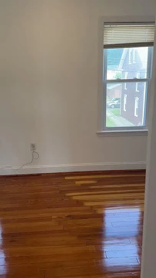
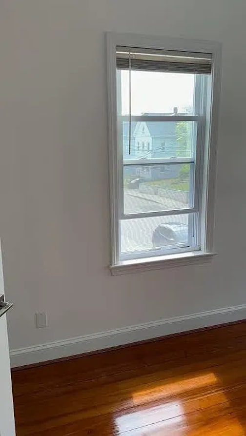
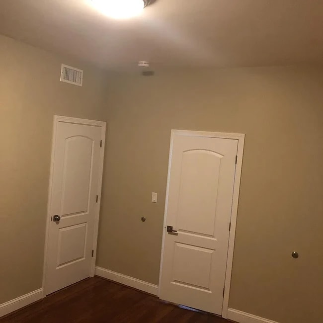
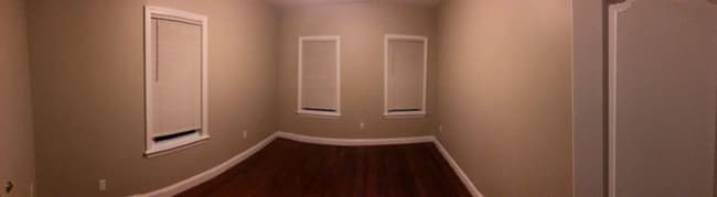
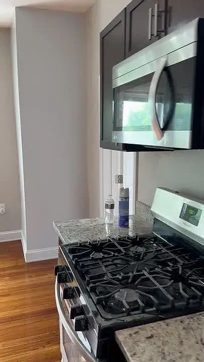
Freshly painted. Great place to live in this two unit house. 2 min to walk to the train station, 25 min express to Boston, 5 min to Natick mall, also close to MB. In harmony near water and parks. Full privacy and away from big buildings where you are a number. Excellent condition. Tons of windows and natural light, beautiful wooded floor throughout, Hvac, gas amenities and cooking. High ceilings. Big parking lot. Washer and dryer in the building. No smoking any kind at the property. First come first served Owners pays for water, sewer, trash. Tenants pays gas and electricity. No parking fee. Last months rent due with signing a 1 year lease.
60 Bridges St is a house located in Middlesex County and the 01702 ZIP Code. This area is served by the Framingham attendance zone.
* Price shown is total price based on community-supplied monthly required fees. Excludes user-selected optional fees and variable or usage-based fees and required charges due at or prior to move-in or at move-out. Price, availability, fees, and any applicable rent special are subject to change without notice.
* Square footage definitions vary. Displayed square footage is approximate.
House Features
- Heating
- Smoke Free
- High Ceilings
- Laundry Facilities
Fees and Policies
The fees below are based on community-supplied data and may exclude additional fees and utilities.
Details
Utilities Included
-
Water
-
Trash Removal
Contact
- Phone Number
- Contact
Location
Get Directions
Just west of Boston and East of Worcester sits Metro West, a region that houses a group of towns and cities with significant historical backgrounds. A total of 19 municipalities make up the core of this community, but other municipalities are considered to be a part of the Interstate 495/Metro West Corridor.
Learn more about living in Metro West
Education
| Colleges & Universities | Distance | ||
|---|---|---|---|
| Colleges & Universities | Distance | ||
| Drive: | 7 min | 2.6 mi | |
| Drive: | 17 min | 7.1 mi | |
| Drive: | 19 min | 9.1 mi | |
| Drive: | 26 min | 13.5 mi |
60 Bridges St is within 7 minutes or 2.6 miles from Framingham State College. It is also near Wellesley College and Babson College.
Schools


Public Elementary School
Grades K-5
696 Students
Attendance Zone
Public Elementary School
Grades K-5
496 Students
Attendance Zone
Public Elementary School
Grades PK-5
401 Students
Nearby
Public Middle School
Grades 6-8
616 Students
Attendance Zone
Public Middle School
Grades 6-8
789 Students
Attendance Zone
Public High School
Grades 9-12
2,566 Students
Attendance Zone
Private Elementary & Middle School
Grades PK-8
174 Students
Nearby
Private High School
Grades 9-12
227 Students
Nearby
School data provided by
 The GreatSchools Rating helps parents compare schools within a state based on a variety of school quality indicators and provides a helpful picture of how effectively each school serves all of its students. Ratings are on a scale of 1 (below average) to 10 (above average) and can include test scores, college readiness, academic progress, advanced courses, equity, discipline and attendance data. We also advise parents to visit schools, consider other information on school performance and programs, and consider family needs as part of the school selection process.
View GreatSchools Rating Methodology
Data provided by GreatSchools.org © 2025. All rights reserved.
View GreatSchools Rating Methodology
Data provided by GreatSchools.org © 2025. All rights reserved.
Transportation options available in Framingham include Riverside Station, located 12.5 miles from 60 Bridges St. 60 Bridges St is near General Edward Lawrence Logan International, located 25.6 miles or 40 minutes away, and Worcester Regional, located 26.4 miles or 47 minutes away.
| Transit / Subway | Distance | ||
|---|---|---|---|
| Transit / Subway | Distance | ||
|
|
Drive: | 23 min | 12.5 mi |
| Commuter Rail | Distance | ||
|---|---|---|---|
| Commuter Rail | Distance | ||
|
|
Walk: | 9 min | 0.5 mi |
|
|
Walk: | 12 min | 0.7 mi |
|
|
Drive: | 6 min | 2.2 mi |
|
|
Drive: | 13 min | 4.0 mi |
|
|
Drive: | 10 min | 4.6 mi |
| Airports | Distance | ||
|---|---|---|---|
| Airports | Distance | ||
|
General Edward Lawrence Logan International
|
Drive: | 40 min | 25.6 mi |
|
Worcester Regional
|
Drive: | 47 min | 26.4 mi |
Time and distance from 60 Bridges St.
| Shopping Centers | Distance | ||
|---|---|---|---|
| Shopping Centers | Distance | ||
| Walk: | 17 min | 0.9 mi | |
| Drive: | 4 min | 1.3 mi | |
| Drive: | 4 min | 1.6 mi |
60 Bridges St has 3 shopping centers within 1.6 miles, which is about a 4-minute walk. The miles and minutes will be for the farthest away property.
| Parks and Recreation | Distance | ||
|---|---|---|---|
| Parks and Recreation | Distance | ||
|
Cowassock Woods and Ashland Town Forest
|
Drive: | 10 min | 4.0 mi |
|
Ashland State Park
|
Drive: | 10 min | 4.0 mi |
|
Callahan State Park
|
Drive: | 11 min | 5.0 mi |
|
Wilfred J. Turenne Wildlife Habitat
|
Drive: | 13 min | 6.3 mi |
|
Cochituate State Park
|
Drive: | 21 min | 12.0 mi |
60 Bridges St has 5 parks within 12.0 miles, including Cowassock Woods and Ashland Town Forest, Ashland State Park, and Callahan State Park.
| Hospitals | Distance | ||
|---|---|---|---|
| Hospitals | Distance | ||
| Drive: | 4 min | 1.4 mi | |
| Drive: | 22 min | 11.0 mi | |
| Drive: | 23 min | 11.2 mi |
60 Bridges St has 3 hospitals within 11.2 miles, the nearest is MetroWest Medical Center which is 1.4 miles away and a 4 minute drive.
| Military Bases | Distance | ||
|---|---|---|---|
| Military Bases | Distance | ||
| Drive: | 11 min | 4.6 mi | |
| Drive: | 36 min | 18.2 mi |
60 Bridges St is 4.6 miles from US Military Reservation, and is convenient to other military bases, including Hanscom Air Force Base.
Amenities
- Heating
- Smoke Free
- High Ceilings
- Laundry Facilities
60 Bridges St Photos
What Are Walk Score®, Transit Score®, and Bike Score® Ratings?
Walk Score® measures the walkability of any address. Transit Score® measures access to public transit. Bike Score® measures the bikeability of any address.
What is a Sound Score Rating?
A Sound Score Rating aggregates noise caused by vehicle traffic, airplane traffic and local sources
60 Bridges St
Framingham, MA 01702