$1,550
/ Month
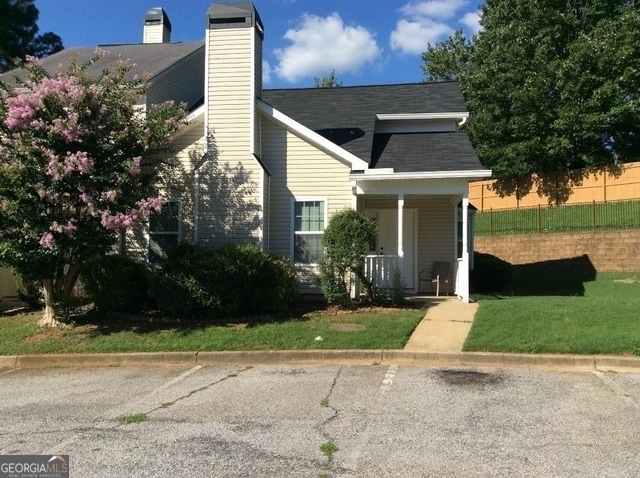
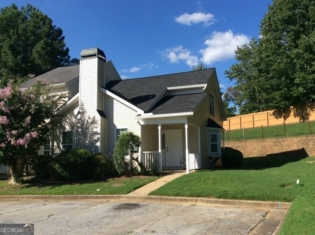
5987 Sherwood Trace
Stonecrest, GA 30038
Today
|
Edit
Favorites
404-391-6015
-
Bedrooms
2
-
Bathrooms
2
-
Square Feet
1,383 sq ft
-
Available
Available Now
Highlights
- Property is near public transit
- Vaulted Ceiling
- Traditional Architecture
- Formal Dining Room
- Porch
- Bay Window
5987 Sherwood Trace

Favorites
About This Home
$1,550 deposit,
Available Now
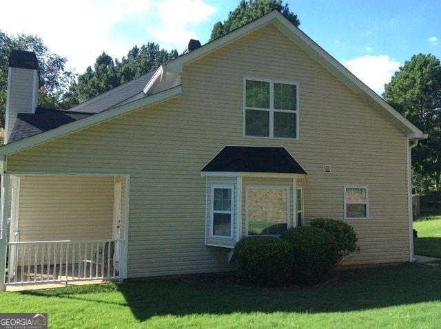
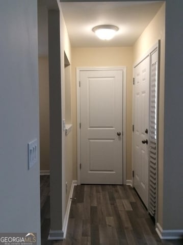
2 Bedroom, 2 Bath Large end unit Townhome with 2 story vaulted living room with fireplace. Bay window in dining area. Renovated 2 years ago with new kitchen cabinets, countertops and appliances. The entire upstairs is a huge bedroom with a private bath and a big walk-in closet. Bedroom down has a custom closet. Flooring includes laminate, tile and carpet flooring. MLS ID 10622964
5987 Sherwood Trace is a townhome located in DeKalb County and the 30038 ZIP Code. This area is served by the DeKalb County attendance zone.
* Price shown is base rent. Excludes user-selected optional fees and variable or usage-based fees and required charges due at or prior to move-in or at move-out. Price, availability, fees, and any applicable rent special are subject to change without notice.
* Square footage definitions vary. Displayed square footage is approximate.
Home Details
Home Type
Townhome
Year Built
Built in 1999 | Remodeled
Bedrooms and Bathrooms
Walk-In Closet
2 Bedrooms | 1 Main Level Bedroom
Bathtub Includes Tile Surround
2 Full Bathrooms
Home Design
Traditional Architecture
Vinyl Siding
Composition Roof
Slab Foundation
Home Security
Fire and Smoke Detector
Interior Spaces
Vaulted Ceiling
Formal Dining Room
Bay Window
Double Pane Windows
Entrance Foyer
Ceiling Fan
Laminate Flooring
1,383 Sq Ft Home
Factory Built Fireplace
1.5-Story Property
Window Treatments
Kitchen
Breakfast Bar
Oven or Range
Microwave
Dishwasher
Disposal
Laundry
Laundry in Hall
Listing and Financial Details
Security Deposit $1,550
12-Month Lease Term
$85 Application Fee
Tax Lot 183
Location
Property is near public transit
Lot Details
5,663 Sq Ft Lot
Level Lot
1 Common Wall
Outdoor Features
Porch
Patio
Parking
Guest Parking
Assigned Parking
2 Parking Spaces
Schools
Flat Rock Elementary School
Lithonia Middle School
Lithonia High School
Utilities
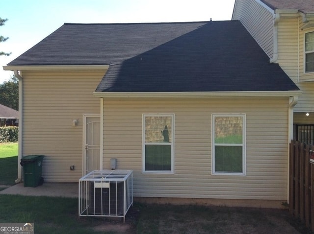
Central Heating and Cooling System
High Speed Internet
Heat Pump System
Cable TV Available
Phone Available
Underground Utilities
Electric Water Heater
Community Details
Overview
Property has a Home Owners Association
Wellington Manor Subdivision
Association fees include management fee
Pet Policy
No Pets Allowed
Fees and Policies
The fees below are based on community-supplied data and may exclude additional fees and utilities.
-
One-Time Basics
-
Due at Application
-
Application Fee Per ApplicantCharged per applicant.$85
-
-
Due at Move-In
-
Security Deposit - RefundableCharged per unit.$1,550
-
-
Due at Application
Property Fee Disclaimer: Based on community-supplied data and independent market research. Subject to change without notice. May exclude fees for mandatory or optional services and usage-based utilities.
Contact
- Listed by Charmaine Phillips | Portfolio Builders Real Estate
- Phone Number
- Contact
-
Source
 Georgia Multiple Listing Service
Copyright © 2026 Georgia Multiple Listing Service. All rights reserved. All information provided by the listing agent / broker is deemed reliable but is not guaranteed and should be independently verified.
Location
Get Directions
Amenities
- Dishwasher
- Disposal
- Pantry
- Microwave
- Range
- Refrigerator
Southeast DeKalb refers to a sprawling region in the southeastern portion of DeKalb County. Among the many communities in this area are the communities of Clarkston, Stone Mountain, Lithonia, Panthersville, Gresham Park, and Sheffield Woods.
Each community in this region has its own distinct character. Southeast DeKalb offers ample opportunities for outdoor recreation at destinations such as Stone Mountain Park, Panola Mountain State Park, and Arabia Mountain National Heritage Area. Southeast DeKalb sits within easy driving distance of all that Greater Atlanta has to offer, with close proximity to major thoroughfares like I-285, I-20, and U.S. 278.
Learn more about living in Southeast DeKalb
Education
| Colleges & Universities | Distance | ||
|---|---|---|---|
| Colleges & Universities | Distance | ||
| Drive: | 19 min | 10.3 mi | |
| Drive: | 21 min | 12.3 mi | |
| Drive: | 21 min | 12.5 mi | |
| Drive: | 26 min | 15.6 mi |
5987 Sherwood Trace is within 19 minutes or 10.3 miles from Georgia Perim. Coll., Decatur. It is also near Georgia Perim., Clarkston and Agnes Scott College.
Schools


Public Elementary School
Grades PK-5
996 Students
Attendance Zone
Public Middle School
Grades 6-8
1,214 Students
Attendance Zone
Public High School
Grades 9-12
1,483 Students
Attendance Zone
Private Elementary, Middle & High School
Grades PK-11
33 Students
Nearby
Private Elementary, Middle & High School
Grades K-12
8 Students
Nearby
School data provided by
 The GreatSchools Rating helps parents compare schools within a state based on a variety of school quality indicators and provides a helpful picture of how effectively each school serves all of its students. Ratings are on a scale of 1 (below average) to 10 (above average) and can include test scores, college readiness, academic progress, advanced courses, equity, discipline and attendance data. We also advise parents to visit schools, consider other information on school performance and programs, and consider family needs as part of the school selection process.
View GreatSchools Rating Methodology
Data provided by GreatSchools.org © 2026. All rights reserved.
View GreatSchools Rating Methodology
Data provided by GreatSchools.org © 2026. All rights reserved.
Transportation options available in Stonecrest include Indian Creek, located 10.1 miles from 5987 Sherwood Trace. 5987 Sherwood Trace is near Hartsfield - Jackson Atlanta International, located 20.2 miles or 33 minutes away.
| Transit / Subway | Distance | ||
|---|---|---|---|
| Transit / Subway | Distance | ||
|
|
Drive: | 16 min | 10.1 mi |
|
|
Drive: | 19 min | 11.1 mi |
|
|
Drive: | 21 min | 12.7 mi |
| Commuter Rail | Distance | ||
|---|---|---|---|
| Commuter Rail | Distance | ||
|
|
Drive: | 31 min | 20.5 mi |
| Airports | Distance | ||
|---|---|---|---|
| Airports | Distance | ||
|
Hartsfield - Jackson Atlanta International
|
Drive: | 33 min | 20.2 mi |
Time and distance from 5987 Sherwood Trace.
| Shopping Centers | Distance | ||
|---|---|---|---|
| Shopping Centers | Distance | ||
| Walk: | 10 min | 0.6 mi | |
| Drive: | 5 min | 1.6 mi | |
| Drive: | 5 min | 1.6 mi |
5987 Sherwood Trace has 3 shopping centers within 1.6 miles, which is about a 5-minute drive. The miles and minutes will be for the farthest away property.
| Parks and Recreation | Distance | ||
|---|---|---|---|
| Parks and Recreation | Distance | ||
|
Arabia Mountain Heritage Area and Nature Center
|
Drive: | 11 min | 4.9 mi |
|
Panola Mountain State Park
|
Drive: | 16 min | 7.0 mi |
|
DeShong Park
|
Drive: | 21 min | 9.5 mi |
|
Ferns of the World Garden
|
Drive: | 17 min | 10.0 mi |
|
Stone Mountain State Memorial Park
|
Drive: | 27 min | 11.6 mi |
5987 Sherwood Trace has 5 parks within 11.6 miles, including Arabia Mountain Heritage Area and Nature Center, Panola Mountain State Park, and Ferns of the World Garden.
| Hospitals | Distance | ||
|---|---|---|---|
| Hospitals | Distance | ||
| Walk: | 14 min | 0.8 mi | |
| Drive: | 16 min | 9.7 mi | |
| Drive: | 19 min | 10.3 mi |
5987 Sherwood Trace has 3 hospitals within 10.3 miles, the nearest is Emory Hillandale Hospital which is 0.8 mile away and a 14 minute walk.
| Military Bases | Distance | ||
|---|---|---|---|
| Military Bases | Distance | ||
| Drive: | 29 min | 17.9 mi | |
| Drive: | 31 min | 20.9 mi |
5987 Sherwood Trace is 17.9 miles from Fort Gillem, and is convenient to other military bases, including Fort McPherson.
You May Also Like
Similar Rentals Nearby


What Are Walk Score®, Transit Score®, and Bike Score® Ratings?
Walk Score® measures the walkability of any address. Transit Score® measures access to public transit. Bike Score® measures the bikeability of any address.
What is a Sound Score Rating?
A Sound Score Rating aggregates noise caused by vehicle traffic, airplane traffic and local sources

5987 Sherwood Trace
Stonecrest, GA 30038