
$2,950
Total Monthly Price
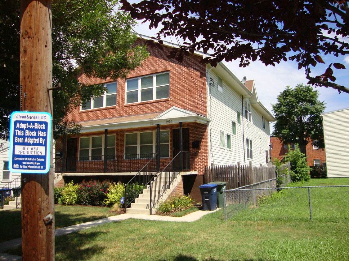
5920 Clay St NE
Washington, DC 20019
Favorites
-
Bedrooms
4
-
Bathrooms
3.5
-
Square Feet
2,600 sq ft
-
Available
Available Now
Highlights
- Pets Allowed
- Yard
- Basement
- Deck
- Double Vanities
5920 Clay St NE

Favorites
About This Home
12 Month Lease,
$2,950 deposit,
Available Now
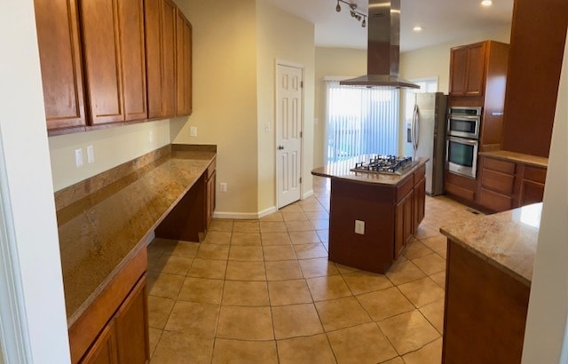
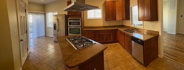
Spacious 4 bedroom 3.5-bathroom townhouse with a large kitchen, basement recreation room and laundry room. The unit includes a rear deck, fenced yard, off-street parking and is approximately 0.4 miles (9 min walk) to the Capital Heights Metro station.
5920 Clay St Ne is a townhome located in District of Columbia County and the 20019 ZIP Code. This area is served by the District Of Columbia Public Schools attendance zone.
* Price shown is total price based on community-supplied monthly required fees. Excludes user-selected optional fees and variable or usage-based fees and required charges due at or prior to move-in or at move-out. Price, availability, fees, and any applicable rent special are subject to change without notice.
* Square footage definitions vary. Displayed square footage is approximate.
Townhome Features
Washer/Dryer
Tub/Shower
Heating
Basement
- Washer/Dryer
- Heating
- Cable Ready
- Double Vanities
- Tub/Shower
- Sprinkler System
- Kitchen
- Basement
- Recreation Room
- Laundry Facilities
- Deck
- Yard
Fees and Policies
The fees listed below are community-provided and may exclude utilities or add-ons. All payments are made directly to the property and are non-refundable unless otherwise specified.
- Dogs Allowed
-
Fees not specified
- Cats Allowed
-
Fees not specified
- Parking
-
Surface Lot--
Details
Utilities Included
-
Water
-
Trash Removal
-
Sewer
Contact
- Contact
Location
Get Directions
Grant Park is a hilly, wooded neighborhood located on the north side of Capitol View and directly east of Lincoln Heights. The narrow streets are lined with square, brick houses and a variety of apartment communities. At the east end of the neighborhood, the Watts Branch Playground includes a spray ground, picnic areas, and the Marvin Gaye Recreation Center. Grant Park is an affordable, mostly residential neighborhood located about seven miles southeast of Downtown DC. Residents have easy access to the Tenleytown Metro Station for car-free commutes into the city.
Learn more about living in Grant Park
Education
| Colleges & Universities | Distance | ||
|---|---|---|---|
| Colleges & Universities | Distance | ||
| Drive: | 10 min | 5.0 mi | |
| Drive: | 11 min | 5.4 mi | |
| Drive: | 12 min | 6.2 mi | |
| Drive: | 12 min | 6.3 mi |
5920 Clay St NE is within 10 minutes or 5.0 miles from Univ. of Md. Univ. Coll.. It is also near Gallaudet University and Georgetown Law.
Schools


Public Elementary School
Grades PK-5
189 Students
Attendance Zone
Public Middle School
Grades 6-8
289 Students
Attendance Zone
Public High School
Grades 9-12
544 Students
Attendance Zone
Private Elementary & Middle School
Grades PK-8
Nearby
Private Elementary School
Grades PK-5
50 Students
Nearby
Private High School
Grades 9-12
Nearby
School data provided by
 The GreatSchools Rating helps parents compare schools within a state based on a variety of school quality indicators and provides a helpful picture of how effectively each school serves all of its students. Ratings are on a scale of 1 (below average) to 10 (above average) and can include test scores, college readiness, academic progress, advanced courses, equity, discipline and attendance data. We also advise parents to visit schools, consider other information on school performance and programs, and consider family needs as part of the school selection process.
View GreatSchools Rating Methodology
Data provided by GreatSchools.org © 2026. All rights reserved.
View GreatSchools Rating Methodology
Data provided by GreatSchools.org © 2026. All rights reserved.
Transportation options available in Washington include Capitol Heights, Blue/Silver Line Center Platform, located 0.5 mile from 5920 Clay St NE. 5920 Clay St NE is near Ronald Reagan Washington Ntl, located 11.8 miles or 22 minutes away, and Baltimore/Washington International Thurgood Marshall, located 28.1 miles or 42 minutes away.
| Transit / Subway | Distance | ||
|---|---|---|---|
| Transit / Subway | Distance | ||
|
Capitol Heights, Blue/Silver Line Center Platform
|
Walk: | 9 min | 0.5 mi |
|
|
Drive: | 3 min | 1.6 mi |
|
|
Drive: | 4 min | 1.7 mi |
|
|
Drive: | 4 min | 1.8 mi |
|
|
Drive: | 7 min | 3.3 mi |
| Commuter Rail | Distance | ||
|---|---|---|---|
| Commuter Rail | Distance | ||
|
|
Drive: | 10 min | 5.6 mi |
|
|
Drive: | 11 min | 5.8 mi |
| Drive: | 12 min | 5.9 mi | |
| Drive: | 12 min | 7.3 mi | |
|
|
Drive: | 12 min | 7.3 mi |
| Airports | Distance | ||
|---|---|---|---|
| Airports | Distance | ||
|
Ronald Reagan Washington Ntl
|
Drive: | 22 min | 11.8 mi |
|
Baltimore/Washington International Thurgood Marshall
|
Drive: | 42 min | 28.1 mi |
Getting Around
 What do Walkability, Transit, Drivability, and Bikeability mean?
Walkability measures the walking distance to day-to-day needs.
Transit measures access to public transportation.
Drivability measures congestion, parking availability, and access to major roads.
Bikeability measures the suitability for cycling.
How It Works
What do Walkability, Transit, Drivability, and Bikeability mean?
Walkability measures the walking distance to day-to-day needs.
Transit measures access to public transportation.
Drivability measures congestion, parking availability, and access to major roads.
Bikeability measures the suitability for cycling.
How It Works
Moderately Walkable
Walkability
60
/ 100
Good Public Transit
Transit
70
/ 100
Very Drivable
Drivability
80
/ 100
Fairly Bikeable
Bikeability
50
/ 100
Scores provided by
-
Soundscore™
-
/ 100
Traffic
-Airport
-Businesses
-Scores provided by
HowLoud What is a Sound Score Rating? A Sound Score Rating aggregates noise caused by vehicle traffic, airplane traffic and local sources. How It WorksTime and distance from 5920 Clay St NE.
| Shopping Centers | Distance | ||
|---|---|---|---|
| Shopping Centers | Distance | ||
| Walk: | 14 min | 0.8 mi | |
| Drive: | 4 min | 1.3 mi | |
| Drive: | 4 min | 1.7 mi |
5920 Clay St NE has 3 shopping centers within 1.7 miles, which is about a 4-minute drive. The miles and minutes will be for the farthest away property.
| Parks and Recreation | Distance | ||
|---|---|---|---|
| Parks and Recreation | Distance | ||
|
Fort Dupont Park
|
Drive: | 8 min | 2.9 mi |
|
Kingman and Heritage Island Park
|
Drive: | 7 min | 3.6 mi |
|
Bladensburg Waterfront Park
|
Drive: | 7 min | 4.0 mi |
|
Walker Mill Regional Park
|
Drive: | 8 min | 4.3 mi |
|
National Arboretum
|
Drive: | 11 min | 5.5 mi |
5920 Clay St NE has 5 parks within 5.5 miles, including Fort Dupont Park, Kingman and Heritage Island Park, and Walker Mill Regional Park.
| Hospitals | Distance | ||
|---|---|---|---|
| Hospitals | Distance | ||
| Drive: | 7 min | 3.3 mi | |
| Drive: | 16 min | 6.3 mi | |
| Drive: | 15 min | 6.4 mi |
5920 Clay St NE has 3 hospitals within 6.4 miles, the nearest is University of Maryland Prince George's Hospital Center which is 3.3 miles away and a 7 minute drive.
| Military Bases | Distance | ||
|---|---|---|---|
| Military Bases | Distance | ||
| Drive: | 13 min | 6.6 mi | |
| Drive: | 15 min | 7.4 mi | |
| Drive: | 18 min | 7.7 mi |
5920 Clay St NE has 3 military bases within 7.7 miles, the nearest is Washington Navy Yard which is 6.6 miles away and a 13 minute drive.
Amenities
- Washer/Dryer
- Heating
- Cable Ready
- Double Vanities
- Tub/Shower
- Sprinkler System
- Kitchen
- Basement
- Recreation Room
- Laundry Facilities
- Deck
- Yard
5920 Clay St NE Photos
-
Front view
-
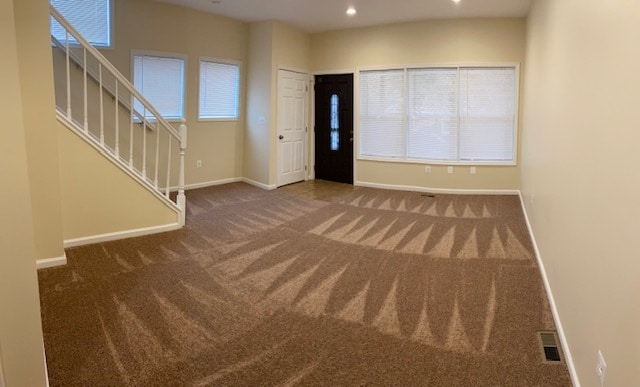
Living room
-
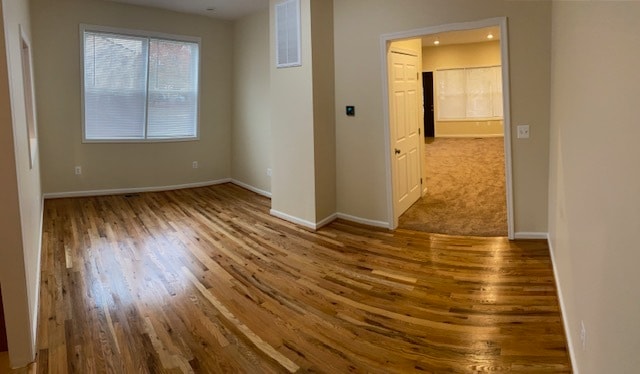
Dining Room
-
Kitchen
-
Kitchen
-
Kitchen
-
Half bath
-
Master bedroom
-
Master bedroom bath
What Are Walk Score®, Transit Score®, and Bike Score® Ratings?
Walk Score® measures the walkability of any address. Transit Score® measures access to public transit. Bike Score® measures the bikeability of any address.
What is a Sound Score Rating?
A Sound Score Rating aggregates noise caused by vehicle traffic, airplane traffic and local sources.
5920 Clay St NE
Washington, DC 20019