
Presidential Towers
555 W Madison St,
Chicago, IL 60661
$1,640 - $9,400
Studio - 2 Beds


Five Story, Elevatored, Fireproof, Concrete building located across from the beach - Walk to: Loyola U., Red-line Thorndale station Express bus in front of property Walk or bike along the Lake paths Shopping Dining Nightlife Beaches Parks Healthclubs Whole Foods Salons Schools Theater Library, etc.
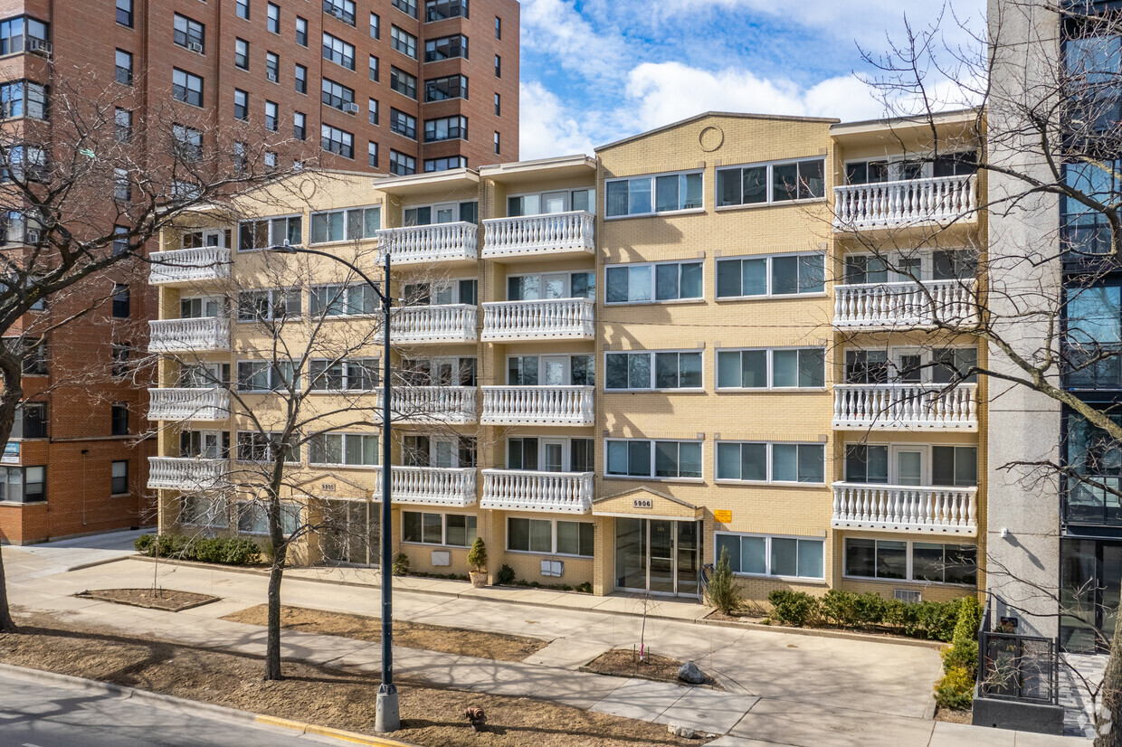
5906 N Sheridan Rd. is an apartment community located in Cook County and the 60660 ZIP Code. This area is served by the Chicago Public Schools attendance zone.
Unique Features
Laundry Facilities
Gated
24 Hour Access
Property Manager on Site
Air Conditioning
Dishwasher
High Speed Internet Access
Hardwood Floors
Island Kitchen
Granite Countertops
Microwave
Refrigerator
Located at the tip of Lincoln Park and at the end of Lake Shore Drive, Edgewater developed during the late 1800s as a resort town for Chicago's prominent citizens. The gorgeous beaches that stretch along Lake Michigan in Edgewater still attract visitors, and its beautiful skyline of towering offices and apartment buildings house those who've discovered the endless charm of this historic neighborhoods.
Edgewater is about seven miles north of Downtown Chicago, stretched along the coast and offering gorgeous parks and hiking trails along the lake, in addition to the beaches. The neighborhood is home to the Bryn Mawr Historic District, fantastic restaurants, and a variety of locally-owned shops and businesses. Loyola University Chicago, considered one of the best universities in the world, borders Edgewater on the northeast corner. The Swedish American Museum, established in 1976, is one of the neighborhood's landmarks.
Learn more about living in Edgewater| Colleges & Universities | Distance | ||
|---|---|---|---|
| Colleges & Universities | Distance | ||
| Walk: | 14 min | 0.8 mi | |
| Drive: | 4 min | 2.4 mi | |
| Drive: | 9 min | 3.9 mi | |
| Drive: | 10 min | 4.4 mi |


Transportation options available in Chicago include Thorndale Station, located 0.2 mile from 5906 N Sheridan Rd.. 5906 N Sheridan Rd. is near Chicago O'Hare International, located 15.4 miles or 26 minutes away, and Chicago Midway International, located 19.9 miles or 28 minutes away.
| Transit / Subway | Distance | ||
|---|---|---|---|
| Transit / Subway | Distance | ||
|
|
Walk: | 4 min | 0.2 mi |
|
|
Walk: | 9 min | 0.5 mi |
|
|
Walk: | 10 min | 0.6 mi |
|
|
Drive: | 2 min | 1.2 mi |
|
|
Drive: | 3 min | 1.3 mi |
| Commuter Rail | Distance | ||
|---|---|---|---|
| Commuter Rail | Distance | ||
| Drive: | 3 min | 1.5 mi | |
|
|
Drive: | 6 min | 2.5 mi |
|
|
Drive: | 6 min | 3.3 mi |
|
|
Drive: | 7 min | 3.9 mi |
|
|
Drive: | 9 min | 5.5 mi |
| Airports | Distance | ||
|---|---|---|---|
| Airports | Distance | ||
|
Chicago O'Hare International
|
Drive: | 26 min | 15.4 mi |
|
Chicago Midway International
|
Drive: | 28 min | 19.9 mi |
Time and distance from 5906 N Sheridan Rd..
| Shopping Centers | Distance | ||
|---|---|---|---|
| Shopping Centers | Distance | ||
| Walk: | 5 min | 0.3 mi | |
| Walk: | 14 min | 0.7 mi | |
| Walk: | 19 min | 1.0 mi |
| Parks and Recreation | Distance | ||
|---|---|---|---|
| Parks and Recreation | Distance | ||
|
Touhy Park
|
Drive: | 5 min | 2.5 mi |
|
Warren Park
|
Drive: | 5 min | 2.7 mi |
|
Chase Park
|
Drive: | 5 min | 2.8 mi |
|
Rogers Park
|
Drive: | 7 min | 3.7 mi |
|
Winnemac Park
|
Drive: | 7 min | 3.7 mi |
| Hospitals | Distance | ||
|---|---|---|---|
| Hospitals | Distance | ||
| Drive: | 2 min | 1.7 mi | |
| Drive: | 2 min | 1.9 mi | |
| Drive: | 5 min | 1.9 mi |
| Military Bases | Distance | ||
|---|---|---|---|
| Military Bases | Distance | ||
| Drive: | 35 min | 23.1 mi |
What Are Walk Score®, Transit Score®, and Bike Score® Ratings?
Walk Score® measures the walkability of any address. Transit Score® measures access to public transit. Bike Score® measures the bikeability of any address.
What is a Sound Score Rating?
A Sound Score Rating aggregates noise caused by vehicle traffic, airplane traffic and local sources
5906 N Sheridan Rd
Chicago, IL 60660


