$3,650
Total Monthly Price
12 Month Lease
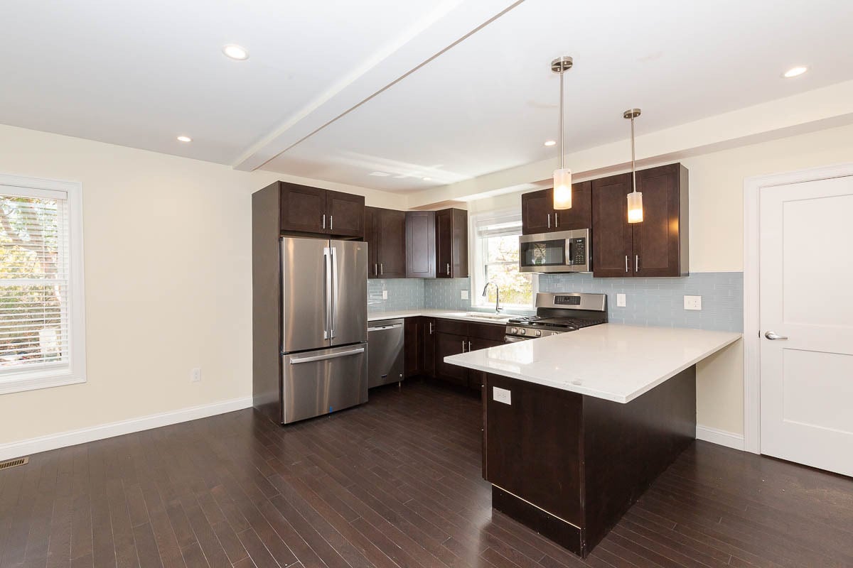
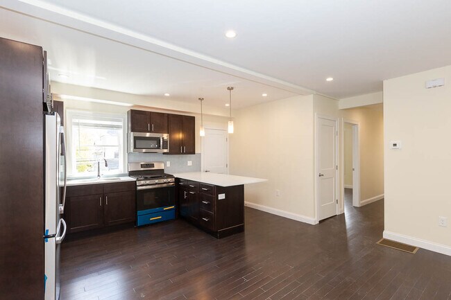
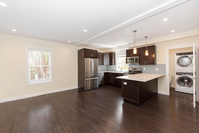
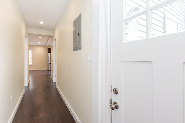
59 Catherine St Unit 1
Boston, MA 02131
Favorites
59 Catherine St Unit 1

Favorites
About This Home
12 Month Lease,
$3,650 deposit,
Available Sep 1
Welcome to Roslindale - a more suburban community just on the outskirts of metro Boston! Abutting West Roxbury & Jamaica Plain, Roslindale is a commuter’s dream with Orange Line service at Forest Hill station for a quick trip to Downtown Boston, and commuter rail stops in Roslindale Village & at Bellevue! Many attractions nearby including the Arnold Arboretum, George Wright gold course, Franklin Park & the Zoo, Legacy Place in Dedham, and much more!
59 Catherine St is a condo located in Suffolk County and the 02131 ZIP Code.
* Price shown is total price based on community-supplied monthly required fees. Excludes user-selected optional fees and variable or usage-based fees and required charges due at or prior to move-in or at move-out. Price, availability, fees, and any applicable rent special are subject to change without notice.
* Square footage definitions vary. Displayed square footage is approximate.
Contact
- Contact
Location
Get Directions
Situated seven miles southwest of downtown Boston, Forest Hills-Woodbourne in Jamaica Plain is a mostly residential neighborhood of multi-family homes for rent. Large green spaces cover much of the neighborhood, with the Woodbourne historical district consisting of houses dating back to the 19th century. Residents walk to the Forest Hills subway station on the Orange Line to head into downtown. This station also acts as a hub for many bus lines to take locals to other parts of the city and is home to a small business area.
The Arnold Arboretum covers a large portion of this neighborhood, and many locals wander the landscape paths, go bird watching, or relax under the maple trees. For a hearty breakfast, walk over to the Forest Hills Diner for eggs and home fries. Brassica Kitchen and Cafe serves up a tasting menu of pork belly and seaweed tagliatelle along with creative cocktails. After dinner, settle in a Eugene O'Neill's to watch the game.
Learn more about living in Forest Hills-Woodbourne
Education
| Colleges & Universities | Distance | ||
|---|---|---|---|
| Colleges & Universities | Distance | ||
| Drive: | 8 min | 3.9 mi | |
| Drive: | 10 min | 4.0 mi | |
| Drive: | 8 min | 4.4 mi | |
| Drive: | 8 min | 4.5 mi |
59 Catherine St Unit 1 is within 10 minutes or 4.0 miles from Curry College. It is also near Wentworth Inst. of Technology and MCPHS University, Boston.
Schools
Private High School
Grades 9-12
Nearby
School data provided by
 The GreatSchools Rating helps parents compare schools within a state based on a variety of school quality indicators and provides a helpful picture of how effectively each school serves all of its students. Ratings are on a scale of 1 (below average) to 10 (above average) and can include test scores, college readiness, academic progress, advanced courses, equity, discipline and attendance data. We also advise parents to visit schools, consider other information on school performance and programs, and consider family needs as part of the school selection process.
View GreatSchools Rating Methodology
Data provided by GreatSchools.org © 2026. All rights reserved.
View GreatSchools Rating Methodology
Data provided by GreatSchools.org © 2026. All rights reserved.
Transportation options available in Boston include Forest Hills Station, located 1.0 mile from 59 Catherine St Unit 1. 59 Catherine St Unit 1 is near General Edward Lawrence Logan International, located 9.2 miles or 18 minutes away.
| Transit / Subway | Distance | ||
|---|---|---|---|
| Transit / Subway | Distance | ||
|
|
Walk: | 19 min | 1.0 mi |
|
|
Drive: | 4 min | 1.9 mi |
|
|
Drive: | 5 min | 2.4 mi |
|
|
Drive: | 5 min | 2.6 mi |
|
|
Drive: | 7 min | 3.2 mi |
| Commuter Rail | Distance | ||
|---|---|---|---|
| Commuter Rail | Distance | ||
|
|
Walk: | 19 min | 1.0 mi |
|
|
Drive: | 4 min | 1.4 mi |
|
|
Drive: | 5 min | 2.1 mi |
|
|
Drive: | 6 min | 2.1 mi |
| Drive: | 5 min | 2.3 mi |
| Airports | Distance | ||
|---|---|---|---|
| Airports | Distance | ||
|
General Edward Lawrence Logan International
|
Drive: | 18 min | 9.2 mi |
Getting Around
 What do Walkability, Transit, Drivability, and Bikeability mean?
Walkability measures the walking distance to day-to-day needs.
Transit measures access to public transportation.
Drivability measures congestion, parking availability, and access to major roads.
Bikeability measures the suitability for cycling.
How It Works
What do Walkability, Transit, Drivability, and Bikeability mean?
Walkability measures the walking distance to day-to-day needs.
Transit measures access to public transportation.
Drivability measures congestion, parking availability, and access to major roads.
Bikeability measures the suitability for cycling.
How It Works
Moderately Walkable
Walkability
70
/ 100
Good Public Transit
Transit
60
/ 100
Fairly Drivable
Drivability
50
/ 100
Moderately Bikeable
Bikeability
70
/ 100
Scores provided by
-
Soundscore™
-
/ 100
Traffic
-Airport
-Businesses
-Scores provided by
HowLoud What is a Sound Score Rating? A Sound Score Rating aggregates noise caused by vehicle traffic, airplane traffic and local sources. How It WorksTime and distance from 59 Catherine St Unit 1.
| Shopping Centers | Distance | ||
|---|---|---|---|
| Shopping Centers | Distance | ||
| Walk: | 10 min | 0.6 mi | |
| Drive: | 3 min | 1.2 mi | |
| Drive: | 3 min | 1.6 mi |
59 Catherine St Unit 1 has 3 shopping centers within 1.6 miles, which is about a 3-minute drive. The miles and minutes will be for the farthest away property.
| Parks and Recreation | Distance | ||
|---|---|---|---|
| Parks and Recreation | Distance | ||
|
Mass Audubon's Boston Nature Center and Wildlife Sanctuary
|
Walk: | 19 min | 1.0 mi |
|
Franklin Park Zoo
|
Drive: | 6 min | 2.9 mi |
|
Arnold Arboretum of Harvard University
|
Drive: | 6 min | 3.0 mi |
|
Lower Neponset River Trail
|
Drive: | 7 min | 3.0 mi |
|
Stony Brook Reservation
|
Drive: | 7 min | 3.1 mi |
59 Catherine St Unit 1 has 5 parks within 3.1 miles, including Mass Audubon's Boston Nature Center and Wildlife Sanctuary, Arnold Arboretum of Harvard University, and Franklin Park Zoo.
| Hospitals | Distance | ||
|---|---|---|---|
| Hospitals | Distance | ||
| Drive: | 6 min | 2.4 mi | |
| Drive: | 4 min | 2.6 mi | |
| Drive: | 7 min | 4.0 mi |
59 Catherine St Unit 1 has 3 hospitals within 4.0 miles, the nearest is Arbour Hospital which is 2.4 miles away and a 6 minute drive.
| Military Bases | Distance | ||
|---|---|---|---|
| Military Bases | Distance | ||
| Drive: | 30 min | 17.0 mi |
59 Catherine St Unit 1 is 17.0 miles and a 30 minute drive from US Military Reservation.
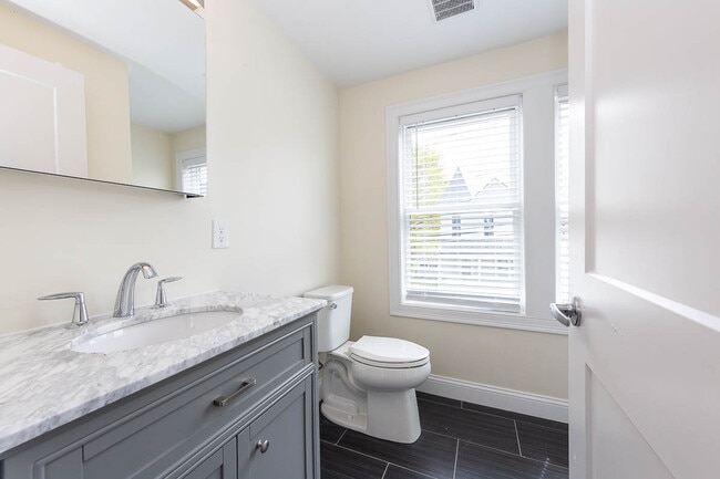
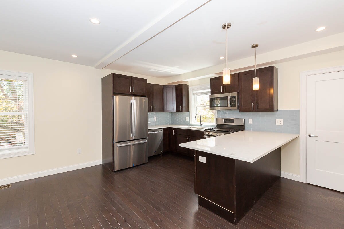
59 Catherine St Unit 1 Photos
What Are Walk Score®, Transit Score®, and Bike Score® Ratings?
Walk Score® measures the walkability of any address. Transit Score® measures access to public transit. Bike Score® measures the bikeability of any address.
What is a Sound Score Rating?
A Sound Score Rating aggregates noise caused by vehicle traffic, airplane traffic and local sources.
59 Catherine St
Boston, MA 02131