
$1,820 / Month
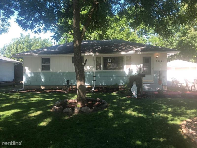
5841 Regent Ave N
Minneapolis, MN 55429
2 Weeks Ago
Favorites
5841 Regent Ave N

Favorites
Check Back Soon for Upcoming Availability
| Beds | Baths | Average SF |
|---|---|---|
| 3 Bedrooms 3 Bedrooms 3 Br | 2 Baths 2 Baths 2 Ba | 1,812 SF |
Fees and Policies
The fees below are based on community-supplied data and may exclude additional fees and utilities.
- Dogs Allowed
-
Fees not specified
- Cats Allowed
-
Fees not specified
About This Property
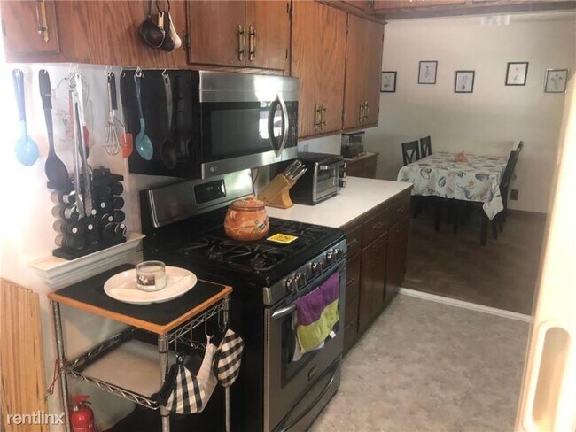
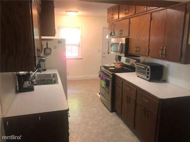
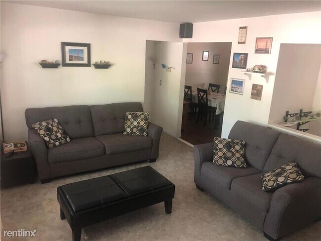
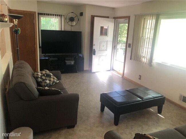
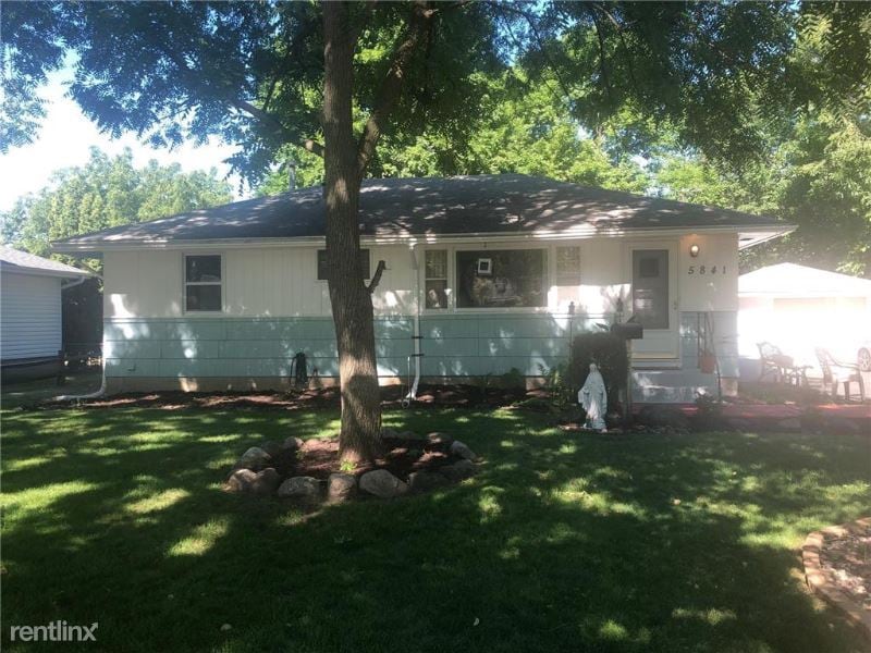
(612) 712-5499 - 5841 Regent - Property Id: 651341 This great Crystal neighborhood home is located in a quiet area right next to the Crystal Airport for small aircraft enthusiasts. It features 3 bedrooms and 2 bathrooms. The lower level bathroom is roughed in ready for a shower and tub to be added. The basement family room is roughed in ready for a wet bar to be installed too. With some newer appliances, updated windows. PLEASE NOTE: THIS PROPERTY IS LISTED FOR SALE AT $260,000. This listing is subject to prior sale or removal from sale. Availability of any listing should always be independently verified. Listing information is provided solely to identify potential properties for potential purchase. This is not an offer to rent. This property is available for sale and is subject to Home Partners of America or third party investor purchasing this property before it can be leased to a potential renter. Courtesy listing of Nicholas J. Montgomery with Advice Homes Real Estate Services LLC Apply at TurboTenant: http://rental.turbotenant.com/p/5841-regent-ave-n-crystal-mn/651341 Property Id 651341 (RLNE6761731) Lease lengths: Rent-to-Own. Pet policies: Small Dogs Allowed, Cats Allowed, Large Dogs Allowed.
5841 Regent Ave N is a house located in Hennepin County and the 55429 ZIP Code. This area is served by the Robbinsdale Public attendance zone.
Location
Get Directions
The Skyway neighborhood consists of the businesses, shops, and apartments that line the Minneapolis Skyway System. A climate-controlled series of pedestrian footbridges, located one or two stories above ground, the Minneapolis Skyway links multiple buildings over a eighty-block area of downtown Minneapolis.
The Skyway System hosts thousands of commuters and visitors every day. If you live in an apartment connected to the Skyway System and work in one of the major buildings in downtown Minneapolis, you can avoid stepping outside all winter long, as the Skyway provides access to home, work, shops, entertainment from theater to professional sports, and almost everything else you could possibly need.
Learn more about living in SkywayBelow are rent ranges for similar nearby apartments
Education
| Colleges & Universities | Distance | ||
|---|---|---|---|
| Colleges & Universities | Distance | ||
| Drive: | 10 min | 5.3 mi | |
| Drive: | 17 min | 10.5 mi | |
| Drive: | 18 min | 11.0 mi | |
| Drive: | 20 min | 11.8 mi |
5841 Regent Ave N is within 10 minutes or 5.3 miles from North Hennepin Comm. Coll.. It is also near University of St. Thomas and Minneapolis College.
Schools


Charter Elementary & Middle School
Grades PK-8
510 Students
Nearby
Public Elementary School
Grades PK-5
483 Students
Attendance Zone
Public Middle School
Grades 6-8
632 Students
Attendance Zone
Public High School
Grades 9-12
1,630 Students
Attendance Zone
Private Elementary, Middle & High School
Grades PK-12
683 Students
Nearby
Private Elementary, Middle & High School
Grades K-12
143 Students
Nearby
Private Elementary & Middle School
Grades PK-8
102 Students
Nearby
School data provided by
 The GreatSchools Rating helps parents compare schools within a state based on a variety of school quality indicators and provides a helpful picture of how effectively each school serves all of its students. Ratings are on a scale of 1 (below average) to 10 (above average) and can include test scores, college readiness, academic progress, advanced courses, equity, discipline and attendance data. We also advise parents to visit schools, consider other information on school performance and programs, and consider family needs as part of the school selection process.
View GreatSchools Rating Methodology
Data provided by GreatSchools.org © 2025. All rights reserved.
View GreatSchools Rating Methodology
Data provided by GreatSchools.org © 2025. All rights reserved.
Transportation options available in Minneapolis include Target Field Station Platform 2, located 9.9 miles from 5841 Regent Ave N. 5841 Regent Ave N is near Minneapolis-St Paul International/Wold-Chamberlain, located 23.1 miles or 34 minutes away.
| Transit / Subway | Distance | ||
|---|---|---|---|
| Transit / Subway | Distance | ||
| Drive: | 17 min | 9.9 mi | |
|
|
Drive: | 17 min | 10.1 mi |
|
|
Drive: | 17 min | 10.2 mi |
|
|
Drive: | 17 min | 10.2 mi |
|
|
Drive: | 18 min | 10.4 mi |
| Commuter Rail | Distance | ||
|---|---|---|---|
| Commuter Rail | Distance | ||
|
|
Drive: | 10 min | 4.9 mi |
|
|
Drive: | 18 min | 8.1 mi |
|
|
Drive: | 22 min | 12.7 mi |
|
|
Drive: | 24 min | 16.1 mi |
| Drive: | 26 min | 16.2 mi |
| Airports | Distance | ||
|---|---|---|---|
| Airports | Distance | ||
|
Minneapolis-St Paul International/Wold-Chamberlain
|
Drive: | 34 min | 23.1 mi |
Time and distance from 5841 Regent Ave N.
| Shopping Centers | Distance | ||
|---|---|---|---|
| Shopping Centers | Distance | ||
| Drive: | 3 min | 1.4 mi | |
| Drive: | 3 min | 1.4 mi | |
| Drive: | 3 min | 1.4 mi |
5841 Regent Ave N has 3 shopping centers within 1.4 miles, which is about a 3-minute drive. The miles and minutes will be for the farthest away property.
| Parks and Recreation | Distance | ||
|---|---|---|---|
| Parks and Recreation | Distance | ||
|
Shingle Creek Park
|
Drive: | 7 min | 3.1 mi |
|
Victory Park
|
Drive: | 7 min | 3.2 mi |
|
Bohanon Park
|
Drive: | 9 min | 3.8 mi |
|
Webber Park
|
Drive: | 10 min | 3.9 mi |
|
Carl Kroening Interpretive Center
|
Drive: | 10 min | 4.2 mi |
5841 Regent Ave N has 5 parks within 4.2 miles, including Shingle Creek Park, Victory Park, and Bohanon Park.
| Hospitals | Distance | ||
|---|---|---|---|
| Hospitals | Distance | ||
| Drive: | 8 min | 4.5 mi | |
| Drive: | 20 min | 11.0 mi | |
| Drive: | 22 min | 12.6 mi |
5841 Regent Ave N has 3 hospitals within 12.6 miles, the nearest is North Memorial Health which is 4.5 miles away and a 8 minute drive.
| Military Bases | Distance | ||
|---|---|---|---|
| Military Bases | Distance | ||
| Drive: | 31 min | 21.4 mi |
5841 Regent Ave N is 21.4 miles and a 31 minute drive from Fort Snelling Military Reservation.
You May Also Like
Similar Rentals Nearby


What Are Walk Score®, Transit Score®, and Bike Score® Ratings?
Walk Score® measures the walkability of any address. Transit Score® measures access to public transit. Bike Score® measures the bikeability of any address.
What is a Sound Score Rating?
A Sound Score Rating aggregates noise caused by vehicle traffic, airplane traffic and local sources
5841 Regent Ave N
Minneapolis, MN 55429