
$897 / Month
5741 Ollie St
Pittsburgh, PA 15207
2 Weeks Ago
Favorites
5741 Ollie St

Favorites
Check Back Soon for Upcoming Availability
| Beds | Baths | Average SF |
|---|---|---|
| 2 Bedrooms 2 Bedrooms 2 Br | 1 Bath 1 Bath 1 Ba | 1,100 SF |
Fees and Policies
The fees below are based on community-supplied data and may exclude additional fees and utilities.
- Dogs Allowed
-
Fees not specified
- Cats Allowed
-
Fees not specified
About This Property
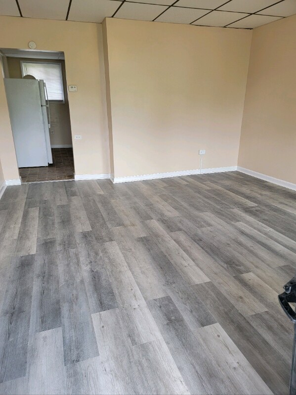
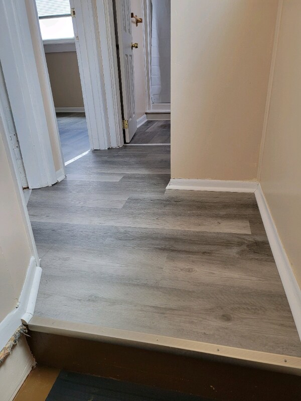
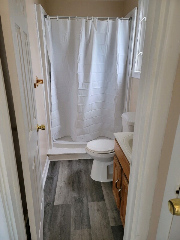
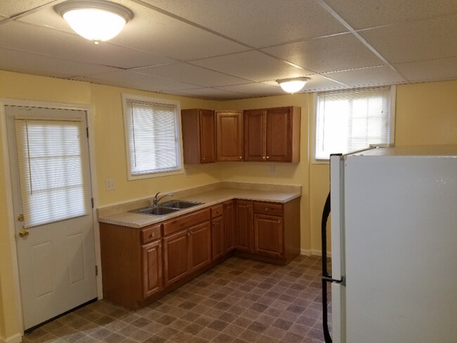
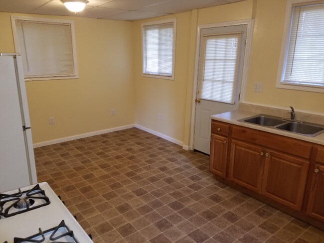
Property Id: 903121 ASK ABOUT OUR RESIDENT REWARDS PROGRAM 2 Bedroom Single Family House Recently remodeled Ready for immediate occupancy Quiet Neighborhood Within walking distance of Public Transportation and School, Includes: Spacious Living room with lots of natural lighting, Roomy Eat in Kitchen, Large Bathroom with Shower and Tub, Wall to wall waterproof flooring Covered Front and Rear Porch Fenced in Back Yard Full Basement Laundry Hookups including accommodations for either a Gas or Electric Dryer New Forced Air Gas Heat Furnace Call MCF Group Inc at 412 298-4531 for details or to schedule an appointment to view house. NOT ACCEPTING VOUCHERS Near Munhall, West Mifflin, Hazelwood, Greenfield, Squirrel Hill, West Homestead, Mckeesport, Duquesne, Port Vue, Liberty, Glassport, Dravosburg, Route 885, Route 837, Route 51, Baldwin, Brentwood, Century III Mall, Waterfront, Allegheny County Airport, Kennywood, CCAC South, Jefferson Hospital, USS Steel Irwin and Edgar Tompson Works
5741 Ollie St is a house located in Allegheny County and the 15207 ZIP Code. This area is served by the Pittsburgh Public Schools attendance zone.
House Features
- Oven
- Refrigerator
- Lawn
Location
Get Directions
Known for rugged hills and rolling countryside mixed with developed areas called boroughs, the southern portion of Allegheny County remains a beautiful compliment to nearby city life in Pittsburgh. Located about 14 miles southeast of Pittsburgh, it takes about an hour to reach the city's center. One of Pennsylvania’s largest areas, South Allegheny consists of several towns and suburbs set in an idyllic landscape. Great destinations include historic Kennywood Park, which first opened in 1899 and is listed on the National Register of Historic Places.
Learn more about living in South Allegheny
Amenities
- Oven
- Refrigerator
- Lawn
Education
| Colleges & Universities | Distance | ||
|---|---|---|---|
| Colleges & Universities | Distance | ||
| Drive: | 13 min | 5.0 mi | |
| Drive: | 20 min | 7.1 mi | |
| Drive: | 17 min | 7.3 mi | |
| Drive: | 19 min | 7.8 mi |
5741 Ollie St is within 13 minutes or 5.0 miles from Allegheny Co. C.C, South. It is also near Carlow College and Carnegie Mellon University.
Schools


Public Elementary & Middle School
Grades PK-8
272 Students
Attendance Zone
Public High School
Grades 9-12
1,362 Students
Attendance Zone
Private Elementary, Middle & High School
Grades PK-12
196 Students
Nearby
Private Elementary & Middle School
Grades PK-8
305 Students
Nearby
Private Elementary School
Grades PK-6
110 Students
Nearby
School data provided by
 The GreatSchools Rating helps parents compare schools within a state based on a variety of school quality indicators and provides a helpful picture of how effectively each school serves all of its students. Ratings are on a scale of 1 (below average) to 10 (above average) and can include test scores, college readiness, academic progress, advanced courses, equity, discipline and attendance data. We also advise parents to visit schools, consider other information on school performance and programs, and consider family needs as part of the school selection process.
View GreatSchools Rating Methodology
Data provided by GreatSchools.org © 2025. All rights reserved.
View GreatSchools Rating Methodology
Data provided by GreatSchools.org © 2025. All rights reserved.
Transportation options available in Pittsburgh include South Bank Station, located 6.7 miles from 5741 Ollie St. 5741 Ollie St is near Pittsburgh International, located 25.2 miles or 45 minutes away, and Arnold Palmer Regional, located 33.2 miles or 62 minutes away.
| Transit / Subway | Distance | ||
|---|---|---|---|
| Transit / Subway | Distance | ||
| Drive: | 16 min | 6.7 mi | |
| Drive: | 16 min | 6.9 mi | |
| Drive: | 17 min | 7.2 mi | |
| Drive: | 18 min | 7.5 mi | |
| Drive: | 18 min | 7.9 mi |
| Commuter Rail | Distance | ||
|---|---|---|---|
| Commuter Rail | Distance | ||
|
|
Drive: | 20 min | 8.6 mi |
|
|
Drive: | 45 min | 23.7 mi |
|
|
Drive: | 65 min | 33.4 mi |
|
|
Drive: | 62 min | 40.6 mi |
| Airports | Distance | ||
|---|---|---|---|
| Airports | Distance | ||
|
Pittsburgh International
|
Drive: | 45 min | 25.2 mi |
|
Arnold Palmer Regional
|
Drive: | 62 min | 33.2 mi |
Time and distance from 5741 Ollie St.
| Shopping Centers | Distance | ||
|---|---|---|---|
| Shopping Centers | Distance | ||
| Drive: | 5 min | 2.1 mi | |
| Drive: | 6 min | 2.4 mi | |
| Drive: | 7 min | 2.7 mi |
5741 Ollie St has 3 shopping centers within 2.7 miles, which is about a 7-minute drive. The miles and minutes will be for the farthest away property.
| Parks and Recreation | Distance | ||
|---|---|---|---|
| Parks and Recreation | Distance | ||
|
Rivers Of Steel National Heritage Area
|
Drive: | 10 min | 4.1 mi |
|
Frick Park
|
Drive: | 18 min | 6.6 mi |
|
Frick Environmental Center
|
Drive: | 18 min | 6.6 mi |
|
Renziehausen Park Rose Garden & Arboretum
|
Drive: | 15 min | 7.5 mi |
|
Schenley Park
|
Drive: | 19 min | 7.5 mi |
5741 Ollie St has 5 parks within 7.5 miles, including Rivers Of Steel National Heritage Area, Frick Park, and Frick Environmental Center.
| Hospitals | Distance | ||
|---|---|---|---|
| Hospitals | Distance | ||
| Drive: | 11 min | 5.3 mi | |
| Drive: | 12 min | 5.7 mi | |
| Drive: | 16 min | 6.9 mi |
5741 Ollie St has 3 hospitals within 6.9 miles, the nearest is UPMC Mckeesport Hospital which is 5.3 miles away and a 11 minute drive.
| Military Bases | Distance | ||
|---|---|---|---|
| Military Bases | Distance | ||
| Drive: | 41 min | 23.7 mi |
5741 Ollie St is 23.7 miles and a 41 minute drive from Pittsburgh Air Reserve Station.
You May Also Like
Similar Rentals Nearby


What Are Walk Score®, Transit Score®, and Bike Score® Ratings?
Walk Score® measures the walkability of any address. Transit Score® measures access to public transit. Bike Score® measures the bikeability of any address.
What is a Sound Score Rating?
A Sound Score Rating aggregates noise caused by vehicle traffic, airplane traffic and local sources

5741 Ollie St
Pittsburgh, PA 15207