$850
/ Month
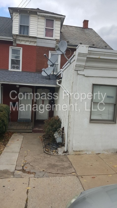
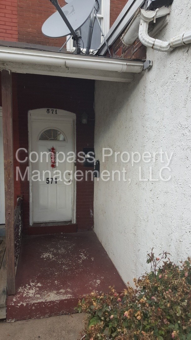
571 Olive St
Coatesville, PA 19320
Favorites
571 Olive St

Favorites
Check Back Soon for Upcoming Availability
| Beds | Baths | Average SF |
|---|---|---|
| 2 Bedrooms 2 Bedrooms 2 Br | 1 Bath 1 Bath 1 Ba | — |
About This Property
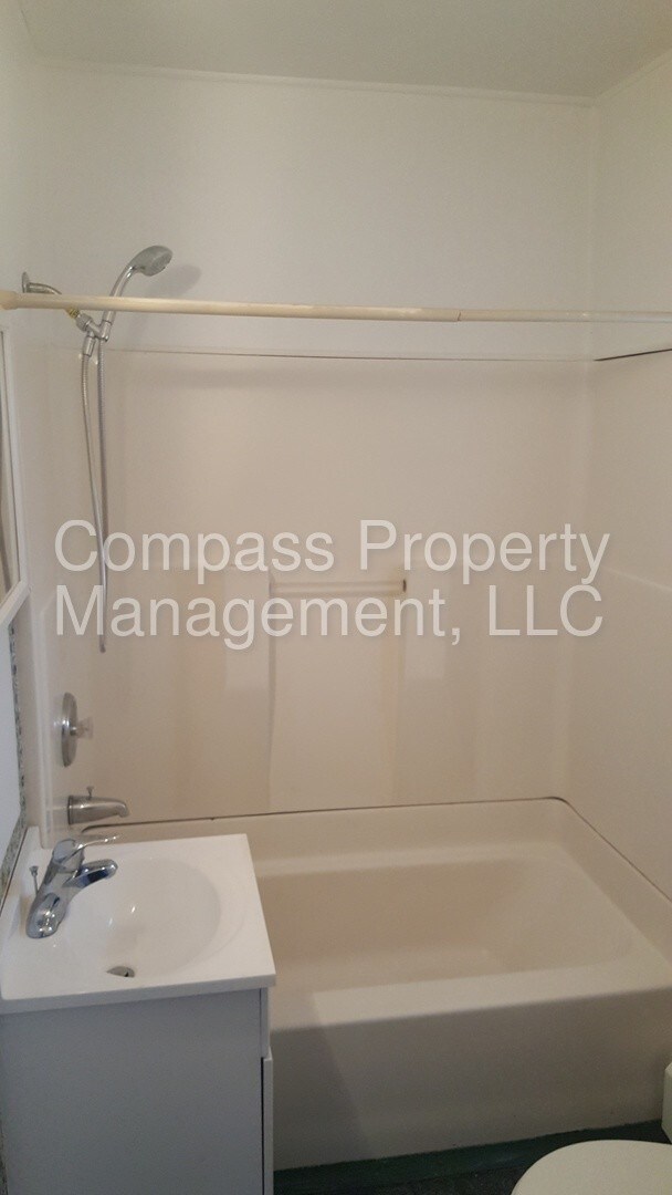
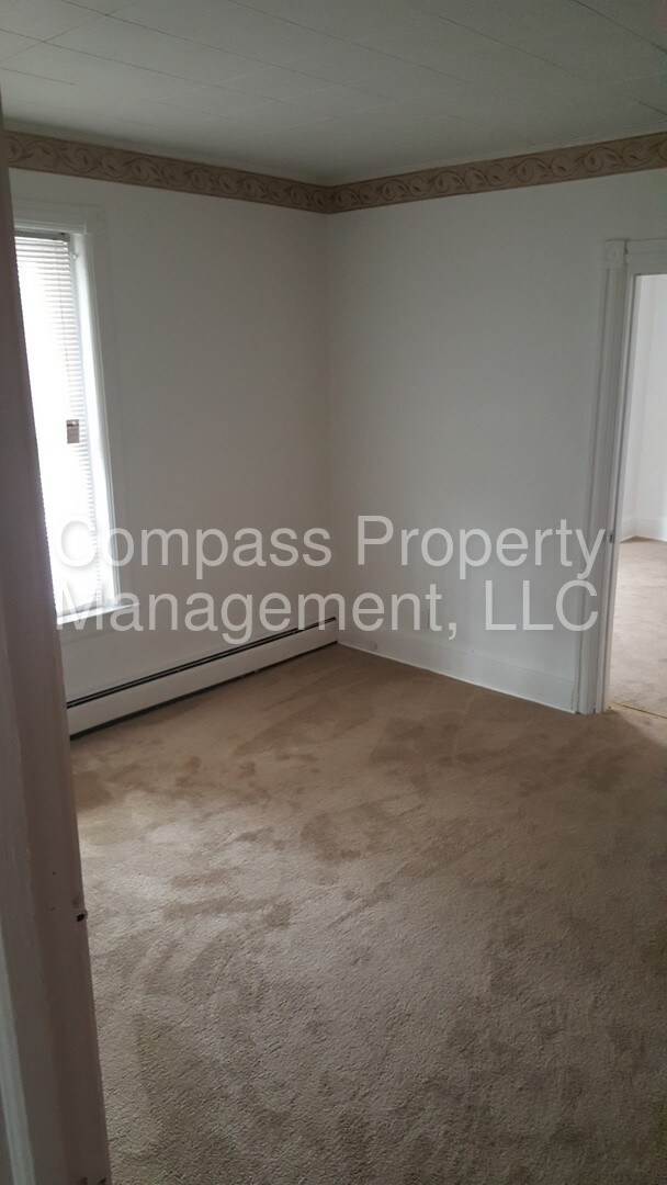
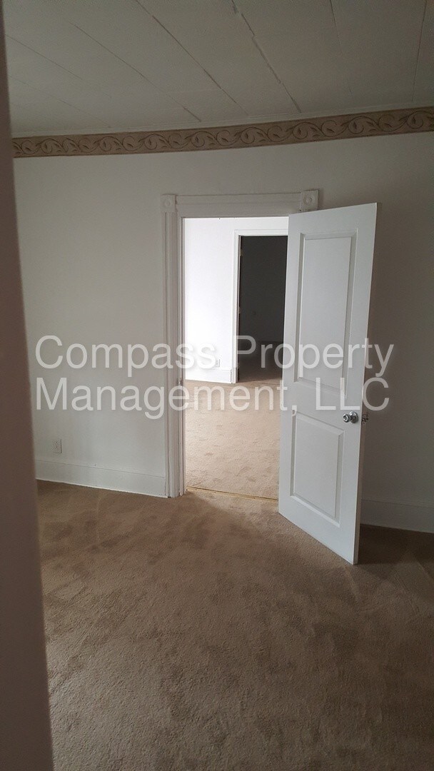
TO VIEW THIS PROPERTY SEE "View A Property Now" @ compass.property This 1st Floor Apartment at 571-1 Olive St Coatesville PA 19320 includes Heat, Water, Sewer & Trash Located in Coatesville City & Coatesville Area School District. Bedrooms: 2 Bathroom: 1 Market Rent: $850 Security Deposit: $850 Utilities Tenant pays: Electric, Gas (For Stove) Utilities Landlord pays: Water, Sewer, Trash & Heat Appliances: Refrigerator, Gas Stove Accommodations: No Pets, Outside Smoking Only, Special Programs Considered SEE ALL AVAILABLE LISTINGS @ www.compass.property COMPASS PROPERTY MANAGEMENT LLC Rental Terms: Rent: $850, Application Fee: $25, Security Deposit: $850, Available Now Pet Policy: Cats not allowed, Dogs not allowed This property allows self guided viewing without an appointment. Contact for details.
571 Olive St is an apartment community located in Chester County and the 19320 ZIP Code. This area is served by the Coatesville Area School District attendance zone.
571 Olive St,
Coatesville,
PA
19320
Coatesville is the only city in Chester County, Pennsylvania, sitting about 39 miles west of Philadelphia along the historic Lincoln Highway corridor. Its identity is deeply rooted in steel-making history. The Lukens Steel Company helped shape the city in the early 20th century, and that industrial legacy still gives Coatesville a gritty, authentic character that sets it apart from the polished suburbs surrounding it.
Today, the city is in the midst of a steady revitalization, drawing interest from renters who want Chester County access without the premium price tag that comes with neighboring communities. The Brandywine River traces the area’s edge, and the National Iron and Steel Heritage Museum anchors a growing cultural presence downtown.
Housing here covers a solid range of options, from converted rowhouses and older brick apartment buildings to newer apartment communities that reflect ongoing investment in the city’s future.
Learn more about living in Coatesville
Education
| Colleges & Universities | Distance | ||
|---|---|---|---|
| Colleges & Universities | Distance | ||
| Drive: | 26 min | 14.3 mi | |
| Drive: | 27 min | 15.8 mi | |
| Drive: | 30 min | 17.2 mi | |
| Drive: | 40 min | 21.4 mi |
571 Olive St is within 26 minutes or 14.3 miles from West Chester Univ.. It is also near Immaculata University and Lincoln University.
Schools


Public Elementary, Middle & High School
Grades K-12
3,283 Students
Nearby
Charter Elementary School
Grades K-5
411 Students
Nearby
Public Elementary & Middle School
Grades K-8
389 Students
Nearby
Public High School
Grades 9-12
1,412 Students
Attendance Zone
Private Elementary School
Grades K-5
13 Students
Nearby
Private Elementary School
Grades PK-5
58 Students
Nearby
School data provided by
 The GreatSchools Rating helps parents compare schools within a state based on a variety of school quality indicators and provides a helpful picture of how effectively each school serves all of its students. Ratings are on a scale of 1 (below average) to 10 (above average) and can include test scores, college readiness, academic progress, advanced courses, equity, discipline and attendance data. We also advise parents to visit schools, consider other information on school performance and programs, and consider family needs as part of the school selection process.
View GreatSchools Rating Methodology
Data provided by GreatSchools.org © 2026. All rights reserved.
View GreatSchools Rating Methodology
Data provided by GreatSchools.org © 2026. All rights reserved.
Walkability Near 571 Olive St Coatesville, PA 19320
Getting Around
 What do Walkability, Transit, Drivability, and Bikeability mean?
Walkability measures the walking distance to day-to-day needs.
Transit measures access to public transportation.
Drivability measures congestion, parking availability, and access to major roads.
Bikeability measures the suitability for cycling.
How It Works
What do Walkability, Transit, Drivability, and Bikeability mean?
Walkability measures the walking distance to day-to-day needs.
Transit measures access to public transportation.
Drivability measures congestion, parking availability, and access to major roads.
Bikeability measures the suitability for cycling.
How It Works
Moderately Walkable
Walkability
60
/ 100
Limited Public Transit
Transit
30
/ 100
Moderately Drivable
Drivability
60
/ 100
Somewhat Bikeable
Bikeability
20
/ 100
Scores provided by
-
Soundscore™
-
/ 100
Traffic
-Airport
-Businesses
-Scores provided by
HowLoud What is a Sound Score Rating? A Sound Score Rating aggregates noise caused by vehicle traffic, airplane traffic and local sources. How It WorksYou May Also Like
Similar Rentals Nearby
-
-
2 Beds$3,269+3 Beds$3,418+Total Monthly PriceTotal Monthly Price NewPrices include base rent and required monthly fees of $55. Variable costs based on usage may apply.Base Rent:2 Beds$3,213+3 Beds$3,362+Specials
Fitness Center Pool Dishwasher Refrigerator Kitchen In Unit Washer & Dryer
-
-
-
-
-
-
-
-


What Are Walk Score®, Transit Score®, and Bike Score® Ratings?
Walk Score® measures the walkability of any address. Transit Score® measures access to public transit. Bike Score® measures the bikeability of any address.
What is a Sound Score Rating?
A Sound Score Rating aggregates noise caused by vehicle traffic, airplane traffic and local sources.

571 Olive St
Coatesville, PA 19320