$4,150
/ Month
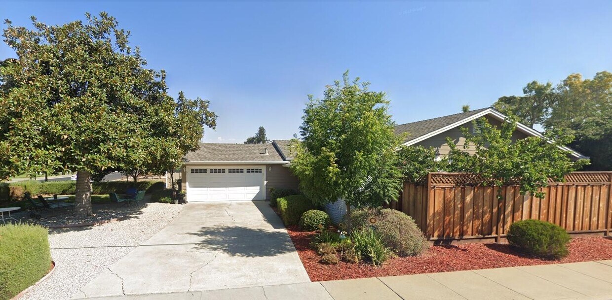
566 N Central Ave
Campbell, CA 95008
2 Weeks Ago
|
Edit
Favorites
566 N Central Ave

Favorites
Check Back Soon for Upcoming Availability
| Beds | Baths | Average SF |
|---|---|---|
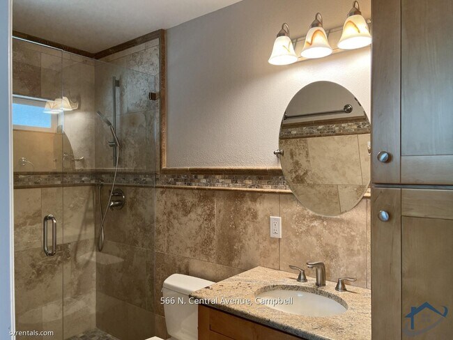
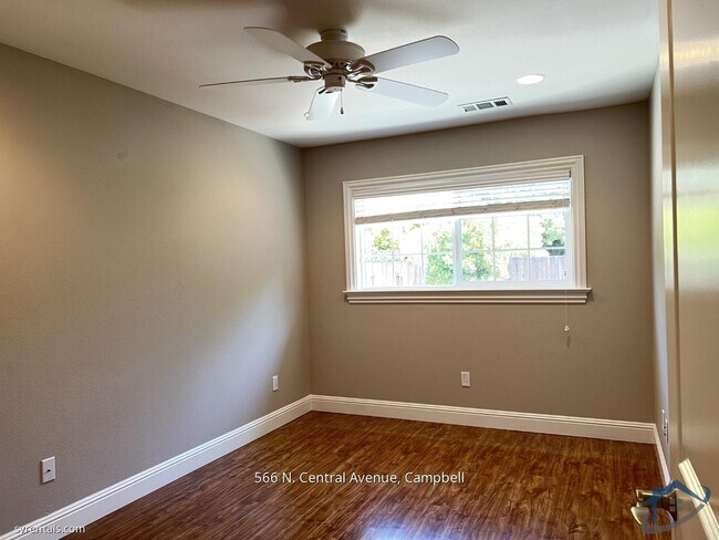
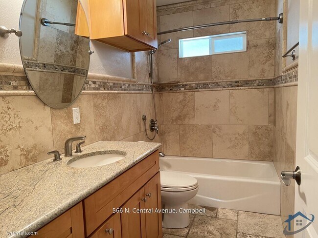
| 3 Bedrooms 3 Bedrooms 3 Br | 2 Baths 2 Baths 2 Ba | 1,239 SF |
Fees and Policies
The fees listed below are community-provided and may exclude utilities or add-ons. All payments are made directly to the property and are non-refundable unless otherwise specified.
About This Property
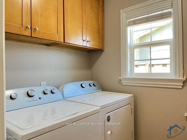
This home has a spacious, open kitchen/family room and is close to downtown Campbell's vibrant dining, shopping, and entertainment scene. Central heating and air-conditioning for year-round comfort. The backyard is a private retreat with space to garden and relax, the perfect backdrop for gatherings or unwinding after a long day. 2-car garage. Easy access to major highways ensures seamless connectivity to Silicon Valley and all commute routes. Showing Requests and Applications accepted only through manager's website.
566 N Central Ave is a house located in Santa Clara County and the 95008 ZIP Code. This area is served by the Campbell Union High School District attendance zone.
House Features
- Fireplace
566 N Central Ave,
Campbell,
CA
95008
Located a quick five miles from downtown San Jose, the Winchester neighborhood is a mix of upscale businesses and residences. Hop on I-280, and travel to the downtown area in under 10 minutes. Winchester's proximity to I-880 also makes this neighborhood an excellent option for commuters to the surrounding cities of Los Gatos and Santa Clara. Rental options mostly consist of luxury apartment complexes.
Shopping enthusiasts delight in Santana Row, a deluxe combination of stores, restaurants, and living space. Enjoy a sweet snack at Kara's Cupcakes or find the perfect outfit at H&M. Throughout the year, Santana Row also hosts free events such as music and film series. Those who prefer indoor malls head to Westfield Valley Fair and its mix of national chains, including Macy's and the Cheesecake Factory.
Learn more about living in WinchesterBelow are rent ranges for similar nearby apartments
Amenities
- Fireplace
Education
| Colleges & Universities | Distance | ||
|---|---|---|---|
| Colleges & Universities | Distance | ||
| Drive: | 5 min | 2.4 mi | |
| Drive: | 10 min | 5.5 mi | |
| Drive: | 11 min | 6.2 mi | |
| Drive: | 14 min | 8.1 mi |
566 N Central Ave is within 5 minutes or 2.4 miles from San Jose City College. It is also near Santa Clara University and San Jose State University.
Schools


Public Elementary School
Grades K-5
407 Students
Nearby
Public Elementary School
Grades K-5
436 Students
Attendance Zone
Public Middle School
Grades 6-8
677 Students
Attendance Zone
Public High School
Grades 9-12
1,350 Students
Attendance Zone
Private Elementary, Middle & High School
Grades K-12
Nearby
Private Elementary & Middle School
Grades PK-8
158 Students
Nearby
School data provided by
 The GreatSchools Rating helps parents compare schools within a state based on a variety of school quality indicators and provides a helpful picture of how effectively each school serves all of its students. Ratings are on a scale of 1 (below average) to 10 (above average) and can include test scores, college readiness, academic progress, advanced courses, equity, discipline and attendance data. We also advise parents to visit schools, consider other information on school performance and programs, and consider family needs as part of the school selection process.
View GreatSchools Rating Methodology
Data provided by GreatSchools.org © 2026. All rights reserved.
View GreatSchools Rating Methodology
Data provided by GreatSchools.org © 2026. All rights reserved.
Transportation options available in Campbell include Hamilton Station, located 0.6 mile from 566 N Central Ave. 566 N Central Ave is near Norman Y Mineta San Jose International, located 6.5 miles or 10 minutes away, and San Francisco International, located 37.8 miles or 48 minutes away.
| Transit / Subway | Distance | ||
|---|---|---|---|
| Transit / Subway | Distance | ||
| Walk: | 11 min | 0.6 mi | |
| Walk: | 15 min | 0.8 mi | |
|
|
Drive: | 3 min | 1.3 mi |
| Drive: | 4 min | 1.5 mi | |
| Drive: | 4 min | 2.2 mi |
| Commuter Rail | Distance | ||
|---|---|---|---|
| Commuter Rail | Distance | ||
| Drive: | 8 min | 4.3 mi | |
| Drive: | 8 min | 4.3 mi | |
| Drive: | 8 min | 4.4 mi | |
| Drive: | 9 min | 5.2 mi | |
| Drive: | 8 min | 5.3 mi |
| Airports | Distance | ||
|---|---|---|---|
| Airports | Distance | ||
|
Norman Y Mineta San Jose International
|
Drive: | 10 min | 6.5 mi |
|
San Francisco International
|
Drive: | 48 min | 37.8 mi |
Walkability Near 566 N Central Ave Campbell, CA 95008
Getting Around
 What do Walkability, Transit, Drivability, and Bikeability mean?
Walkability measures the walking distance to day-to-day needs.
Transit measures access to public transportation.
Drivability measures congestion, parking availability, and access to major roads.
Bikeability measures the suitability for cycling.
How It Works
What do Walkability, Transit, Drivability, and Bikeability mean?
Walkability measures the walking distance to day-to-day needs.
Transit measures access to public transportation.
Drivability measures congestion, parking availability, and access to major roads.
Bikeability measures the suitability for cycling.
How It Works
Moderately Walkable
Walkability
60
/ 100
Some Public Transit
Transit
40
/ 100
Exceptionally Drivable
Drivability
90
/ 100
Moderately Bikeable
Bikeability
60
/ 100
Scores provided by
-
Soundscore™
-
/ 100
Traffic
-Airport
-Businesses
-Scores provided by
HowLoud What is a Sound Score Rating? A Sound Score Rating aggregates noise caused by vehicle traffic, airplane traffic and local sources. How It WorksTime and distance from 566 N Central Ave.
| Shopping Centers | Distance | ||
|---|---|---|---|
| Shopping Centers | Distance | ||
| Walk: | 8 min | 0.4 mi | |
| Walk: | 15 min | 0.8 mi | |
| Drive: | 3 min | 1.3 mi |
566 N Central Ave has 3 shopping centers within 1.3 miles, which is about a 3-minute drive. The miles and minutes will be for the farthest away property.
| Parks and Recreation | Distance | ||
|---|---|---|---|
| Parks and Recreation | Distance | ||
|
Orchard City Green
|
Walk: | 12 min | 0.6 mi |
|
John D. Morgan Park
|
Drive: | 4 min | 1.8 mi |
|
Edith Morley Park
|
Drive: | 5 min | 2.3 mi |
|
Los Gatos Creek Trail
|
Drive: | 3 min | 2.4 mi |
|
Jack Fischer Park
|
Drive: | 8 min | 3.5 mi |
566 N Central Ave has 5 parks within 3.5 miles, including Orchard City Green, John D. Morgan Park, and Edith Morley Park.
| Hospitals | Distance | ||
|---|---|---|---|
| Hospitals | Distance | ||
| Drive: | 4 min | 2.1 mi | |
| Drive: | 7 min | 4.2 mi | |
| Drive: | 10 min | 5.9 mi |
566 N Central Ave has 3 hospitals within 5.9 miles, the nearest is Santa Clara Valley Medical Center which is 2.1 miles away and a 4 minute drive.
| Military Bases | Distance | ||
|---|---|---|---|
| Military Bases | Distance | ||
| Drive: | 23 min | 14.8 mi |
566 N Central Ave is 14.8 miles and a 23 minute drive from Ames Research Center.
You May Also Like
Similar Rentals Nearby


What Are Walk Score®, Transit Score®, and Bike Score® Ratings?
Walk Score® measures the walkability of any address. Transit Score® measures access to public transit. Bike Score® measures the bikeability of any address.
What is a Sound Score Rating?
A Sound Score Rating aggregates noise caused by vehicle traffic, airplane traffic and local sources.

566 N Central Ave
Campbell, CA 95008