
$925 / Month
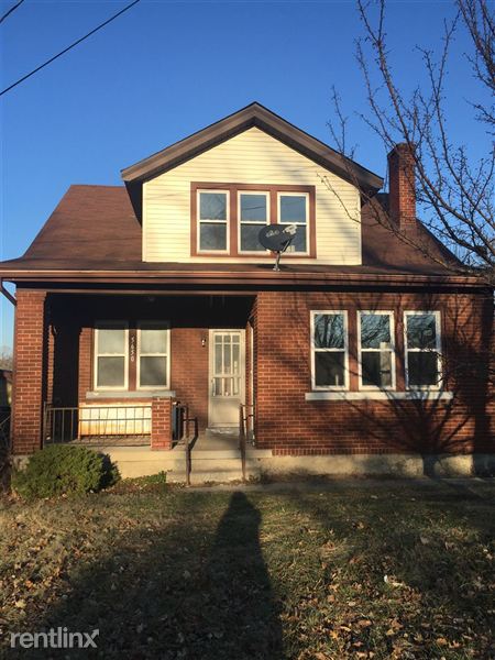
5650 Colerain Ave
Cincinnati, OH 45239
2 Weeks Ago
Favorites
5650 Colerain Ave

Favorites
Check Back Soon for Upcoming Availability
| Beds | Baths | Average SF |
|---|---|---|
| 4 Bedrooms 4 Bedrooms 4 Br | 2 Baths 2 Baths 2 Ba | 1,792 SF |
About This Property
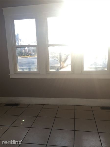
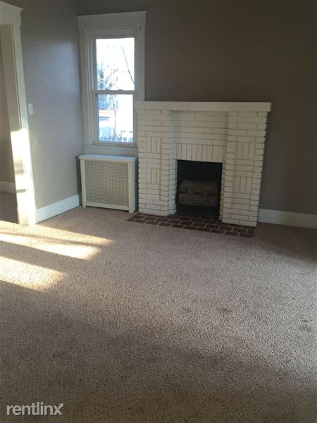
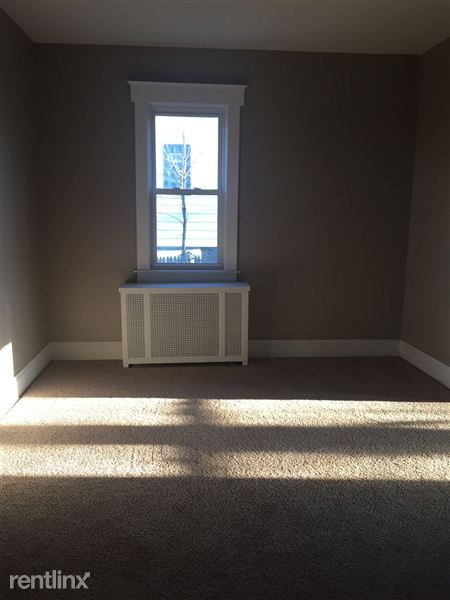
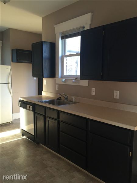
(513) 921-9560 - Please call 513-921-9560 for appointment availability. In order to schedule a private showing outside of appointments, you must submit an application through our office. Applications are available online, in our office or at appointments. You will need a copy of your ID, proof of income (30 days), $20 app fee {per person 18 years old+}. This home has all that you want! If being close to everything is what you want, don't miss out on this house. The living room opens up to the dining room and kitchen, which includes a dishwasher. The first floor has a full bathroom and a bedroom. Going to the second floor, there are three more bedrooms along with another full bathroom. Then entire home has new carpet and fresh, modern paint. The full, unfinished basement has a ton of storage space and a washer and dryer hookup. Don't let 5650 Colerain slip through your fingers! Office: 513-921-9560 Fax: 513-332-9573 3554 Blue Rock Rd Cincinnati OH 45239 To see a list of all available properties go to: http://www.cincired.com/ (RLNE2057214) Other Amenities - Parking, Basement. Appliances - Dishwasher, Refrigerator, Range, Oven. Lease lengths - 12 Months. Details regarding this property's Utilities - Resident Pays Heat, Resident Pays Electricity, Resident Pays Gas, Resident Pays Water, Resident Pays Trash Pick-up. Pet policies - Dogs Allowed- w/ deposit, Cats Allowed- w/ deposit.
5650 Colerain Ave is a house located in Hamilton County and the 45239 ZIP Code. This area is served by the Cincinnati Public Schools attendance zone.
Location
Get Directions
Mount Airy is a classic suburban neighborhood with peaceful streets lined with single-family homes. Interstate 74 and Highway 22 makes the seven mile drive into Downtown Cincinnati and beyond accessible, but Mount Airy has a lot to offer from within. Its southern border encompasses Mount Airy Forest, which provides residents with outdoor fun. There are also a few fast food restaurants within the neighborhood, but residents can easily travel to the surrounding areas or into downtown for a diverse selection of restaurants. Renters will find that they have a few affordable options of apartments in longstanding brick buildings to choose from.
Learn more about living in Mount AiryBelow are rent ranges for similar nearby apartments
Education
| Colleges & Universities | Distance | ||
|---|---|---|---|
| Colleges & Universities | Distance | ||
| Drive: | 13 min | 4.8 mi | |
| Drive: | 14 min | 6.5 mi | |
| Drive: | 16 min | 6.9 mi | |
| Drive: | 19 min | 8.5 mi |
5650 Colerain Ave is within 13 minutes or 4.8 miles from Cincinnati State. It is also near University of Cincinnati and Univ. of Cincinnati, Medical.
Schools


Public Elementary & Middle School
Grades PK-7
569 Students
Attendance Zone
Public Middle & High School
Grades 7-12
760 Students
Attendance Zone
Public Middle & High School
Grades 7-12
897 Students
Attendance Zone
Public High School
Grades 9-12
25 Students
Attendance Zone
Private Elementary, Middle & High School
Grades PK-10
268 Students
Nearby
Private High School
Grades 9-12
738 Students
Nearby
School data provided by
 The GreatSchools Rating helps parents compare schools within a state based on a variety of school quality indicators and provides a helpful picture of how effectively each school serves all of its students. Ratings are on a scale of 1 (below average) to 10 (above average) and can include test scores, college readiness, academic progress, advanced courses, equity, discipline and attendance data. We also advise parents to visit schools, consider other information on school performance and programs, and consider family needs as part of the school selection process.
View GreatSchools Rating Methodology
Data provided by GreatSchools.org © 2025. All rights reserved.
View GreatSchools Rating Methodology
Data provided by GreatSchools.org © 2025. All rights reserved.
Transportation options available in Cincinnati include Brewery District Station, Elm & Henry, located 7.2 miles from 5650 Colerain Ave. 5650 Colerain Ave is near Cincinnati/Northern Kentucky International, located 21.2 miles or 39 minutes away.
| Transit / Subway | Distance | ||
|---|---|---|---|
| Transit / Subway | Distance | ||
| Drive: | 15 min | 7.2 mi | |
| Drive: | 15 min | 7.3 mi | |
| Drive: | 15 min | 7.4 mi | |
| Drive: | 15 min | 7.4 mi | |
| Drive: | 16 min | 7.5 mi |
| Commuter Rail | Distance | ||
|---|---|---|---|
| Commuter Rail | Distance | ||
|
|
Drive: | 14 min | 7.1 mi |
| Airports | Distance | ||
|---|---|---|---|
| Airports | Distance | ||
|
Cincinnati/Northern Kentucky International
|
Drive: | 39 min | 21.2 mi |
Time and distance from 5650 Colerain Ave.
| Shopping Centers | Distance | ||
|---|---|---|---|
| Shopping Centers | Distance | ||
| Walk: | 13 min | 0.7 mi | |
| Walk: | 14 min | 0.7 mi | |
| Drive: | 3 min | 1.5 mi |
5650 Colerain Ave has 3 shopping centers within 1.5 miles, which is about a 3-minute walk. The miles and minutes will be for the farthest away property.
| Parks and Recreation | Distance | ||
|---|---|---|---|
| Parks and Recreation | Distance | ||
|
Mt. Airy Forest
|
Drive: | 6 min | 2.1 mi |
|
LaBoiteaux Woods
|
Drive: | 7 min | 2.7 mi |
|
Buttercup Valley
|
Drive: | 7 min | 3.0 mi |
|
Farbach-Werner Nature Preserve
|
Drive: | 7 min | 3.1 mi |
|
Caldwell Preserve
|
Drive: | 12 min | 5.6 mi |
5650 Colerain Ave has 5 parks within 5.6 miles, including Mt. Airy Forest, LaBoiteaux Woods, and Buttercup Valley.
| Hospitals | Distance | ||
|---|---|---|---|
| Hospitals | Distance | ||
| Drive: | 8 min | 3.3 mi | |
| Drive: | 12 min | 5.7 mi | |
| Drive: | 16 min | 7.0 mi |
5650 Colerain Ave has 3 hospitals within 7.0 miles, the nearest is Mercy Health - West Hospital which is 3.3 miles away and a 8 minute drive.
| Military Bases | Distance | ||
|---|---|---|---|
| Military Bases | Distance | ||
| Drive: | 70 min | 54.3 mi | |
| Drive: | 76 min | 59.4 mi | |
| Drive: | 79 min | 62.7 mi |
5650 Colerain Ave has 3 military bases within 62.7 miles, the nearest is Gentile Air Force Station which is 54.3 miles away and a 70 minute drive.
You May Also Like
Similar Rentals Nearby


What Are Walk Score®, Transit Score®, and Bike Score® Ratings?
Walk Score® measures the walkability of any address. Transit Score® measures access to public transit. Bike Score® measures the bikeability of any address.
What is a Sound Score Rating?
A Sound Score Rating aggregates noise caused by vehicle traffic, airplane traffic and local sources

5650 Colerain Ave
Cincinnati, OH 45239