
$1,015 / Month
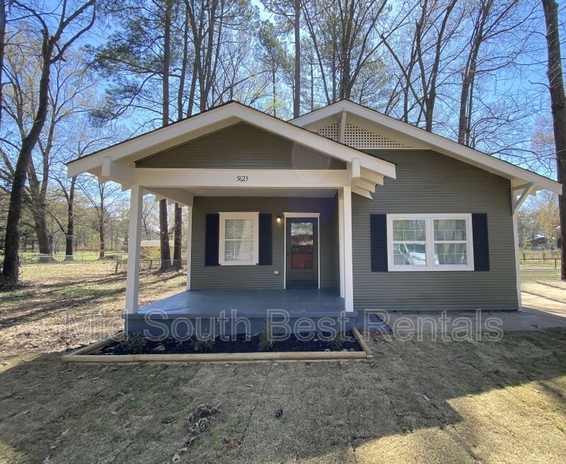
5623 Fisher St
Little Rock, AR 72209
2 Weeks Ago
Favorites
5623 Fisher St

Favorites
Check Back Soon for Upcoming Availability
| Beds | Baths | Average SF |
|---|---|---|
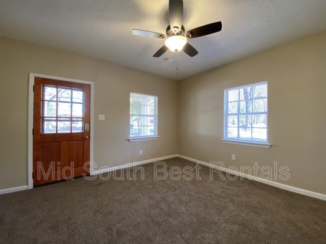
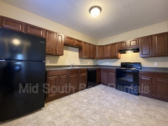
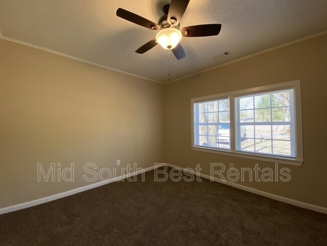
| 3 Bedrooms 3 Bedrooms 3 Br | 2 Baths 2 Baths 2 Ba | 1,191 SF |
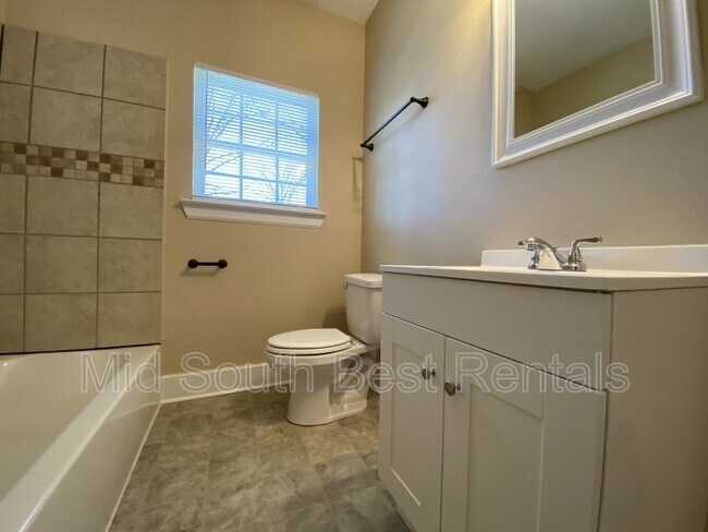
About This Property
Apply for Free! Applications are processed the same day and an agent will be reaching out to you immediately upon approval. Apply for free here: https://forms.monday.com/forms/6ab3a990d37c8e1fa81cb3133056c02a
5623 Fisher St is a house located in Pulaski County and the 72209 ZIP Code. This area is served by the Little Rock attendance zone.
Location
Get Directions
Wakefield is a largely residential community located about six miles southwest of Downtown Little Rock. Wakefield offers a wide variety of affordable apartments and houses available for rent in a quiet locale.
Wakefield’s main commercial thoroughfares are Geyer Springs Road and West 65th Street, where residents enjoy access to a host of everyday conveniences like grocery stores, casual restaurants, and service-oriented shops. The University of Arkansas at Little Rock is just a short drive north of the community while direct access to Interstate 30 connects Wakefield to all that Greater Little Rock has to offer.
Learn more about living in WakefieldBelow are rent ranges for similar nearby apartments
Education
| Colleges & Universities | Distance | ||
|---|---|---|---|
| Colleges & Universities | Distance | ||
| Drive: | 9 min | 3.9 mi | |
| Drive: | 14 min | 6.7 mi | |
| Drive: | 13 min | 8.1 mi | |
| Drive: | 21 min | 12.5 mi |
5623 Fisher St is within 9 minutes or 3.9 miles from UA Little Rock. It is also near Univ. of Ark. Medical Scis. and Philander Smith College.
Schools


Public Elementary School
Grades K-5
287 Students
Nearby
Public Elementary School
Grades K-5
481 Students
Attendance Zone
Charter Middle & High School
Grades 6-12
85 Students
Nearby
Public Middle School
Grades 6-8
665 Students
Attendance Zone
Private Elementary, Middle & High School
Grades PK-12
Nearby
School data provided by
 The GreatSchools Rating helps parents compare schools within a state based on a variety of school quality indicators and provides a helpful picture of how effectively each school serves all of its students. Ratings are on a scale of 1 (below average) to 10 (above average) and can include test scores, college readiness, academic progress, advanced courses, equity, discipline and attendance data. We also advise parents to visit schools, consider other information on school performance and programs, and consider family needs as part of the school selection process.
View GreatSchools Rating Methodology
Data provided by GreatSchools.org © 2025. All rights reserved.
View GreatSchools Rating Methodology
Data provided by GreatSchools.org © 2025. All rights reserved.
Transportation options available in Little Rock include 2Nd St & Rock St, located 8.2 miles from 5623 Fisher St. 5623 Fisher St is near Bill and Hillary Clinton Ntl/Adams Field, located 9.1 miles or 13 minutes away.
| Transit / Subway | Distance | ||
|---|---|---|---|
| Transit / Subway | Distance | ||
| Drive: | 13 min | 8.2 mi | |
| Drive: | 13 min | 8.3 mi | |
| Drive: | 13 min | 8.3 mi | |
| Drive: | 13 min | 8.4 mi | |
| Drive: | 13 min | 8.7 mi |
| Commuter Rail | Distance | ||
|---|---|---|---|
| Commuter Rail | Distance | ||
|
|
Drive: | 14 min | 9.2 mi |
|
|
Drive: | 44 min | 38.7 mi |
| Airports | Distance | ||
|---|---|---|---|
| Airports | Distance | ||
|
Bill and Hillary Clinton Ntl/Adams Field
|
Drive: | 13 min | 9.1 mi |
Time and distance from 5623 Fisher St.
| Shopping Centers | Distance | ||
|---|---|---|---|
| Shopping Centers | Distance | ||
| Walk: | 12 min | 0.6 mi | |
| Walk: | 13 min | 0.7 mi | |
| Walk: | 15 min | 0.8 mi |
5623 Fisher St has 3 shopping centers within 0.8 mile, which is about a 15-minute walk. The miles and minutes will be for the farthest away property.
| Parks and Recreation | Distance | ||
|---|---|---|---|
| Parks and Recreation | Distance | ||
|
Little Rock Zoo
|
Drive: | 12 min | 5.7 mi |
|
Central High School National Historic Site
|
Drive: | 13 min | 5.8 mi |
|
Little Rock Audubon Center
|
Drive: | 10 min | 7.0 mi |
|
Central Arkansas Nature Center
|
Drive: | 13 min | 8.1 mi |
|
Museum of Discovery
|
Drive: | 13 min | 8.2 mi |
5623 Fisher St has 5 parks within 8.2 miles, including Little Rock Zoo, Central High School National Historic Site, and Little Rock Audubon Center.
| Hospitals | Distance | ||
|---|---|---|---|
| Hospitals | Distance | ||
| Drive: | 13 min | 6.3 mi | |
| Drive: | 13 min | 6.4 mi | |
| Drive: | 14 min | 9.0 mi |
5623 Fisher St has 3 hospitals within 9.0 miles, the nearest is Arkansas State Hospital which is 6.3 miles away and a 13 minute drive.
| Military Bases | Distance | ||
|---|---|---|---|
| Military Bases | Distance | ||
| Drive: | 41 min | 22.3 mi | |
| Drive: | 38 min | 25.4 mi | |
| Drive: | 46 min | 33.8 mi |
5623 Fisher St has 3 military bases within 33.8 miles, the nearest is Camp Joseph T. Robinson Hill which is 22.3 miles away and a 41 minute drive.
You May Also Like
Similar Rentals Nearby


What Are Walk Score®, Transit Score®, and Bike Score® Ratings?
Walk Score® measures the walkability of any address. Transit Score® measures access to public transit. Bike Score® measures the bikeability of any address.
What is a Sound Score Rating?
A Sound Score Rating aggregates noise caused by vehicle traffic, airplane traffic and local sources

5623 Fisher St
Little Rock, AR 72209