
$1,300
/ Month
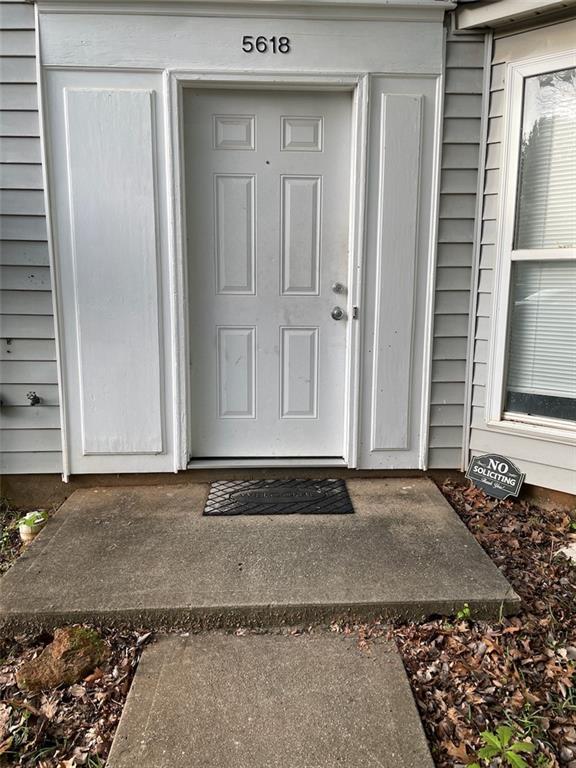
5618 Stonington Trace Pkwy
Stone Mountain, GA 30087
1 Day Ago
|
Edit
Favorites
-
Bedrooms
2
-
Bathrooms
2.5
-
Square Feet
1,452 sq ft
5618 Stonington Trace Pkwy

Favorites
About This Home
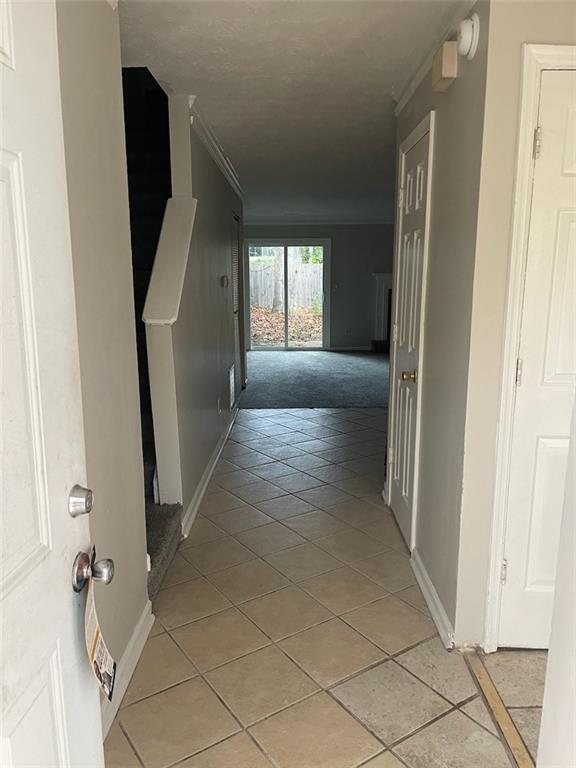
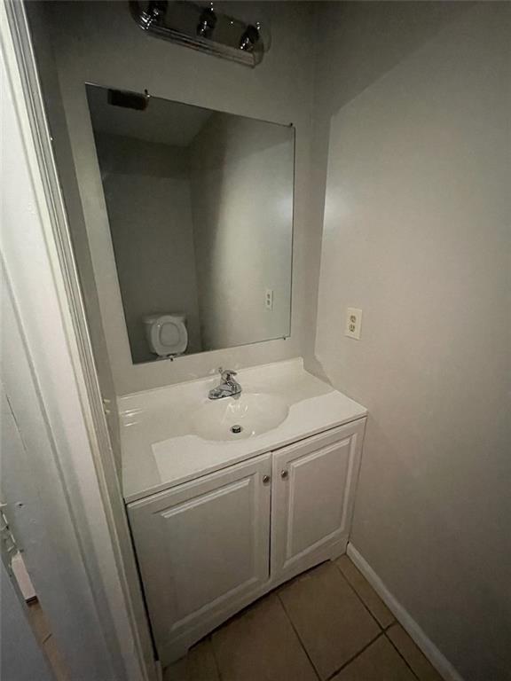
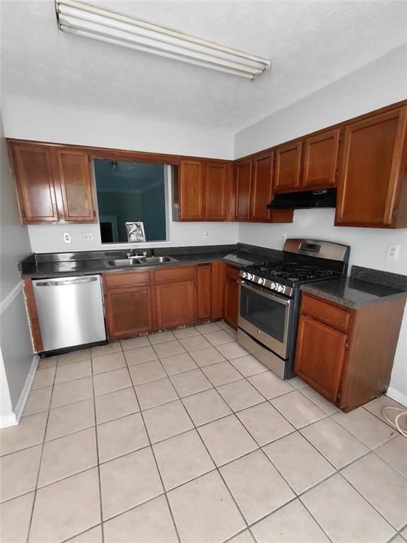
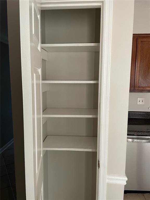
Move-In Ready Rental in Stone Mountain - Updated - Clean - Great Location - Available Now Welcome to 5618 Stonington Trace Parkway a freshly updated clean home that is move-in ready and available now! This well-maintained property features a roommate style floor plan,large living room,and abundant natural light,making it perfect for comfortable everyday living and entertaining. The home has recently undergone improvements and maintenance,giving it a clean,refreshed feel throughout. The kitchen offers ample cabinet storage,great counter space,and an easy flow into the dining and living areas. All bedrooms are generously sized with good closet space,providing comfort and functionality. Enjoy a private backyard,ideal for relaxing or outdoor activities. Located in a quiet,established neighborhood,this home offers both privacy and convenience. Conveniently located near Stone Mountain Park,shopping,restaurants,and with easy access to major highways including Hwy 78 and I-285—making commuting to Atlanta,Decatur,and surrounding areas quick and easy. Apply today and schedule your tour. MLS ID 7744077
5618 Stonington Trace Pkwy is a townhome located in DeKalb County and the 30087 ZIP Code. This area is served by the Dekalb County School District attendance zone.
* Price shown is base rent. Excludes user-selected optional fees and variable or usage-based fees and required charges due at or prior to move-in or at move-out. Price, availability, fees, and any applicable rent special are subject to change without notice.
* Square footage definitions vary. Displayed square footage is approximate.
Contact
- Listed by Demetri Clark | Virtual Properties Realty. Biz
-
Source
 First Multiple Listing Service, Inc.
Copyright © 2026 First Multiple Listing Service, Inc. All rights reserved. All information provided by the listing agent/broker is deemed reliable but is not guaranteed and should be independently verified.
Location
Get Directions
Southeast DeKalb refers to a sprawling region in the southeastern portion of DeKalb County. Among the many communities in this area are the communities of Clarkston, Stone Mountain, Lithonia, Panthersville, Gresham Park, and Sheffield Woods.
Each community in this region has its own distinct character. Southeast DeKalb offers ample opportunities for outdoor recreation at destinations such as Stone Mountain Park, Panola Mountain State Park, and Arabia Mountain National Heritage Area. Southeast DeKalb sits within easy driving distance of all that Greater Atlanta has to offer, with close proximity to major thoroughfares like I-285, I-20, and U.S. 278.
Learn more about living in Southeast DeKalb
Education
| Colleges & Universities | Distance | ||
|---|---|---|---|
| Colleges & Universities | Distance | ||
| Drive: | 12 min | 5.7 mi | |
| Drive: | 16 min | 9.0 mi | |
| Drive: | 19 min | 9.9 mi | |
| Drive: | 23 min | 13.6 mi |
5618 Stonington Trace Pkwy is within 12 minutes or 5.7 miles from Georgia Perim., Clarkston. It is also near Agnes Scott College and Emory University, Clairmont.
Schools


Public Middle School
Grades 6-8
751 Students
Nearby
Public High School
Grades 9-12
951 Students
Nearby
School data provided by
 The GreatSchools Rating helps parents compare schools within a state based on a variety of school quality indicators and provides a helpful picture of how effectively each school serves all of its students. Ratings are on a scale of 1 (below average) to 10 (above average) and can include test scores, college readiness, academic progress, advanced courses, equity, discipline and attendance data. We also advise parents to visit schools, consider other information on school performance and programs, and consider family needs as part of the school selection process.
View GreatSchools Rating Methodology
Data provided by GreatSchools.org © 2026. All rights reserved.
View GreatSchools Rating Methodology
Data provided by GreatSchools.org © 2026. All rights reserved.
Transportation options available in Stone Mountain include Kensington, located 6.2 miles from 5618 Stonington Trace Pkwy. 5618 Stonington Trace Pkwy is near Hartsfield - Jackson Atlanta International, located 23.7 miles or 36 minutes away.
| Transit / Subway | Distance | ||
|---|---|---|---|
| Transit / Subway | Distance | ||
|
|
Drive: | 12 min | 6.2 mi |
|
|
Drive: | 13 min | 6.4 mi |
|
|
Drive: | 15 min | 8.0 mi |
|
|
Drive: | 16 min | 8.8 mi |
|
|
Drive: | 17 min | 9.8 mi |
| Commuter Rail | Distance | ||
|---|---|---|---|
| Commuter Rail | Distance | ||
|
|
Drive: | 30 min | 18.1 mi |
| Airports | Distance | ||
|---|---|---|---|
| Airports | Distance | ||
|
Hartsfield - Jackson Atlanta International
|
Drive: | 36 min | 23.7 mi |
Getting Around
 What do Walkability, Transit, Drivability, and Bikeability mean?
Walkability measures the walking distance to day-to-day needs.
Transit measures access to public transportation.
Drivability measures congestion, parking availability, and access to major roads.
Bikeability measures the suitability for cycling.
How It Works
What do Walkability, Transit, Drivability, and Bikeability mean?
Walkability measures the walking distance to day-to-day needs.
Transit measures access to public transportation.
Drivability measures congestion, parking availability, and access to major roads.
Bikeability measures the suitability for cycling.
How It Works
Somewhat Walkable
Walkability
30
/ 100
Limited Public Transit
Transit
30
/ 100
Exceptionally Drivable
Drivability
90
/ 100
Fairly Bikeable
Bikeability
40
/ 100
Scores provided by
-
Soundscore™
-
/ 100
Traffic
-Airport
-Businesses
-Scores provided by
HowLoud What is a Sound Score Rating? A Sound Score Rating aggregates noise caused by vehicle traffic, airplane traffic and local sources. How It WorksTime and distance from 5618 Stonington Trace Pkwy.
| Shopping Centers | Distance | ||
|---|---|---|---|
| Shopping Centers | Distance | ||
| Walk: | 8 min | 0.4 mi | |
| Walk: | 20 min | 1.1 mi | |
| Drive: | 3 min | 1.9 mi |
5618 Stonington Trace Pkwy has 3 shopping centers within 1.9 miles, which is about a 3-minute drive. The miles and minutes will be for the farthest away property.
| Parks and Recreation | Distance | ||
|---|---|---|---|
| Parks and Recreation | Distance | ||
|
Stone Mountain State Memorial Park
|
Drive: | 12 min | 4.7 mi |
|
DeShong Park
|
Drive: | 11 min | 5.5 mi |
|
Forty Oaks Nature Preserve
|
Drive: | 13 min | 6.2 mi |
|
Mountain Park
|
Drive: | 13 min | 6.7 mi |
|
Yellow River Park
|
Drive: | 16 min | 7.6 mi |
5618 Stonington Trace Pkwy has 5 parks within 7.6 miles, including Stone Mountain State Memorial Park, DeShong Park, and Forty Oaks Nature Preserve.
| Hospitals | Distance | ||
|---|---|---|---|
| Hospitals | Distance | ||
| Drive: | 12 min | 6.4 mi | |
| Drive: | 14 min | 7.6 mi | |
| Drive: | 19 min | 10.2 mi |
5618 Stonington Trace Pkwy has 3 hospitals within 10.2 miles, the nearest is Emory Hillandale Hospital which is 6.4 miles away and a 12 minute drive.
| Military Bases | Distance | ||
|---|---|---|---|
| Military Bases | Distance | ||
| Drive: | 34 min | 19.5 mi | |
| Drive: | 33 min | 21.4 mi |
5618 Stonington Trace Pkwy is 19.5 miles from Fort McPherson, and is convenient to other military bases, including Fort Gillem.
You May Also Like
Similar Rentals Nearby
-
-
-
2 Beds$2,350+3 Beds$3,137+Total Monthly PriceTotal Monthly Price NewPrices include base rent and required monthly fees of $174. Variable costs based on usage may apply.Base Rent:2 Beds$2,176+3 Beds$2,963+Specials
Pets Allowed Fitness Center Pool Dishwasher In Unit Washer & Dryer Walk-In Closets Stainless Steel Appliances
-
-
-
-
2 Beds$1,378+3 Beds$1,528+Total Monthly Price12 Month LeaseTotal Monthly Price NewPrices include required monthly fees of $79 - $99.Base Rent:2 Beds$1,2993 Beds$1,449
Pets Allowed Pool Dishwasher Refrigerator Kitchen Walk-In Closets
-
-
-


What Are Walk Score®, Transit Score®, and Bike Score® Ratings?
Walk Score® measures the walkability of any address. Transit Score® measures access to public transit. Bike Score® measures the bikeability of any address.
What is a Sound Score Rating?
A Sound Score Rating aggregates noise caused by vehicle traffic, airplane traffic and local sources.
5618 Stonington Trace Pkwy
Stone Mountain, GA 30087