$2,509
/ Month
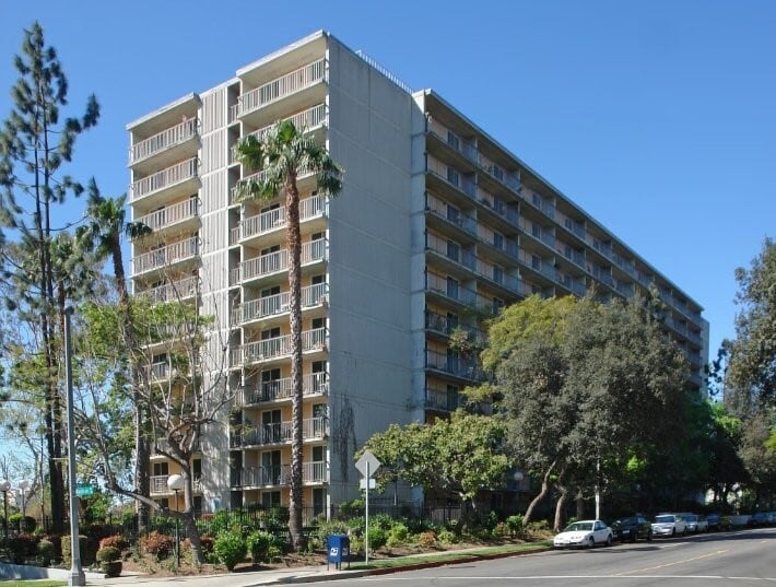
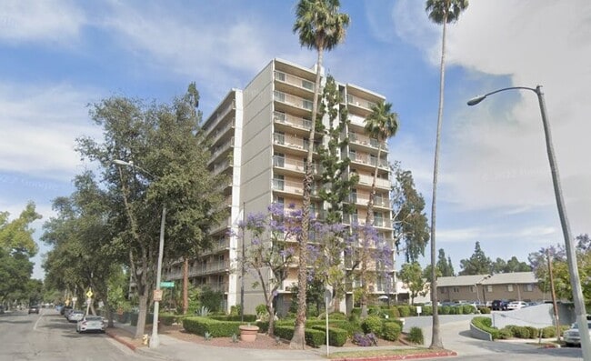
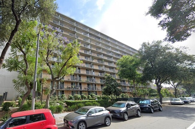
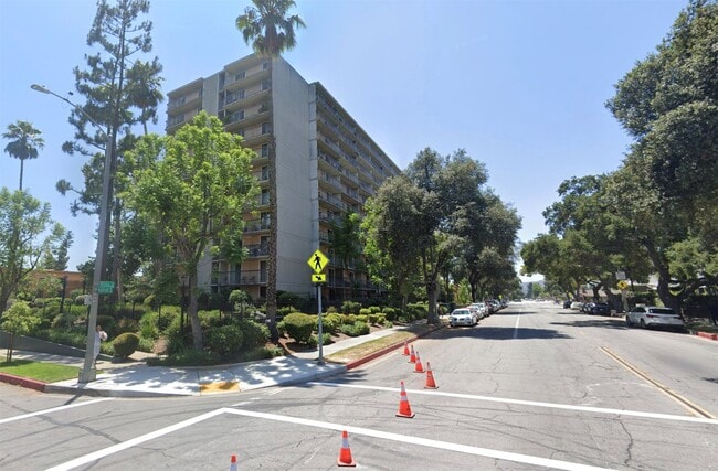
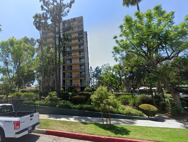
560 E Villa St
Pasadena, CA 91101
Today
|
Edit
Favorites
626-281-8301
-
Bedrooms
1
-
Bathrooms
1
-
Square Feet
--
-
Available
Available Now
Highlight
- Pets Allowed
560 E Villa St

Favorites
About This Home
Available Now
MLS# 66969989
560 E Villa St is an apartment community located in Los Angeles County and the 91101 ZIP Code.
* Price shown is base rent. Excludes user-selected optional fees and variable or usage-based fees and required charges due at or prior to move-in or at move-out. Price, availability, fees, and any applicable rent special are subject to change without notice.
* Square footage definitions vary. Displayed square footage is approximate.
Home Details
Year Built
Built in 1973
Bedrooms and Bathrooms
1 Full Bathroom
1 Bedroom
Home Design
Apartment
Listing and Financial Details
Property Available on 6/8/25
12 Month Lease Term
Community Details
Overview
Retirement Housing Foundation Association
Pet Policy
Pets Allowed
Pet Deposit Required
Fees and Policies
The fees listed below are community-provided and may exclude utilities or add-ons. All payments are made directly to the property and are non-refundable unless otherwise specified.
-
Dogs
-
Allowed
-
-
Cats
-
Allowed
-
Property Fee Disclaimer: Based on community-supplied data and independent market research. Subject to change without notice. May exclude fees for mandatory or optional services and usage-based utilities.
Contact
- Listed by Rick Rivera | Rental Housing Deals
- Phone Number
- Contact
-
Source
 Houston Association of REALTORS®
Copyright © 2026 Houston Association of Realtors. All rights reserved. All information provided by the listing agent/broker is deemed reliable but is not guaranteed and should be independently verified.
Location
Get Directions
Large, attractive homes and sidewalks shaded by a lush canopy of oak trees are the first thing you’ll notice in Pasadena’s Oaks neighborhood. This mainly-residential community enjoys the benefits of a few key resources within walking distance: Madison Elementary School on the north end of the neighborhood is close enough for local students to get to class on foot, and a small cluster of cafes and shops along Los Robles Avenue is an excellent spot to pick up groceries or grab your morning coffee.
The central Pasadena location puts residents just a few blocks north of downtown, making it convenient to walk to the vibrant dining, nightlife, and arts scene along Colorado Boulevard anytime.
Learn more about living in The Oaks Pasadena
Education
| Colleges & Universities | Distance | ||
|---|---|---|---|
| Colleges & Universities | Distance | ||
| Walk: | 12 min | 0.7 mi | |
| Drive: | 5 min | 2.1 mi | |
| Drive: | 6 min | 2.4 mi | |
| Drive: | 6 min | 2.7 mi |
560 E Villa St is within 12 minutes or 0.7 mile from Fuller Theological Seminary. It is also near Pasadena City College and Caltech.
Transportation options available in Pasadena include Memorial Park Station, located 0.9 mile from 560 E Villa St. 560 E Villa St is near Bob Hope, located 17.0 miles or 23 minutes away, and Los Angeles International, located 25.8 miles or 41 minutes away.
| Transit / Subway | Distance | ||
|---|---|---|---|
| Transit / Subway | Distance | ||
|
|
Walk: | 17 min | 0.9 mi |
|
|
Drive: | 4 min | 1.4 mi |
|
|
Drive: | 3 min | 1.4 mi |
|
|
Drive: | 3 min | 1.8 mi |
|
|
Drive: | 5 min | 2.2 mi |
| Commuter Rail | Distance | ||
|---|---|---|---|
| Commuter Rail | Distance | ||
|
|
Drive: | 13 min | 9.5 mi |
|
|
Drive: | 18 min | 10.7 mi |
|
|
Drive: | 19 min | 10.8 mi |
|
|
Drive: | 20 min | 10.8 mi |
| Drive: | 22 min | 14.8 mi |
| Airports | Distance | ||
|---|---|---|---|
| Airports | Distance | ||
|
Bob Hope
|
Drive: | 23 min | 17.0 mi |
|
Los Angeles International
|
Drive: | 41 min | 25.8 mi |
Time and distance from 560 E Villa St.
| Shopping Centers | Distance | ||
|---|---|---|---|
| Shopping Centers | Distance | ||
| Walk: | 7 min | 0.4 mi | |
| Walk: | 17 min | 0.9 mi | |
| Walk: | 18 min | 1.0 mi |
560 E Villa St has 3 shopping centers within 1.0 mile, which is about a 18-minute walk. The miles and minutes will be for the farthest away property.
| Parks and Recreation | Distance | ||
|---|---|---|---|
| Parks and Recreation | Distance | ||
|
Kidspace Children's Museum
|
Drive: | 5 min | 2.5 mi |
|
Huntington Botanical Gardens
|
Drive: | 9 min | 3.5 mi |
|
Jet Propulsion Laboratory
|
Drive: | 7 min | 3.8 mi |
|
Eaton Canyon Nature Center
|
Drive: | 9 min | 4.2 mi |
|
Los Angeles County Arboretum
|
Drive: | 9 min | 6.0 mi |
560 E Villa St has 5 parks within 6.0 miles, including Kidspace Children's Museum, Huntington Botanical Gardens, and Jet Propulsion Laboratory.
| Hospitals | Distance | ||
|---|---|---|---|
| Hospitals | Distance | ||
| Drive: | 4 min | 2.0 mi | |
| Drive: | 7 min | 3.7 mi | |
| Drive: | 13 min | 5.8 mi |
560 E Villa St has 3 hospitals within 5.8 miles, the nearest is Huntington Memorial Hospital which is 2.0 miles away and a 4 minute drive.
| Military Bases | Distance | ||
|---|---|---|---|
| Military Bases | Distance | ||
| Drive: | 38 min | 27.3 mi | |
| Drive: | 47 min | 30.6 mi |
560 E Villa St is 27.3 miles from Los Angeles Air Force Base, and is convenient to other military bases, including Los Alamitos Army Airfield.
You May Also Like
Similar Rentals Nearby
-
-
-
1 Bed$2,456+2 Beds$3,337+Total Monthly PriceTotal Monthly Price NewPrices include base rent and required monthly fees of $45. Variable costs based on usage may apply.Base Rent:1 Bed$2,411+2 Beds$3,292+2 Months Free
Pets Allowed Fitness Center Pool In Unit Washer & Dryer Clubhouse Balcony
-
-
-
-
-
-
-


 - Violet on Virgil")


What Are Walk Score®, Transit Score®, and Bike Score® Ratings?
Walk Score® measures the walkability of any address. Transit Score® measures access to public transit. Bike Score® measures the bikeability of any address.
What is a Sound Score Rating?
A Sound Score Rating aggregates noise caused by vehicle traffic, airplane traffic and local sources

560 E Villa St
Pasadena, CA 91101