

$2,500 / Month
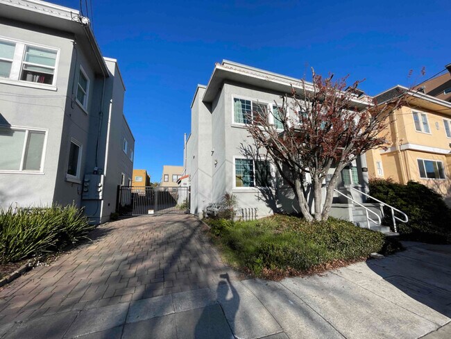
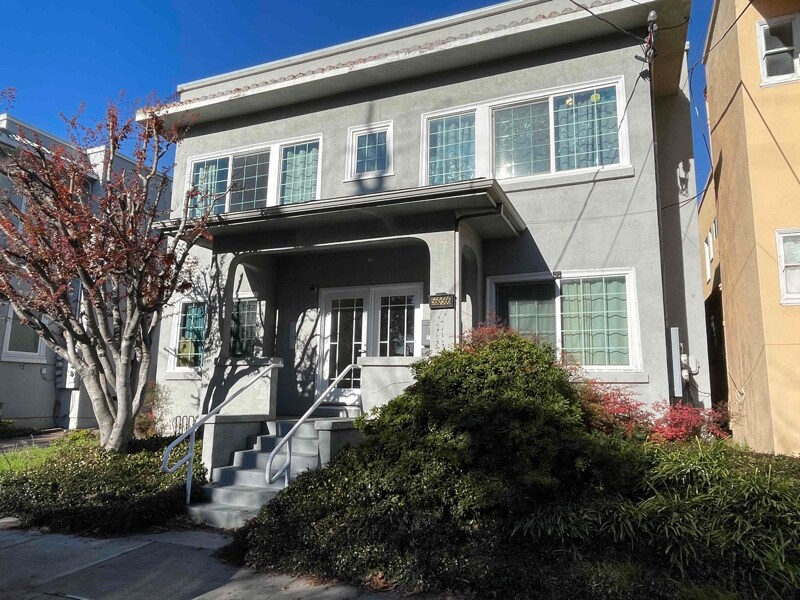
560 29th St
Oakland, CA 94609
2 Weeks Ago
Favorites
560 29th St

Favorites
Check Back Soon for Upcoming Availability
| Beds | Baths | Average SF |
|---|---|---|
| 2 Bedrooms 2 Bedrooms 2 Br | 1 Bath 1 Bath 1 Ba | 600 SF |
Fees and Policies
The fees below are based on community-supplied data and may exclude additional fees and utilities.
- Dogs Allowed
-
Fees not specified
- Cats Allowed
-
Fees not specified
Details
Utilities Included
-
Trash Removal
About This Property
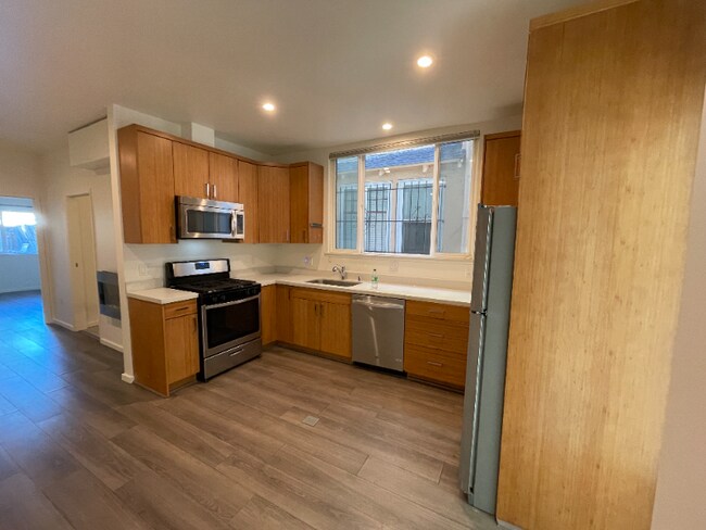
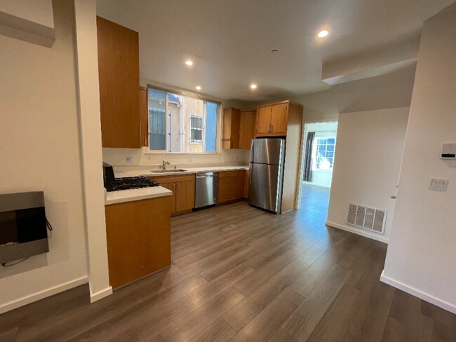
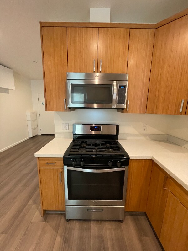
Property Id: 1055492 Check out this beautiful railroad-style condo in Oakland's Pill Hill neighborhood, in between Downtown Oakland and Temescal Neighborhoods. Walk to BART and uptown restaurants and bars. Features: -Secure building -Electronically-controlled gated parking included with rent -Updated kitchen appliances -Dishwasher & Garbage Disposal -Shared free laundry facilities -Small Building, only 4 units
560 29th St is a condo located in Alameda County and the 94609 ZIP Code. This area is served by the Oakland Unified attendance zone.
Condo Features
Dishwasher
Microwave
Refrigerator
Disposal
- Cable Ready
- Intercom
- Dishwasher
- Disposal
- Microwave
- Oven
- Refrigerator
- Freezer
- Fenced Lot
Location
Get Directions
Pill Hill is a small neighborhood located about a mile north of Downtown Oakland. Various medical facilities are located in the neighborhood, hence the name. Along with pharmacies and doctor’s offices, Pill Hill is home to the Alta Bates Summit Medical Center. Pill Hill has apartments and condos available for rent. The iconic Telegraph Avenue runs through Pill Hill so residents have access to cafes, coffee shops, and grocery stores within walking distance, but many residents take advantage of the neighborhood’s central location by traveling into neighboring communities for more shopping, dining, and entertainment options. Explore eateries on Piedmont Avenue, or head to Adams Point to access Lake Merritt. Pill Hill is nestled between Interstate 580 and 980 so it’s a great choice for anyone who wants to be able to travel across the Bay Area with ease into other major cities like Berkeley and San Francisco.
Learn more about living in Pill HillBelow are rent ranges for similar nearby apartments
Amenities
- Cable Ready
- Intercom
- Dishwasher
- Disposal
- Microwave
- Oven
- Refrigerator
- Freezer
- Fenced Lot
Expenses
Utilities Included
Trash Removal
Included
Education
| Colleges & Universities | Distance | ||
|---|---|---|---|
| Colleges & Universities | Distance | ||
| Walk: | 7 min | 0.4 mi | |
| Drive: | 4 min | 1.4 mi | |
| Drive: | 6 min | 2.9 mi | |
| Drive: | 8 min | 3.4 mi |
560 29th St is within 7 minutes or 0.4 mile from Samuel Merritt University. It is also near Lincoln University, Oakland and Laney College.
Schools


Public Elementary School
Grades K-5
347 Students
Nearby
Public Elementary School
Grades K-5
262 Students
Attendance Zone
Public Middle School
Grades 6-8
314 Students
Attendance Zone
Public High School
Grades 9-12
1,796 Students
Attendance Zone
Private Elementary & Middle School
Grades PK-8
237 Students
Nearby
Private Elementary, Middle & High School
Grades K-12
37 Students
Nearby
School data provided by
 The GreatSchools Rating helps parents compare schools within a state based on a variety of school quality indicators and provides a helpful picture of how effectively each school serves all of its students. Ratings are on a scale of 1 (below average) to 10 (above average) and can include test scores, college readiness, academic progress, advanced courses, equity, discipline and attendance data. We also advise parents to visit schools, consider other information on school performance and programs, and consider family needs as part of the school selection process.
View GreatSchools Rating Methodology
Data provided by GreatSchools.org © 2025. All rights reserved.
View GreatSchools Rating Methodology
Data provided by GreatSchools.org © 2025. All rights reserved.
Transportation options available in Oakland include Macarthur Station, located 1.2 miles from 560 29th St. 560 29th St is near Metro Oakland International, located 10.8 miles or 17 minutes away, and San Francisco International, located 22.5 miles or 35 minutes away.
| Transit / Subway | Distance | ||
|---|---|---|---|
| Transit / Subway | Distance | ||
|
|
Drive: | 2 min | 1.2 mi |
|
|
Drive: | 2 min | 1.2 mi |
|
|
Drive: | 3 min | 1.4 mi |
|
|
Drive: | 3 min | 1.4 mi |
|
|
Drive: | 6 min | 3.6 mi |
| Commuter Rail | Distance | ||
|---|---|---|---|
| Commuter Rail | Distance | ||
|
|
Drive: | 5 min | 2.2 mi |
|
|
Drive: | 6 min | 3.3 mi |
|
|
Drive: | 9 min | 5.4 mi |
| Drive: | 16 min | 10.1 mi | |
| Drive: | 16 min | 10.1 mi |
| Airports | Distance | ||
|---|---|---|---|
| Airports | Distance | ||
|
Metro Oakland International
|
Drive: | 17 min | 10.8 mi |
|
San Francisco International
|
Drive: | 35 min | 22.5 mi |
Time and distance from 560 29th St.
| Shopping Centers | Distance | ||
|---|---|---|---|
| Shopping Centers | Distance | ||
| Walk: | 9 min | 0.5 mi | |
| Walk: | 17 min | 0.9 mi | |
| Drive: | 3 min | 1.1 mi |
560 29th St has 3 shopping centers within 1.1 miles, which is about a 3-minute walk. The miles and minutes will be for the farthest away property.
| Parks and Recreation | Distance | ||
|---|---|---|---|
| Parks and Recreation | Distance | ||
|
Lakeside Park Garden Center
|
Walk: | 21 min | 1.1 mi |
|
Lakeside Park
|
Drive: | 4 min | 1.4 mi |
|
Rotary Nature Center
|
Drive: | 4 min | 1.4 mi |
|
Morcom Rose Garden
|
Drive: | 5 min | 1.5 mi |
|
Juan Bautista de Anza National Historic Trail
|
Drive: | 4 min | 1.8 mi |
560 29th St has 5 parks within 1.8 miles, including Lakeside Park Garden Center, Rotary Nature Center, and Lakeside Park.
| Hospitals | Distance | ||
|---|---|---|---|
| Hospitals | Distance | ||
| Walk: | 9 min | 0.5 mi | |
| Drive: | 2 min | 1.1 mi | |
| Drive: | 3 min | 1.5 mi |
560 29th St has 3 hospitals within 1.5 miles, the nearest is Alta Bates Summit Medical Center which is 0.5 mile away and a 9 minute walk.
| Military Bases | Distance | ||
|---|---|---|---|
| Military Bases | Distance | ||
| Drive: | 12 min | 4.3 mi | |
| Drive: | 12 min | 5.0 mi |
560 29th St is 4.3 miles from Oakland Army Base, and is convenient to other military bases, including Alameda/US Naval Air Station Alameda.
You May Also Like
Similar Rentals Nearby
-
-

-

-
1 / 36

-
-
-
-

-

-


What Are Walk Score®, Transit Score®, and Bike Score® Ratings?
Walk Score® measures the walkability of any address. Transit Score® measures access to public transit. Bike Score® measures the bikeability of any address.
What is a Sound Score Rating?
A Sound Score Rating aggregates noise caused by vehicle traffic, airplane traffic and local sources
560 29th St
Oakland, CA 94609