
Venue Residences
3688 Overland Ave,
Los Angeles, CA 90034
$3,550 - $4,795
1-2 Beds
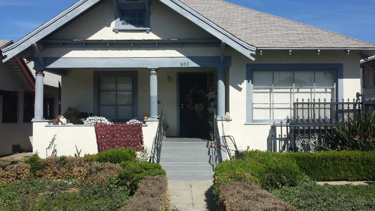

555 W 45th St is ready for you to visit. With a location on W. 45th St. in Los Angeles's 90037 Zip code, you can easily connect with a number of highlights in the surrounding area. From pricing to features, the leasing team will assist you in finding the perfect floorplan option. Come by to view the available floorplans. Come see 555 W 45th St today.
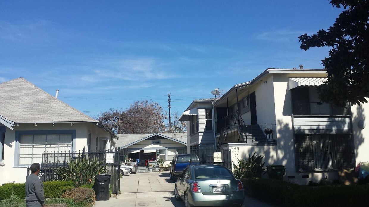
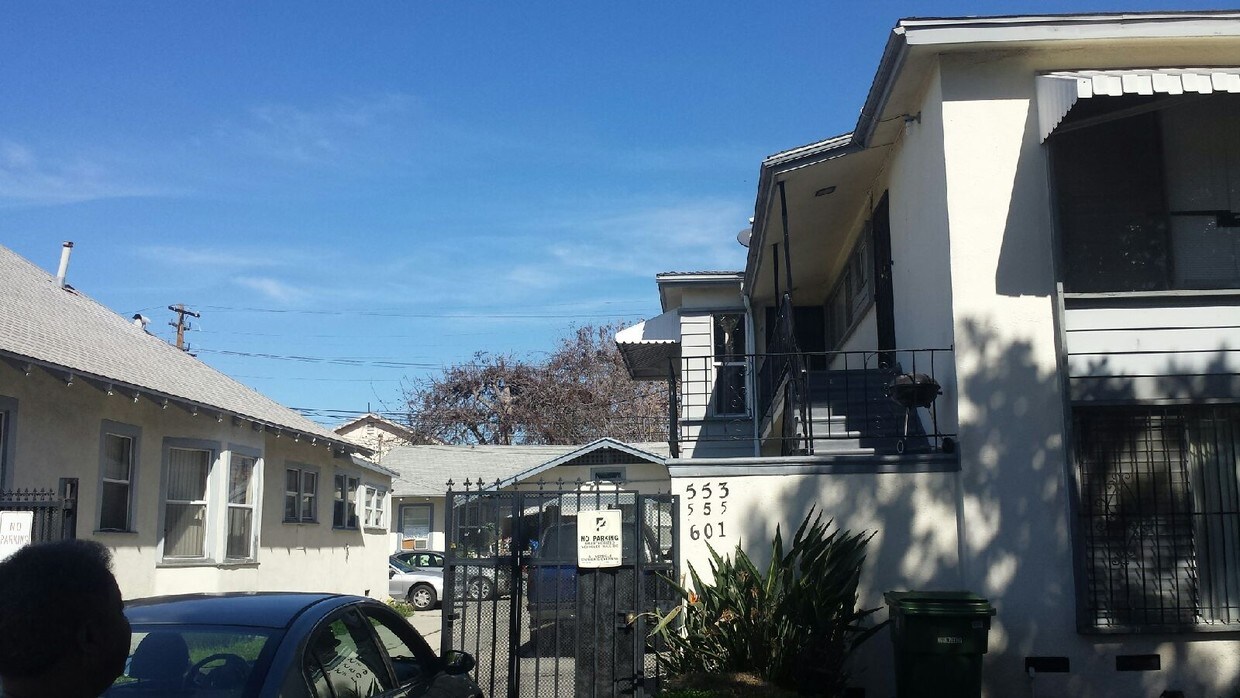
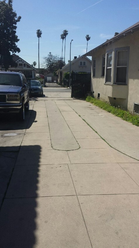
553-603 W 45th St is an apartment community located in Los Angeles County and the 90037 ZIP Code. This area is served by the Los Angeles Unified Rocp School District attendance zone.
Controlled Access
24 Hour Access
Storage Space
Online Services
Refrigerator
Tub/Shower
Freezer
Oven
Situated just south of the University of Southern California and the Los Angeles Memorial Coliseum, Vermont Harbor is one of Los Angeles’ buzzing neighborhoods. Vermont Harbor itself is a densely populated, urban area with an array of rental choices. The neighborhood’s main avenues hold conveniently located shops, restaurants, and businesses. Vermont Harbor’s eastern border is Interstate 110, making the six-mile drive into Downtown Los Angeles accessible. The neighborhood is centrally located to many of Southern California’s cities, making additional excitement and opportunity available to Vermont Harbor residents.
Learn more about living in Vermont HarborCompare neighborhood and city base rent averages by bedroom.
| Vermont Harbor | Los Angeles, CA | |
|---|---|---|
| Studio | $1,106 | $1,712 |
| 1 Bedroom | $934 | $2,178 |
| 2 Bedrooms | $1,279 | $3,017 |
| 3 Bedrooms | $1,862 | $4,255 |
| Colleges & Universities | Distance | ||
|---|---|---|---|
| Colleges & Universities | Distance | ||
| Drive: | 5 min | 2.5 mi | |
| Drive: | 5 min | 2.5 mi | |
| Drive: | 4 min | 2.5 mi | |
| Drive: | 6 min | 4.1 mi |


Transportation options available in Los Angeles include Expo/Vermont, located 1.5 miles from 553-603 W 45th St. 553-603 W 45th St is near Los Angeles International, located 10.8 miles or 19 minutes away, and Bob Hope, located 21.1 miles or 29 minutes away.
| Transit / Subway | Distance | ||
|---|---|---|---|
| Transit / Subway | Distance | ||
|
|
Drive: | 3 min | 1.5 mi |
|
|
Drive: | 3 min | 1.8 mi |
|
|
Drive: | 3 min | 1.9 mi |
|
|
Drive: | 4 min | 2.5 mi |
|
|
Drive: | 4 min | 2.5 mi |
| Commuter Rail | Distance | ||
|---|---|---|---|
| Commuter Rail | Distance | ||
|
|
Drive: | 9 min | 5.9 mi |
|
|
Drive: | 11 min | 6.1 mi |
| Drive: | 13 min | 9.9 mi | |
|
|
Drive: | 18 min | 10.3 mi |
|
|
Drive: | 16 min | 10.5 mi |
| Airports | Distance | ||
|---|---|---|---|
| Airports | Distance | ||
|
Los Angeles International
|
Drive: | 19 min | 10.8 mi |
|
Bob Hope
|
Drive: | 29 min | 21.1 mi |
Scores provided by
Traffic
-Airport
-Businesses
-Scores provided by
HowLoud What is a Sound Score Rating? A Sound Score Rating aggregates noise caused by vehicle traffic, airplane traffic and local sources. How It WorksTime and distance from 553-603 W 45th St.
| Shopping Centers | Distance | ||
|---|---|---|---|
| Shopping Centers | Distance | ||
| Walk: | 8 min | 0.4 mi | |
| Walk: | 10 min | 0.5 mi | |
| Walk: | 11 min | 0.6 mi |
| Parks and Recreation | Distance | ||
|---|---|---|---|
| Parks and Recreation | Distance | ||
|
California Science Center
|
Walk: | 19 min | 1.0 mi |
|
Natural History Museum of LA County
|
Drive: | 4 min | 1.7 mi |
|
Exposition Park Rose Garden
|
Drive: | 4 min | 1.8 mi |
|
Augustus Hawkins Natural Park
|
Drive: | 5 min | 3.4 mi |
|
MacArthur Park Lake
|
Drive: | 8 min | 4.7 mi |
| Hospitals | Distance | ||
|---|---|---|---|
| Hospitals | Distance | ||
| Drive: | 6 min | 3.1 mi | |
| Drive: | 7 min | 4.3 mi | |
| Drive: | 7 min | 4.7 mi |
| Military Bases | Distance | ||
|---|---|---|---|
| Military Bases | Distance | ||
| Drive: | 16 min | 12.4 mi |
What Are Walk Score®, Transit Score®, and Bike Score® Ratings?
Walk Score® measures the walkability of any address. Transit Score® measures access to public transit. Bike Score® measures the bikeability of any address.
What is a Sound Score Rating?
A Sound Score Rating aggregates noise caused by vehicle traffic, airplane traffic and local sources.

553-603 W 45th St
Los Angeles, CA 90037


