


$875
/ Month
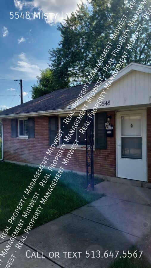
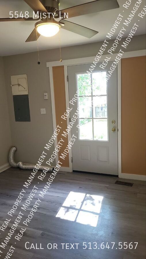
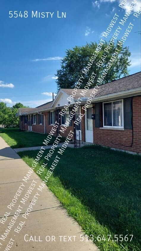
5548 Misty Ln
Dayton, OH 45424
Favorites
-
Bedrooms
2
-
Bathrooms
1
-
Square Feet
--
5548 Misty Ln

Favorites
About This Home
---- SCHEDULE A SHOWING ONLINE AT: ----
5548 Misty Ln is an apartment community located in Montgomery County and the 45424 ZIP Code.
* Price shown is base rent. Excludes user-selected optional fees and variable or usage-based fees and required charges due at or prior to move-in or at move-out. Price, availability, fees, and any applicable rent special are subject to change without notice.
* Square footage definitions vary. Displayed square footage is approximate.
Contact
- Listed by Jackie Kincaid
Location
Get Directions
Dayton sits in Ohio's Miami Valley region where the Great Miami River runs through a city built on genuine invention — Orville and Wilbur Wright called it home, and that spirit of ingenuity still shapes the place today. Wright-Patterson Air Force Base anchors a strong aerospace and defense economy, while the University of Dayton and Wright State University give the city a steady pulse of academic energy. Healthcare is another major pillar, with regional health systems providing some of the area's largest employment. Downtown and Webster Station draw renters to lofts and mid-rise apartment communities steps from Day Air Ballpark and RiverScape MetroPark, while the Oregon District offers historic streets full of character. St. Anne's Hill and South Park are known for restored Victorian architecture and a quieter residential feel.
Learn more about living in Dayton
Education
| Colleges & Universities | Distance | ||
|---|---|---|---|
| Colleges & Universities | Distance | ||
| Drive: | 14 min | 7.9 mi | |
| Drive: | 14 min | 8.4 mi | |
| Drive: | 18 min | 10.0 mi | |
| Drive: | 37 min | 19.0 mi |
5548 Misty Ln is within 14 minutes or 8.4 miles from Sinclair Community College. It is also near Wright State University and University of Dayton.
Getting Around
 What do Walkability, Transit, Drivability, and Bikeability mean?
Walkability measures the walking distance to day-to-day needs.
Transit measures access to public transportation.
Drivability measures congestion, parking availability, and access to major roads.
Bikeability measures the suitability for cycling.
How It Works
What do Walkability, Transit, Drivability, and Bikeability mean?
Walkability measures the walking distance to day-to-day needs.
Transit measures access to public transportation.
Drivability measures congestion, parking availability, and access to major roads.
Bikeability measures the suitability for cycling.
How It Works
Fairly Walkable
Walkability
40
/ 100
Limited Public Transit
Transit
20
/ 100
Very Drivable
Drivability
80
/ 100
Fairly Bikeable
Bikeability
50
/ 100
Scores provided by
-
Soundscore™
-
/ 100
Traffic
-Airport
-Businesses
-Scores provided by
HowLoud What is a Sound Score Rating? A Sound Score Rating aggregates noise caused by vehicle traffic, airplane traffic and local sources. How It WorksYou May Also Like
Similar Rentals Nearby


What Are Walk Score®, Transit Score®, and Bike Score® Ratings?
Walk Score® measures the walkability of any address. Transit Score® measures access to public transit. Bike Score® measures the bikeability of any address.
What is a Sound Score Rating?
A Sound Score Rating aggregates noise caused by vehicle traffic, airplane traffic and local sources.
5548 Misty Ln
Dayton, OH 45424