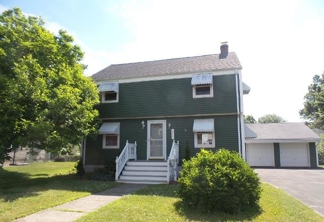
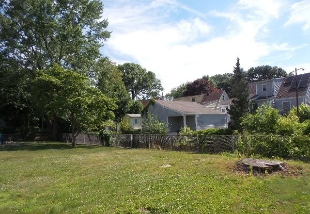
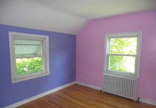
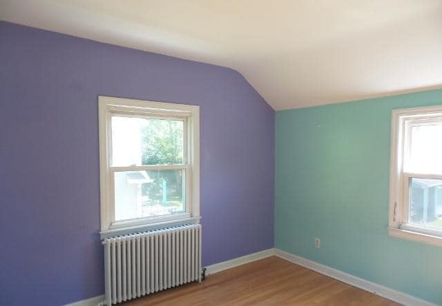
$205,000 Total Monthly Price

552 Light St

,

Stratford, CT 06614

Share Listing
Favorites
552 Light St
Share Listing
Favorites

Check Back Soon for Upcoming Availability

Beds Baths Average SF
3 Bedrooms 3 Bedrooms 3 Br 1 Bath 1 Bath 1 Ba 1,470 SF

About This Property

Address: 552 Light St Stratford, CT, 06614 Fairfield County Bed/Bath: 3/1.50 Total Rooms: 6 Square Feet: 1470 Year: 1951 Housing Type: Single Family Home Number of Stories: 2 HOA Fees: $0.00 Revitalization Area: No Lot Size: 8276.00 sq ft Listing Information List Date: 07/19/2018 Listing Period: Extended Period Deadline: 12/29/2018 11:59:59 PM CT List Price: $205,000.00 FHA Financing: IE (Insured Escrow) 203K Eligible: Yes *Subject to an FHA appraisal Buyer selects Closing Agent/Firm. HUD REO - This property is available for sale by sealed bid only, for details, availability, photos, the property inspections report and bidding instructions please visit 4reo.com. These homes are sold \'AS IS\', and the seller makes no representations or warranties. Please email info@4reo.com or call 888-871-2345 for any questions you may have and a Keller Williams Realty REO specialist will be able to direct you.

552 Light St is a house located in Fairfield County and the 06614 ZIP Code. This area is served by the Stratford School District attendance zone.

Location
552 Light St, Stratford,
CT 06614
Get Directions
| Edit

Under 30 minutes

Commute Time is calculated at rush hour.
Neighborhood

Trumbull/Upper Stratford/Shelton is an expansive area encompassing the land north of Bridgeport and Lower Stratford. The area is largely residential and complemented by lush woods. Renters have options of modern apartments and townhomes for rent. Although this community is mostly residential, Highways 25 and 8 allow for easy travel to surrounding areas, including the 25-mile drive east to New Haven and the 70-mile drive to New York. These two roads also hold the main retail areas including places like Hawley Lane Mall and Westfield Trumbull. Outside of this area, residents are in proximity to some of Connecticut’s best attractions like the Connecticut’s Beardsley Zoo and the Roosevelt Forest.

Learn more about living in Trumbull/Upper Stratford/Shelton 

Below are rent ranges for similar nearby apartments

Education
Colleges & Universities Distance
Drive: 8 min 4.6 mi
Drive: 14 min 7.0 mi
Drive: 15 min 8.7 mi
Drive: 17 min 10.4 mi
552 Light St is within 8 minutes or 4.6 miles from University of Bridgeport. It is also near Sacred Heart University and Fairfield University.
Schools
Public Elementary School
Grades K-5
262 Students
Nearby
Public Elementary School
Grades K-5
441 Students
Attendance Zone
Public Middle School
Grades 6-8
539 Students
Attendance Zone
Public High School
Grades 9-12
1,127 Students
Attendance Zone
Private Elementary & Middle School
Grades PK-8
222 Students
Nearby
Private Elementary, Middle & High School
Grades K-12
22 Students
Nearby
Private Middle & High School
Grades 6-12
9 Students
Nearby
Transportation

552 Light St is near Tweed/New Haven, located 20.0 miles or 33 minutes away, and Long Island MacArthur, located 38.1 miles or 115 minutes away.

Commuter Rail Distance
Drive: 4 min 1.7 mi
Drive: 8 min 3.9 mi
Drive: 11 min 6.0 mi
Drive: 13 min 6.8 mi
Drive: 14 min 8.6 mi
Airports Distance
Airports Distance
Tweed/New Haven
Drive: 33 min 20.0 mi
Long Island MacArthur
Drive: 115 min 38.1 mi

Walkability Near 552 Light St Stratford, CT 06614

Getting Around
Fairly Walkable
Walkability
50 / 100
Some Public Transit
Transit
40 / 100
Exceptionally Drivable
Drivability
90 / 100
Fairly Bikeable
Bikeability
40 / 100

Scores provided by

What do Walkability, Transit, Drivability, and Bikeability mean? Walkability measures the walking distance to day-to-day needs. Transit measures access to public transportation. Drivability measures congestion, parking availability, and access to major roads. Bikeability measures the suitability for cycling. How It Works
-
Soundscore
- / 100

Traffic

-

Airport

-

Businesses

-

Scores provided by

HowLoud What is a Sound Score Rating? A Sound Score Rating aggregates noise caused by vehicle traffic, airplane traffic and local sources. How It Works
Points of Interest

Time and distance from 552 Light St.

Shopping Centers Distance
Walk: 14 min 0.7 mi
Walk: 15 min 0.8 mi
Walk: 18 min 1.0 mi
552 Light St has 3 shopping centers within 1.0 mile, which is about a 18-minute walk. The miles and minutes will be for the farthest away property.
Parks and Recreation Distance
Beardsley Zoo
Drive: 5 min 2.9 mi
Boothe Memorial Park and Museum
Drive: 7 min 4.0 mi
Silver Sands State Park
Drive: 10 min 5.2 mi
Discovery Museum and Planetarium
Drive: 11 min 6.0 mi
Audubon Center at Milford Point
Drive: 14 min 6.4 mi
552 Light St has 5 parks within 6.4 miles, including Beardsley Zoo, Boothe Memorial Park and Museum, and Silver Sands State Park.
Hospitals Distance
Hospitals Distance
Drive: 4 min 1.6 mi
Drive: 3 min 1.7 mi
Drive: 7 min 3.8 mi
552 Light St has 3 hospitals within 3.8 miles, the nearest is Bridgeport Hospital which is 1.6 miles away and a 4 minute drive.
Military Bases Distance
Drive: 136 min 50.1 mi
Drive: 81 min 55.2 mi
Drive: 84 min 58.7 mi
552 Light St has 3 military bases within 58.7 miles, the nearest is Eatons Neck CG Station North which is 50.1 miles away and a 136 minute drive.

You May Also Like

Similar Rentals Nearby