
$3,800
/ Month
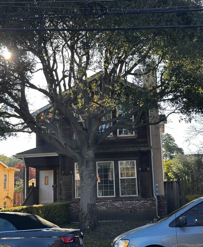
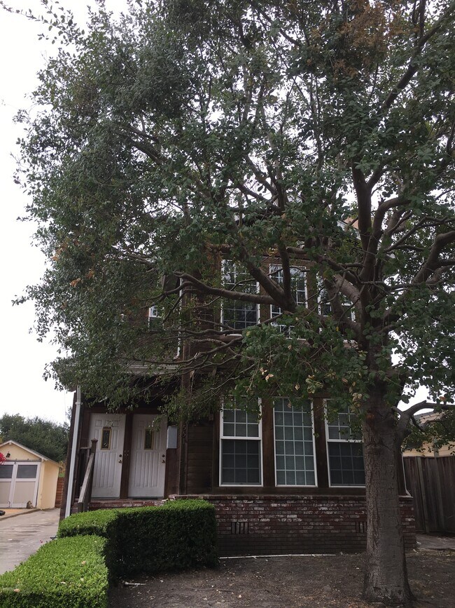
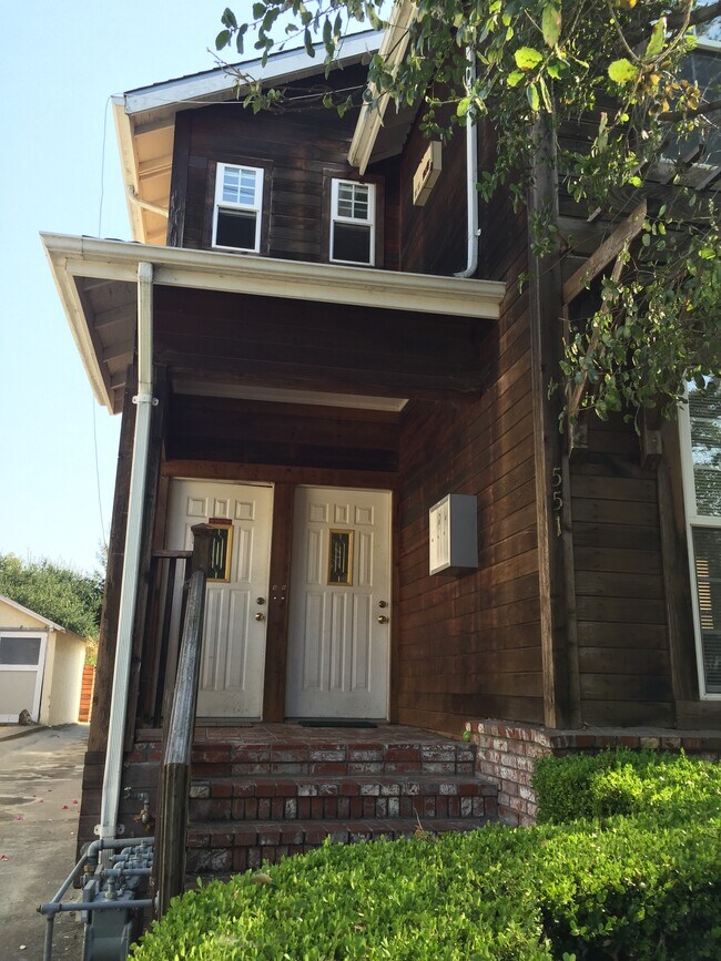
551 59th Street Unit A
Oakland, CA 94609
2 Weeks Ago
|
Edit
Favorites
-
Bedrooms
4
-
Bathrooms
3
-
Square Feet
1,850 sq ft
-
Available
Available Jan 26
Highlights
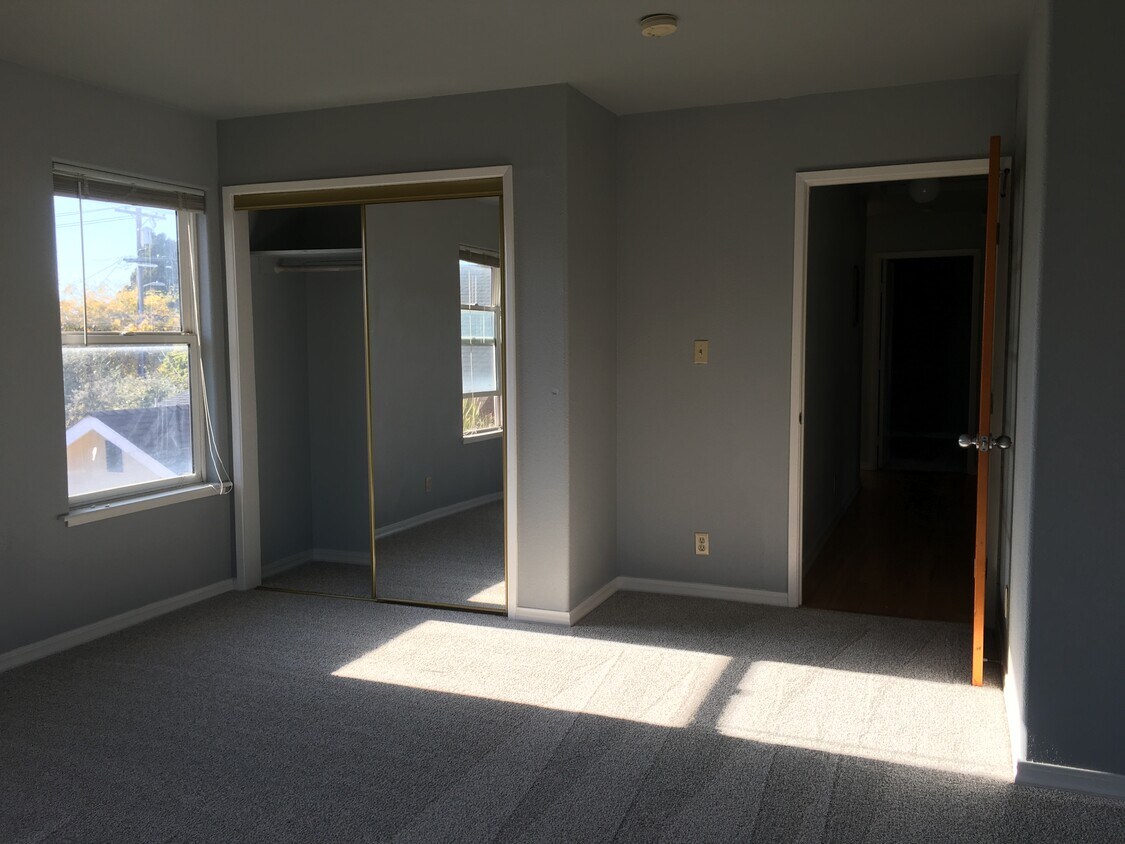
- Hardwood Floors
- Fireplace
- Playground
- Security System
551 59th Street Unit A

Favorites
About This Home
12 Month Lease,
$2,500 deposit,
Available Jan 26
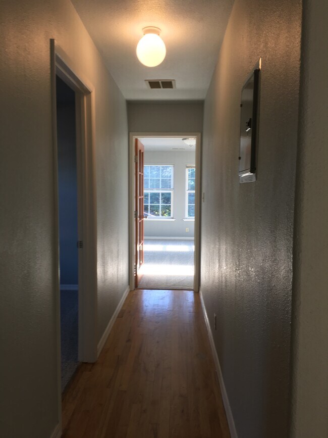
Beautiful spacious upstairs unit. Room of various sizes from a very large ( almost a studio) one to a very small one. Ideal for housemates who want to pay different amounts. Property located in hip and diverse North Oakland 1.8 miles away from UC Berkeley .8. miles to Rockridge Bart .7 miles to Temescal district with some of the best restaurants in oakland 8 blocks from Hwy 24 entrance .6 miles to Whole Foods Across the street from Bushrod Park (baseball, basketball, soccer, tennis, pickle ball, playground) Community garden down the street 1 parking spaces in the rear and street parking Showing in Jan 2026 Oakland Tech HS school district
Property located in hip and diverse North Oakland 1.8 miles away from UC Berkeley .8. miles to Rockridge Bart .7 miles to Temescal district with some of the best restaurants in oakland 8 blocks from Hwy 24 entrance .6 miles to Whole Foods Across the street from Bushrod Park (baseball, basketball, soccer, tennis, pickle ball, playground) Community garden down the street
551 59Th Street is an apartment community located in Alameda County and the 94609 ZIP Code.
* Price shown is base rent. Excludes user-selected optional fees and variable or usage-based fees and required charges due at or prior to move-in or at move-out. Price, availability, fees, and any applicable rent special are subject to change without notice.
* Square footage definitions vary. Displayed square footage is approximate.
Apartment Features
Dishwasher
Washer/Dryer Hookup
Hardwood Floors
Refrigerator
- Washer/Dryer Hookup
- Heating
- Cable Ready
- Security System
- Tub/Shower
- Fireplace
- Dishwasher
- Disposal
- Kitchen
- Oven
- Refrigerator
- Hardwood Floors
- Carpet
- Tile Floors
- Dining Room
- Family Room
- Playground
Fees and Policies
The fees below are based on community-supplied data and may exclude additional fees and utilities.
- Parking
-
Surface Lot--
Details
Utilities Included
-
Trash Removal
Contact
- Listed by jessie nakamura
- Contact
Location
Get Directions
Upper Telegraph is a centrally located neighborhood in the city of Oakland. Upper Telegraph is home to numerous local staples like Bushrod Park and Community Garden, healthcare centers, and a busy commercial strip along Telegraph Avenue. Locals can easily shop in the neighborhood or head less than 10 miles south to Downtown Oakland for places like Jack London Square and the Uptown District. More great features offered by Downtown Oakland include scenic sites like the Bonsai Garden and Lake Merritt. While Downtown Oakland is Upper Telegraph’s southern neighbor, the city of Berkeley is the neighborhood’s northern neighbor. Downtown Berkeley, the University of California-Berkley, and several national and state parks sit just north of Upper Telegraph.
Learn more about living in Upper Telegraph
Education
| Colleges & Universities | Distance | ||
|---|---|---|---|
| Colleges & Universities | Distance | ||
| Drive: | 5 min | 1.9 mi | |
| Drive: | 7 min | 2.2 mi | |
| Drive: | 9 min | 3.0 mi | |
| Drive: | 8 min | 3.9 mi |
551 59th Street Unit A is within 5 minutes or 1.9 miles from Samuel Merritt University. It is also near Berkeley City College and UC Berkeley.
Transportation options available in Oakland include Rockridge Station, located 0.8 mile from 551 59th Street Unit A. 551 59th Street Unit A is near Metro Oakland International, located 13.0 miles or 20 minutes away, and San Francisco International, located 23.3 miles or 36 minutes away.
| Transit / Subway | Distance | ||
|---|---|---|---|
| Transit / Subway | Distance | ||
|
|
Walk: | 15 min | 0.8 mi |
|
|
Drive: | 4 min | 1.1 mi |
|
|
Drive: | 3 min | 1.7 mi |
|
|
Drive: | 7 min | 2.2 mi |
|
|
Drive: | 7 min | 3.5 mi |
| Commuter Rail | Distance | ||
|---|---|---|---|
| Commuter Rail | Distance | ||
|
|
Drive: | 7 min | 2.5 mi |
|
|
Drive: | 8 min | 4.7 mi |
|
|
Drive: | 11 min | 6.0 mi |
| Drive: | 18 min | 10.8 mi | |
| Drive: | 19 min | 11.7 mi |
| Airports | Distance | ||
|---|---|---|---|
| Airports | Distance | ||
|
Metro Oakland International
|
Drive: | 20 min | 13.0 mi |
|
San Francisco International
|
Drive: | 36 min | 23.3 mi |
Time and distance from 551 59th Street Unit A.
| Shopping Centers | Distance | ||
|---|---|---|---|
| Shopping Centers | Distance | ||
| Walk: | 12 min | 0.7 mi | |
| Walk: | 13 min | 0.7 mi | |
| Walk: | 19 min | 1.0 mi |
551 59th Street Unit A has 3 shopping centers within 1.0 mile, which is about a 19-minute walk. The miles and minutes will be for the farthest away property.
| Parks and Recreation | Distance | ||
|---|---|---|---|
| Parks and Recreation | Distance | ||
|
Willard Park
|
Drive: | 4 min | 1.3 mi |
|
People's Park
|
Drive: | 5 min | 1.7 mi |
|
Habitot Children's Museum
|
Drive: | 6 min | 1.9 mi |
|
Temescal Regional Park
|
Drive: | 4 min | 2.0 mi |
|
UC Berkeley Museum of Paleontology
|
Drive: | 9 min | 2.4 mi |
551 59th Street Unit A has 5 parks within 2.4 miles, including Willard Park, People's Park, and Habitot Children's Museum.
| Hospitals | Distance | ||
|---|---|---|---|
| Hospitals | Distance | ||
| Walk: | 14 min | 0.8 mi | |
| Walk: | 19 min | 1.0 mi | |
| Drive: | 4 min | 1.8 mi |
551 59th Street Unit A has 3 hospitals within 1.8 miles, the nearest is Children's Hospital & Research Center Oakland which is 0.8 mile away and a 14 minute walk.
| Military Bases | Distance | ||
|---|---|---|---|
| Military Bases | Distance | ||
| Drive: | 15 min | 6.4 mi | |
| Drive: | 16 min | 7.5 mi |
551 59th Street Unit A is 6.4 miles from Oakland Army Base, and is convenient to other military bases, including Alameda/US Naval Air Station Alameda.
Amenities
- Washer/Dryer Hookup
- Heating
- Cable Ready
- Security System
- Tub/Shower
- Fireplace
- Dishwasher
- Disposal
- Kitchen
- Oven
- Refrigerator
- Hardwood Floors
- Carpet
- Tile Floors
- Dining Room
- Family Room
- Playground
551 59th Street Unit A Photos
What Are Walk Score®, Transit Score®, and Bike Score® Ratings?
Walk Score® measures the walkability of any address. Transit Score® measures access to public transit. Bike Score® measures the bikeability of any address.
What is a Sound Score Rating?
A Sound Score Rating aggregates noise caused by vehicle traffic, airplane traffic and local sources
551 59th Street
Oakland, CA 94609