
$1,600
/ Month
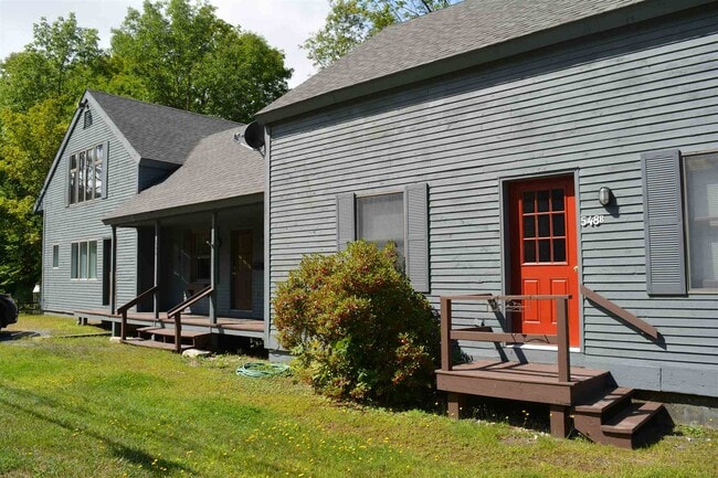
548 Rte 10 N Unit B
Grantham, NH 03753
Favorites
548 Rte 10 N Unit B

Favorites
Check Back Soon for Upcoming Availability
| Beds | Baths | Average SF |
|---|---|---|
| 1 Bedroom 1 Bedroom 1 Br | 1 Bath 1 Bath 1 Ba | 1,152 SF |
About This Property
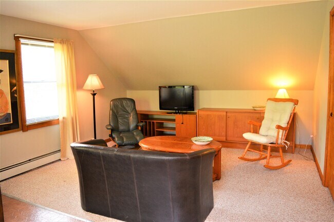
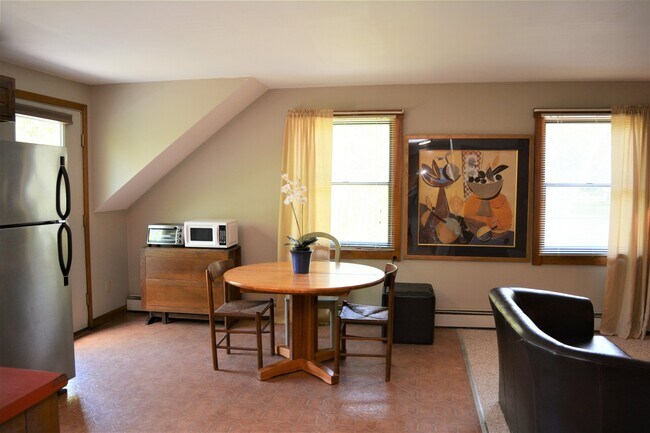
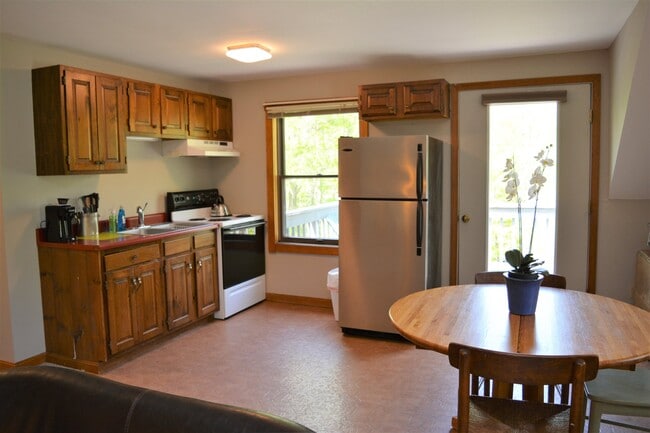
Long Term Apartment- Grantham, NH for $1600/month with heat included. 1 Bedroom 1 Bathroom, furnished or unfurnished. Open lay out makes for a spacious living area along with extra large bedroom with two closets. 2nd floor apartment. No pets. Available October 2023! Agent interest. No Pets
548 Rte 10 N is an apartment community located in Sullivan County and the 03753 ZIP Code.
548 Rte 10 N,
Grantham,
NH
03753
Surrounded by beautiful mountains and acres of preserved land, Grantham is a small, rural town with plenty of natural resources for residents and visitors to explore. The expansive Eastman Pond provides space for a host of year-round recreational activities in Grantham, including paddle boarding and kayaking in warmer months as well as snowshoeing and ice skating in colder months.
Grantham is also home to Eastman Golf Links, which has been consistently rated a four-star facility by the New England Golf Guide. Grantham offers residents the tranquility of a remote, small town with convenience to I-89. Larger towns are close to Grantham, with Lebanon just 12 miles away and Concord about 45 miles away.
Learn more about living in Grantham
Education
| Colleges & Universities | Distance | ||
|---|---|---|---|
| Colleges & Universities | Distance | ||
| Drive: | 20 min | 12.9 mi | |
| Drive: | 27 min | 19.2 mi | |
| Drive: | 53 min | 32.3 mi | |
| Drive: | 81 min | 53.9 mi |
548 Rte 10 N Unit B is within 20 minutes or 12.9 miles from Colby-Sawyer College. It is also near Dartmouth College and New England College.
Walkability Near 548 Rte 10 N Grantham, NH 03753
Getting Around
 What do Walkability, Transit, Drivability, and Bikeability mean?
Walkability measures the walking distance to day-to-day needs.
Transit measures access to public transportation.
Drivability measures congestion, parking availability, and access to major roads.
Bikeability measures the suitability for cycling.
How It Works
What do Walkability, Transit, Drivability, and Bikeability mean?
Walkability measures the walking distance to day-to-day needs.
Transit measures access to public transportation.
Drivability measures congestion, parking availability, and access to major roads.
Bikeability measures the suitability for cycling.
How It Works
Not Walkable
Walkability
10
/ 100
Exceptionally Drivable
Drivability
100
/ 100
Not Bikeable
Bikeability
0
/ 100
Scores provided by
-
Soundscore™
-
/ 100
Traffic
-Airport
-Businesses
-Scores provided by
HowLoud What is a Sound Score Rating? A Sound Score Rating aggregates noise caused by vehicle traffic, airplane traffic and local sources. How It WorksYou May Also Like
Similar Rentals Nearby
-
-
-
 Total Monthly Price New1 Bed$2,818+Total Monthly PricePrices include base rent and required monthly fees. Variable costs based on usage may apply.
 -
-
-
-
-
-
-


What Are Walk Score®, Transit Score®, and Bike Score® Ratings?
Walk Score® measures the walkability of any address. Transit Score® measures access to public transit. Bike Score® measures the bikeability of any address.
What is a Sound Score Rating?
A Sound Score Rating aggregates noise caused by vehicle traffic, airplane traffic and local sources.

548 Rte 10 N
Grantham, NH 03753