
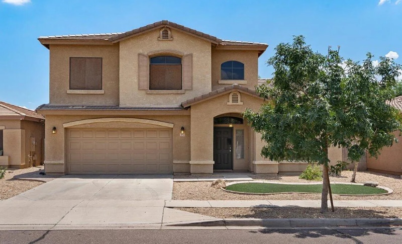
5443 W Marietta Dr
Phoenix, AZ 85339
-
Bedrooms
4
-
Bathrooms
3
-
Square Feet
2,500 sq ft
-
Available
Available Jun 15
Highlights
- Smoke Free
- Fenced Lot

About This Home
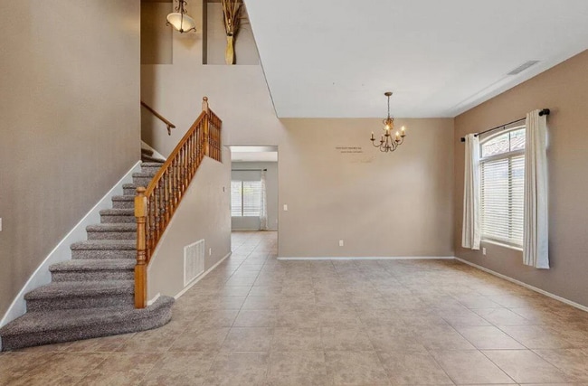
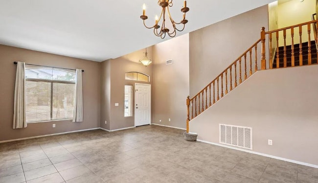
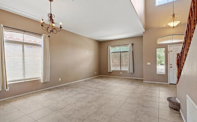
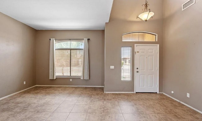
Property Id: 10099 RENTING THIS BEAUTIFUL 4BEDROOM 3 BATH HOME HAS TILE THROUGHOUT THE COMMON AREAS. LARGE OPEN KITCHEN W/ GRANITE COUNTERTOPS. MASTER BEDROOM HAS WALK IN CLOSET, MASTER BATH FEATURES DUAL SINKS. LARGE BACKYARD W/ COVERED PATIO FOR ENTERTAINING FAMILY AND FRIENDS. 2 CAR GARAGE. COMMUNITY PARK NEARBY. PET FEE: *$200.00 (Refundable Deposit) pet must be under 30 lbs. *$200.00 (Non-Refundable Deposit) *$25/month fee per pet. Note: Front and Back Yard to be maintained by Renter.
5443 W Marietta Dr is a house located in Maricopa County and the 85339 ZIP Code. This area is served by the Phoenix Union High School District attendance zone.
House Features
Dishwasher
Microwave
Disposal
Tile Floors
- Smoke Free
- Dishwasher
- Disposal
- Microwave
- Oven
- Tile Floors
- Fenced Lot
Contact
- Phone Number
- Contact
-
Source

Laveen, a small urban village in Maricopa County, was once a predominantly pastoral community that has now bloomed into a mecca of housing and commercial developments. It’s about eight miles southwest of Phoenix, and is home to great schools within the Laveen Elementary and Phoenix Union High School Districts.
The annual barbecue is a Laveen tradition that pays homage to its rural roots. It began in 1950 and consists of country music, dancing, and a cow milking competition. You’ll love this community because of its scenic view of South Mountain Park, the easy commute to Phoenix Sky Harbor International Airport, as well as nightlife at Lone Butte Casino in Chandler.
Learn more about living in Laveen- Smoke Free
- Dishwasher
- Disposal
- Microwave
- Oven
- Tile Floors
- Fenced Lot
| Colleges & Universities | Distance | ||
|---|---|---|---|
| Colleges & Universities | Distance | ||
| Drive: | 19 min | 9.9 mi | |
| Drive: | 20 min | 10.1 mi | |
| Drive: | 19 min | 11.7 mi | |
| Drive: | 22 min | 12.1 mi |


View GreatSchools Rating Methodology
Data provided by GreatSchools.org © 2026. All rights reserved.
Transportation options available in Phoenix include Jefferson/1St Ave, located 9.5 miles from 5443 W Marietta Dr. 5443 W Marietta Dr is near Phoenix Sky Harbor International, located 13.2 miles or 25 minutes away, and Phoenix-Mesa Gateway, located 37.8 miles or 49 minutes away.
| Transit / Subway | Distance | ||
|---|---|---|---|
| Transit / Subway | Distance | ||
|
|
Drive: | 18 min | 9.5 mi |
|
|
Drive: | 18 min | 9.6 mi |
|
|
Drive: | 18 min | 9.6 mi |
|
|
Drive: | 18 min | 9.7 mi |
|
|
Drive: | 18 min | 11.1 mi |
| Commuter Rail | Distance | ||
|---|---|---|---|
| Commuter Rail | Distance | ||
|
|
Drive: | 47 min | 36.2 mi |
| Airports | Distance | ||
|---|---|---|---|
| Airports | Distance | ||
|
Phoenix Sky Harbor International
|
Drive: | 25 min | 13.2 mi |
|
Phoenix-Mesa Gateway
|
Drive: | 49 min | 37.8 mi |
Scores provided by
Traffic
-Airport
-Businesses
-Scores provided by
HowLoud What is a Sound Score Rating? A Sound Score Rating aggregates noise caused by vehicle traffic, airplane traffic and local sources. How It WorksTime and distance from 5443 W Marietta Dr.
| Shopping Centers | Distance | ||
|---|---|---|---|
| Shopping Centers | Distance | ||
| Walk: | 17 min | 0.9 mi | |
| Drive: | 4 min | 1.9 mi | |
| Drive: | 5 min | 2.0 mi |
| Parks and Recreation | Distance | ||
|---|---|---|---|
| Parks and Recreation | Distance | ||
|
Alkire Park
|
Drive: | 14 min | 7.2 mi |
|
Nina Mason Pulliam Rio Salado Audubon Center
|
Drive: | 14 min | 7.4 mi |
|
Colter Park
|
Drive: | 14 min | 7.4 mi |
|
Camelback Mountain Park
|
Drive: | 20 min | 9.7 mi |
|
El Oso Park
|
Drive: | 16 min | 10.1 mi |
| Hospitals | Distance | ||
|---|---|---|---|
| Hospitals | Distance | ||
| Drive: | 3 min | 1.7 mi | |
| Drive: | 15 min | 8.0 mi | |
| Drive: | 17 min | 11.5 mi |
| Military Bases | Distance | ||
|---|---|---|---|
| Military Bases | Distance | ||
| Drive: | 23 min | 11.8 mi | |
| Drive: | 30 min | 20.8 mi | |
| Drive: | 97 min | 73.3 mi |
You May Also Like
What Are Walk Score®, Transit Score®, and Bike Score® Ratings?
Walk Score® measures the walkability of any address. Transit Score® measures access to public transit. Bike Score® measures the bikeability of any address.
What is a Sound Score Rating?
A Sound Score Rating aggregates noise caused by vehicle traffic, airplane traffic and local sources.
5443 W Marietta Dr
Phoenix, AZ 85339