

$2,500
/ Month
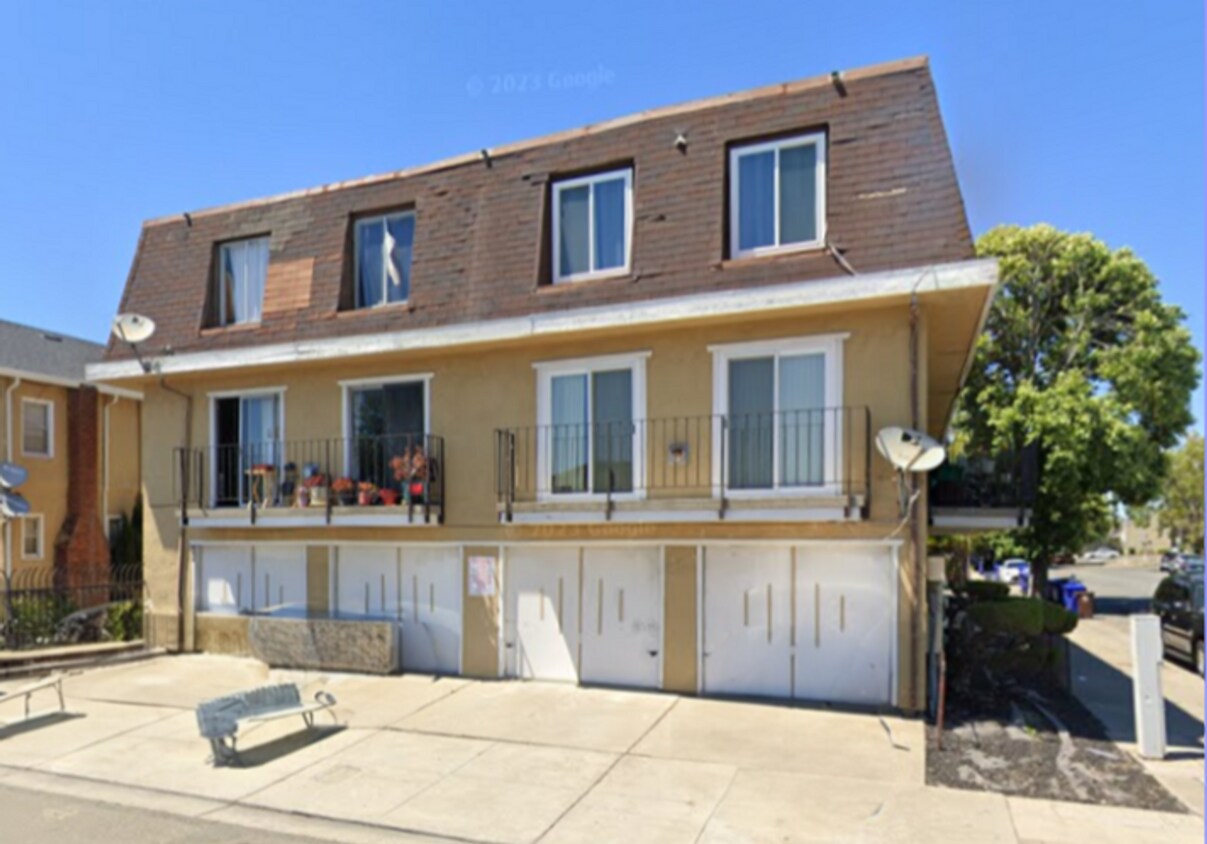
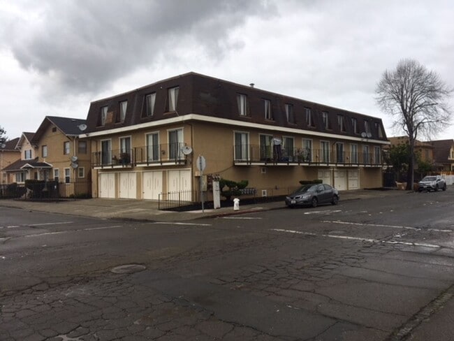
541 Nevin Ave
Richmond, CA 94801
Today
Favorites
510-236-9718
-
Bedrooms
2
-
Bathrooms
1.5
-
Square Feet
780 sq ft
-
Available
Available Now
541 Nevin Ave

Favorites
About This Home
Available Now
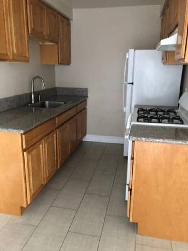
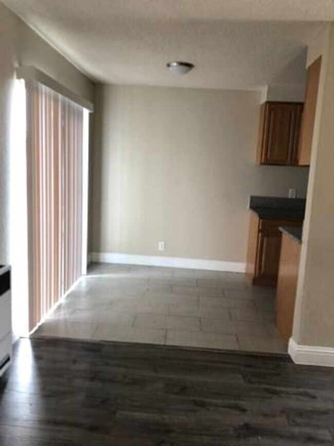
2 Bedroom 1.5 Bath Split-Level Condo in Richmond – Available Now! ? Spacious split-level floorplan ? Updated kitchen with modern appliances ? Two private balconies ? On-site laundry area ? Shared landscaped courtyard Parking: 1 garage/driveway space per tenant, one car only Utilities Included: Water, Garbage Tenant Responsible For: PG&E, Internet, Cable Pet Policy: No pets allowed Smoking Policy: No smoking permitted Hablamos Español!
541 Nevin Ave is a house located in Contra Costa County and the 94801 ZIP Code. This area is served by the West Contra Costa Unified attendance zone.
* Price shown is base rent. Excludes user-selected optional fees and variable or usage-based fees and required charges due at or prior to move-in or at move-out. Price, availability, fees, and any applicable rent special are subject to change without notice.
* Square footage definitions vary. Displayed square footage is approximate.
Contact
- Listed by EPM Properties, LLC | EPM Properties, LLC
- Phone Number
- Contact
Location
Get Directions
The Iron Triangle neighborhood sits in the heart of Central Richmond, California. With the area being largely residential, most rentals reside in the upper part of the triangle and an easy three-mile commute north to Point Richmond, a major shipping and industrial area. To the south, Berkeley and Oakland lie roughly 10 miles away via Interstate 580.
Locals often head for the Miller/Knox Regional Shoreline for a bit of jogging or cycling, or to cast a line off the fishing pier. Wade into the waters of San Francisco Bay at Keller Beach on the northern end of the park, or enjoy a show at the Masquers Playhouse, also just outside the Iron Triangle's southern border. Most eateries sit along Interstate 580, including several fast food chains. The MacDonald 80 Shopping Center lies roughly three miles east of the neighborhood. Drive another three miles and find Wildcat Canyon Regional Park and the Tilden Nature Area.
Learn more about living in Iron Triangle
Education
| Colleges & Universities | Distance | ||
|---|---|---|---|
| Colleges & Universities | Distance | ||
| Drive: | 7 min | 3.3 mi | |
| Drive: | 16 min | 9.2 mi | |
| Drive: | 20 min | 10.3 mi | |
| Drive: | 19 min | 11.1 mi |
541 Nevin Ave is within 7 minutes or 3.3 miles from Contra Costa College. It is also near Berkeley City College and UC Berkeley.
Schools


Public Elementary School
Grades K-6
316 Students
Attendance Zone
Public Elementary School
Grades K-5
270 Students
Nearby
Public Middle School
Grades 7-8
404 Students
Attendance Zone
Public High School
Grades 9-12
823 Students
Attendance Zone
Private Elementary, Middle & High School
Grades K-12
Nearby
Private Elementary, Middle & High School
Grades PK-12
Nearby
School data provided by
 The GreatSchools Rating helps parents compare schools within a state based on a variety of school quality indicators and provides a helpful picture of how effectively each school serves all of its students. Ratings are on a scale of 1 (below average) to 10 (above average) and can include test scores, college readiness, academic progress, advanced courses, equity, discipline and attendance data. We also advise parents to visit schools, consider other information on school performance and programs, and consider family needs as part of the school selection process.
View GreatSchools Rating Methodology
Data provided by GreatSchools.org © 2025. All rights reserved.
View GreatSchools Rating Methodology
Data provided by GreatSchools.org © 2025. All rights reserved.
Transportation options available in Richmond include Richmond Station, located 0.6 mile from 541 Nevin Ave. 541 Nevin Ave is near Metro Oakland International, located 22.2 miles or 31 minutes away, and San Francisco International, located 29.9 miles or 43 minutes away.
| Transit / Subway | Distance | ||
|---|---|---|---|
| Transit / Subway | Distance | ||
|
|
Walk: | 11 min | 0.6 mi |
|
|
Drive: | 6 min | 3.1 mi |
|
|
Drive: | 6 min | 3.1 mi |
|
|
Drive: | 9 min | 5.2 mi |
|
|
Drive: | 14 min | 8.6 mi |
| Commuter Rail | Distance | ||
|---|---|---|---|
| Commuter Rail | Distance | ||
| Walk: | 11 min | 0.6 mi | |
|
|
Drive: | 11 min | 7.8 mi |
| Drive: | 16 min | 9.3 mi | |
|
|
Drive: | 14 min | 9.6 mi |
| Drive: | 16 min | 10.2 mi |
| Airports | Distance | ||
|---|---|---|---|
| Airports | Distance | ||
|
Metro Oakland International
|
Drive: | 31 min | 22.2 mi |
|
San Francisco International
|
Drive: | 43 min | 29.9 mi |
Time and distance from 541 Nevin Ave.
| Shopping Centers | Distance | ||
|---|---|---|---|
| Shopping Centers | Distance | ||
| Walk: | 9 min | 0.5 mi | |
| Drive: | 4 min | 1.9 mi | |
| Drive: | 4 min | 2.0 mi |
541 Nevin Ave has 3 shopping centers within 2.0 miles, which is about a 4-minute walk. The miles and minutes will be for the farthest away property.
| Parks and Recreation | Distance | ||
|---|---|---|---|
| Parks and Recreation | Distance | ||
|
Rosie the Riveter WWII Home Front National Historical Park
|
Drive: | 5 min | 2.2 mi |
|
Marina Park & Green
|
Drive: | 5 min | 2.4 mi |
|
Miller/Knox Regional Shoreline
|
Drive: | 5 min | 2.4 mi |
|
Shimada Friendship Park
|
Drive: | 7 min | 3.1 mi |
|
Brooks Island Regional Preserve
|
Drive: | 10 min | 4.1 mi |
541 Nevin Ave has 5 parks within 4.1 miles, including Rosie the Riveter WWII Home Front National Historical Park, Marina Park & Green, and Miller/Knox Regional Shoreline.
| Hospitals | Distance | ||
|---|---|---|---|
| Hospitals | Distance | ||
| Drive: | 19 min | 10.8 mi | |
| Drive: | 16 min | 11.7 mi | |
| Drive: | 16 min | 11.8 mi |
541 Nevin Ave has 3 hospitals within 11.8 miles, the nearest is Alta Bates Summit Medical Center - Alta Bates Campus which is 10.8 miles away and a 19 minute drive.
| Military Bases | Distance | ||
|---|---|---|---|
| Military Bases | Distance | ||
| Drive: | 7 min | 3.4 mi | |
| Drive: | 12 min | 5.9 mi | |
| Drive: | 25 min | 15.9 mi |
541 Nevin Ave has 3 military bases within 15.9 miles, the nearest is Armory West Contra Costa which is 3.4 miles away and a 7 minute drive.
You May Also Like
Similar Rentals Nearby


What Are Walk Score®, Transit Score®, and Bike Score® Ratings?
Walk Score® measures the walkability of any address. Transit Score® measures access to public transit. Bike Score® measures the bikeability of any address.
What is a Sound Score Rating?
A Sound Score Rating aggregates noise caused by vehicle traffic, airplane traffic and local sources

541 Nevin Ave
Richmond, CA 94801