
Bristol Station Apartments
90 Bristol Station Ct,
Carteret, NJ 07008
$2,224 - $2,750
1-2 Beds
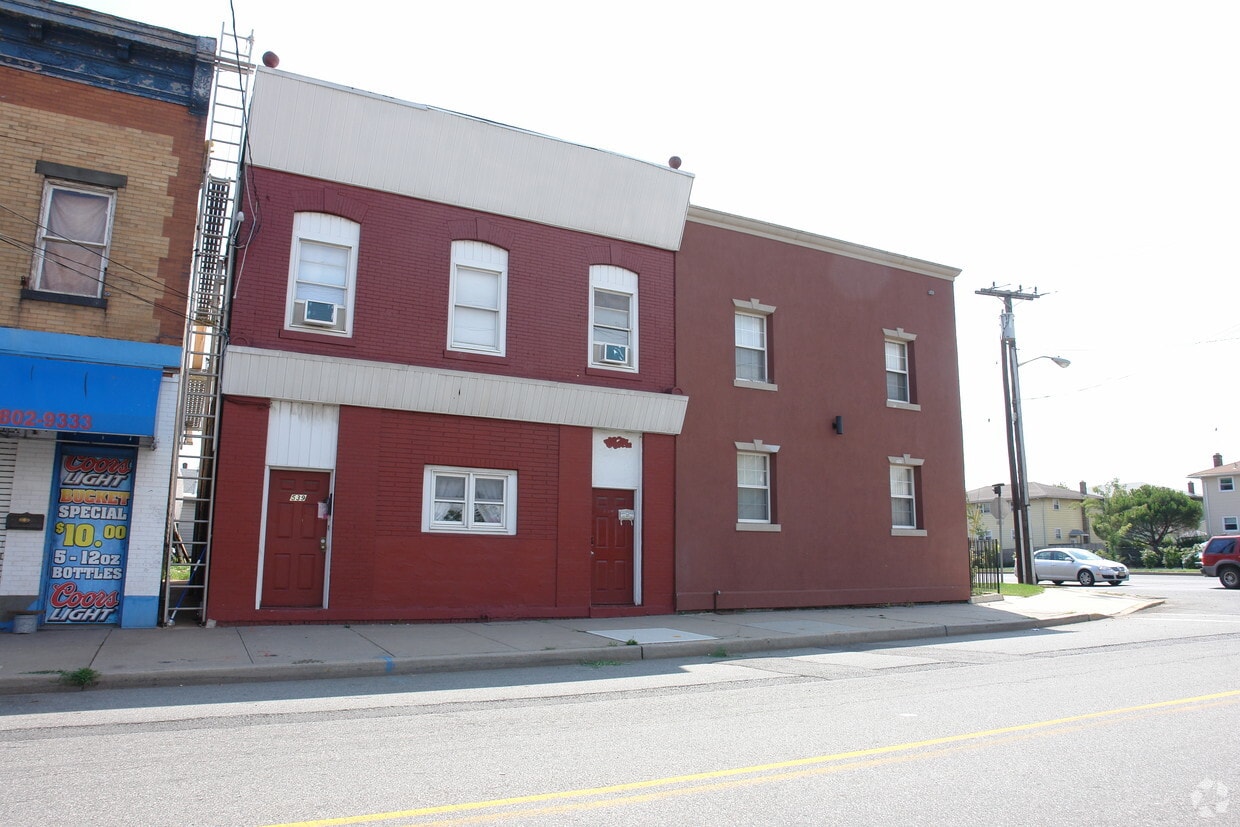
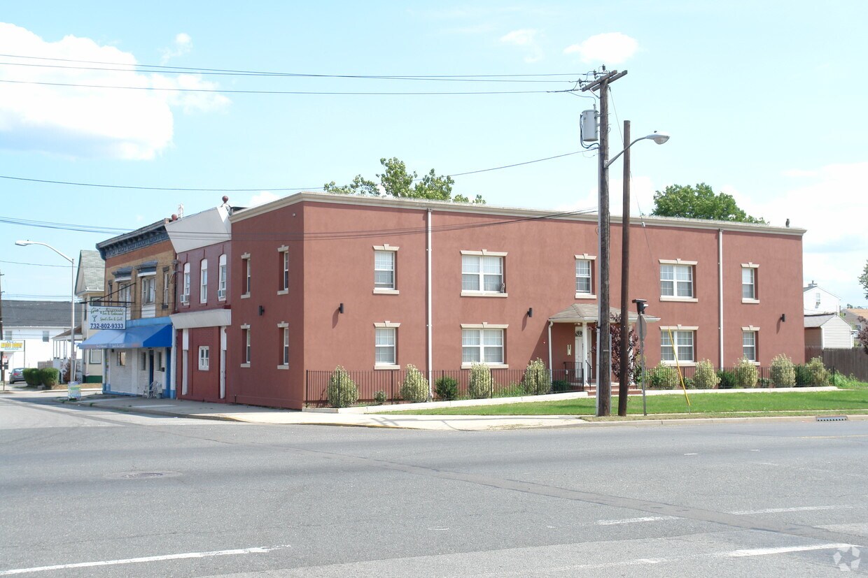

At 539 Roosevelt Ave, experience fine living. The 07008 location in Carteret has much to offer its residents. Here at this community, the leasing team is ready to help you find your perfect new home. Make sure you to see the current floorplan options. Visit 539 Roosevelt Ave today.
539 Roosevelt Ave is an apartment community located in Middlesex County and the 07008 ZIP Code. This area is served by the Carteret Public School District attendance zone.
Carteret, a borough in northeastern Middlesex County, sits along the Arthur Kill waterway and bills itself as the "Center of it All," a nod to its central location just 22 miles from Manhattan and 10 miles from Newark. Named after Sir George Carteret, one of the earliest proprietors of the province of New Jersey, the borough has a rich history dating back to its founding in 1906. Renters looking at apartments for rent in Carteret will find a well-connected community with easy access to major employment hubs, green spaces, and everyday conveniences all within a compact five-square-mile area.
Renters in Carteret can choose from a mix of apartments, condos, townhomes, and houses spread across established residential neighborhoods. Washington Avenue features brick-paved sidewalks and locally-owned shops and cafes, while Roosevelt Avenue offers a more contemporary mix of dining and retail.
Learn more about living in Carteret| Colleges & Universities | Distance | ||
|---|---|---|---|
| Colleges & Universities | Distance | ||
| Drive: | 13 min | 7.2 mi | |
| Drive: | 16 min | 8.8 mi | |
| Drive: | 18 min | 10.1 mi | |
| Drive: | 22 min | 13.0 mi |


Transportation options available in Carteret include 8Th Street Light Rail Station, located 11.7 miles from 539 Roosevelt Ave. 539 Roosevelt Ave is near Newark Liberty International, located 13.3 miles or 21 minutes away, and LaGuardia, located 30.7 miles or 50 minutes away.
| Transit / Subway | Distance | ||
|---|---|---|---|
| Transit / Subway | Distance | ||
| Drive: | 19 min | 11.7 mi | |
|
|
Drive: | 21 min | 12.9 mi |
|
|
Drive: | 20 min | 14.6 mi |
|
|
Drive: | 19 min | 14.6 mi |
|
|
Drive: | 25 min | 16.7 mi |
| Commuter Rail | Distance | ||
|---|---|---|---|
| Commuter Rail | Distance | ||
|
|
Drive: | 9 min | 4.5 mi |
|
|
Drive: | 8 min | 4.7 mi |
|
|
Drive: | 10 min | 5.4 mi |
|
|
Drive: | 21 min | 11.2 mi |
|
|
Drive: | 23 min | 12.6 mi |
| Airports | Distance | ||
|---|---|---|---|
| Airports | Distance | ||
|
Newark Liberty International
|
Drive: | 21 min | 13.3 mi |
|
LaGuardia
|
Drive: | 50 min | 30.7 mi |
Scores provided by
Traffic
-Airport
-Businesses
-Scores provided by
HowLoud What is a Sound Score Rating? A Sound Score Rating aggregates noise caused by vehicle traffic, airplane traffic and local sources. How It WorksTime and distance from 539 Roosevelt Ave.
| Shopping Centers | Distance | ||
|---|---|---|---|
| Shopping Centers | Distance | ||
| Walk: | 16 min | 0.9 mi | |
| Drive: | 3 min | 1.4 mi | |
| Drive: | 15 min | 9.5 mi |
| Parks and Recreation | Distance | ||
|---|---|---|---|
| Parks and Recreation | Distance | ||
|
Liberty State Park
|
Drive: | 4 min | 2.1 mi |
|
Hawk Rise Sanctuary
|
Drive: | 11 min | 5.5 mi |
|
Staten Island Industrial Park
|
Drive: | 15 min | 9.1 mi |
|
William T. Davis Wildlife Refuge
|
Drive: | 16 min | 10.3 mi |
|
Freshkills Park
|
Drive: | 23 min | 13.2 mi |
| Hospitals | Distance | ||
|---|---|---|---|
| Hospitals | Distance | ||
| Drive: | 11 min | 5.5 mi | |
| Drive: | 12 min | 6.9 mi | |
| Drive: | 14 min | 7.7 mi |
| Military Bases | Distance | ||
|---|---|---|---|
| Military Bases | Distance | ||
| Drive: | 19 min | 8.4 mi | |
| Drive: | 22 min | 9.2 mi | |
| Drive: | 26 min | 14.7 mi |
What Are Walk Score®, Transit Score®, and Bike Score® Ratings?
Walk Score® measures the walkability of any address. Transit Score® measures access to public transit. Bike Score® measures the bikeability of any address.
What is a Sound Score Rating?
A Sound Score Rating aggregates noise caused by vehicle traffic, airplane traffic and local sources.


