


$1,550 / Month
5371 Louis Pl Unit 6
East Los Angeles, CA 90022
Today
Favorites
213-205-5946
-
Bedrooms
Studio
-
Bathrooms
1
-
Square Feet
500 sq ft
-
Available
Available Now
5371 Louis Pl Unit 6

Favorites
About This Home
Available Now
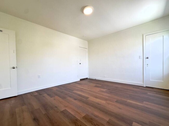
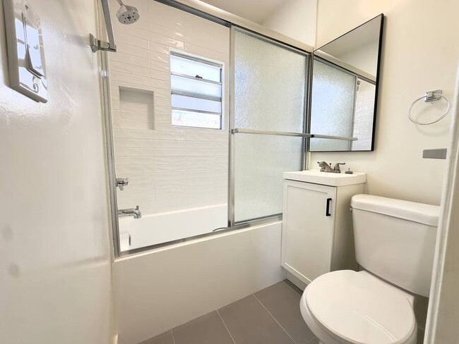
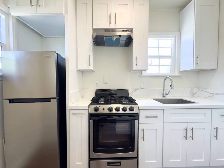
---- SCHEDULE A SHOWING ONLINE AT: ---- This conveniently located East Los Angeles apartment puts you at the center of everything you need. Situated at 5371 Louis Place in the 90022 zip code, you'll enjoy: PROPERTY HIGHLIGHTS: - Spacious 500 square foot floor plan - One full bathroom - ALL utilities included in rent - Reserved parking available ($100/month) - Highly walkable location (WalkScore: 87) - Easy freeway access - Excellent public transportation options LOCATION ADVANTAGES: - Shopping & Services: Target, CVS, Chase Bank, Wells Fargo all nearby - Recreation: Close to Bristow Park, Woods Avenue Park, and Bandini Park - Education: Near local high schools and middle schools - Community: Walking distance to local parks and churches Transportation: - Just blocks from the 710 freeway - Easy access to 5, 60, 10 & 101 freeways - 0.1 miles from 66 Metro Line and Union Pacific/Salazar Park Line - 0.2 miles from 18, 258, and Whittier Blvd/Saybrook Bus Line - 0.9 miles from the Metro Rail L Line (Gold) LEASE TERMS: Monthly Rent: $1,550 Security Deposit: $1,550 Utilities: ALL paid by owner (water, gas, electricity) Parking: Available for $100/month Don't miss this opportunity to live in a convenient East Los Angeles location with the rare benefit of ALL utilities included! Contact us today to schedule a viewing.
5371 Louis Pl is an apartment community located in Los Angeles County and the 90022 ZIP Code.
* Price shown is base rent and may not include non-optional fees and utilities.
Price, availability, fees, and any applicable rent special are subject to change without notice.
* Square footage definitions vary. Displayed square footage is approximate.
Features
- Air Conditioning
- Refrigerator
Fees and Policies
The fees below are based on community-supplied data and may exclude additional fees and utilities.
- Parking
-
Garage--Assigned Parking
-
Other--Assigned Parking
Contact
- Listed by LMA Leasing
- Phone Number
- Contact
Location
Get Directions
Amenities
- Air Conditioning
- Refrigerator
Southeast Los Angeles is directly south of the Fashion District and east of the University of Southern California (USC). This large neighborhood is minutes from downtown Los Angeles, Hollywood, and Beverly Hills, with easy access to the 110 Freeway. This great location places you near sunny beaches, nature trails, and a bevy of leading employers. Students can access both USC and California State University Long Beach from their Southeast LA apartment.
This densely populated, diverse neighborhood features everything from food trucks and corner markets to wide sidewalks and residential areas filled with bungalows, ranch, and Spanish Colonial architecture. Southeast LA features palm trees and mountain views, tampered with gritty undertones to give it a cool, funky vibe.
As for outdoor fun, take your pick between Catalina Island, Venus Beach, or the Santa Monica Pier. Nearby, you’ll find more sunny beaches like White Point, Cabrillo, and Long Beach.
Learn more about living in Southeast Los Angeles
Education
| Colleges & Universities | Distance | ||
|---|---|---|---|
| Colleges & Universities | Distance | ||
| Drive: | 4 min | 1.9 mi | |
| Drive: | 10 min | 5.3 mi | |
| Drive: | 12 min | 5.8 mi | |
| Drive: | 12 min | 7.5 mi |
5371 Louis Pl Unit 6 is within 4 minutes or 1.9 miles from East Los Angeles College. It is also near Cal State Los Angeles and USC, Health Sciences Campus.
Transportation options available in East Los Angeles include Atlantic, located 1.3 miles from 5371 Louis Pl Unit 6. 5371 Louis Pl Unit 6 is near Long Beach (Daugherty Field), located 17.2 miles or 28 minutes away, and Los Angeles International, located 23.3 miles or 33 minutes away.
| Transit / Subway | Distance | ||
|---|---|---|---|
| Transit / Subway | Distance | ||
|
|
Drive: | 3 min | 1.3 mi |
|
|
Drive: | 3 min | 1.5 mi |
| Drive: | 4 min | 1.8 mi | |
|
|
Drive: | 7 min | 3.8 mi |
|
|
Drive: | 9 min | 6.0 mi |
| Commuter Rail | Distance | ||
|---|---|---|---|
| Commuter Rail | Distance | ||
|
|
Drive: | 5 min | 2.3 mi |
|
|
Drive: | 8 min | 3.4 mi |
|
|
Drive: | 11 min | 7.1 mi |
|
|
Drive: | 13 min | 7.2 mi |
| Drive: | 15 min | 11.0 mi |
| Airports | Distance | ||
|---|---|---|---|
| Airports | Distance | ||
|
Long Beach (Daugherty Field)
|
Drive: | 28 min | 17.2 mi |
|
Los Angeles International
|
Drive: | 33 min | 23.3 mi |
Time and distance from 5371 Louis Pl Unit 6.
| Shopping Centers | Distance | ||
|---|---|---|---|
| Shopping Centers | Distance | ||
| Walk: | 1 min | 0.1 mi | |
| Walk: | 5 min | 0.3 mi | |
| Walk: | 7 min | 0.4 mi |
5371 Louis Pl Unit 6 has 3 shopping centers within 0.4 mile, which is about a 7-minute walk. The miles and minutes will be for the farthest away property.
| Parks and Recreation | Distance | ||
|---|---|---|---|
| Parks and Recreation | Distance | ||
|
Pio Pico State Historic Park
|
Drive: | 13 min | 5.3 mi |
|
Hollenbeck Lake
|
Drive: | 8 min | 5.7 mi |
|
Augustus Hawkins Natural Park
|
Drive: | 14 min | 6.9 mi |
|
Whittier Narrows Recreation Area
|
Drive: | 13 min | 7.3 mi |
|
Audubon Center at Debs Park
|
Drive: | 15 min | 10.0 mi |
5371 Louis Pl Unit 6 has 5 parks within 10.0 miles, including Hollenbeck Lake, Pio Pico State Historic Park, and Augustus Hawkins Natural Park.
| Hospitals | Distance | ||
|---|---|---|---|
| Hospitals | Distance | ||
| Drive: | 4 min | 2.1 mi | |
| Drive: | 5 min | 2.2 mi | |
| Drive: | 6 min | 2.6 mi |
5371 Louis Pl Unit 6 has 3 hospitals within 2.6 miles, the nearest is Los Angeles Community Hospital which is 2.1 miles away and a 4 minute drive.
| Military Bases | Distance | ||
|---|---|---|---|
| Military Bases | Distance | ||
| Drive: | 30 min | 20.0 mi | |
| Drive: | 30 min | 21.6 mi |
5371 Louis Pl Unit 6 is 20.0 miles from Los Alamitos Army Airfield, and is convenient to other military bases, including Los Angeles Air Force Base.
You May Also Like
Similar Rentals Nearby


What Are Walk Score®, Transit Score®, and Bike Score® Ratings?
Walk Score® measures the walkability of any address. Transit Score® measures access to public transit. Bike Score® measures the bikeability of any address.
What is a Sound Score Rating?
A Sound Score Rating aggregates noise caused by vehicle traffic, airplane traffic and local sources
5371 Louis Pl
East Los Angeles, CA 90022