$2,465
/ Month
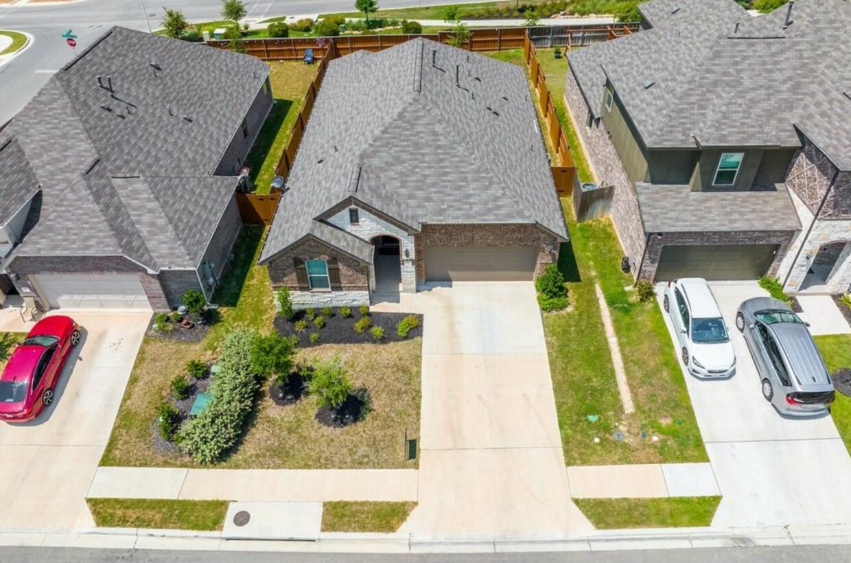
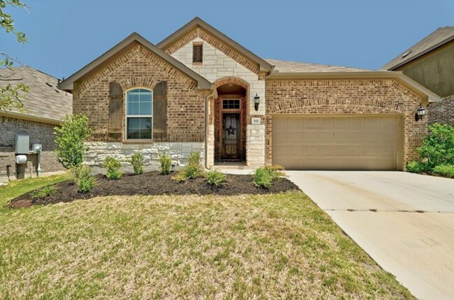
537 Leadtree Loop
Mustang Ridge, TX 78610
Favorites
537 Leadtree Loop

Favorites
Check Back Soon for Upcoming Availability
| Beds | Baths | Average SF |
|---|---|---|
| 3 Bedrooms 3 Bedrooms 3 Br | 2 Baths 2 Baths 2 Ba | 1,850 SF |
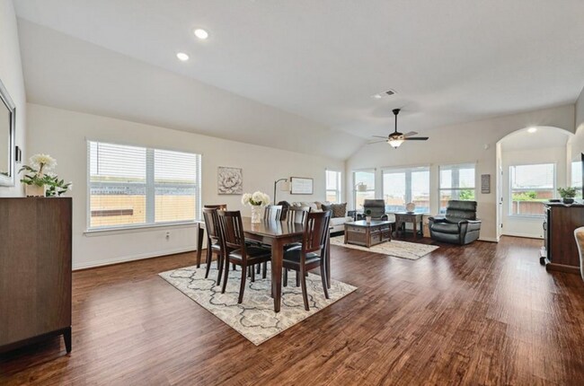
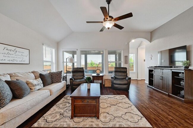
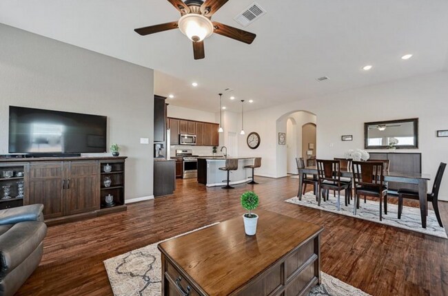
About This Property
Breakfast Bar, Ceiling Fans , Double Vanity, Entrance Foyer, High Ceilings, Multiple Living Areas, Recessed Lighting, Security System-Owned, Shower Only, Smoke Detector, Tray Ceiling(s), Walk-In Closet(s), Water Softener-Owned, Window Treatments
537 Leadtree Loop is a house located in Hays County and the 78610 ZIP Code. This area is served by the Hays Consolidated Independent School District attendance zone.
537 Leadtree Loop,
Mustang Ridge,
TX
78610
Education
| Colleges & Universities | Distance | ||
|---|---|---|---|
| Colleges & Universities | Distance | ||
| Drive: | 20 min | 11.5 mi | |
| Drive: | 20 min | 12.3 mi | |
| Drive: | 24 min | 14.3 mi | |
| Drive: | 28 min | 19.4 mi |
537 Leadtree Loop is within 20 minutes or 11.5 miles from Austin C.C., South Austin. It is also near USAHS and St. Edward's University.
Schools


Public Elementary & Middle School
Grades K-8
18 Students
Nearby
Public Elementary School
Grades PK-5
559 Students
Attendance Zone
Public Middle School
Grades 6-8
1,047 Students
Attendance Zone
Public High School
Grades 9-12
2,613 Students
Nearby
Private Elementary, Middle & High School
Grades K-12
Nearby
Private Elementary & Middle School
Grades PK-8
305 Students
Nearby
Private Middle & High School
Grades 6-12
Nearby
School data provided by
 The GreatSchools Rating helps parents compare schools within a state based on a variety of school quality indicators and provides a helpful picture of how effectively each school serves all of its students. Ratings are on a scale of 1 (below average) to 10 (above average) and can include test scores, college readiness, academic progress, advanced courses, equity, discipline and attendance data. We also advise parents to visit schools, consider other information on school performance and programs, and consider family needs as part of the school selection process.
View GreatSchools Rating Methodology
Data provided by GreatSchools.org © 2026. All rights reserved.
View GreatSchools Rating Methodology
Data provided by GreatSchools.org © 2026. All rights reserved.
Walkability Near 537 Leadtree Loop Mustang Ridge, TX 78610
Getting Around
 What do Walkability, Transit, Drivability, and Bikeability mean?
Walkability measures the walking distance to day-to-day needs.
Transit measures access to public transportation.
Drivability measures congestion, parking availability, and access to major roads.
Bikeability measures the suitability for cycling.
How It Works
What do Walkability, Transit, Drivability, and Bikeability mean?
Walkability measures the walking distance to day-to-day needs.
Transit measures access to public transportation.
Drivability measures congestion, parking availability, and access to major roads.
Bikeability measures the suitability for cycling.
How It Works
Somewhat Walkable
Walkability
30
/ 100
Exceptionally Drivable
Drivability
100
/ 100
Somewhat Bikeable
Bikeability
30
/ 100
Scores provided by
-
Soundscore™
-
/ 100
Traffic
-Airport
-Businesses
-Scores provided by
HowLoud What is a Sound Score Rating? A Sound Score Rating aggregates noise caused by vehicle traffic, airplane traffic and local sources. How It WorksYou May Also Like
Similar Rentals Nearby
-
-
1 / 34

-
-
-
1 / 25

-
-
-

-

-


What Are Walk Score®, Transit Score®, and Bike Score® Ratings?
Walk Score® measures the walkability of any address. Transit Score® measures access to public transit. Bike Score® measures the bikeability of any address.
What is a Sound Score Rating?
A Sound Score Rating aggregates noise caused by vehicle traffic, airplane traffic and local sources.

537 Leadtree Loop
Mustang Ridge, TX 78610