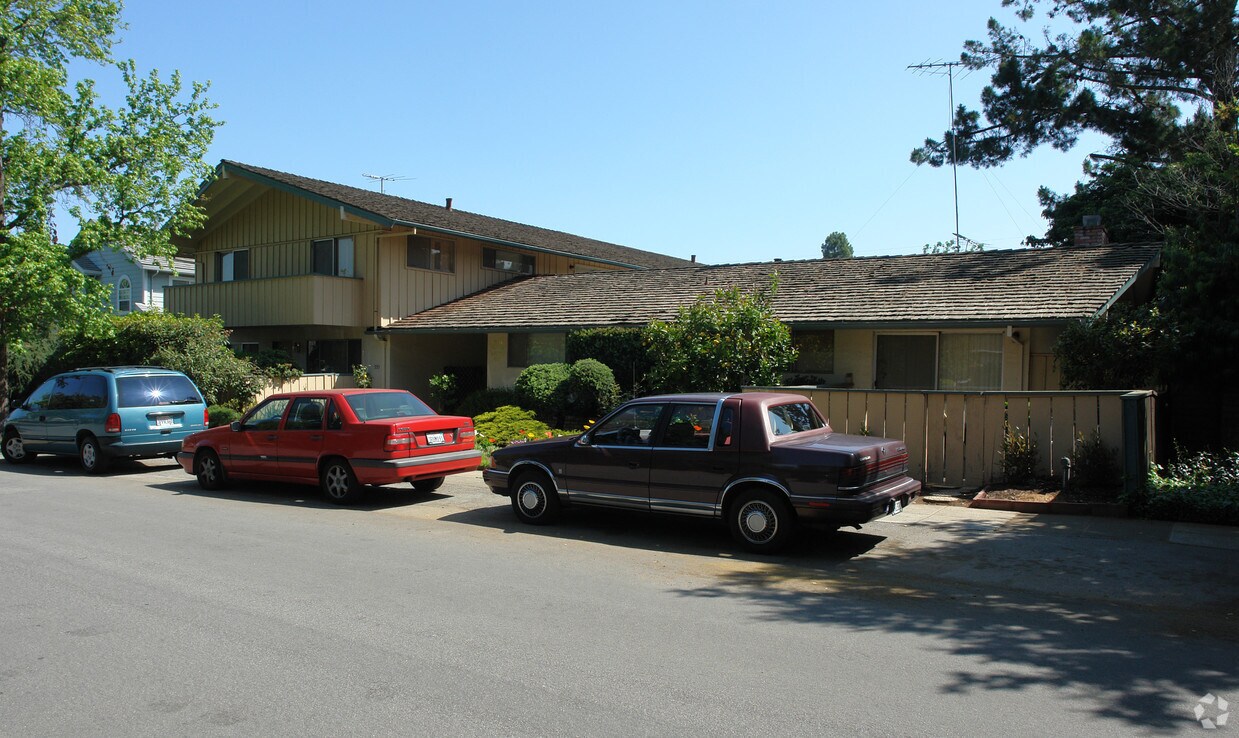
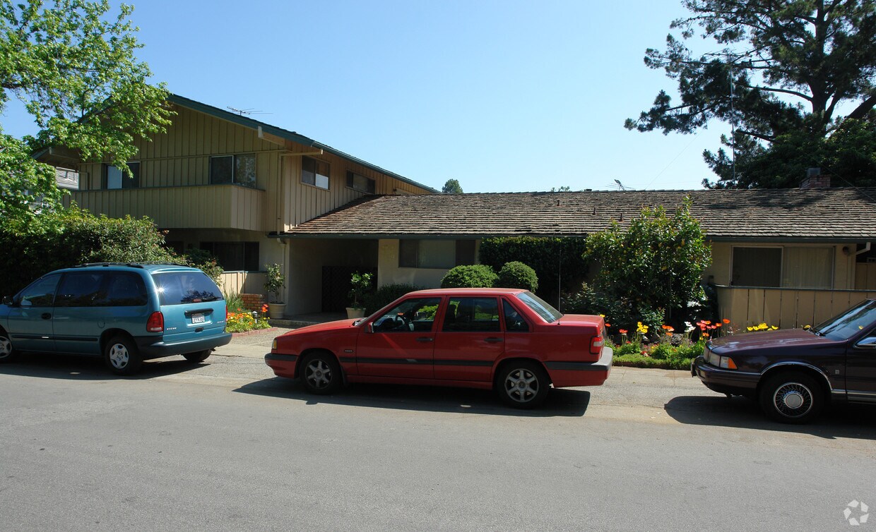
535-547 Tyndall St
535-547 Tyndall St,
Los Altos,
CA
94022
2 Weeks Ago
Favorites
535-547 Tyndall St
Favorites
Check Back Soon for Upcoming Availability
Fees and Policies
Details
Property Information
-
Built in 1964
-
7 units/2 stories
About 535-547 Tyndall St Los Altos, CA 94022
Experience Los Altos living at 535-547 Tyndall St. The location in Los Altos's 94022 area has so much to offer its residents. Come by to check out the current floorplan options. The community staff is ready and waiting for you to visit. Stop by to talk about your next apartment.
535-547 Tyndall St is an apartment community located in Santa Clara County and the 94022 ZIP Code. This area is served by the Los Altos Elementary attendance zone.
Location
Get Directions
North Los Altos contains the city’s vibrant commercial centers. The many shops and eateries of Main Street are in the southern portion of North Los Altos, while the diverse restaurants and cafes of San Antonio Road are in the northern stretches near San Antonio Center.
Outside of these commercial areas, North Los Altos is predominantly residential, offering an array of apartments available for rent along tree-lined avenues. Many of the rentals in North Los Altos feature stunning mountain views, as well as close proximity to Mountain View, Foothill College, Stanford University, and Palo Alto. Getting around from North Los Altos is simple with access to El Camino Real, Interstate 280, and San Antonio Station.
Learn more about living in North Los AltosBelow are rent ranges for similar nearby apartments
| Beds | Average Size | Lowest | Typical | Premium |
|---|---|---|---|---|
| Studio Studio Studio | 491 Sq Ft | $2,150 | $3,457 | $5,386 |
| 1 Bed 1 Bed 1 Bed | 754-758 Sq Ft | $2,495 | $3,882 | $6,223 |
| 2 Beds 2 Beds 2 Beds | 1141-1149 Sq Ft | $3,295 | $5,027 | $7,915 |
| 3 Beds 3 Beds 3 Beds | 1408 Sq Ft | $4,441 | $4,962 | $5,750 |
| 4 Beds 4 Beds 4 Beds | 2516 Sq Ft | $6,840 | $13,420 | $20,000 |
Education
| Colleges & Universities | Distance | ||
|---|---|---|---|
| Colleges & Universities | Distance | ||
| Drive: | 5 min | 1.8 mi | |
| Drive: | 8 min | 3.6 mi | |
| Drive: | 12 min | 5.6 mi | |
| Drive: | 12 min | 6.2 mi |
535-547 Tyndall St is within 5 minutes or 1.8 miles from Foothill Coll., Los Altos. It is also near Foothill College, Middlefield and Stanford University.
Schools


Charter Elementary & Middle School
Grades K-8
1,058 Students
Nearby
Public Elementary School
Grades K-5
367 Students
Nearby
Public Elementary School
Grades K-6
441 Students
Attendance Zone
Public Middle School
Grades 7-8
497 Students
Attendance Zone
Public High School
Grades 9-12
2,141 Students
Attendance Zone
Private Elementary & Middle School
Grades K-8
250 Students
Nearby
Private Elementary School
Grades K-6
75 Students
Nearby
Private High School
Grades 9-12
1,776 Students
Nearby
School data provided by
 The GreatSchools Rating helps parents compare schools within a state based on a variety of school quality indicators and provides a helpful picture of how effectively each school serves all of its students. Ratings are on a scale of 1 (below average) to 10 (above average) and can include test scores, college readiness, academic progress, advanced courses, equity, discipline and attendance data. We also advise parents to visit schools, consider other information on school performance and programs, and consider family needs as part of the school selection process.
View GreatSchools Rating Methodology
Data provided by GreatSchools.org © 2025. All rights reserved.
View GreatSchools Rating Methodology
Data provided by GreatSchools.org © 2025. All rights reserved.
Transportation options available in Los Altos include Mountain View Station, located 3.1 miles from 535-547 Tyndall St. 535-547 Tyndall St is near Norman Y Mineta San Jose International, located 12.0 miles or 20 minutes away, and San Francisco International, located 26.2 miles or 37 minutes away.
| Transit / Subway | Distance | ||
|---|---|---|---|
| Transit / Subway | Distance | ||
| Drive: | 8 min | 3.1 mi | |
|
|
Drive: | 8 min | 3.2 mi |
|
|
Drive: | 10 min | 4.2 mi |
|
|
Drive: | 10 min | 4.4 mi |
| Drive: | 12 min | 5.2 mi |
| Commuter Rail | Distance | ||
|---|---|---|---|
| Commuter Rail | Distance | ||
| Drive: | 5 min | 2.6 mi | |
| Drive: | 8 min | 3.1 mi | |
| Drive: | 9 min | 3.3 mi | |
| Drive: | 11 min | 4.8 mi | |
| Drive: | 11 min | 5.0 mi |
| Airports | Distance | ||
|---|---|---|---|
| Airports | Distance | ||
|
Norman Y Mineta San Jose International
|
Drive: | 20 min | 12.0 mi |
|
San Francisco International
|
Drive: | 37 min | 26.2 mi |
Time and distance from 535-547 Tyndall St.
| Shopping Centers | Distance | ||
|---|---|---|---|
| Shopping Centers | Distance | ||
| Drive: | 4 min | 1.5 mi | |
| Drive: | 3 min | 1.7 mi | |
| Drive: | 4 min | 1.7 mi |
535-547 Tyndall St has 3 shopping centers within 1.7 miles, which is about a 4-minute drive. The miles and minutes will be for the farthest away property.
| Parks and Recreation | Distance | ||
|---|---|---|---|
| Parks and Recreation | Distance | ||
|
Redwood Grove
|
Drive: | 3 min | 1.5 mi |
|
Foothill College Observatory
|
Drive: | 5 min | 2.0 mi |
|
Terman Park
|
Drive: | 6 min | 2.9 mi |
|
Esther Clark Nature Preserve
|
Drive: | 6 min | 2.9 mi |
|
Byrne Preserve
|
Drive: | 8 min | 3.3 mi |
535-547 Tyndall St has 5 parks within 3.3 miles, including Redwood Grove, Foothill College Observatory, and Esther Clark Nature Preserve.
| Hospitals | Distance | ||
|---|---|---|---|
| Hospitals | Distance | ||
| Drive: | 6 min | 2.3 mi | |
| Drive: | 13 min | 6.4 mi | |
| Drive: | 14 min | 6.7 mi |
535-547 Tyndall St has 3 hospitals within 6.7 miles, the nearest is El Camino Hospital which is 2.3 miles away and a 6 minute drive.
| Military Bases | Distance | ||
|---|---|---|---|
| Military Bases | Distance | ||
| Drive: | 15 min | 6.1 mi |
535-547 Tyndall St is 6.1 miles and a 15 minute drive from Ames Research Center.
You May Also Like
What neighborhood is the property located in?
535-547 Tyndall St Los Altos, CA 94022 is in North Los Altos in the city of Los Altos. Here you’ll find three shopping centers within 1.7 miles of the property. Five parks are within 3.3 miles, including Redwood Grove, Foothill College Observatory, and Esther Clark Nature Preserve.
Similar Rentals Nearby


What Are Walk Score®, Transit Score®, and Bike Score® Ratings?
Walk Score® measures the walkability of any address. Transit Score® measures access to public transit. Bike Score® measures the bikeability of any address.
What is a Sound Score Rating?
A Sound Score Rating aggregates noise caused by vehicle traffic, airplane traffic and local sources
Responded To This Review