
$950 / Month
5349 E Arbor Cir
Mesa, AZ 85206
2 Weeks Ago
Favorites
5349 E Arbor Cir

Favorites
Check Back Soon for Upcoming Availability
| Beds | Baths | Average SF |
|---|---|---|
| 2 Bedrooms 2 Bedrooms 2 Br | 2 Baths 2 Baths 2 Ba | 854 SF |
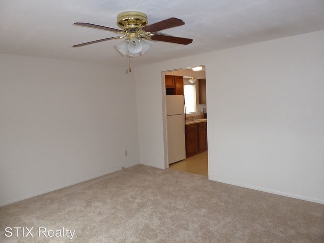
About This Property
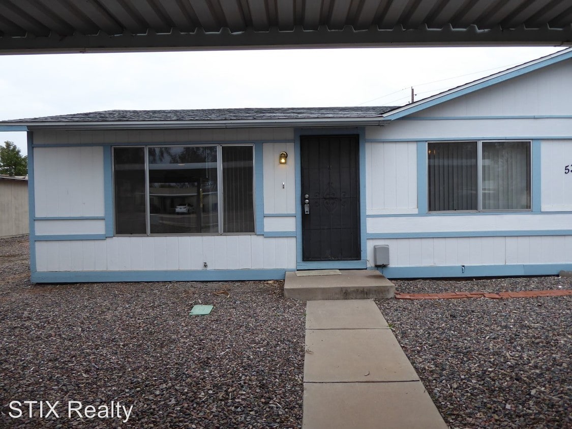
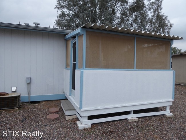
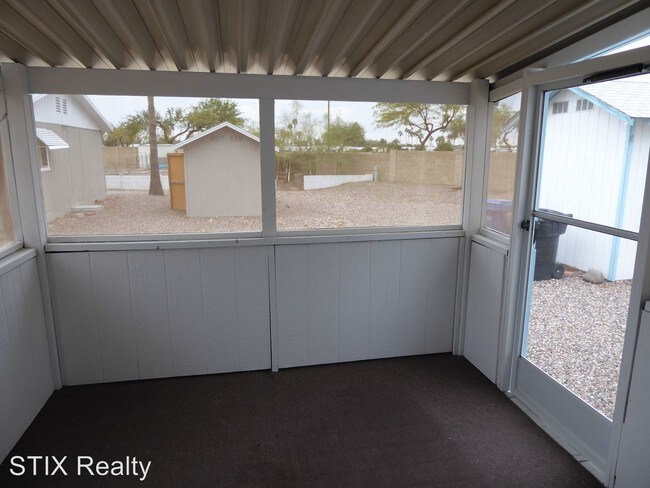
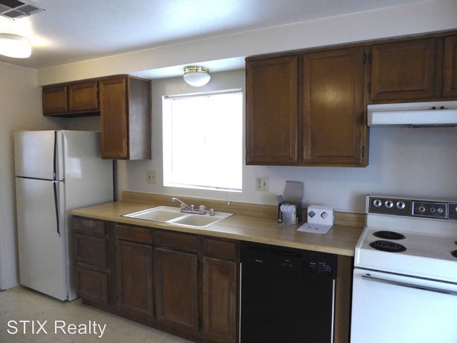
(480) 464-0700 - Central Mesa charmer - 2 bedroom and 2 baths near Main and Higley in Mesa. This unit will be available early Decembert. Small dog or cat acceptable. Enclosed back porch and storage shed complete the yard. Located on a quiet cul-de-sac, 2 car covered carport. Call Stix Realty 480 464-0700 to schedule a showing. (RLNE2775870) Pet policies: Small Dogs Allowed, Cats Allowed.
5349 E Arbor Cir is a condo located in Maricopa County and the 85206 ZIP Code.
Location
Get Directions
North of the Phoenix Mesa Gateway Airport is Superstition Springs, a community just 20 minutes outside of Mesa. The north section of the neighborhood boasts an expansive variety of shops and dining establishments.
The Superstition Springs Center mall is a major fashion hub, surrounded by Burlington, Target, and WinCo Foods market. Restaurants in the area include Olive Garden, The Cheesecake Factory, and BJ’s Restaurant and Brewhouse. The mall itself houses its own food court, along with an outdoor amphitheater and movie theater. Residents enjoy the convenience of being close to Mesa, Scottsdale, and Phoenix. Golfers will appreciate the championship golf course at the Superstition Springs Golf Club off Baseline Road.
Learn more about living in Superstition SpringsBelow are rent ranges for similar nearby apartments
| Beds | Average Size | Lowest | Typical | Premium |
|---|---|---|---|---|
| Studio Studio Studio | 537 Sq Ft | $750 | $1,467 | $1,679 |
| 1 Bed 1 Bed 1 Bed | 724 Sq Ft | $917 | $1,560 | $4,357 |
| 2 Beds 2 Beds 2 Beds | 1034 Sq Ft | $1,008 | $1,829 | $5,500 |
| 3 Beds 3 Beds 3 Beds | 1417-1419 Sq Ft | $1,295 | $2,329 | $5,995 |
| 4 Beds 4 Beds 4 Beds | 2291 Sq Ft | $2,099 | $3,786 | $25,000 |
Education
| Colleges & Universities | Distance | ||
|---|---|---|---|
| Colleges & Universities | Distance | ||
| Drive: | 9 min | 4.1 mi | |
| Drive: | 10 min | 5.2 mi | |
| Drive: | 12 min | 6.8 mi | |
| Drive: | 13 min | 7.0 mi |
5349 E Arbor Cir is within 9 minutes or 4.1 miles from A.T. Still Univ. AZ. It is also near Mesa C.C., Red Mountain Campus and Benedictine University.
Transportation options available in Mesa include Gilbert Rd/Main St, located 5.1 miles from 5349 E Arbor Cir. 5349 E Arbor Cir is near Phoenix-Mesa Gateway, located 10.0 miles or 19 minutes away, and Phoenix Sky Harbor International, located 22.7 miles or 32 minutes away.
| Transit / Subway | Distance | ||
|---|---|---|---|
| Transit / Subway | Distance | ||
|
|
Drive: | 9 min | 5.1 mi |
|
|
Drive: | 10 min | 5.6 mi |
|
|
Drive: | 11 min | 6.4 mi |
|
|
Drive: | 13 min | 7.0 mi |
|
|
Drive: | 15 min | 7.6 mi |
| Commuter Rail | Distance | ||
|---|---|---|---|
| Commuter Rail | Distance | ||
|
|
Drive: | 54 min | 40.8 mi |
| Airports | Distance | ||
|---|---|---|---|
| Airports | Distance | ||
|
Phoenix-Mesa Gateway
|
Drive: | 19 min | 10.0 mi |
|
Phoenix Sky Harbor International
|
Drive: | 32 min | 22.7 mi |
Time and distance from 5349 E Arbor Cir.
| Shopping Centers | Distance | ||
|---|---|---|---|
| Shopping Centers | Distance | ||
| Walk: | 10 min | 0.5 mi | |
| Walk: | 12 min | 0.6 mi | |
| Walk: | 14 min | 0.7 mi |
5349 E Arbor Cir has 3 shopping centers within 0.7 mile, which is about a 14-minute walk. The miles and minutes will be for the farthest away property.
| Parks and Recreation | Distance | ||
|---|---|---|---|
| Parks and Recreation | Distance | ||
|
Red Mountain Park
|
Drive: | 8 min | 4.7 mi |
|
Riparian Preserve at Water Ranch
|
Drive: | 9 min | 4.9 mi |
|
Arizona Museum of Natural History
|
Drive: | 13 min | 7.2 mi |
|
i.d.e.a. Museum
|
Drive: | 14 min | 7.4 mi |
|
Usery Mountain Recreation Area
|
Drive: | 22 min | 11.1 mi |
5349 E Arbor Cir has 5 parks within 11.1 miles, including Red Mountain Park, Riparian Preserve at Water Ranch, and Arizona Museum of Natural History.
| Hospitals | Distance | ||
|---|---|---|---|
| Hospitals | Distance | ||
| Drive: | 4 min | 2.1 mi | |
| Drive: | 4 min | 2.4 mi | |
| Drive: | 5 min | 2.7 mi |
5349 E Arbor Cir has 3 hospitals within 2.7 miles, the nearest is Banner Baywood Medical Center which is 2.1 miles away and a 4 minute drive.
| Military Bases | Distance | ||
|---|---|---|---|
| Military Bases | Distance | ||
| Drive: | 32 min | 23.4 mi | |
| Drive: | 61 min | 47.9 mi | |
| Drive: | 122 min | 99.5 mi |
5349 E Arbor Cir has 3 military bases within 99.5 miles, the nearest is Phoenix Sky Harbor Airport Air Guard Station which is 23.4 miles away and a 32 minute drive.
You May Also Like
Similar Rentals Nearby


What Are Walk Score®, Transit Score®, and Bike Score® Ratings?
Walk Score® measures the walkability of any address. Transit Score® measures access to public transit. Bike Score® measures the bikeability of any address.
What is a Sound Score Rating?
A Sound Score Rating aggregates noise caused by vehicle traffic, airplane traffic and local sources

5349 E Arbor Cir
Mesa, AZ 85206