$2,000
/ Month
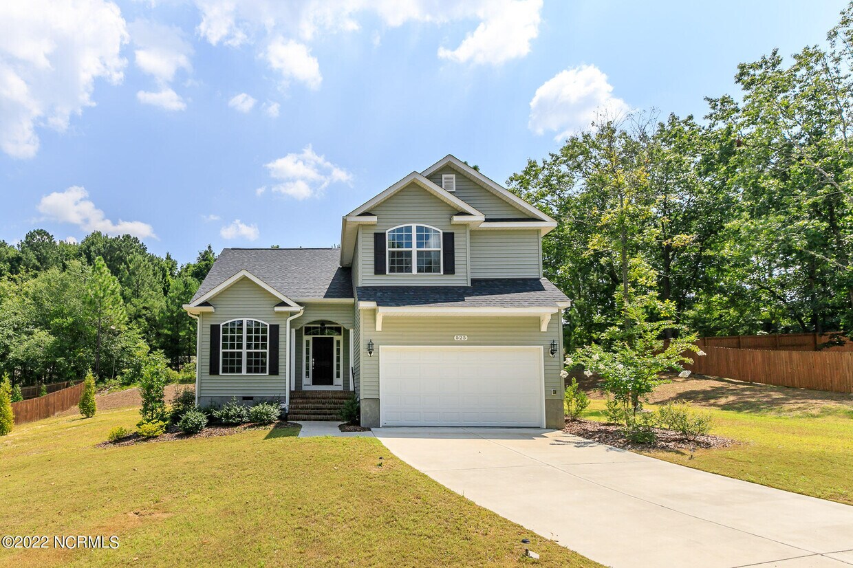
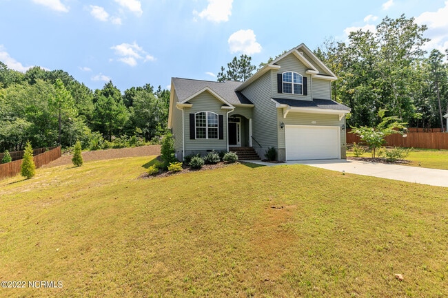
525 Clark St
Southern Pines, NC 28387
Favorites
525 Clark St

Favorites
Check Back Soon for Upcoming Availability
| Beds | Baths | Average SF |
|---|---|---|
| 4 Bedrooms 4 Bedrooms 4 Br | 2.5 Baths 2.5 Baths 2.5 Ba | 1,890 SF |
About This Property
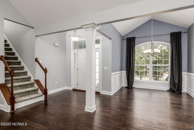
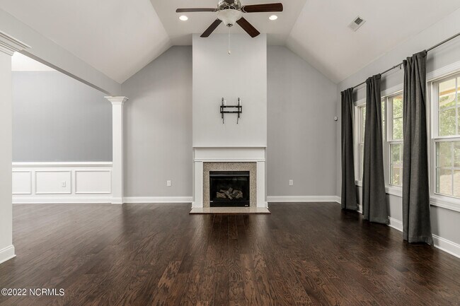
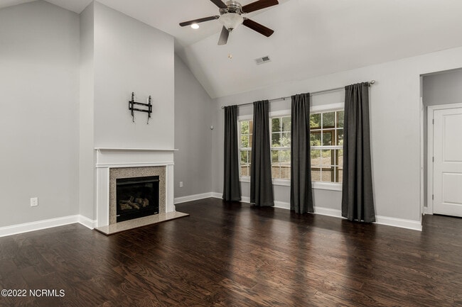
This beautiful 4 bed 2.5 bath home is located within walking distance to Broad St Southern Pines, perfect for participating in all of the amazing activities this wonderful town has to offer! You'll find hardwood floors, granite countertops, stainless steel appliances, washer/dryer to remain and a screened-in back porch! Great home in a great location! Pets are negotiable.
525 Clark St is a house located in Moore County and the 28387 ZIP Code. This area is served by the Moore County School District attendance zone.
House Features
- Smoke Free
525 Clark St,
Southern Pines,
NC
28387
Amenities
- Smoke Free
Education
| Colleges & Universities | Distance | ||
|---|---|---|---|
| Colleges & Universities | Distance | ||
| Drive: | 9 min | 4.6 mi | |
| Drive: | 40 min | 26.7 mi | |
| Drive: | 55 min | 36.7 mi | |
| Drive: | 56 min | 36.9 mi |
525 Clark St is within 9 minutes or 4.6 miles from Sandhills Community College. It is also near Central Carolina Comm. Coll. and Fayetteville Tech. Comm. Coll..
Schools


Public Elementary School
Grades PK-5
277 Students
Attendance Zone
Public Elementary School
Grades PK-5
612 Students
Attendance Zone
Public Middle School
Grades 6-8
576 Students
Attendance Zone
Public High School
Grades 9-12
2,221 Students
Attendance Zone
Private Elementary, Middle & High School
Grades PK-12
139 Students
Nearby
School data provided by
 The GreatSchools Rating helps parents compare schools within a state based on a variety of school quality indicators and provides a helpful picture of how effectively each school serves all of its students. Ratings are on a scale of 1 (below average) to 10 (above average) and can include test scores, college readiness, academic progress, advanced courses, equity, discipline and attendance data. We also advise parents to visit schools, consider other information on school performance and programs, and consider family needs as part of the school selection process.
View GreatSchools Rating Methodology
Data provided by GreatSchools.org © 2026. All rights reserved.
View GreatSchools Rating Methodology
Data provided by GreatSchools.org © 2026. All rights reserved.
Walkability Near 525 Clark St Southern Pines, NC 28387
Getting Around
 What do Walkability, Transit, Drivability, and Bikeability mean?
Walkability measures the walking distance to day-to-day needs.
Transit measures access to public transportation.
Drivability measures congestion, parking availability, and access to major roads.
Bikeability measures the suitability for cycling.
How It Works
What do Walkability, Transit, Drivability, and Bikeability mean?
Walkability measures the walking distance to day-to-day needs.
Transit measures access to public transportation.
Drivability measures congestion, parking availability, and access to major roads.
Bikeability measures the suitability for cycling.
How It Works
Somewhat Walkable
Walkability
30
/ 100
Very Drivable
Drivability
80
/ 100
Fairly Bikeable
Bikeability
40
/ 100
Scores provided by
-
Soundscore™
-
/ 100
Traffic
-Airport
-Businesses
-Scores provided by
HowLoud What is a Sound Score Rating? A Sound Score Rating aggregates noise caused by vehicle traffic, airplane traffic and local sources. How It WorksYou May Also Like
Similar Rentals Nearby
-
-

-

-

-

-
 4 Beds, 3 Baths, 2,440 sq ft$2,900Total Monthly PriceTotal Monthly Price NewPrices include all required monthly fees.215 Canterbury Rd
 -
 4 Beds, 2 Baths, 1,460 sq ft$2,000Total Monthly PriceTotal Monthly Price NewPrices include all required monthly fees.1420 Central Dr
 -
 4 Beds, 3 Baths, 2,230 sq ft$2,375Total Monthly Price12 Month LeaseTotal Monthly Price NewPrices include all required monthly fees.204 Sandy Springs Rd
 -
 4 Beds, 3 Baths, 1,925 sq ft$2,200Total Monthly Price12 Month LeaseTotal Monthly Price NewPrices include all required monthly fees.765 Conductor Ct
 -


What Are Walk Score®, Transit Score®, and Bike Score® Ratings?
Walk Score® measures the walkability of any address. Transit Score® measures access to public transit. Bike Score® measures the bikeability of any address.
What is a Sound Score Rating?
A Sound Score Rating aggregates noise caused by vehicle traffic, airplane traffic and local sources.

525 Clark St
Southern Pines, NC 28387