

$4,150
/ Month
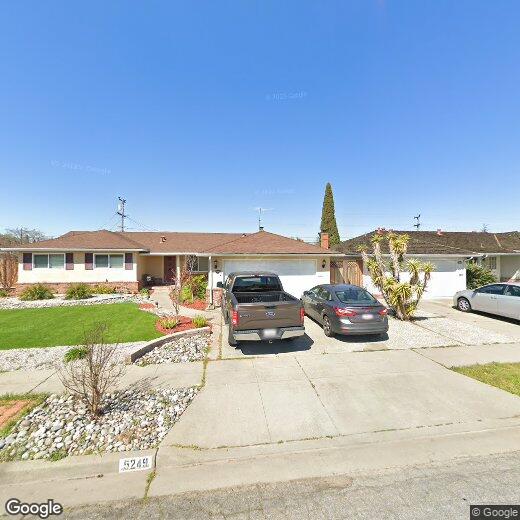
5237 Waller Ave
Fremont, CA 94536
Favorites
510-364-2407
-
Bedrooms
4
-
Bathrooms
2
-
Square Feet
1,594 sq ft
-
Available
Available Now
5237 Waller Ave

Favorites
About This Home
Available Now
Ready to Move-in! Beautiful single-family home in the highly sought-after Glenmoor neighborhood! 4 bedrooms 2 bathrooms,Living room used as 4th bedroom,Family room,Dining room,Hardwood flooring and plush carpeting,copper plumbing. Easy access to 880,Dumbarton Bridge,BART and Centerville Station. Walking distance to great schools,shopping and restaurants. The rent does not include furniture. The pictures in the house are old staged pictures. Apply with RentSpree
5237 Waller Ave is a house located in Alameda County and the 94536 ZIP Code. This area is served by the Fremont Unified School District attendance zone.
* Price shown is base rent. Excludes user-selected optional fees and variable or usage-based fees and required charges due at or prior to move-in or at move-out. Price, availability, fees, and any applicable rent special are subject to change without notice.
* Square footage definitions vary. Displayed square footage is approximate.
Contact
- Listed by Abby Chin | MRL Group,Inc.
- Phone Number
- Contact
-
Source
 Bay East Association of REALTORS ®
Copyright© 2026 Bay East, Contra Costa, bridgeMLS. All rights reserved. All information provided by the listing agent/broker is deemed reliable but is not guaranteed and should be independently verified.
Location
Get Directions
Glenmoor is one of Fremont’s largest and oldest neighborhoods. Complemented by palm-tree-lined streets, Glenmoor is filled with ranch-style and Mediterranean-style single-family houses and modern apartments and townhomes. The cost of living in Fremont is rather high, and rent tends to be more expensive, but there are moderately priced options available as well. Glenmoor has excellent schools, a community pool, small neighborhood parks, and plenty of sidewalks.
As a neighborhood in Silicon Valley, professionals enjoy convenient commutes to multiple technology offices. Amplified by an active neighborhood association, Glenmoor feels like a separate city, maintaining a small-town feeling where everyone knows their neighbors. The neighborhood association hosts community events including a 4th of July parade, barbecues, and holiday ceremonies. Residents also enjoy Glenmoor’s central location that allows them to access the entire city of Fremont and other Bay Area communities.
Learn more about living in Glenmoor
Education
| Colleges & Universities | Distance | ||
|---|---|---|---|
| Colleges & Universities | Distance | ||
| Drive: | 4 min | 1.9 mi | |
| Drive: | 13 min | 7.4 mi | |
| Drive: | 17 min | 11.9 mi | |
| Drive: | 18 min | 12.7 mi |
5237 Waller Ave is within 4 minutes or 1.9 miles from Ohlone College, Newark. It is also near Ohlone College, Fremont Campus and Chabot College.
Schools

Public Elementary School
Grades K-5
486 Students
Nearby
Private Elementary School
Grades K-5
29 Students
Nearby
Private Elementary School
Grades PK-K
44 Students
Nearby
School data provided by
 The GreatSchools Rating helps parents compare schools within a state based on a variety of school quality indicators and provides a helpful picture of how effectively each school serves all of its students. Ratings are on a scale of 1 (below average) to 10 (above average) and can include test scores, college readiness, academic progress, advanced courses, equity, discipline and attendance data. We also advise parents to visit schools, consider other information on school performance and programs, and consider family needs as part of the school selection process.
View GreatSchools Rating Methodology
Data provided by GreatSchools.org © 2026. All rights reserved.
View GreatSchools Rating Methodology
Data provided by GreatSchools.org © 2026. All rights reserved.
Transportation options available in Fremont include Fremont, located 2.8 miles from 5237 Waller Ave. 5237 Waller Ave is near Norman Y Mineta San Jose International, located 16.8 miles or 22 minutes away, and Metro Oakland International, located 20.6 miles or 27 minutes away.
| Transit / Subway | Distance | ||
|---|---|---|---|
| Transit / Subway | Distance | ||
|
|
Drive: | 7 min | 2.8 mi |
|
|
Drive: | 10 min | 5.6 mi |
|
|
Drive: | 11 min | 6.2 mi |
|
|
Drive: | 15 min | 10.6 mi |
| Drive: | 22 min | 16.1 mi |
| Commuter Rail | Distance | ||
|---|---|---|---|
| Commuter Rail | Distance | ||
| Drive: | 6 min | 2.2 mi | |
| Drive: | 6 min | 2.7 mi | |
| Drive: | 17 min | 12.5 mi | |
|
|
Drive: | 17 min | 12.5 mi |
| Drive: | 19 min | 14.4 mi |
| Airports | Distance | ||
|---|---|---|---|
| Airports | Distance | ||
|
Norman Y Mineta San Jose International
|
Drive: | 22 min | 16.8 mi |
|
Metro Oakland International
|
Drive: | 27 min | 20.6 mi |
Getting Around
 What do Walkability, Transit, Drivability, and Bikeability mean?
Walkability measures the walking distance to day-to-day needs.
Transit measures access to public transportation.
Drivability measures congestion, parking availability, and access to major roads.
Bikeability measures the suitability for cycling.
How It Works
What do Walkability, Transit, Drivability, and Bikeability mean?
Walkability measures the walking distance to day-to-day needs.
Transit measures access to public transportation.
Drivability measures congestion, parking availability, and access to major roads.
Bikeability measures the suitability for cycling.
How It Works
Moderately Walkable
Walkability
60
/ 100
Limited Public Transit
Transit
30
/ 100
Exceptionally Drivable
Drivability
90
/ 100
Fairly Bikeable
Bikeability
50
/ 100
Scores provided by
-
Soundscore™
-
/ 100
Traffic
-Airport
-Businesses
-Scores provided by
HowLoud What is a Sound Score Rating? A Sound Score Rating aggregates noise caused by vehicle traffic, airplane traffic and local sources. How It WorksTime and distance from 5237 Waller Ave.
| Shopping Centers | Distance | ||
|---|---|---|---|
| Shopping Centers | Distance | ||
| Walk: | 10 min | 0.5 mi | |
| Walk: | 13 min | 0.7 mi | |
| Walk: | 18 min | 0.9 mi |
5237 Waller Ave has 3 shopping centers within 0.9 mile, which is about a 18-minute walk. The miles and minutes will be for the farthest away property.
| Parks and Recreation | Distance | ||
|---|---|---|---|
| Parks and Recreation | Distance | ||
|
Quarry Lakes Regional Recreation Area
|
Drive: | 8 min | 3.6 mi |
|
Central Park (Lake Elizabeth)
|
Drive: | 9 min | 3.7 mi |
|
Alameda Creek Regional Trail
|
Drive: | 8 min | 3.8 mi |
|
Niles Community Park
|
Drive: | 12 min | 5.3 mi |
|
Ardenwood Historic Farm
|
Drive: | 10 min | 6.6 mi |
5237 Waller Ave has 5 parks within 6.6 miles, including Ardenwood Historic Farm, Quarry Lakes Regional Recreation Area, and Central Park (Lake Elizabeth).
| Hospitals | Distance | ||
|---|---|---|---|
| Hospitals | Distance | ||
| Drive: | 6 min | 2.6 mi | |
| Drive: | 6 min | 2.6 mi | |
| Drive: | 14 min | 9.7 mi |
5237 Waller Ave has 3 hospitals within 9.7 miles, the nearest is Washington Hospital which is 2.6 miles away and a 6 minute drive.
| Military Bases | Distance | ||
|---|---|---|---|
| Military Bases | Distance | ||
| Drive: | 18 min | 12.7 mi | |
| Drive: | 20 min | 15.3 mi | |
| Drive: | 28 min | 19.6 mi |
5237 Waller Ave has 3 military bases within 19.6 miles, the nearest is Air National Guard Base which is 12.7 miles away and a 18 minute drive.
You May Also Like
Similar Rentals Nearby


What Are Walk Score®, Transit Score®, and Bike Score® Ratings?
Walk Score® measures the walkability of any address. Transit Score® measures access to public transit. Bike Score® measures the bikeability of any address.
What is a Sound Score Rating?
A Sound Score Rating aggregates noise caused by vehicle traffic, airplane traffic and local sources.
5237 Waller Ave
Fremont, CA 94536