$6,750
Total Monthly Price
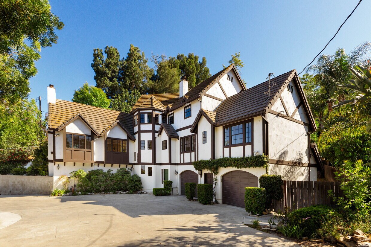
5237 San Feliciano Dr
Woodland Hills, CA 91364
Favorites
-
Bedrooms
3
-
Bathrooms
2.5
-
Square Feet
3,373 sq ft
-
Available
Available Now
Highlight
- Fireplace
5237 San Feliciano Dr

Favorites
About This Home
12 Month Lease,
$13,500 deposit,
Available Now
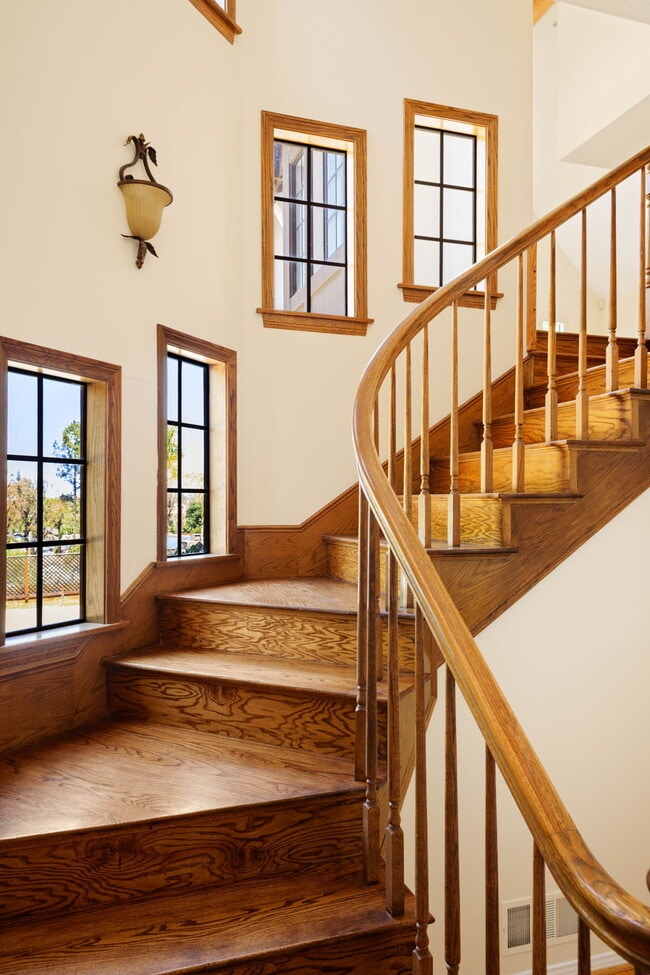
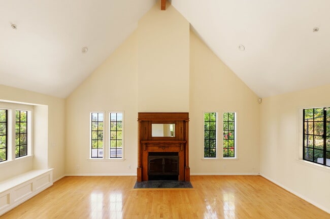
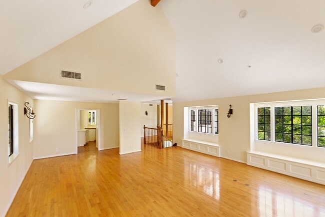
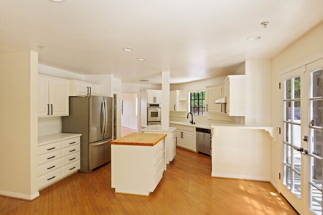
Tucked behind a long private driveway, this upgraded 3BR/2.5BA Woodland Hills cottage offers 3,373 sq ft of multi-level living with city views, dual fireplaces (living room + primary suite), wood and tile floors, multi-zone A/C, and forced-air heat. An attached 2-car garage and extra-long concrete drive provide parking for up to 6. Set on a 9,000+ sq ft lot in a sought-after pocket near top-rated Woodland Hills Elementary Charter and Taft Charter High, with easy access to The Village, Warner Center, and the 101. Unfurnished, 1+ year lease.
5237 San Feliciano Dr is a house located in Los Angeles County and the 91364 ZIP Code. This area is served by the Los Angeles Unified Rocp School District attendance zone.
* Price shown is total price based on community-supplied monthly required fees. Excludes user-selected optional fees and variable or usage-based fees and required charges due at or prior to move-in or at move-out. Price, availability, fees, and any applicable rent special are subject to change without notice.
* Square footage definitions vary. Displayed square footage is approximate.
House Features
- Air Conditioning
- Fireplace
- Tile Floors
Contact
- Contact
Location
Get Directions
Woodland Hills sits at the southwestern edge of the San Fernando Valley, where the Santa Monica Mountains form a natural backdrop and 120,000 trees planted in the 1920s still shade the streets today. The neighborhood is part of the City of Los Angeles, yet it carries a quieter, more spread-out character than most of the city. Warner Center serves as the commercial and employment core, drawing businesses, retail, and dining to the heart of the community. Pierce College, with its 426-acre campus and working farm, adds an educational anchor that shapes the area's rhythm throughout the year.
The housing mix leans toward garden-style apartment communities, low-rise buildings, and single-family rentals, with options concentrated near Ventura Boulevard and Warner Center. Renters who want more space or a hillside setting can find that here, often at a premium compared to neighboring areas like Canoga Park or Tarzana.
Learn more about living in Woodland Hills
Education
| Colleges & Universities | Distance | ||
|---|---|---|---|
| Colleges & Universities | Distance | ||
| Drive: | 8 min | 3.8 mi | |
| Drive: | 18 min | 10.4 mi | |
| Drive: | 26 min | 16.2 mi | |
| Drive: | 30 min | 18.0 mi |
5237 San Feliciano Dr is within 8 minutes or 3.8 miles from Pierce College. It is also near Cal State Northridge and Mount St. Mary's Coll, Chalon.
Schools


Public Elementary School
Grades K-5
621 Students
Attendance Zone
Public Elementary, Middle & High School
Grades PK-12
1,286 Students
Nearby
Public Middle School
Grades 6-8
607 Students
Attendance Zone
Public High School
Grades 9-12
2,221 Students
Attendance Zone
Private Elementary, Middle & High School
Grades K-12
Nearby
Private Elementary School
Grades PK-5
336 Students
Nearby
School data provided by
 The GreatSchools Rating helps parents compare schools within a state based on a variety of school quality indicators and provides a helpful picture of how effectively each school serves all of its students. Ratings are on a scale of 1 (below average) to 10 (above average) and can include test scores, college readiness, academic progress, advanced courses, equity, discipline and attendance data. We also advise parents to visit schools, consider other information on school performance and programs, and consider family needs as part of the school selection process.
View GreatSchools Rating Methodology
Data provided by GreatSchools.org © 2026. All rights reserved.
View GreatSchools Rating Methodology
Data provided by GreatSchools.org © 2026. All rights reserved.
Getting Around
 What do Walkability, Transit, Drivability, and Bikeability mean?
Walkability measures the walking distance to day-to-day needs.
Transit measures access to public transportation.
Drivability measures congestion, parking availability, and access to major roads.
Bikeability measures the suitability for cycling.
How It Works
What do Walkability, Transit, Drivability, and Bikeability mean?
Walkability measures the walking distance to day-to-day needs.
Transit measures access to public transportation.
Drivability measures congestion, parking availability, and access to major roads.
Bikeability measures the suitability for cycling.
How It Works
Moderately Walkable
Walkability
70
/ 100
Limited Public Transit
Transit
30
/ 100
Exceptionally Drivable
Drivability
100
/ 100
Fairly Bikeable
Bikeability
40
/ 100
Scores provided by
Active
Soundscore™
73
/ 100
Traffic
BusyAirport
CalmBusinesses
ActiveScores provided by
HowLoud What is a Sound Score Rating? A Sound Score Rating aggregates noise caused by vehicle traffic, airplane traffic and local sources. How It Works
Amenities
- Air Conditioning
- Fireplace
- Tile Floors
5237 San Feliciano Dr Photos

5237 San Feliciano Dr
Woodland Hills, CA 91364