

$800 / Month
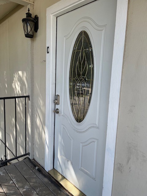
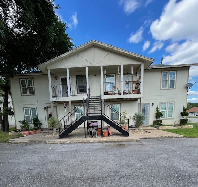
5208 Tahoe Trail
Austin, TX 78745
1 Week Ago
Favorites
-
Bedrooms
2
-
Bathrooms
1
-
Square Feet
728 sq ft
5208 Tahoe Trail

Favorites
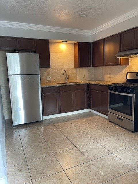
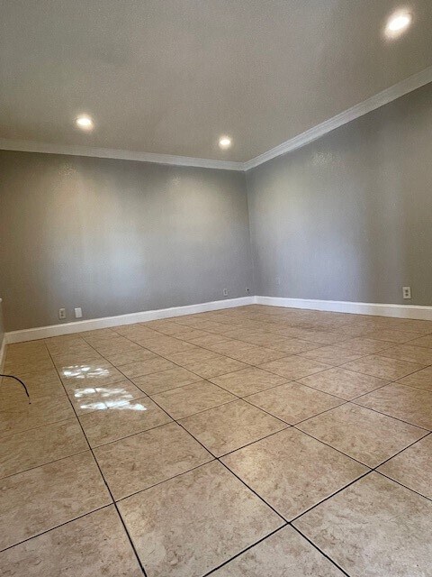
About This Home
---- SCHEDULE A SHOWING ONLINE AT: ----
5208 Tahoe Trail is a condo located in Travis County and the 78745 ZIP Code.
* Price shown is base rent and may not include non-optional fees and utilities.
Price, availability, fees, and any applicable rent special are subject to change without notice.
* Square footage definitions vary. Displayed square footage is approximate.
Contact
- Listed by Locayt
Location
Get Directions
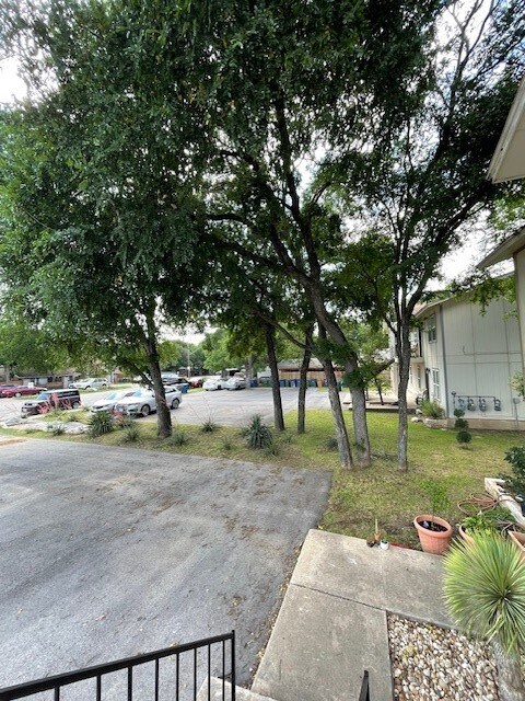
The Westgate neighborhood, located five miles south of downtown near Highway 71, epitomizes South Austin's comfortable yet hip lifestyle. The small enclave provides big city amenities with a small-town feel.
Often overlooked in favor of more urban locations closer to the city center, Westgate remains one of the last neighborhoods in Austin proper that offers its signature style at a more affordable price point. There’s colorful ranch-style homes and upscale modular apartments that will suit a variety of renter tastes. Though not as walkable as other areas, Westgate still offers many urban comforts, such as coffee shops, diverse restaurants, and specialty boutiques.
Westgate stands out as a safe, well-established community with a distinctly Austin vibe, and should you need to explore the city, it’s just a 20-minute drive away.
Learn more about living in Westgate
Education
| Colleges & Universities | Distance | ||
|---|---|---|---|
| Colleges & Universities | Distance | ||
| Drive: | 3 min | 1.3 mi | |
| Drive: | 8 min | 4.2 mi | |
| Drive: | 10 min | 5.9 mi | |
| Drive: | 12 min | 7.1 mi |
5208 Tahoe Trail is within 3 minutes or 1.3 miles from Austin C.C., South Austin. It is also near St. Edward's University and Austin C.C., Rio Grande Campus.
Transportation options available in Austin include Downtown Station, located 7.7 miles from 5208 Tahoe Trail. 5208 Tahoe Trail is near Austin-Bergstrom International, located 11.8 miles or 24 minutes away.
| Transit / Subway | Distance | ||
|---|---|---|---|
| Transit / Subway | Distance | ||
| Drive: | 12 min | 7.7 mi | |
| Drive: | 13 min | 8.4 mi | |
| Drive: | 16 min | 10.0 mi | |
| Drive: | 20 min | 11.3 mi | |
| Drive: | 18 min | 12.4 mi |
| Commuter Rail | Distance | ||
|---|---|---|---|
| Commuter Rail | Distance | ||
|
|
Drive: | 11 min | 4.9 mi |
|
|
Drive: | 38 min | 28.7 mi |
|
|
Drive: | 52 min | 42.0 mi |
| Airports | Distance | ||
|---|---|---|---|
| Airports | Distance | ||
|
Austin-Bergstrom International
|
Drive: | 24 min | 11.8 mi |
Time and distance from 5208 Tahoe Trail.
| Shopping Centers | Distance | ||
|---|---|---|---|
| Shopping Centers | Distance | ||
| Walk: | 13 min | 0.7 mi | |
| Walk: | 14 min | 0.8 mi | |
| Drive: | 3 min | 1.4 mi |
5208 Tahoe Trail has 3 shopping centers within 1.4 miles, which is about a 3-minute walk. The miles and minutes will be for the farthest away property.
| Parks and Recreation | Distance | ||
|---|---|---|---|
| Parks and Recreation | Distance | ||
|
Barton Creek Greenbelt (360 Access)
|
Drive: | 3 min | 1.8 mi |
|
Goat Cave Nature Preserve
|
Drive: | 6 min | 2.5 mi |
|
Umlauf Sculpture Garden and Museum
|
Drive: | 9 min | 3.9 mi |
|
Blunn Creek Nature Preserve
|
Drive: | 9 min | 4.7 mi |
|
Zilker Botanical Garden
|
Drive: | 8 min | 4.7 mi |
5208 Tahoe Trail has 5 parks within 4.7 miles, including Barton Creek Greenbelt (360 Access), Goat Cave Nature Preserve, and Umlauf Sculpture Garden and Museum.
| Hospitals | Distance | ||
|---|---|---|---|
| Hospitals | Distance | ||
| Drive: | 3 min | 1.6 mi | |
| Drive: | 4 min | 2.4 mi | |
| Drive: | 8 min | 4.3 mi |
5208 Tahoe Trail has 3 hospitals within 4.3 miles, the nearest is Austin Oaks Hospital which is 1.6 miles away and a 3 minute drive.
| Military Bases | Distance | ||
|---|---|---|---|
| Military Bases | Distance | ||
| Drive: | 80 min | 63.6 mi | |
| Drive: | 103 min | 80.3 mi |
5208 Tahoe Trail is 63.6 miles from Randolph Air Force Base, and is convenient to other military bases, including Camp Bullis Military Training Reservation.
You May Also Like
Similar Rentals Nearby
-
-

-
 $2,5002 Beds, 2 Baths, 1,081 sq ftApartment for Rent
 -
 $3,0002 Beds, 2 Baths, 1,026 sq ftCondo for Rent
 -

-
 $1,9953 Beds, 2.5 Baths, 1,524 sq ftCondo for Rent
 -

-

-

-

What Are Walk Score®, Transit Score®, and Bike Score® Ratings?
Walk Score® measures the walkability of any address. Transit Score® measures access to public transit. Bike Score® measures the bikeability of any address.
What is a Sound Score Rating?
A Sound Score Rating aggregates noise caused by vehicle traffic, airplane traffic and local sources
5208 Tahoe Trail
Austin, TX 78745