
$1,699
/ Month
517 Fox Trail Cir E
Westerville, OH 43081
2 Weeks Ago
|
Edit
Favorites
517 Fox Trail Cir E

Favorites
Check Back Soon for Upcoming Availability
| Beds | Baths | Average SF |
|---|---|---|
| 2 Bedrooms 2 Bedrooms 2 Br | 1.5 Baths 1.5 Baths 1.5 Ba | 1,280 SF |
Fees and Policies
The fees listed below are community-provided and may exclude utilities or add-ons. All payments are made directly to the property and are non-refundable unless otherwise specified.
- Dogs Allowed
-
Fees not specified
- Cats Allowed
-
Fees not specified
- Parking
-
Garage--
About This Property
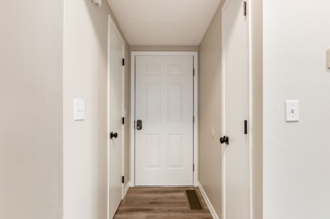
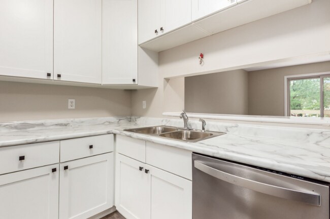
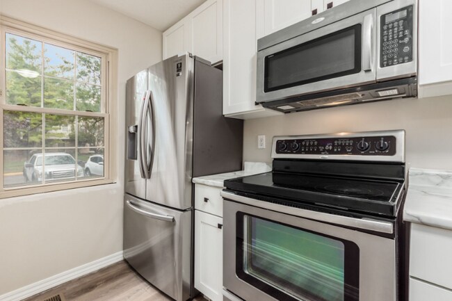
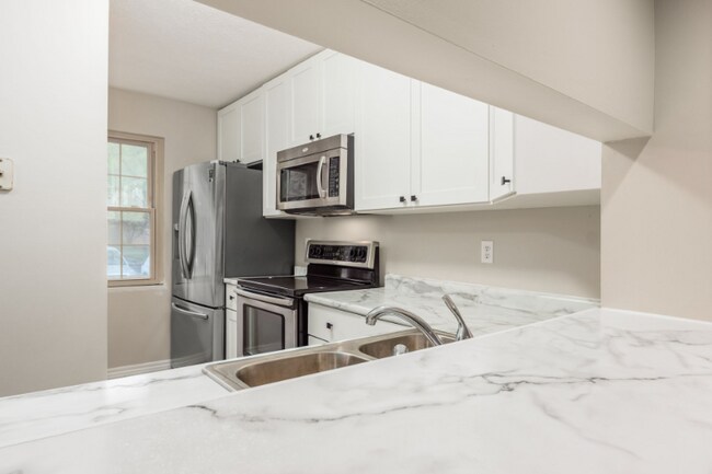
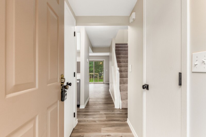
Property Id: 1631957 Westerville- Foxtrail Condominiums ** 2 Bedroom Townhouse with 1280 Sq. Ft.** One & One Half Baths- One with Soaking Tub-One with Pedestal Sink** Great Room has Patio Door out to Deck & Park-Like Setting ** Finished Lower Level with Two Lighted Ceiling Fans** All Appliances including Washer/Dryer** New Kitchen Appliances & Cabinet **Freshly painted& new carpets** Quiet, Private, Community** 2 Parking Spaces **St Ann's/ Mt. Carmel Hospital & Otterbein University and Sharon Woods Park Nearby ** EZ Access to I-270 & Rt 3. Full basement with laundry room and storage. Owners bedroom has built in vanity dressing area. New roof was just put on this year. This home is move in ready and only needs your personal touches
517 Fox Trail Cir E is a townhome located in Franklin County and the 43081 ZIP Code. This area is served by the Westerville City School District attendance zone.
Townhome Features
Washer/Dryer
Dishwasher
Microwave
Refrigerator
- Washer/Dryer
- Cable Ready
- Dishwasher
- Disposal
- Microwave
- Refrigerator
- Vinyl Flooring
- Lawn
517 Fox Trail Cir E,
Westerville,
OH
43081
Around 15 miles outside of the center of Columbus, Ohio, Outer Northeast Columbus includes the neighborhoods of Westerville and Huber Ridge. The area has an abundant selection of parks, lakes and golf courses, attracting people who seek outdoor recreation. Both Interstate 71 and Highway 270 border Outer Northeast Columbus, making travel to downtown and other areas of the city simple and convenient.
Many families flock to outer northeast Columbus for its recreation and amenities. Westerville includes plenty of dining and shopping options, along with excellent residential neighborhoods and schools. Residents find refuge from busier areas of the city while enjoying the benefits of easy commutes, along with plenty of opportunities for fun and entertainment.
Learn more about living in Northeast Columbus
Amenities
- Washer/Dryer
- Cable Ready
- Dishwasher
- Disposal
- Microwave
- Refrigerator
- Vinyl Flooring
- Lawn
Education
| Colleges & Universities | Distance | ||
|---|---|---|---|
| Colleges & Universities | Distance | ||
| Drive: | 5 min | 2.1 mi | |
| Drive: | 16 min | 9.6 mi | |
| Drive: | 21 min | 12.6 mi | |
| Drive: | 23 min | 13.1 mi |
517 Fox Trail Cir E is within 5 minutes or 2.1 miles from Otterbein College. It is also near Ohio Dominican University and The Ohio State University.
Schools


Public Elementary School
Grades PK-5
Nearby
Public Elementary School
Grades K-5
Attendance Zone
Public Middle School
Grades 6-8
Attendance Zone
Public High School
Grades 9-12
Attendance Zone
Private Elementary, Middle & High School
Grades K-12
Nearby
Private Elementary & Middle School
Grades K-8
Nearby
Private Elementary & Middle School
Grades K-8
Nearby
School data provided by
 The GreatSchools Rating helps parents compare schools within a state based on a variety of school quality indicators and provides a helpful picture of how effectively each school serves all of its students. Ratings are on a scale of 1 (below average) to 10 (above average) and can include test scores, college readiness, academic progress, advanced courses, equity, discipline and attendance data. We also advise parents to visit schools, consider other information on school performance and programs, and consider family needs as part of the school selection process.
View GreatSchools Rating Methodology
Data provided by GreatSchools.org © 2026. All rights reserved.
View GreatSchools Rating Methodology
Data provided by GreatSchools.org © 2026. All rights reserved.
Walkability Near 517 Fox Trail Cir E Westerville, OH 43081
Getting Around
 What do Walkability, Transit, Drivability, and Bikeability mean?
Walkability measures the walking distance to day-to-day needs.
Transit measures access to public transportation.
Drivability measures congestion, parking availability, and access to major roads.
Bikeability measures the suitability for cycling.
How It Works
What do Walkability, Transit, Drivability, and Bikeability mean?
Walkability measures the walking distance to day-to-day needs.
Transit measures access to public transportation.
Drivability measures congestion, parking availability, and access to major roads.
Bikeability measures the suitability for cycling.
How It Works
Fairly Walkable
Walkability
50
/ 100
Limited Public Transit
Transit
20
/ 100
Exceptionally Drivable
Drivability
100
/ 100
Moderately Bikeable
Bikeability
70
/ 100
Scores provided by
-
Soundscore™
-
/ 100
Traffic
-Airport
-Businesses
-Scores provided by
HowLoud What is a Sound Score Rating? A Sound Score Rating aggregates noise caused by vehicle traffic, airplane traffic and local sources. How It WorksYou May Also Like
Similar Rentals Nearby


What Are Walk Score®, Transit Score®, and Bike Score® Ratings?
Walk Score® measures the walkability of any address. Transit Score® measures access to public transit. Bike Score® measures the bikeability of any address.
What is a Sound Score Rating?
A Sound Score Rating aggregates noise caused by vehicle traffic, airplane traffic and local sources.
517 Fox Trail Cir E
Westerville, OH 43081