
Presidential Towers
555 W Madison St,
Chicago, IL 60661
$1,700 - $6,628
Studio - 2 Beds
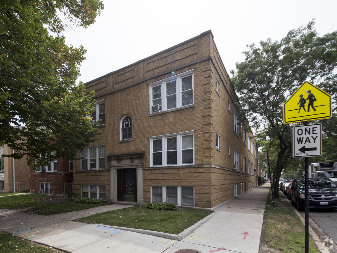
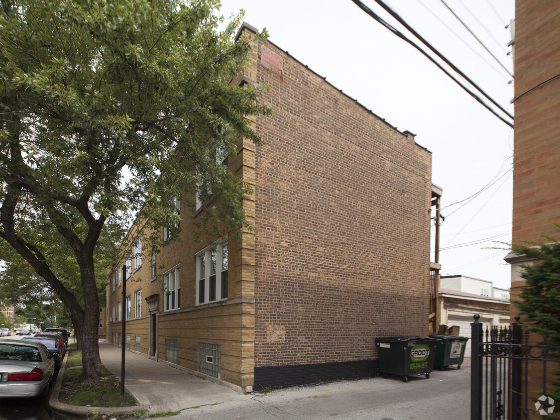

5157-5159 W Agatite Ave in Chicago, IL is ready to be your home. With a location on W. Agatite Ave in Chicago's 60630 Zip code, residents can easily connect with a number of attractions within a few miles. The leasing staff is ready to show you our community. Be sure to come for a visit to check out the apartment floorplan options. Contact us or drop by to schedule a tour today and find your new home at 5157-5159 W Agatite Ave.
5157-5159 W Agatite Ave is an apartment community located in Cook County and the 60630 ZIP Code. This area is served by the Chicago Public Schools attendance zone.
Located on the Northwest side of Chicago, Jefferson Park is a scenic neighborhood named in honor of U.S. President Thomas Jefferson. Jefferson’s tree-lined streets, lush parks, and vast wooded areas provide the neighborhood with a pervasive sense of natural beauty, while numerous diverse restaurants and the landmark Copernicus Civic and Cultural Center contribute an international flair.
Known for being a family-friendly community, Jefferson Park hosts a wide variety of fun events throughout the year, including Taste of Polonia, Jeff Fest, and the Roberts Square Park Annual Picnic. Jefferson Park’s bustling Milwaukee Avenue features a slew of stores, restaurants, and businesses, offering residents plenty of modern conveniences. Getting around from Jefferson Park is simple with quick access to public transportation and the Kennedy Expressway.
Learn more about living in Jefferson ParkCompare neighborhood and city base rent averages by bedroom.
| Jefferson Park | Chicago, IL | |
|---|---|---|
| Studio | $1,119 | $1,656 |
| 1 Bedroom | $1,260 | $2,054 |
| 2 Bedrooms | $2,137 | $2,601 |
| 3 Bedrooms | $2,338 | $3,112 |
| Colleges & Universities | Distance | ||
|---|---|---|---|
| Colleges & Universities | Distance | ||
| Drive: | 4 min | 1.9 mi | |
| Drive: | 7 min | 3.6 mi | |
| Drive: | 9 min | 4.1 mi | |
| Drive: | 8 min | 4.3 mi |


Transportation options available in Chicago include Jefferson Park Station, located 1.3 miles from 5157-5159 W Agatite Ave. 5157-5159 W Agatite Ave is near Chicago O'Hare International, located 8.8 miles or 15 minutes away, and Chicago Midway International, located 12.7 miles or 24 minutes away.
| Transit / Subway | Distance | ||
|---|---|---|---|
| Transit / Subway | Distance | ||
|
|
Drive: | 2 min | 1.3 mi |
|
|
Drive: | 4 min | 2.3 mi |
|
|
Drive: | 5 min | 2.9 mi |
|
|
Drive: | 5 min | 3.1 mi |
|
|
Drive: | 6 min | 3.5 mi |
| Commuter Rail | Distance | ||
|---|---|---|---|
| Commuter Rail | Distance | ||
|
|
Walk: | 12 min | 0.6 mi |
|
|
Drive: | 2 min | 1.3 mi |
|
|
Drive: | 3 min | 1.6 mi |
|
|
Drive: | 3 min | 1.9 mi |
|
|
Drive: | 3 min | 2.0 mi |
| Airports | Distance | ||
|---|---|---|---|
| Airports | Distance | ||
|
Chicago O'Hare International
|
Drive: | 15 min | 8.8 mi |
|
Chicago Midway International
|
Drive: | 24 min | 12.7 mi |
Scores provided by
Traffic
-Airport
-Businesses
-Scores provided by
HowLoud What is a Sound Score Rating? A Sound Score Rating aggregates noise caused by vehicle traffic, airplane traffic and local sources. How It WorksTime and distance from 5157-5159 W Agatite Ave.
| Shopping Centers | Distance | ||
|---|---|---|---|
| Shopping Centers | Distance | ||
| Walk: | 2 min | 0.1 mi | |
| Walk: | 8 min | 0.4 mi | |
| Walk: | 13 min | 0.7 mi |
| Parks and Recreation | Distance | ||
|---|---|---|---|
| Parks and Recreation | Distance | ||
|
Portage Park
|
Walk: | 13 min | 0.7 mi |
|
Kilbourn Park
|
Drive: | 4 min | 1.7 mi |
|
Labagh Woods
|
Drive: | 5 min | 2.1 mi |
|
Gompers Park
|
Drive: | 4 min | 2.3 mi |
|
Indian Road Woods
|
Drive: | 6 min | 2.8 mi |
| Hospitals | Distance | ||
|---|---|---|---|
| Hospitals | Distance | ||
| Drive: | 3 min | 1.6 mi | |
| Drive: | 4 min | 2.3 mi | |
| Drive: | 7 min | 4.0 mi |
| Military Bases | Distance | ||
|---|---|---|---|
| Military Bases | Distance | ||
| Drive: | 23 min | 16.5 mi | |
| Drive: | 37 min | 28.4 mi | |
| Drive: | 45 min | 29.3 mi |
What Are Walk Score®, Transit Score®, and Bike Score® Ratings?
Walk Score® measures the walkability of any address. Transit Score® measures access to public transit. Bike Score® measures the bikeability of any address.
What is a Sound Score Rating?
A Sound Score Rating aggregates noise caused by vehicle traffic, airplane traffic and local sources.

5157-5159 W Agatite Ave
Chicago, IL 60630


