
Hudson Park Community
1 Alexander St,
Yonkers, NY 10701
$2,250 - $3,500
1-2 Beds
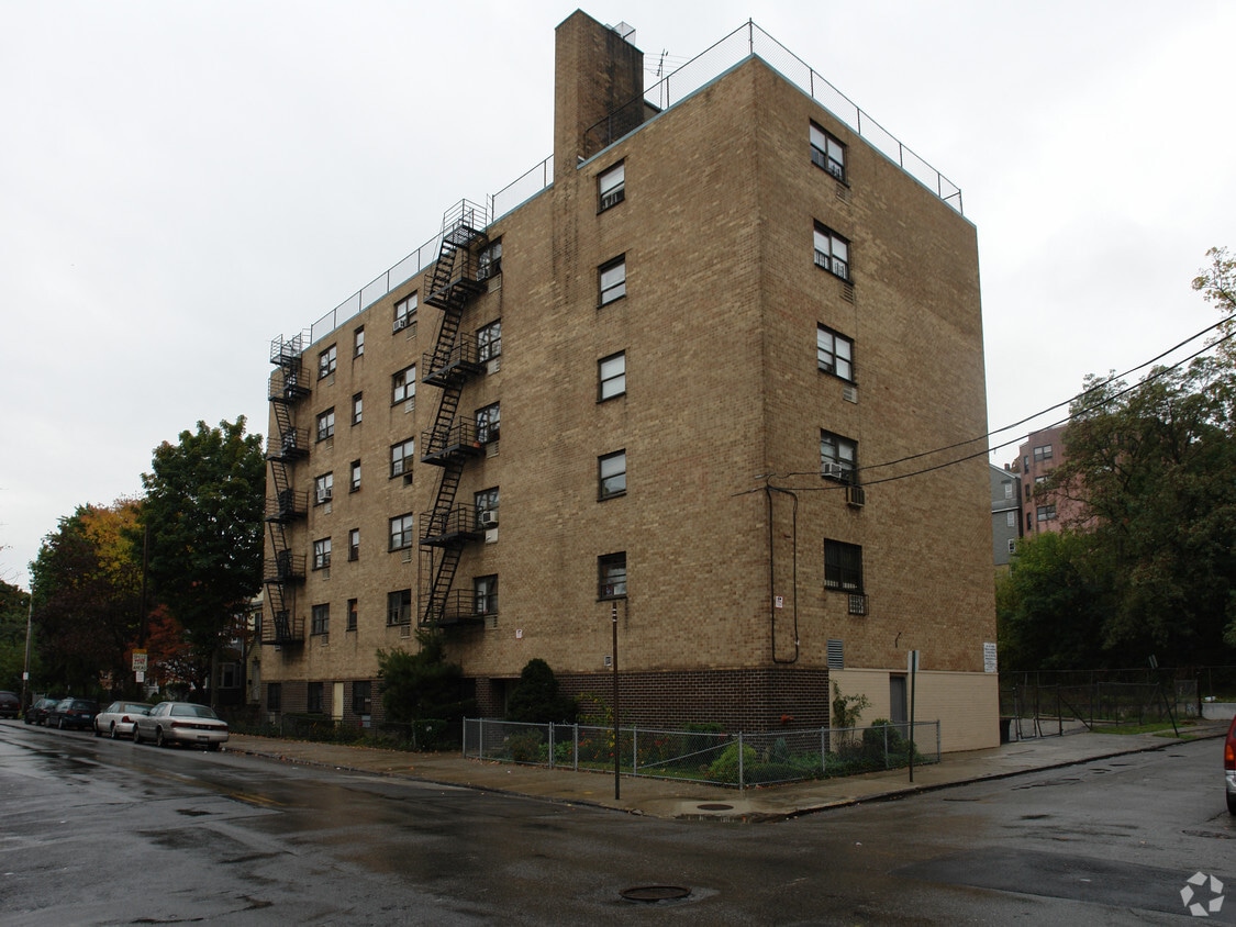
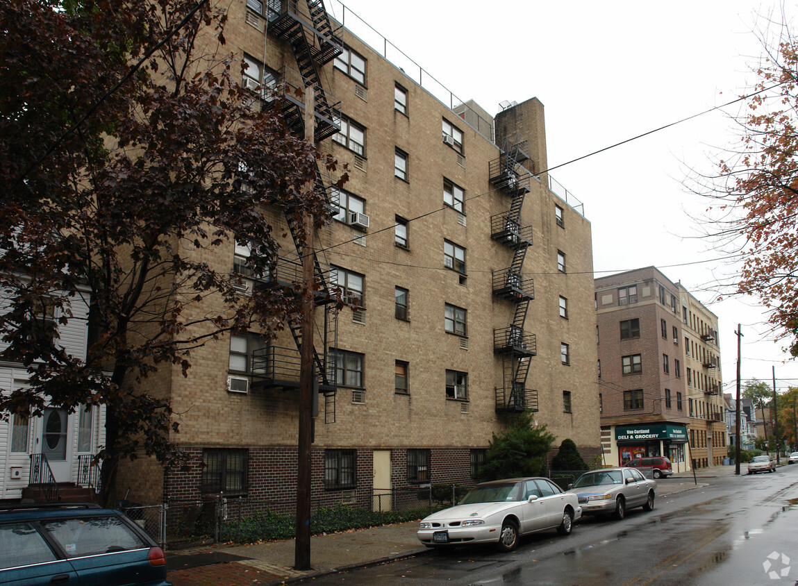
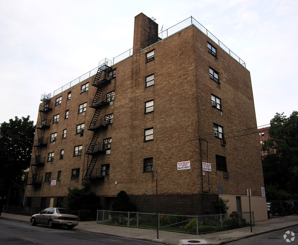
505 Van Cortlandt Park Ave in Yonkers, NY is ready for your visit. The 505 Van Cortlandt Park Ave location in Yonkers's 10705 Zip code is an ideal place to move. Schedule a time to check out the apartment floorplan options. Here at this community, the leasing staff is ready to help match you with the perfect floorplan. Contact us or stop by today.
505 Van Cortlandt Park Ave is an apartment community located in Westchester County and the 10705 ZIP Code. This area is served by the Yonkers City School District attendance zone.
Air Conditioning
High Speed Internet Access
Refrigerator
Tub/Shower
Appropriately named, Park Hill rests on a bluff overlooking the Hudson River and has several parks. The neighborhood is also located between Van Cortlandt Park and Tibbets Brook Park. This charming locale is known for its scenic views and quaint houses in a variety of styles including Victorians, Tudor-style, and Queen Annes, but there are apartments, condos, and townhomes available for rent as well. Along with restaurants, grocers, and stores along South Broadway, Park Hill is located directly south of Getty Square, the city’s downtown district. For even more shopping, dining, and entertainment options, residents can travel into New York’s boroughs via Route 9 or the Saw Mill River Parkway. There are also several bus stops in Park Hill and a train station is just a few blocks away.
Learn more about living in Park HillCompare neighborhood and city base rent averages by bedroom.
| Park Hill | Yonkers, NY | |
|---|---|---|
| Studio | $1,106 | $1,990 |
| 1 Bedroom | $1,138 | $2,308 |
| 2 Bedrooms | $1,282 | $3,051 |
| 3 Bedrooms | $1,229 | $3,294 |
| Colleges & Universities | Distance | ||
|---|---|---|---|
| Colleges & Universities | Distance | ||
| Drive: | 4 min | 2.3 mi | |
| Drive: | 7 min | 3.9 mi | |
| Drive: | 9 min | 4.3 mi | |
| Drive: | 9 min | 5.0 mi |


Transportation options available in Yonkers include Van Cortlandt Park-242 Street, located 2.2 miles from 505 Van Cortlandt Park Ave. 505 Van Cortlandt Park Ave is near LaGuardia, located 15.1 miles or 26 minutes away, and Westchester County, located 22.2 miles or 32 minutes away.
| Transit / Subway | Distance | ||
|---|---|---|---|
| Transit / Subway | Distance | ||
|
|
Drive: | 4 min | 2.2 mi |
|
|
Drive: | 5 min | 2.6 mi |
|
|
Drive: | 7 min | 2.9 mi |
|
|
Drive: | 8 min | 3.3 mi |
|
|
Drive: | 5 min | 3.5 mi |
| Commuter Rail | Distance | ||
|---|---|---|---|
| Commuter Rail | Distance | ||
|
|
Drive: | 3 min | 1.2 mi |
|
|
Drive: | 4 min | 1.8 mi |
|
|
Drive: | 6 min | 2.4 mi |
|
|
Drive: | 7 min | 2.9 mi |
|
|
Drive: | 9 min | 4.6 mi |
| Airports | Distance | ||
|---|---|---|---|
| Airports | Distance | ||
|
LaGuardia
|
Drive: | 26 min | 15.1 mi |
|
Westchester County
|
Drive: | 32 min | 22.2 mi |
Scores provided by
Traffic
-Airport
-Businesses
-Scores provided by
HowLoud What is a Sound Score Rating? A Sound Score Rating aggregates noise caused by vehicle traffic, airplane traffic and local sources. How It WorksTime and distance from 505 Van Cortlandt Park Ave.
| Shopping Centers | Distance | ||
|---|---|---|---|
| Shopping Centers | Distance | ||
| Walk: | 6 min | 0.3 mi | |
| Drive: | 4 min | 1.5 mi | |
| Drive: | 3 min | 1.7 mi |
| Parks and Recreation | Distance | ||
|---|---|---|---|
| Parks and Recreation | Distance | ||
|
Beczak Environmental Education Center
|
Drive: | 4 min | 2.0 mi |
|
Wave Hill
|
Drive: | 6 min | 2.4 mi |
|
Riverdale Park
|
Drive: | 6 min | 2.8 mi |
|
Van Cortlandt Park
|
Drive: | 5 min | 3.9 mi |
|
Tenafly Nature Center
|
Drive: | 21 min | 12.9 mi |
| Hospitals | Distance | ||
|---|---|---|---|
| Hospitals | Distance | ||
| Walk: | 20 min | 1.1 mi | |
| Drive: | 6 min | 3.6 mi | |
| Drive: | 9 min | 4.6 mi |
| Military Bases | Distance | ||
|---|---|---|---|
| Military Bases | Distance | ||
| Drive: | 26 min | 14.1 mi | |
| Drive: | 35 min | 18.0 mi | |
| Drive: | 42 min | 27.6 mi |
What Are Walk Score®, Transit Score®, and Bike Score® Ratings?
Walk Score® measures the walkability of any address. Transit Score® measures access to public transit. Bike Score® measures the bikeability of any address.
What is a Sound Score Rating?
A Sound Score Rating aggregates noise caused by vehicle traffic, airplane traffic and local sources.


