
Presidential Towers
555 W Madison St,
Chicago, IL 60661
$1,694 - $6,612
Studio - 2 Beds
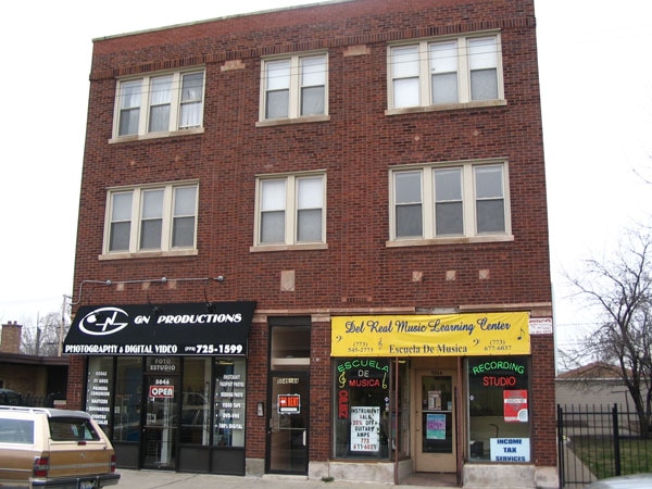

Find your new home at 5044 W Diversey Ave. Based in Chicago's 60639 Zip code, moving here offers a variety of nearby points of interest. Come for a visit to check out the current floorplan options. Here at this community, the professional leasing team is ready to help you in finding your perfect place. Stop by 5044 W Diversey Ave today.
5044 W Diversey Ave is an apartment community located in Cook County and the 60639 ZIP Code. This area is served by the Chicago Public Schools attendance zone.
Air Conditioning
Refrigerator
Heating
Oven
The Cragin neighborhood of Chicago, also known as Belmont-Cragin, sits halfway between Diversey and Fullerton Avenue, just over nine miles northwest of Downtown Chicago. Sitting eight miles northwest of the Loop, Cragin, once a hub of Chicago industry, now combines a suburban pace of life with urban conveniences. Locally owned restaurants, bars, and coffee shops are scattered around the neighborhood’s walkable layout. Contemporary apartment developments have popped up as more residents flock to areas outside Chicago. You’ll find mid-rise apartments in modern styles and long-standing rentals as well. Access to Interstate 90 and Chicago’s Blue Line makes it easy to commute into and out of the city.
Learn more about living in CraginCompare neighborhood and city base rent averages by bedroom.
| Cragin | Chicago, IL | |
|---|---|---|
| Studio | $858 | $1,658 |
| 1 Bedroom | $896 | $2,055 |
| 2 Bedrooms | $1,323 | $2,601 |
| 3 Bedrooms | $1,819 | $3,111 |
| Colleges & Universities | Distance | ||
|---|---|---|---|
| Colleges & Universities | Distance | ||
| Drive: | 9 min | 4.0 mi | |
| Drive: | 9 min | 4.1 mi | |
| Drive: | 12 min | 5.0 mi | |
| Drive: | 13 min | 5.5 mi |


Transportation options available in Chicago include Logan Square Station, located 2.5 miles from 5044 W Diversey Ave. 5044 W Diversey Ave is near Chicago Midway International, located 10.8 miles or 20 minutes away, and Chicago O'Hare International, located 11.4 miles or 20 minutes away.
| Transit / Subway | Distance | ||
|---|---|---|---|
| Transit / Subway | Distance | ||
|
|
Drive: | 6 min | 2.5 mi |
|
|
Drive: | 6 min | 2.7 mi |
|
|
Drive: | 7 min | 3.3 mi |
|
|
Drive: | 8 min | 3.5 mi |
|
|
Drive: | 8 min | 3.6 mi |
| Commuter Rail | Distance | ||
|---|---|---|---|
| Commuter Rail | Distance | ||
|
|
Drive: | 5 min | 1.7 mi |
|
|
Drive: | 4 min | 1.8 mi |
|
|
Drive: | 5 min | 1.9 mi |
|
|
Drive: | 5 min | 2.0 mi |
|
|
Drive: | 7 min | 2.8 mi |
| Airports | Distance | ||
|---|---|---|---|
| Airports | Distance | ||
|
Chicago Midway International
|
Drive: | 20 min | 10.8 mi |
|
Chicago O'Hare International
|
Drive: | 20 min | 11.4 mi |
Scores provided by
Traffic
-Airport
-Businesses
-Scores provided by
HowLoud What is a Sound Score Rating? A Sound Score Rating aggregates noise caused by vehicle traffic, airplane traffic and local sources. How It WorksTime and distance from 5044 W Diversey Ave.
| Shopping Centers | Distance | ||
|---|---|---|---|
| Shopping Centers | Distance | ||
| Walk: | 12 min | 0.7 mi | |
| Walk: | 14 min | 0.8 mi | |
| Drive: | 3 min | 1.1 mi |
| Parks and Recreation | Distance | ||
|---|---|---|---|
| Parks and Recreation | Distance | ||
|
Kilbourn Park
|
Drive: | 5 min | 1.7 mi |
|
LaFollette Park
|
Drive: | 5 min | 2.0 mi |
|
Riis Park
|
Drive: | 5 min | 2.1 mi |
|
Portage Park
|
Drive: | 6 min | 2.7 mi |
|
Wonder Works Children's Museum
|
Drive: | 8 min | 3.3 mi |
| Hospitals | Distance | ||
|---|---|---|---|
| Hospitals | Distance | ||
| Drive: | 4 min | 1.8 mi | |
| Drive: | 7 min | 3.2 mi | |
| Drive: | 9 min | 3.9 mi |
| Military Bases | Distance | ||
|---|---|---|---|
| Military Bases | Distance | ||
| Drive: | 29 min | 19.0 mi | |
| Drive: | 42 min | 27.4 mi | |
| Drive: | 53 min | 32.4 mi |
What Are Walk Score®, Transit Score®, and Bike Score® Ratings?
Walk Score® measures the walkability of any address. Transit Score® measures access to public transit. Bike Score® measures the bikeability of any address.
What is a Sound Score Rating?
A Sound Score Rating aggregates noise caused by vehicle traffic, airplane traffic and local sources.

5044 W Diversey Ave
Chicago, IL 60639


