
Province
398 W Valley Blvd,
San Gabriel, CA 91776
$3,075 - $6,565
Studio - 3 Beds
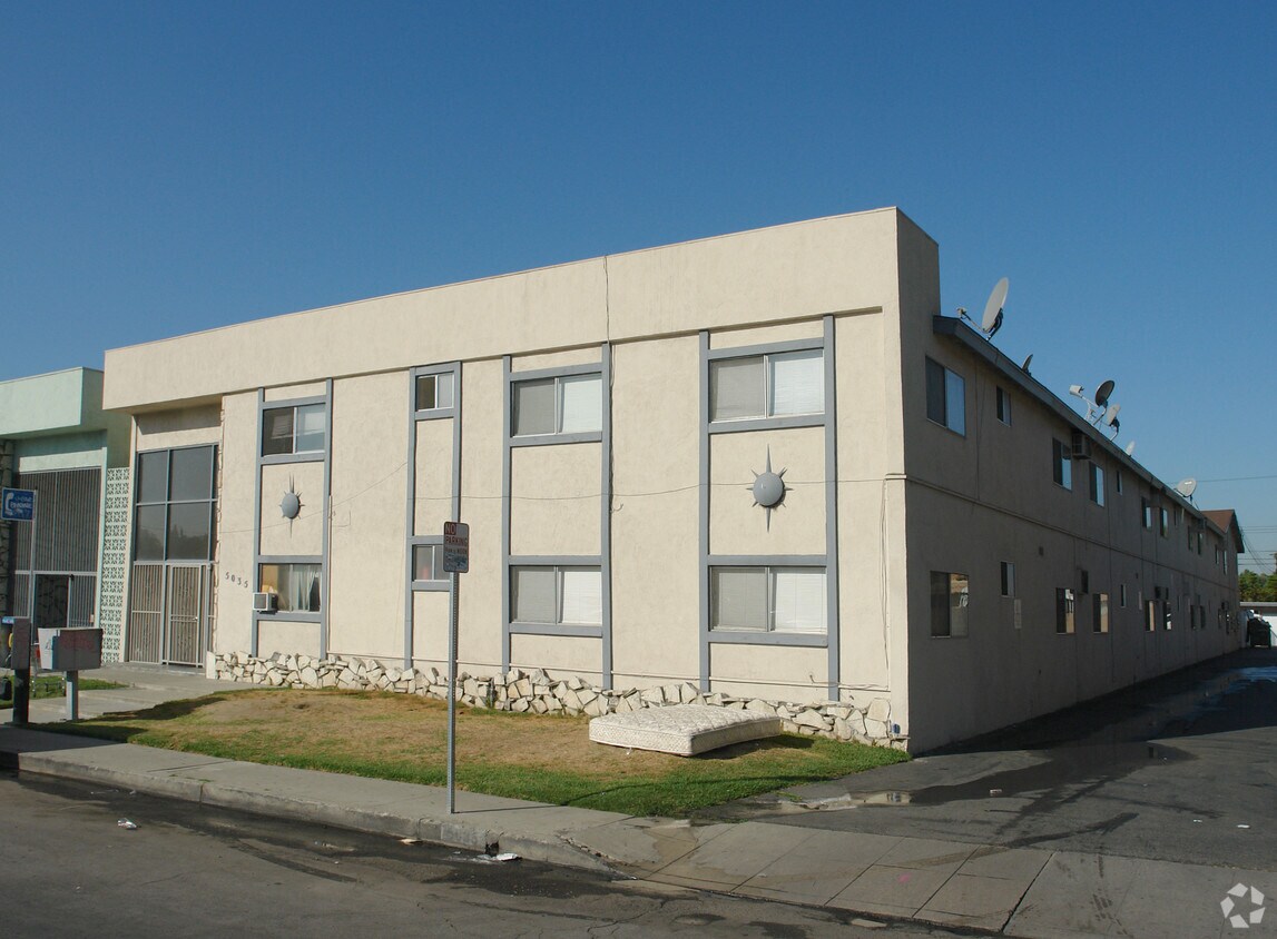
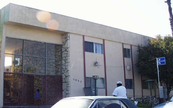
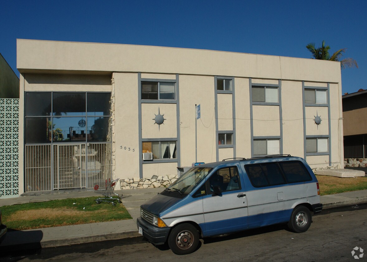

Thanks for visiting 5035 Rosemead Blvd. This community is located on Rosemead Blvd in San Gabriel. From amenities to floor plan options, the professional leasing team will assist you in finding your new place. Drop by the leasing office to schedule a tour and find your new home at 5035 Rosemead Blvd.
5035 Rosemead Blvd is an apartment community located in Los Angeles County and the 91776 ZIP Code. This area is served by the San Gabriel Unified attendance zone.
Situated about ten miles northeast of Los Angeles, San Gabriel is a scenic suburb often regarded as the “Birthplace of the Los Angeles Region.” The city boasts a rich history dating back to the 1700s, when the Mission San Gabriel (known as the “Pride of the California Missions”) was founded.
San Gabriel’s historic roots are on display to this day, with the vibrant Mission District serving as the city’s hub of culture, art, and history. City Hall, the San Gabriel Mission Playhouse, and numerous well-maintained Spanish Colonial Revival style buildings are the cornerstones of the District. A host of diverse eateries, cafes, offices, shops, and museums—including the famed San Gabriel Mission—are also found in this vibrant downtown area.
Area residents enjoy a bevy of outdoor activities at Vincent Lugo Park, Smith Park, and San Gabriel Country Club.
Learn more about living in San Gabriel| Colleges & Universities | Distance | ||
|---|---|---|---|
| Colleges & Universities | Distance | ||
| Drive: | 14 min | 6.1 mi | |
| Drive: | 14 min | 6.7 mi | |
| Drive: | 15 min | 7.3 mi | |
| Drive: | 15 min | 7.9 mi |


Transportation options available in San Gabriel include Sierra Madre Villa Station, located 4.8 miles from 5035 Rosemead Blvd. 5035 Rosemead Blvd is near Bob Hope, located 24.6 miles or 35 minutes away, and Long Beach (Daugherty Field), located 26.5 miles or 38 minutes away.
| Transit / Subway | Distance | ||
|---|---|---|---|
| Transit / Subway | Distance | ||
|
|
Drive: | 9 min | 4.8 mi |
| Drive: | 11 min | 5.5 mi | |
| Drive: | 14 min | 6.2 mi | |
|
|
Drive: | 15 min | 6.9 mi |
|
|
Drive: | 13 min | 7.2 mi |
| Commuter Rail | Distance | ||
|---|---|---|---|
| Commuter Rail | Distance | ||
|
|
Drive: | 7 min | 3.1 mi |
|
|
Drive: | 18 min | 8.7 mi |
|
|
Drive: | 15 min | 9.5 mi |
|
|
Drive: | 21 min | 14.1 mi |
| Drive: | 20 min | 15.4 mi |
| Airports | Distance | ||
|---|---|---|---|
| Airports | Distance | ||
|
Bob Hope
|
Drive: | 35 min | 24.6 mi |
|
Long Beach (Daugherty Field)
|
Drive: | 38 min | 26.5 mi |
Time and distance from 5035 Rosemead Blvd.
| Shopping Centers | Distance | ||
|---|---|---|---|
| Shopping Centers | Distance | ||
| Walk: | 13 min | 0.7 mi | |
| Walk: | 17 min | 0.9 mi | |
| Walk: | 20 min | 1.1 mi |
| Parks and Recreation | Distance | ||
|---|---|---|---|
| Parks and Recreation | Distance | ||
|
Whittier Narrows Recreation Area
|
Drive: | 10 min | 3.8 mi |
|
Los Angeles County Arboretum
|
Drive: | 10 min | 4.6 mi |
|
Huntington Botanical Gardens
|
Drive: | 13 min | 5.6 mi |
|
Whittier Narrows Nature Center
|
Drive: | 12 min | 5.9 mi |
|
Chilao Visitor Center
|
Drive: | 11 min | 6.3 mi |
| Hospitals | Distance | ||
|---|---|---|---|
| Hospitals | Distance | ||
| Walk: | 7 min | 0.4 mi | |
| Drive: | 6 min | 2.6 mi | |
| Drive: | 10 min | 4.9 mi |
| Military Bases | Distance | ||
|---|---|---|---|
| Military Bases | Distance | ||
| Drive: | 41 min | 28.7 mi | |
| Drive: | 39 min | 29.1 mi |
What Are Walk Score®, Transit Score®, and Bike Score® Ratings?
Walk Score® measures the walkability of any address. Transit Score® measures access to public transit. Bike Score® measures the bikeability of any address.
What is a Sound Score Rating?
A Sound Score Rating aggregates noise caused by vehicle traffic, airplane traffic and local sources

5035 Rosemead Blvd
San Gabriel, CA 91776


 - Violet on Virgil")


 - AVA Burbank")